Category:1811 maps of the United Kingdom
Jump to navigation
Jump to search
Countries of Europe: Austria · France‡ · Germany · Italy · Norway · Poland · Russia‡ · Spain‡ · Turkey‡ · United Kingdom
‡: partly located in Europe
‡: partly located in Europe
| 1810 1811 1812 1813 1814 1815 |
Media in category "1811 maps of the United Kingdom"
The following 21 files are in this category, out of 21 total.
-
 (1811) MAP OF ENGLAND AND WALES.jpg 2,368 × 3,124; 1.67 MB
-
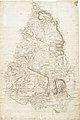
 (1811) MAP OF SCOTLAND.jpg 2,400 × 3,091; 1.77 MB
-
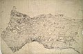
 Ordnance Survey Drawings - Axbridge (OSD 49).jpg 5,056 × 3,747; 5.31 MB
-
 Ordnance Survey Drawings - Bampton (OSD 161).jpg 4,000 × 2,585; 3.9 MB
-
 Ordnance Survey Drawings - Banbury, Oxfordshire (OSD 225).jpg 4,000 × 3,844; 4.91 MB
-
 Ordnance Survey Drawings - Cheltenham (OSD 172).jpg 5,637 × 3,914; 4.89 MB
-
 Ordnance Survey Drawings - Glastonbury (OSD 50).jpg 4,000 × 2,752; 4.77 MB
-
 Ordnance Survey Drawings - Grampound, Cornwall (OSD 6).jpg 5,706 × 3,665; 4.25 MB
-
 Ordnance Survey Drawings - Helston, Cornwall (OSD 3).jpg 5,770 × 3,618; 4.23 MB
-
 Ordnance Survey Drawings - Lampeter, Cardigan (Sir Ceredigeon) (OSD 186).jpg 5,700 × 3,665; 4.47 MB
-
 Ordnance Survey Drawings - Llandovery, Carmarthenshire (OSD 189).jpg 2,352 × 4,000; 3.36 MB
-
 Ordnance Survey Drawings - Llantriant (OSD 177).jpg 3,767 × 5,645; 4.64 MB
-

-
 Ordnance Survey Drawings - Newent (OSD 174).jpg 2,888 × 4,000; 4.61 MB
-
 Ordnance Survey Drawings - Newport (OSD 176).jpg 4,000 × 2,283; 2.7 MB
-
 Ordnance Survey Drawings - Pershore, Worcestershire (OSD 217).jpg 4,000 × 3,168; 3.31 MB
-
 Ordnance Survey Drawings - Tewkesbury (OSD 173).jpg 4,000 × 2,553; 4.39 MB
-
 Ordnance Survey Drawings - Wallingford (OSD 157).jpg 3,465 × 4,000; 5.14 MB
-
 Ordnance Survey Drawings - Wantage (OSD 160).jpg 4,000 × 2,598; 3.5 MB
-
 Ordnance Survey Drawings - Windsor (OSD 153).jpg 3,682 × 4,000; 5.27 MB
-
 Ordnance Survey Drawings - Woodstock (OSD 162).jpg 4,000 × 2,726; 4.16 MB
_MAP_OF_ENGLAND_AND_WALES.jpg)
_MAP_OF_SCOTLAND.jpg)
.jpg)
.jpg)
.jpg)
.jpg)
.jpg)
.jpg)
.jpg)
_(OSD_186).jpg)
.jpg)
.jpg)
_(OSD_187).jpg)
.jpg)
.jpg)
.jpg)
.jpg)
.jpg)
.jpg)
.jpg)
.jpg)