Category:1821 maps
Jump to navigation
Jump to search
| ← 1820 1821 1822 1823 1824 1825 1826 1827 1828 1829 → |
Deutsch: Karten mit Bezug zum Jahr 1821
English: Maps related to the year 1821
Español: Mapas relativos al año 1821
Français : Cartes concernant l’an 1821
Русский: Карты 1821 года
Subcategories
This category has the following 7 subcategories, out of 7 total.
A
- 1821 maps of Africa (11 F)
E
G
N
O
- Oberreit, Sect. Altenberg, 1821 (45 F)
S
- 1821 maps of South America (4 F)
Media in category "1821 maps"
The following 46 files are in this category, out of 46 total.
-
 BERKH(1821) p515.jpg 6,671 × 2,458; 7.37 MB
-
 BERKH(1821) p517.jpg 997 × 448; 303 KB
-

-

-

-

-

-

-

-
-

-
-

-

-

-

-

-
 A plan to illustrate the situation of the principal hills of ancient Rome (7537858594).jpg 2,000 × 1,545; 2.23 MB
-
 Abazia(Grand Abazia).jpg 2,160 × 1,582; 1.38 MB
-
-
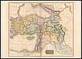 Asiatic Turkey (FL36010628 2715326).jpg 17,867 × 12,766; 310.22 MB
-

-
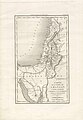
 Carte de la Palestine dressée pour l'usage des Collèges 1821 A Paris, (FL36012578 3911555).jpg 13,201 × 9,694; 174.25 MB
-

-
 John Cary, A new map of Arabia (FL35865402 2491820).jpg 15,040 × 12,906; 244.8 MB
-
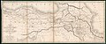
 John Thomson, Arabia, Egypt, Abyssinia, Red Sea &c (FL35865435 2492217).jpg 15,169 × 12,579; 270.97 MB
-

-
 Low Wood Gunpowder Mills map.jpg 600 × 600; 125 KB
-
 Map tarma 1821.JPG 3,352 × 1,886; 3.5 MB
-
 Orbis Romani pars orientalis (8358154606).jpg 591 × 800; 120 KB
-
 Ordnance Survey Drawings - Bodfari (OSD 322).jpg 2,495 × 4,000; 2.67 MB
-
 Ordnance Survey Drawings - East Harling (OSD 291).jpg 4,000 × 2,309; 2.34 MB
-
 Ordnance Survey Drawings - Hartshorn (OSD 295).jpg 4,198 × 4,576; 2.99 MB
-
 Ordnance Survey Drawings - Howden, Yorkshire (OSD 292).jpg 4,000 × 1,824; 1.92 MB
-
 Ordnance Survey Drawings - Meliden (OSD 323).jpg 4,000 × 3,091; 3.33 MB
-
 Ordnance Survey Drawings - Whittlesey (OSD 270).jpg 3,316 × 4,000; 3.81 MB
-
-
 Plan of the harbours and fortifications of Valetta in the island of Malta RMG F0433.tiff 5,429 × 7,259; 112.75 MB
-
 Rochwitzkarte.JPG 748 × 703; 270 KB
-
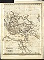
 Solomon Löwisohn, Schauplatz der Bibel (FL199985592 2368735).jpg 7,113 × 5,593; 62.68 MB
-
 Tableau politique de la terre - par F. A Perrot ; et A.-M. Perrot - btv1b530834721.jpg 9,131 × 6,975; 8.28 MB
-
 Tableau politique de la terre - par Jr A ; ... et A.-M. Perrot - btv1b530935629.jpg 10,451 × 7,120; 9.84 MB
-
 The world (4584054572).jpg 2,000 × 1,551; 2.6 MB
-

-
 Видъ представляющій Синайскую гору, всѣ чудесныя и древнія мѣста (FL13730388 2729278).jpg 10,151 × 8,449; 114.24 MB
-
 Карта Смоленской губернии.jpg 4,888 × 4,723; 7.23 MB
_p517.jpg)


.jpg)


.jpg)
.jpg)
.jpg)
.jpg)
.jpg)
.jpg)
.jpg)
.jpg)
.jpg)
.jpg)


.jpg)
.jpg)
.jpg)
.jpg)
.jpg)
.jpg)
.jpg)
.jpg)

.jpg)


.jpg)

.jpg)

_p515.jpg)