Category:1831 maps of Europe
Jump to navigation
Jump to search
Temperate regions: North America · South America · Africa · Europe · Asia · – Polar regions: – Other regions:
| ← 1830 1831 1832 1833 1834 1835 1836 1837 1838 1839 → |
English: 1831 maps of Europe
Español: Mapas de Europa en 1831
Suomi: Euroopan kartat vuodelta 1831
Română: Hărți ale Europei din 1831
Subcategories
This category has the following 8 subcategories, out of 8 total.
Media in category "1831 maps of Europe"
The following 6 files are in this category, out of 6 total.
-

-
 Carte générale d'Europe dressée - par Charle... - btv1b53093003c.jpg 9,016 × 6,824; 10.42 MB
-
 Carte générale d'Europe dressée - par Charle... - btv1b53093004t.jpg 9,368 × 6,752; 10.89 MB
-

-
 Denmark 1831.jpg 4,928 × 6,209; 3.94 MB
-
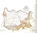 Кнежевина Србија 1831. година.jpg 1,500 × 1,364; 443 KB
.jpg)


.jpg)

