Category:1840 maps of the Russian Empire
Jump to navigation
Jump to search
| 1840 1841 1846 1847 1848 → |
Карты Российской империи, изданные в 1840 году
Media in category "1840 maps of the Russian Empire"
The following 3 files are in this category, out of 3 total.
-
 Leonard Chodzko. Littoral de la Mer-Noire. 1840.jpg 1,200 × 840; 288 KB
-
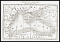
 1840 French map of the world depicting the territories of the British, French and Russian Empires.jpg 15,366 × 11,273; 36.22 MB
-
 Map of Circassia Wellcome L0040021.jpg 3,763 × 1,789; 1.73 MB


