Category:1848 maps
Jump to navigation
Jump to search
| ← 1840 1841 1842 1843 1844 1845 1846 1847 1848 1849 → |
Deutsch: Karten mit Bezug zum Jahr 1848
English: Maps related to the year 1848
Español: Mapas relativos al año 1848
Français : Cartes concernant l’an 1848
Русский: Карты 1848 года
Subcategories
This category has the following 10 subcategories, out of 10 total.
A
- 1848 maps of Africa (7 F)
E
G
N
O
- 1848 maps of Oceania (4 F)
P
- Platt's großer Atlas der Erde (74 F)
S
- 1848 maps of South America (7 F)
Media in category "1848 maps"
The following 71 files are in this category, out of 71 total.
-
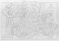
 Wien im October 1848 p048 Plan von Wien.jpg 1,499 × 1,916; 2.26 MB
-

-

-
-
 Abhandlungen der Königlichen Akademie der Wissenschaften in Berlin (1848) (16143948444).jpg 3,250 × 3,086; 1.63 MB
-
 Abhandlungen der Königlichen Akademie der Wissenschaften in Berlin (1848) (16558990727).jpg 3,184 × 3,082; 1.71 MB
-

-

-
 Bad Homburg, Coghlans Stadtplan von 1848.JPG 2,076 × 1,620; 1.21 MB
-
 Batalla de Elviña (Battle of Corunna) - 16-01-1809 - mapa (map).jpg 1,199 × 917; 923 KB
-
 Benjamin Zeeb Wolf Ben Nathan Nata Lichtenstaedter, מפת ארצות הקדם (FL17237344 2480888).jpg 6,398 × 4,310; 43.37 MB
-
 C. F. Wigand, Plan von Pressburg (FL39696785 3699922).jpg 10,775 × 8,139; 116.45 MB
-

-

-
 Carte du département de la Loire - 1848.jpg 7,554 × 10,488; 11.45 MB
-
 Chart. LOC 2003627051.jpg 10,234 × 5,533; 5.44 MB
-
 Chart. LOC 2003627051.tif 10,234 × 5,533; 162 MB
-

-
 Connecticut for schools, families, and general use LOC gm70001741.jpg 12,368 × 9,249; 15.38 MB
-

-
 Detailed map of Yamato Province, enlarged and revised in Kaei period (14775312839).jpg 1,557 × 2,000; 1.56 MB
-
 Douro river map Forrester.jpg 6,913 × 1,687; 3.05 MB
-

-
 Formigas 1849 map.png 1,007 × 1,622; 4.68 MB
-
 France location map-Departements 1848.svg 2,000 × 1,922; 587 KB
-
 Gaea excursoria Germanica (Taf. 23) BHL27432415.jpg 2,041 × 3,568; 975 KB
-
 Gaea excursoria Germanica (Taf. 24) BHL27432416.jpg 2,041 × 3,568; 816 KB
-
 Gamla Stan och Riddarholmen 1848.jpg 2,296 × 2,892; 3.53 MB
-
 Globe terrestre, Malby & Co, 1848 (37499591734).jpg 5,184 × 3,456; 7.25 MB
-
 Helgeandsholmen 1848.jpg 1,066 × 782; 243 KB
-
 Izmaylovo map 1848.jpg 1,000 × 678; 408 KB
-
 Kaart van Zuid Holland 1848.jpg 13,583 × 9,961; 28.8 MB
-
 Madrid-1848-Rafo y Ribera.jpg 2,792 × 1,920; 470 KB
-

-
 Map & profiles of the Vt. Central and Vt. and Canada Railroads LOC 79693228.jpg 19,397 × 8,055; 12.93 MB
-
 Map & profiles of the Vt. Central and Vt. and Canada Railroads LOC 79693228.tif 19,397 × 8,055; 447.01 MB
-
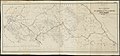 Map and profiles of the Vt. Central and Vt. and Canada Railroads (13410961605).jpg 2,000 × 925; 1.35 MB
-

-

-
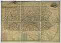
 Map of Delaware County, Pennsylvania - from original surveys, with the farm limits LOC 2012592172.jpg 17,900 × 12,813; 28.04 MB
-
 Map of Delaware County, Pennsylvania - from original surveys, with the farm limits LOC 2012592172.tif 17,900 × 12,813; 656.18 MB
-
-

-

-
 Map of the Carlisle Barracks, Carlisle, Pennsylvania. LOC 86692309.jpg 4,472 × 2,936; 1.2 MB
-
 Map of the Carlisle Barracks, Carlisle, Pennsylvania. LOC 86692309.tif 4,472 × 2,936; 37.56 MB
-
 Map of the Troy and Greenfield Rail Road and its connections (11838754365).jpg 2,000 × 1,393; 2.32 MB
-
 Mount Auburn, avenues and paths (3370528466).jpg 1,795 × 2,000; 3.63 MB
-
 Nikolskoe Plan Nikolskoer Weg Gustav Meyer 1848.jpg 1,506 × 965; 246 KB
-
-

-

-
 Persia afghanistan 1848.jpg 491 × 402; 116 KB
-

-
 Plan of Peaceful Edo (14958881361).jpg 2,258 × 2,000; 2.53 MB
-
 Plano de Madrid, 1848, de Francisco Coello.jpg 5,000 × 2,948; 4.53 MB
-

-

-

-
-

-
 Rogozhskoe 1848.jpg 1,000 × 619; 250 KB
-
-

-
 The Environs Of London.jpg 8,295 × 5,524; 16.12 MB
-

-
 Vojvodina-1848-1.png 638 × 737; 69 KB
-
 W. & A. K. Johnston, Battle of Mount Thabor.16th April 1799 (FL37129674 3911851).jpg 3,091 × 2,362; 3.84 MB
-
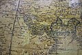
 W. & A. K. Johnston, Map of lower Egypt and part of Syria (FL37129699 3911997).jpg 3,153 × 2,372; 3.07 MB
-

-
 Westindische Inseln (3120220493).jpg 2,000 × 1,640; 2.9 MB

;_Horsburgh,_James;_East_India_Company,_from_the_Digital_Commonwealth_-_commonwealth_0z709793n.jpg)

_(16143948444).jpg)
_(16558990727).jpg)
_(16765187182).jpg)

_-_16-01-1809_-_mapa_(map).jpg)
.jpg)
.jpg)


_y_Armada_Naval_de_Filipinas,_las_primeras_al_LOC_90680732.jpg)
.jpg)


_BHL27432415.jpg)
_BHL27432416.jpg)

.jpg)


.jpg)
.jpg)
.jpg)


.jpg)
.jpg)


.jpg)

.jpg)
.jpg)


.jpg)
.jpg)
.jpg)
.jpg)