Category:1880s maps of Australia
Jump to navigation
Jump to search
Countries of Oceania: Australia · New Zealand · Solomon Islands
Other areas: Hawaii – Partly: Indonesia
Other areas: Hawaii – Partly: Indonesia

Subcategories
This category has the following 2 subcategories, out of 2 total.
- 1887 maps of Australia (6 F)
Media in category "1880s maps of Australia"
The following 30 files are in this category, out of 30 total.
-

-

-

-

-

-

-
 Australie. - Map of Australia, constructed for the use of schools - btv1b53023047n.jpg 9,600 × 7,963; 8.35 MB
-

-

-
 Clarence County (NSW) map.png 435 × 389; 263 KB
-
 Map of Gloucester County NSW (Australia).png 629 × 442; 375 KB
-
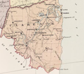
 Map of Hume County (NSW) Australia.png 506 × 440; 342 KB
-
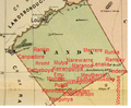
 Map of Monteagle County (NSW) Australia.png 561 × 405; 408 KB
-
 Map of Sandon County (NSW) Australia.png 471 × 434; 357 KB
-
 Map of Yanda County (NSW) Australia.png 262 × 216; 94 KB
-
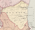 Ragleigh County (NSW) map.png 505 × 434; 392 KB
-

-

-

-

-

-

-

-
-

-

-

-

-
 Map - South Aust. Communications to Europe.jpg 760 × 570; 101 KB
-
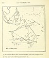
 Scottish geographical magazine (1885) (14596459858).jpg 2,264 × 2,468; 592 KB
%27_(11099348464).jpg)
_(14595226077).jpg)
.jpg)
_Printed_at_Penang_1863%27_(11152209426).jpg)
%27_(11167073354).jpg)
%27_(11169024155).jpg)

.jpg)
.jpg)
_map.png)
.png)
_Australia.png)
_Australia.png)
_Australia.png)
_Australia.png)
_map.png)
.jpg)
.jpg)
.jpg)
.jpg)
.jpg)
.jpg)
%27_(11161060084).jpg)
%27_(11164729416).jpg)

%27_(16403867399).jpg)

_(14596459858).jpg)
.jpg)