Category:230s BC
Sâta a-a navegaçión
Sâta a-a çèrchia
| 3rd century BC: ← 290s-280s-270s-260s-250s-240s-230s-220s-210s-200s → |
decénio | |||||
| Carrega un file murtimediâ | |||||
| Istanza di | |||||
|---|---|---|---|---|---|
| Parte di | |||||
| Consiste di | |||||
| Data |
| ||||
| Preceduto da | |||||
| Seguito da | |||||
| |||||
Sotocategorîe
Quésta categorîa a contêgne e 14 sotocategorîe indicæ chi de sótta, pe 'n totâle de 14.
File inta categorîa "230s BC"
Quésta categorîa a contêgne 17 file, indicæ chi de sótta, in sce 'n totâle de 17.
-
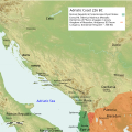 Adriatic Coast 226 BC 3rd century (English).svg 1 600 × 1 600; 8,66 MB
-
 Adriatic Coast 228 BC 3rd century (English).svg 1 600 × 1 600; 8,7 MB
-
 Adriatic Coast 230 BC 3rd century (English).svg 1 600 × 1 600; 8,68 MB
-
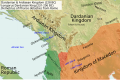 Illyria and Dardania Kingdoms (228 BC) (English).svg 1 037 × 686; 2,1 MB
-
 Illyria and Dardania Kingdoms (228 BC) (Portuguese).svg 1 037 × 686; 2,1 MB
-
 Illyria and Dardania Kingdoms (230 BC) (English).svg 1 037 × 686; 2,08 MB
-
 Illyria and Dardania Kingdoms (230 BC) (Portuguese).svg 1 037 × 686; 2,08 MB
-
 KingdomofTeuta.png 2 000 × 2 000; 3,95 MB
-
 Map of the Kingdom of Agron of the Ardiaei (English).svg 1 600 × 1 600; 6,46 MB
-
 Map of the Kingdom of Agron of the Ardiaei (Portuguese).svg 1 600 × 1 600; 6,46 MB
-
 Map of the Kingdom of Teuta of the Ardiaei (English).svg 1 600 × 1 600; 6,46 MB
-
 Map of the Kingdom of Teuta of the Ardiaei (Portuguese).svg 1 600 × 1 600; 6,46 MB
-
 Map of the territory of Demetrius of Pharos (English).png 2 000 × 2 000; 3,95 MB
-
 Map of the territory of Demetrius of Pharos (English).svg 1 600 × 1 600; 6,43 MB
-
 Map of the territory of Demetrius of Pharos (Portuguese).svg 1 600 × 1 600; 6,43 MB
-
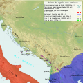
 PAEONIAN ARDIAEAN (ILLYRIAN) DARDANIAN KINGDOMS EXTENT DURING 230 BC.png 1 049 × 938; 1,88 MB
-
 Tetradrachm Ariarathes IV of Cappadocia CdM Paris.jpg 1 125 × 1 125; 1,04 MB
.svg)
.svg)
.svg)
_(English).svg)
_(Portuguese).svg)
_(English).svg)
_(Portuguese).svg)

.svg)
.svg)
.svg)
.svg)
.png)
.svg)
.svg)
_DARDANIAN_KINGDOMS_EXTENT_DURING_230_BC.png)
