Category:Achter Clarenburg 5, Utrecht
Jump to navigation
Jump to search
| Object location | | View all coordinates using: OpenStreetMap |
|---|
building in Utrecht, Netherlands  | |||||
| Upload media | |||||
| Instance of | |||||
|---|---|---|---|---|---|
| Location | Utrecht, Netherlands | ||||
| Street address |
| ||||
| Located on street | |||||
| Heritage designation |
| ||||
 | |||||
|
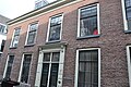
This is a category about rijksmonument number 36062
|
| Address |
|
Media in category "Achter Clarenburg 5, Utrecht"
The following 4 files are in this category, out of 4 total.
-
 Achter Clarenburg 5 - Utrecht.jpg 4,288 × 2,848; 6.6 MB
-
 Gevel - Utrecht - 20235354 - RCE.jpg 1,194 × 1,200; 312 KB
-
 Overzicht - Utrecht - 20235353 - RCE.jpg 1,187 × 1,200; 285 KB
-
 Utrecht - 2016 - panoramio (2).jpg 4,928 × 3,264; 7.03 MB


.jpg)