Category:Aerial photographs of Iowa
Jump to navigation
Jump to search
States of the United States: Alabama · Alaska · Arizona · Arkansas · California · Colorado · Connecticut · Delaware · Florida · Georgia · Hawaii · Idaho · Illinois · Indiana · Iowa · Kansas · Kentucky · Louisiana · Maine · Maryland · Massachusetts · Michigan · Minnesota · Mississippi · Missouri · Montana · Nebraska · Nevada · New Hampshire · New Jersey · New Mexico · New York · North Carolina · North Dakota · Ohio · Oklahoma · Oregon · Pennsylvania · Rhode Island · South Carolina · South Dakota · Tennessee · Texas · Utah · Vermont · Virginia · Washington · West Virginia · Wisconsin · Wyoming – District of Columbia: Washington, D.C.
insular area of the United States: American Samoa · Guam · Northern Mariana Islands · Puerto Rico · United States Virgin Islands – United States Minor Outlying Islands: Baker Island · Midway Atoll · Wake Island
insular area of the United States: American Samoa · Guam · Northern Mariana Islands · Puerto Rico · United States Virgin Islands – United States Minor Outlying Islands: Baker Island · Midway Atoll · Wake Island
Subcategories
This category has the following 5 subcategories, out of 5 total.
A
D
I
Media in category "Aerial photographs of Iowa"
The following 200 files are in this category, out of 271 total.
(previous page) (next page)-
 1969 aerial parsons college.jpg 2,397 × 3,446; 2.78 MB
-
 20170506-OC-PJK-0049 (34111883130).jpg 2,850 × 1,900; 1.54 MB
-
 20170506-OC-PJK-0062 (34455904746).jpg 2,850 × 1,900; 1.29 MB
-
 20170506-OC-PJK-0075 (34111883040).jpg 2,850 × 1,900; 1.54 MB
-
 20170506-OC-PJK-0080 (34455904666).jpg 2,850 × 1,900; 1.17 MB
-
 20170506-OC-PJK-0125 (34111882920).jpg 2,850 × 1,900; 2.28 MB
-
 20170506-OC-PJK-0134 (34455904556).jpg 2,850 × 1,900; 1.24 MB
-
 20170506-OC-PJK-0150 (34111882680).jpg 2,850 × 1,900; 1.5 MB
-
 20170506-OC-PJK-0169 (34455904506).jpg 2,850 × 1,900; 2.03 MB
-
 20170506-OC-PJK-0182 (34455904386).jpg 2,850 × 1,900; 2.21 MB
-
 20170506-OC-PJK-0187 (34111882460).jpg 2,850 × 1,900; 1.85 MB
-
 20170506-OC-PJK-0192 (34455904276).jpg 1,900 × 2,850; 1.98 MB
-

-

-

-

-

-

-

-

-

-

-

-
-

-

-

-

-

-

-

-

-
-

-

-
 Adel, Iowa aerial 01.jpg 2,848 × 4,288; 3.62 MB
-
 Adel, Iowa aerial 01A.jpg 2,848 × 4,288; 9.48 MB
-
 Adel, Iowa aerial 02.jpg 4,288 × 2,848; 3.73 MB
-
 Adel, Iowa aerial 02A.jpg 4,288 × 2,848; 9.71 MB
-
 Aerial 10 km SSW of Bayard, Iowa 01.jpg 4,288 × 2,848; 3.49 MB
-
 Aerial 10 km SSW of Bayard, Iowa 01A.jpg 4,288 × 2,848; 9.58 MB
-
 Aerial 6km NW of Dow City, Iowa 01.jpg 2,848 × 4,288; 3.4 MB
-
 Aerial 6km NW of Dow City, Iowa 01A.jpg 2,848 × 4,288; 8.94 MB
-
 Aerial of Northeast Iowa from 10,000 feet (34111882600).jpg 2,850 × 1,900; 1.69 MB
-
 Aerial view of Hancock, Iowa, June 2017.JPG 4,320 × 3,240; 4.16 MB
-
 Ankeny 1958.jpg 2,202 × 1,497; 1.52 MB
-
 Badger Lake State Wildlife Management Area - Mar 11, 2020.jpg 4,944 × 3,840; 6.51 MB
-
 Badger Lake State Wildlife Management Area aerial 01.jpg 4,288 × 2,848; 3.09 MB
-
 Badger Lake State Wildlife Management Area aerial 01A.jpg 4,288 × 2,848; 10.37 MB
-
 Badger Lake State Wildlife Management Area aerial 02.jpg 4,288 × 2,848; 3.11 MB
-
 Badger Lake State Wildlife Management Area aerial 02A.jpg 4,288 × 2,848; 9.12 MB
-
 Barringer-Arial.jpg 319 × 239; 12 KB
-
 Batavia, Iowa (11004228916).jpg 4,000 × 3,000; 2.1 MB
-
 Bellevue-IA-Aerial.jpg 5,184 × 3,456; 6.04 MB
-
 Black Hawk Bridge Lansing 1995.jpg 4,623 × 3,638; 3.09 MB
-
 Blum Stadium aerial view (Fairfield, Iowa - 1966).jpg 1,136 × 544; 95 KB
-
 Braddyville, Iowa (14203770405).jpg 4,000 × 3,000; 6.8 MB
-
 Brighton, Iowa (9181531880).jpg 4,000 × 3,000; 2.22 MB
-
 Bussey Lake Iowa aerial view.jpg 1,500 × 1,500; 1.17 MB
-
 BVU-campus-aerial.jpg 1,920 × 1,080; 661 KB
-
 Carroll, Iowa aerial 01.jpg 4,288 × 2,848; 3.37 MB
-
 Carroll, Iowa aerial 01A.jpg 4,288 × 2,848; 10.65 MB
-
 Castana, Iowa aerial 01.jpg 2,848 × 4,288; 3.21 MB
-
 Castana, Iowa aerial 01A.jpg 2,848 × 4,288; 9.48 MB
-
 CERA-USGS-labeled.jpg 944 × 739; 335 KB
-
 CERA-USGS-labeled.svg 535 × 383; 843 KB
-
 Chariton, Iowa (11004127835).jpg 4,000 × 3,000; 7.02 MB
-
 Charlotte Iowa.jpg 1,125 × 826; 1.02 MB
-
 Chester, Iowa.jpg 5,172 × 3,082; 12.58 MB
-
 CIty of Grandview Iowa.jpg 2,748 × 1,603; 948 KB
-
 Clarinda, Iowa (14200480001).jpg 4,000 × 3,000; 7.44 MB
-
 Clarinda, Iowa (14201275252).jpg 4,000 × 3,000; 7.31 MB
-
 Clinton, Iowa (21814655706).jpg 4,000 × 3,000; 6.36 MB
-
 Clinton, Iowa (7981555851).jpg 4,000 × 3,000; 6.81 MB
-
 Columbus Junction, Iowa (9179319723).jpg 4,000 × 3,000; 2.11 MB
-
 Columbus Junction, Iowa (9181533536).jpg 4,000 × 3,000; 2.21 MB
-
 Coon Rapids, Iowa aerial 01.jpg 4,288 × 2,848; 3.36 MB
-
 Coon Rapids, Iowa aerial 01A.jpg 4,288 × 2,848; 9.26 MB
-
 Coralville Lake from airplane.JPG 640 × 480; 133 KB
-
 CoralvilleDamSunday15Jun08.jpg 720 × 479; 396 KB
-
 Crawfordsville, Iowa (9179318933).jpg 3,660 × 2,940; 1.48 MB
-
 Decorah High School.jpg 5,594 × 2,880; 9.93 MB
-
 Decorah Municipal Center.jpg 4,000 × 3,000; 9.45 MB
-
 Denison, Iowa aerial 01.jpg 2,848 × 4,288; 3.57 MB
-
 Denison, Iowa aerial 01A.jpg 2,848 × 4,288; 8.74 MB
-
 Denison, Iowa aerial 02.jpg 2,848 × 4,288; 3.55 MB
-
 Denison, Iowa aerial 02A.jpg 2,848 × 4,288; 8.77 MB
-
 Denison, Iowa aerial 03.jpg 2,848 × 4,288; 3.43 MB
-
 Denison, Iowa aerial 03A.jpg 2,848 × 4,288; 8.65 MB
-
 Des Moines River, North of Ottumwa, Iowa (11004355043).jpg 4,000 × 3,000; 2.41 MB
-
 DeWitt, Iowa (21219764543).jpg 4,000 × 3,000; 2.7 MB
-
 DeWitt, Iowa (21652961188).jpg 4,000 × 3,000; 2.63 MB
-
 Dorchester, Iowa.jpg 4,000 × 3,000; 7.9 MB
-
 Dubuque aerial 2.jpg 4,368 × 2,912; 5.64 MB
-
 Dubuque aerial.jpg 4,368 × 2,912; 5.13 MB
-
 Dubuque IA - Julien Dubuque Bridge (US 20).jpg 2,800 × 2,128; 3 MB
-
 Durant, Iowa (14230844363).jpg 4,000 × 3,000; 9.84 MB
-
 East Branch Panther Creek, Iowa aerial 01.jpg 4,288 × 2,848; 3.12 MB
-
 East Branch Panther Creek, Iowa aerial 01A.jpg 4,288 × 2,848; 9.55 MB
-
 Eddyville, Iowa (7981507229).jpg 4,000 × 3,000; 1.94 MB
-
 Effigy-Mounds-Great-Bear.jpg 1,500 × 895; 546 KB
-
 Efmo bird mounds.jpg 250 × 171; 9 KB
-
 Efmo fire point mounds.jpg 450 × 331; 26 KB
-
 Efmo marching bear mounds 02.jpg 450 × 315; 30 KB
-
 Efmo marching bear mounds.jpg 450 × 301; 27 KB
-
 Efmo sny magill mounds 02.jpg 450 × 313; 27 KB
-
 Efmo sny magill mounds.jpg 450 × 313; 27 KB
-
 Eldon, Iowa (11004357303).jpg 4,000 × 3,000; 2.04 MB
-
 Elevated houses on river in Iowa.jpg 4,673 × 3,552; 11.91 MB
-
 Fairfield, Iowa (11004358713).jpg 4,000 × 3,000; 2.39 MB
-
 Fairfield, Iowa (14201278112).jpg 4,000 × 3,000; 6.39 MB
-
 FI0001634.jpg 3,000 × 1,798; 799 KB
-
 Fremont, Iowa and Oskaloosa Municipal Airport (7981512928).jpg 4,000 × 3,000; 1.94 MB
-
 Froelich, Iowa.jpg 3,928 × 2,887; 10.35 MB
-
 Full breach at levee L-575 near Hamburg.jpg 1,024 × 685; 328 KB
-
 Garden Grove, Iowa (11004220686).jpg 4,000 × 3,000; 2.63 MB
-
 Google Data Center, Council Bluffs Iowa (49062863796).jpg 4,000 × 2,250; 6.64 MB
-
 Guttenberg aerial.jpg 2,200 × 1,348; 1.66 MB
-
 Harpers Ferry, Iowa City Hall.jpg 3,662 × 3,000; 8.8 MB
-
 Harpers Ferry, Iowa.jpg 7,509 × 1,906; 11.54 MB
-
 Hedrick, Iowa (7981515682).jpg 4,000 × 3,000; 1.96 MB
-
 Hills, Iowa and U.S. Route 218 (14024050460).jpg 4,000 × 3,000; 9.2 MB
-
 Humeston, Iowa (11004288724).jpg 4,000 × 3,000; 2.66 MB
-
 Humeston, Iowa (14017106289).jpg 4,000 × 3,000; 6.02 MB
-
 I-80 Near the Quad-Cities, Iowa-Illinois (7981552287).jpg 3,000 × 4,000; 2.09 MB
-
 Indianola, Iowa (14024020139).jpg 4,000 × 3,000; 10.02 MB
-
 Indianola, Iowa (14024099127).jpg 4,000 × 3,000; 9.74 MB
-
 Interstate 35 Near Little River Lake and Leon, Iowa (11004219646).jpg 4,000 × 3,000; 2.7 MB
-
 Interstate 80 Crossing Mississippi River, Le Claire, Iowa (14230841863).jpg 4,000 × 3,000; 8.68 MB
-
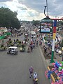 Iowa state fair from the air.jpg 2,160 × 2,880; 1.42 MB
-
 Iowa State Highway 76.jpg 3,923 × 3,963; 11.51 MB
-
 Julien Dubuque Bridge with Dubuque Downtown.jpg 3,648 × 2,736; 5.52 MB
-

-
 Kalona, Iowa (14210681725).jpg 4,000 × 3,000; 10.03 MB
-
 Kalona, Iowa (21218098444).jpg 2,000 × 1,500; 1.03 MB
-
 Kalona, Iowa (21219806773).jpg 4,000 × 3,000; 2.69 MB
-
 Kalona, Iowa.jpg 4,000 × 3,000; 2.66 MB
-
 KC-135 and F-16 over the Field of Dreams.jpg 6,016 × 4,016; 13.93 MB
-
 Keithsburg Illinois and railroad bridge over the Mississippi River.jpg 7,083 × 5,453; 7.75 MB
-
 Kellerton, Iowa (11004347893).jpg 4,000 × 3,000; 2.58 MB
-
 Keokuk County, Iowa (21653993289).jpg 4,000 × 3,000; 2.52 MB
-
 Keokuk, Iowa (101322445).jpg 1,200 × 1,600; 635 KB
-
 Keokuk, Iowa (101322691).jpg 1,600 × 1,200; 616 KB
-
 Keokuk, Iowa (101322787).jpg 1,600 × 1,200; 575 KB
-
 Keswick, Iowa (21652835680).jpg 4,000 × 3,000; 2.72 MB
-
 Keswick, Iowa (21850473751) (cropped).jpg 1,100 × 736; 156 KB
-
 Keswick, Iowa (21850473751).jpg 4,000 × 3,000; 2.7 MB
-
 Knoxville, Iowa (14208245012).jpg 4,000 × 3,000; 8.42 MB
-
 Kurtz Family Farm 1974 - panoramio.jpg 1,476 × 996; 284 KB
-
 Lake Panorama, Iowa aerial 01.jpg 2,848 × 4,288; 3.58 MB
-
 Lake Panorama, Iowa aerial 01A.jpg 2,848 × 4,288; 9.04 MB
-
 Lansing (Black Hawk Bridge) construction and closure.jpg 4,000 × 3,000; 8.71 MB
-
 Lansing Generating Station.jpg 2,012 × 1,320; 333 KB
-
 Lansing IA April 14 2001.jpg 800 × 551; 102 KB
-
 Lansing Iowa bridge-2.jpg 4,000 × 3,000; 9.23 MB
-
 Lansing Iowa bridge-3.jpg 4,000 × 3,295; 10.5 MB
-
 Lansing Iowa bridge-4.jpg 9,486 × 2,751; 16.59 MB
-
 Lansing Iowa bridge-5.jpg 4,000 × 3,000; 8.93 MB
-
 Lansing Iowa bridge-6.jpg 3,062 × 4,718; 9.15 MB
-
 Lansing Iowa bridge-7.jpg 4,858 × 2,059; 6.36 MB
-
 Lansing, Iowa.jpg 10,454 × 1,513; 10.23 MB
-
 Little River Lake and Leon, Iowa (11004287414).jpg 3,575 × 3,000; 2.08 MB
-
 Luther College.jpg 4,896 × 2,542; 7.13 MB
-
 Manilla, Iowa aerial 01.jpg 2,848 × 4,288; 3.29 MB
-
 Manilla, Iowa aerial 01A.jpg 2,848 × 4,288; 8.9 MB
-
 Manilla, Iowa aerial 02.jpg 4,288 × 2,848; 3.4 MB
-
 Manilla, Iowa aerial 02A.jpg 4,288 × 2,848; 9.14 MB
-
 Manning, Iowa aerial 01.jpg 4,288 × 2,848; 3.29 MB
-
 Manning, Iowa aerial 01A.jpg 4,288 × 2,848; 9.67 MB
-
 Maple River aerial 01.jpg 2,848 × 4,288; 3.28 MB
-
 Maple River aerial 01A.jpg 2,848 × 4,288; 8.21 MB
-
 Mapleton, Iowa aerial 01.jpg 2,848 × 4,288; 3.26 MB
-
 Mapleton, Iowa aerial 01A.jpg 2,848 × 4,288; 9.96 MB
-
 Massena, Iowa (14210688325).jpg 4,000 × 3,000; 8.32 MB
-
 McGregor, Iowa.jpg 4,000 × 3,606; 11.57 MB
-
 Mercy Medical Center, Cedar Rapids Iowa.jpg 1,356 × 646; 443 KB
-
 MFL MarMac High School in Monona, Iowa.jpg 5,262 × 2,945; 10.39 MB
-
 Millersburg, Iowa (21829015192) (cropped).jpg 1,669 × 1,196; 311 KB
-
 Millersburg, Iowa (21829015192).jpg 4,000 × 3,000; 2.58 MB
-
 Mississippi River from United 793 (6304857229).jpg 1,600 × 1,200; 292 KB
-
 Mississippi River Lock and Dam number 11.jpg 1,500 × 1,001; 307 KB
-
 Mississippi River Lock and Dam number 12.jpg 1,500 × 1,000; 291 KB
-
 Mississippi River Lock and Dam number 13.jpg 1,500 × 1,001; 287 KB
-
 Mississippi River Lock and Dam number 16.jpg 1,500 × 1,001; 360 KB
-
 Mississippi River Lock and Dam number 17.jpg 2,012 × 1,320; 290 KB
-
 Mississippi River Lock and Dam Number 19 near Keokuk Iowa.jpg 2,004 × 1,276; 221 KB
-
 Mississippi River Lock and Dam number 19.jpg 1,500 × 1,000; 290 KB
-
 Mississippi River Lock and Dam number 9.jpg 2,012 × 1,320; 262 KB
-
 Mississippi River, Clinton, Iowa (21219744663).jpg 4,000 × 3,000; 6.64 MB
-
 Mississippi River, Clinton, Iowa (21652943238).jpg 4,000 × 3,000; 2.75 MB
-
 Mississippi River, Clinton, Iowa (21814666826).jpg 4,000 × 3,000; 2.62 MB
-
 Mississippi River, Clinton, Iowa (21828946842).jpg 4,000 × 3,000; 6.85 MB
-
 Missouri River south of Sioux City aerial 01.jpg 4,288 × 2,848; 3.35 MB
-
 Missouri River south of Sioux City aerial 01A.jpg 4,288 × 2,848; 9.5 MB
-
 Missouri-Floyd Rivers Sioux City Iowa.jpg 1,500 × 1,000; 711 KB
-
 Monona, Iowa.jpg 3,934 × 2,906; 8.46 MB
-
 Moravia, Iowa (11004291494).jpg 4,000 × 3,000; 2.44 MB
-
 Mount Ayr, Iowa (11004285974).jpg 4,000 × 3,000; 2.24 MB
-
 Mouth Upper Iowa River Jan18 2001.jpg 800 × 530; 82 KB
-
 Muscatine, Iowa (7981523355).jpg 4,000 × 3,000; 1.96 MB

.jpg)
.jpg)
.jpg)
.jpg)
.jpg)
.jpg)
.jpg)
.jpg)
.jpg)
.jpg)
.jpg)


.jpg)


.jpg)


.jpg)
.jpg)
.jpg)


.jpg)


.jpg)
.jpg)
.jpg)
.jpg)
.jpg)
.jpg)


.jpg)


.jpg)
.jpg)
.jpg)


.jpg)
.jpg)


.jpg)


.jpg)

.jpg)
.jpg)

.jpg)


.jpg)
.jpg)


.jpg)
.jpg)
.jpg)
.jpg)
.jpg)
.jpg)
.jpg)
.jpg)
.jpg)


.jpg)
.jpg)
.jpg)
.jpg)


.jpg)
.jpg)
.jpg)
.jpg)
.jpg)
.jpg)
_(cropped).jpg)
.jpg)
.jpg)


_construction_and_closure.jpg)


.jpg)


.jpg)


_(cropped).jpg)
.jpg)
.jpg)


.jpg)
.jpg)
.jpg)
.jpg)


.jpg)
.jpg)

.jpg)