Category:Atlas der Neederlanden
Jump to navigation
Jump to search
.jpg)
- See also Atlas der Neederlanden.
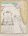
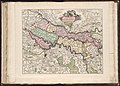
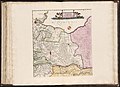
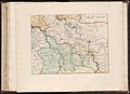
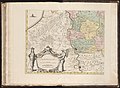
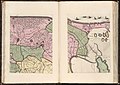
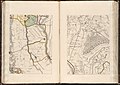
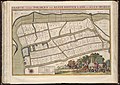
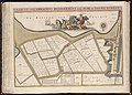
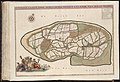
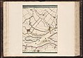
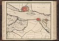
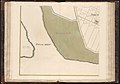
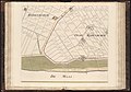
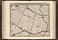
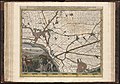
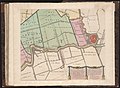
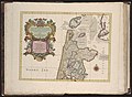
The Atlas der Neederlanden, or Atlas of the Netherlands, is a composite atlas which was presumably collected and composed by the publishing company Covens and Mortier in Amsterdam. The maps are gathered in nine volumes and show how the Low Countries, including Belgium and the former colonies of the Netherlands, have developed over de course of about two decades. The atlas contains more than 600 printed and manuscript maps and is preserved by the Special Collections of the University of Amsterdam.
.jpg) | |||||
| Upload media | |||||
| Instance of | |||||
|---|---|---|---|---|---|
| Main subject | |||||
| Country of origin | |||||
| Publication date |
| ||||
| |||||
Subcategories
This category has the following 9 subcategories, out of 9 total.
A
Pages in category "Atlas der Neederlanden"
This category contains only the following page.
Media in category "Atlas der Neederlanden"
The following 200 files are in this category, out of 638 total.
(previous page) (next page)-
 1773 map of Southeast Asia by Schley.jpg 3,295 × 3,489; 4.39 MB
-
 1773 map of the Arabian Sea by Schley.jpg 2,416 × 3,055; 2.75 MB
-
 Buitenplaats Duivenstein.jpg 1,042 × 607; 394 KB
-
 Buitenplaatsen Leeuwensteijn en Damsigt, Voorburg.jpg 1,069 × 1,043; 691 KB
-
 Map - Special Collections University of Amsterdam - Frontispice Atlas der Neederlanden I.jpg 10,731 × 7,028; 35.57 MB
-
 Map - Special Collections University of Amsterdam - Frontispice Atlas der Neederlanden II.jpg 10,550 × 7,004; 37.37 MB
-

-
 Map - Special Collections University of Amsterdam - Frontispice Atlas der Neederlanden IV.jpg 5,336 × 6,624; 10.28 MB
-
 Map - Special Collections University of Amsterdam - Frontispice Atlas der Neederlanden V.jpg 10,656 × 7,992; 29.79 MB
-
 Map - Special Collections University of Amsterdam - Frontispice Atlas der Neederlanden VI.jpg 10,656 × 7,992; 30.9 MB
-
 Map - Special Collections University of Amsterdam - Frontispice Atlas der Neederlanden VII.jpg 10,656 × 7,992; 30.99 MB
-
 Map - Special Collections University of Amsterdam - Frontispice Atlas der Neederlanden VIII.jpg 10,656 × 7,992; 30.62 MB
-
 Map - Special Collections University of Amsterdam - OTM- HB-KZL I 2 A 1 (01).jpg 9,445 × 7,034; 32.67 MB
-
 Map - Special Collections University of Amsterdam - OTM- HB-KZL I 2 A 1 (02).jpg 11,578 × 6,987; 41.75 MB
-
 Map - Special Collections University of Amsterdam - OTM- HB-KZL I 2 A 1 (03).jpg 9,386 × 6,992; 28.68 MB
-
 Map - Special Collections University of Amsterdam - OTM- HB-KZL I 2 A 1 (04).jpg 9,527 × 6,996; 31.83 MB
-
 Map - Special Collections University of Amsterdam - OTM- HB-KZL I 2 A 1 (05).jpg 9,529 × 6,995; 34.15 MB
-
 Map - Special Collections University of Amsterdam - OTM- HB-KZL I 2 A 1 (06).jpg 9,559 × 7,001; 31.9 MB
-
 Map - Special Collections University of Amsterdam - OTM- HB-KZL I 2 A 1 (07).jpg 9,564 × 6,972; 32.91 MB
-
 Map - Special Collections University of Amsterdam - OTM- HB-KZL I 2 A 1 (08).jpg 9,578 × 7,016; 33.77 MB
-
 Map - Special Collections University of Amsterdam - OTM- HB-KZL I 2 A 1 (09).jpg 9,638 × 7,002; 33.39 MB
-
 Map - Special Collections University of Amsterdam - OTM- HB-KZL I 2 A 1 (10).jpg 9,659 × 6,996; 35.71 MB
-
 Map - Special Collections University of Amsterdam - OTM- HB-KZL I 2 A 1 (11).jpg 9,665 × 6,990; 29.63 MB
-
 Map - Special Collections University of Amsterdam - OTM- HB-KZL I 2 A 1 (12).jpg 9,685 × 6,992; 30.56 MB
-
 Map - Special Collections University of Amsterdam - OTM- HB-KZL I 2 A 1 (13).jpg 9,678 × 6,987; 31.07 MB
-
 Map - Special Collections University of Amsterdam - OTM- HB-KZL I 2 A 1 (14).jpg 9,698 × 6,991; 29.93 MB
-
 Map - Special Collections University of Amsterdam - OTM- HB-KZL I 2 A 1 (15).jpg 9,704 × 7,010; 28.71 MB
-
 Map - Special Collections University of Amsterdam - OTM- HB-KZL I 2 A 1 (16).jpg 9,733 × 6,992; 30.48 MB
-
 Map - Special Collections University of Amsterdam - OTM- HB-KZL I 2 A 1 (17).jpg 9,732 × 6,968; 31.34 MB
-
 Map - Special Collections University of Amsterdam - OTM- HB-KZL I 2 A 1 (18).jpg 9,746 × 6,968; 30.22 MB
-
 Map - Special Collections University of Amsterdam - OTM- HB-KZL I 2 A 1 (19).jpg 9,740 × 6,951; 30.69 MB
-
 Map - Special Collections University of Amsterdam - OTM- HB-KZL I 2 A 1 (20).jpg 9,733 × 6,944; 32.61 MB
-
 Map - Special Collections University of Amsterdam - OTM- HB-KZL I 2 A 1 (21).jpg 9,734 × 6,956; 30.5 MB
-
 Map - Special Collections University of Amsterdam - OTM- HB-KZL I 2 A 1 (22).jpg 9,758 × 6,956; 32.02 MB
-
 Map - Special Collections University of Amsterdam - OTM- HB-KZL I 2 A 1 (23).jpg 9,770 × 6,956; 31.21 MB
-
 Map - Special Collections University of Amsterdam - OTM- HB-KZL I 2 A 1 (24).jpg 9,770 × 6,956; 34.4 MB
-
 Map - Special Collections University of Amsterdam - OTM- HB-KZL I 2 A 1 (25).jpg 9,770 × 6,968; 29.52 MB
-
 Map - Special Collections University of Amsterdam - OTM- HB-KZL I 2 A 1 (26).jpg 9,782 × 6,968; 29.22 MB
-
 Map - Special Collections University of Amsterdam - OTM- HB-KZL I 2 A 1 (27).jpg 9,770 × 6,968; 33 MB
-
 Map - Special Collections University of Amsterdam - OTM- HB-KZL I 2 A 1 (28).jpg 9,782 × 6,980; 31.52 MB
-
 Map - Special Collections University of Amsterdam - OTM- HB-KZL I 2 A 1 (29).jpg 9,782 × 6,968; 33.26 MB
-
 Map - Special Collections University of Amsterdam - OTM- HB-KZL I 2 A 1 (30).jpg 9,782 × 6,992; 31.52 MB
-
 Map - Special Collections University of Amsterdam - OTM- HB-KZL I 2 A 1 (31).jpg 9,782 × 6,992; 32.87 MB
-
 Map - Special Collections University of Amsterdam - OTM- HB-KZL I 2 A 1 (32).jpg 9,782 × 6,968; 35.62 MB
-
 Map - Special Collections University of Amsterdam - OTM- HB-KZL I 2 A 1 (33).jpg 9,782 × 6,968; 33.34 MB
-
 Map - Special Collections University of Amsterdam - OTM- HB-KZL I 2 A 1 (34).jpg 9,782 × 6,968; 35.91 MB
-
 Map - Special Collections University of Amsterdam - OTM- HB-KZL I 2 A 1 (35).jpg 9,770 × 6,968; 35.71 MB
-
 Map - Special Collections University of Amsterdam - OTM- HB-KZL I 2 A 1 (36).jpg 9,782 × 6,980; 39.12 MB
-
 Map - Special Collections University of Amsterdam - OTM- HB-KZL I 2 A 1 (37).jpg 9,770 × 6,992; 32.15 MB
-
 Map - Special Collections University of Amsterdam - OTM- HB-KZL I 2 A 1 (38).jpg 11,051 × 7,539; 41.42 MB
-
 Map - Special Collections University of Amsterdam - OTM- HB-KZL I 2 A 1 (39).jpg 9,710 × 6,992; 33.78 MB
-
 Map - Special Collections University of Amsterdam - OTM- HB-KZL I 2 A 1 (40).jpg 5,379 × 6,703; 15.93 MB
-
 Map - Special Collections University of Amsterdam - OTM- HB-KZL I 2 A 1 (41).jpg 9,735 × 6,980; 34.35 MB
-
 Map - Special Collections University of Amsterdam - OTM- HB-KZL I 2 A 1 (42).jpg 10,288 × 8,182; 39.36 MB
-
 Map - Special Collections University of Amsterdam - OTM- HB-KZL I 2 A 1 (43).jpg 10,491 × 8,195; 39.82 MB
-
 Map - Special Collections University of Amsterdam - OTM- HB-KZL I 2 A 1 (44).jpg 9,700 × 7,003; 34.92 MB
-
 Map - Special Collections University of Amsterdam - OTM- HB-KZL I 2 A 1 (45).jpg 9,685 × 6,982; 34.71 MB
-
 Map - Special Collections University of Amsterdam - OTM- HB-KZL I 2 A 1 (46).jpg 9,689 × 6,989; 31 MB
-
 Map - Special Collections University of Amsterdam - OTM- HB-KZL I 2 A 1 (47).jpg 8,150 × 6,788; 26.89 MB
-
 Map - Special Collections University of Amsterdam - OTM- HB-KZL I 2 A 1 (48).jpg 9,676 × 6,988; 30.44 MB
-
 Map - Special Collections University of Amsterdam - OTM- HB-KZL I 2 A 1 (49).jpg 9,671 × 7,007; 30.67 MB
-
 Map - Special Collections University of Amsterdam - OTM- HB-KZL I 2 A 1 (50).jpg 9,660 × 6,995; 34.07 MB
-
 Map - Special Collections University of Amsterdam - OTM- HB-KZL I 2 A 1 (51).jpg 9,663 × 7,003; 30.88 MB
-
 Map - Special Collections University of Amsterdam - OTM- HB-KZL I 2 A 1 (52).jpg 9,559 × 7,013; 33.35 MB
-
 Map - Special Collections University of Amsterdam - OTM- HB-KZL I 2 A 1 (53).jpg 9,544 × 7,014; 30.56 MB
-
 Map - Special Collections University of Amsterdam - OTM- HB-KZL I 2 A 1 (54).jpg 9,542 × 7,017; 30.65 MB
-
 Map - Special Collections University of Amsterdam - OTM- HB-KZL I 2 A 1 (55).jpg 9,545 × 7,014; 30.87 MB
-
 Map - Special Collections University of Amsterdam - OTM- HB-KZL I 2 A 1 (56).jpg 9,527 × 7,008; 30.12 MB
-
 Map - Special Collections University of Amsterdam - OTM- HB-KZL I 2 A 2 (01).jpg 9,206 × 6,980; 34.09 MB
-
 Map - Special Collections University of Amsterdam - OTM- HB-KZL I 2 A 2 (02).jpg 7,830 × 10,008; 42.19 MB
-
 Map - Special Collections University of Amsterdam - OTM- HB-KZL I 2 A 2 (03).jpg 5,239 × 10,860; 22.61 MB
-
 Map - Special Collections University of Amsterdam - OTM- HB-KZL I 2 A 2 (04).jpg 7,344 × 9,679; 34.66 MB
-
 Map - Special Collections University of Amsterdam - OTM- HB-KZL I 2 A 2 (05).jpg 11,387 × 7,353; 27.62 MB
-
 Map - Special Collections University of Amsterdam - OTM- HB-KZL I 2 A 2 (06).jpg 7,376 × 11,019; 29.25 MB
-
 Map - Special Collections University of Amsterdam - OTM- HB-KZL I 2 A 2 (07).jpg 8,474 × 6,828; 29.5 MB
-
 Map - Special Collections University of Amsterdam - OTM- HB-KZL I 2 A 2 (09).jpg 9,683 × 6,979; 31.02 MB
-
 Map - Special Collections University of Amsterdam - OTM- HB-KZL I 2 A 2 (10).jpg 9,698 × 6,985; 30.51 MB
-
 Map - Special Collections University of Amsterdam - OTM- HB-KZL I 2 A 2 (11).jpg 9,686 × 6,972; 29.8 MB
-
 Map - Special Collections University of Amsterdam - OTM- HB-KZL I 2 A 2 (12).jpg 9,754 × 6,984; 30.67 MB
-
 Map - Special Collections University of Amsterdam - OTM- HB-KZL I 2 A 2 (13).jpg 9,744 × 6,990; 30.13 MB
-
 Map - Special Collections University of Amsterdam - OTM- HB-KZL I 2 A 2 (14).jpg 9,745 × 7,004; 27.49 MB
-
 Map - Special Collections University of Amsterdam - OTM- HB-KZL I 2 A 2 (15).jpg 9,747 × 6,978; 28.51 MB
-
 Map - Special Collections University of Amsterdam - OTM- HB-KZL I 2 A 2 (16).jpg 9,756 × 6,956; 31.37 MB
-
 Map - Special Collections University of Amsterdam - OTM- HB-KZL I 2 A 2 (17).jpg 9,741 × 6,950; 31.78 MB
-
 Map - Special Collections University of Amsterdam - OTM- HB-KZL I 2 A 2 (18).jpg 9,770 × 6,956; 33.53 MB
-
 Map - Special Collections University of Amsterdam - OTM- HB-KZL I 2 A 2 (19).jpg 9,782 × 6,968; 33.3 MB
-
 Map - Special Collections University of Amsterdam - OTM- HB-KZL I 2 A 2 (20).jpg 9,770 × 6,944; 32.05 MB
-
 Map - Special Collections University of Amsterdam - OTM- HB-KZL I 2 A 2 (21).jpg 9,794 × 6,956; 31 MB
-
 Map - Special Collections University of Amsterdam - OTM- HB-KZL I 2 A 2 (22).jpg 9,806 × 6,978; 32.33 MB
-
 Map - Special Collections University of Amsterdam - OTM- HB-KZL I 2 A 2 (23).jpg 9,806 × 6,968; 32.07 MB
-
 Map - Special Collections University of Amsterdam - OTM- HB-KZL I 2 A 2 (24).jpg 9,794 × 6,956; 31.16 MB
-
 Map - Special Collections University of Amsterdam - OTM- HB-KZL I 2 A 2 (25).jpg 9,781 × 6,944; 29.64 MB
-
 Map - Special Collections University of Amsterdam - OTM- HB-KZL I 2 A 2 (26).jpg 9,805 × 6,930; 31.6 MB
-
 Map - Special Collections University of Amsterdam - OTM- HB-KZL I 2 A 2 (27).jpg 9,781 × 6,918; 30.77 MB
-
 Map - Special Collections University of Amsterdam - OTM- HB-KZL I 2 A 2 (28).jpg 9,768 × 6,919; 30.07 MB
-
 Map - Special Collections University of Amsterdam - OTM- HB-KZL I 2 A 2 (29).jpg 9,777 × 6,921; 29.22 MB
-
 Map - Special Collections University of Amsterdam - OTM- HB-KZL I 2 A 2 (30).jpg 9,769 × 6,907; 27.9 MB
-
 Map - Special Collections University of Amsterdam - OTM- HB-KZL I 2 A 2 (31).jpg 9,791 × 6,909; 33.92 MB
-
 Map - Special Collections University of Amsterdam - OTM- HB-KZL I 2 A 2 (32).jpg 9,792 × 6,944; 38.93 MB
-
 Map - Special Collections University of Amsterdam - OTM- HB-KZL I 2 A 2 (33).jpg 9,804 × 6,944; 33.76 MB
-
 Map - Special Collections University of Amsterdam - OTM- HB-KZL I 2 A 2 (34).jpg 9,806 × 6,956; 32.8 MB
-
 Map - Special Collections University of Amsterdam - OTM- HB-KZL I 2 A 2 (35).jpg 9,830 × 6,956; 34.71 MB
-
 Map - Special Collections University of Amsterdam - OTM- HB-KZL I 2 A 2 (36).jpg 9,806 × 6,968; 33.13 MB
-
 Map - Special Collections University of Amsterdam - OTM- HB-KZL I 2 A 2 (37).jpg 9,823 × 6,986; 33.21 MB
-
 Map - Special Collections University of Amsterdam - OTM- HB-KZL I 2 A 2 (38).jpg 9,838 × 6,969; 31.96 MB
-
 Map - Special Collections University of Amsterdam - OTM- HB-KZL I 2 A 2 (39).jpg 9,820 × 6,965; 32.7 MB
-
 Map - Special Collections University of Amsterdam - OTM- HB-KZL I 2 A 2 (40).jpg 9,848 × 6,977; 31.49 MB
-
 Map - Special Collections University of Amsterdam - OTM- HB-KZL I 2 A 2 (41).jpg 9,828 × 6,969; 31.2 MB
-
 Map - Special Collections University of Amsterdam - OTM- HB-KZL I 2 A 2 (42).jpg 9,878 × 6,980; 33.37 MB
-
 Map - Special Collections University of Amsterdam - OTM- HB-KZL I 2 A 2 (43).jpg 9,818 × 6,968; 33.32 MB
-
 Map - Special Collections University of Amsterdam - OTM- HB-KZL I 2 A 2 (44).jpg 9,842 × 6,968; 34.89 MB
-
 Map - Special Collections University of Amsterdam - OTM- HB-KZL I 2 A 2 (45).jpg 9,827 × 7,005; 31.01 MB
-
 Map - Special Collections University of Amsterdam - OTM- HB-KZL I 2 A 2 (46).jpg 9,818 × 6,992; 33.79 MB
-
 Map - Special Collections University of Amsterdam - OTM- HB-KZL I 2 A 2 (47).jpg 11,734 × 6,921; 39.08 MB
-
 Map - Special Collections University of Amsterdam - OTM- HB-KZL I 2 A 2 (48).jpg 9,825 × 7,019; 34.2 MB
-
 Map - Special Collections University of Amsterdam - OTM- HB-KZL I 2 A 2 (49).jpg 10,245 × 6,992; 33.98 MB
-
 Map - Special Collections University of Amsterdam - OTM- HB-KZL I 2 A 2 (50).jpg 9,782 × 7,028; 35.32 MB
-
 Map - Special Collections University of Amsterdam - OTM- HB-KZL I 2 A 2 (51).jpg 9,806 × 7,028; 34.25 MB
-
 Map - Special Collections University of Amsterdam - OTM- HB-KZL I 2 A 2 (52).jpg 9,794 × 7,028; 33.41 MB
-
 Map - Special Collections University of Amsterdam - OTM- HB-KZL I 2 A 2 (53).jpg 9,770 × 7,040; 33.11 MB
-
 Map - Special Collections University of Amsterdam - OTM- HB-KZL I 2 A 2 (54).jpg 9,758 × 7,040; 33.07 MB
-
 Map - Special Collections University of Amsterdam - OTM- HB-KZL I 2 A 2 (55).jpg 10,524 × 6,854; 35.61 MB
-
 Map - Special Collections University of Amsterdam - OTM- HB-KZL I 2 A 2 (56).jpg 9,710 × 7,016; 33.49 MB
-
 Map - Special Collections University of Amsterdam - OTM- HB-KZL I 2 A 2 (57).jpg 9,710 × 7,040; 32.9 MB
-
 Map - Special Collections University of Amsterdam - OTM- HB-KZL I 2 A 2 (58).jpg 9,698 × 7,040; 32.38 MB
-
 Map - Special Collections University of Amsterdam - OTM- HB-KZL I 2 A 2 (59).jpg 9,679 × 7,047; 32.27 MB
-
 Map - Special Collections University of Amsterdam - OTM- HB-KZL I 2 A 2 (60).jpg 10,418 × 7,016; 35.42 MB
-
 Map - Special Collections University of Amsterdam - OTM- HB-KZL I 2 A 2 (61).jpg 10,503 × 7,040; 34.87 MB
-
 Map - Special Collections University of Amsterdam - OTM- HB-KZL I 2 A 2 (62).jpg 9,642 × 7,024; 32.57 MB
-
 Map - Special Collections University of Amsterdam - OTM- HB-KZL I 2 A 2 (63).jpg 9,614 × 7,052; 31.73 MB
-
 Map - Special Collections University of Amsterdam - OTM- HB-KZL I 2 A 3 (01).jpg 9,377 × 7,018; 33.32 MB
-
 Map - Special Collections University of Amsterdam - OTM- HB-KZL I 2 A 3 (02).jpg 9,386 × 7,022; 34.07 MB
-
 Map - Special Collections University of Amsterdam - OTM- HB-KZL I 2 A 3 (03).jpg 9,358 × 7,015; 33.9 MB
-
 Map - Special Collections University of Amsterdam - OTM- HB-KZL I 2 A 3 (04).jpg 9,530 × 7,016; 33.51 MB
-
 Map - Special Collections University of Amsterdam - OTM- HB-KZL I 2 A 3 (05).jpg 13,398 × 6,551; 23.89 MB
-
 Map - Special Collections University of Amsterdam - OTM- HB-KZL I 2 A 3 (06).jpg 11,632 × 7,318; 34.7 MB
-
 Map - Special Collections University of Amsterdam - OTM- HB-KZL I 2 A 3 (07).jpg 9,767 × 7,006; 29.75 MB
-
 Map - Special Collections University of Amsterdam - OTM- HB-KZL I 2 A 3 (08).jpg 9,779 × 7,029; 29.78 MB
-
 Map - Special Collections University of Amsterdam - OTM- HB-KZL I 2 A 3 (09).jpg 9,817 × 7,027; 31.57 MB
-
 Map - Special Collections University of Amsterdam - OTM- HB-KZL I 2 A 3 (10).jpg 9,844 × 7,024; 30.79 MB
-
 Map - Special Collections University of Amsterdam - OTM- HB-KZL I 2 A 3 (11).jpg 9,902 × 7,016; 32.14 MB
-
 Map - Special Collections University of Amsterdam - OTM- HB-KZL I 2 A 3 (11a).jpg 9,914 × 7,016; 32.45 MB
-
 Map - Special Collections University of Amsterdam - OTM- HB-KZL I 2 A 3 (12).jpg 9,910 × 7,030; 32.19 MB
-
 Map - Special Collections University of Amsterdam - OTM- HB-KZL I 2 A 3 (13).jpg 9,895 × 7,039; 32.8 MB
-
 Map - Special Collections University of Amsterdam - OTM- HB-KZL I 2 A 3 (14).jpg 9,928 × 7,010; 35.32 MB
-
 Map - Special Collections University of Amsterdam - OTM- HB-KZL I 2 A 3 (15).jpg 6,498 × 5,208; 15.68 MB
-
 Map - Special Collections University of Amsterdam - OTM- HB-KZL I 2 A 3 (16).jpg 6,489 × 5,118; 13.7 MB
-
 Map - Special Collections University of Amsterdam - OTM- HB-KZL I 2 A 3 (17).jpg 9,936 × 6,978; 34.37 MB
-
 Map - Special Collections University of Amsterdam - OTM- HB-KZL I 2 A 3 (18).jpg 9,938 × 6,992; 40.15 MB
-
 Map - Special Collections University of Amsterdam - OTM- HB-KZL I 2 A 3 (19).jpg 9,962 × 7,040; 36.8 MB
-
 Map - Special Collections University of Amsterdam - OTM- HB-KZL I 2 A 3 (20).jpg 9,970 × 7,003; 28.86 MB
-
 Map - Special Collections University of Amsterdam - OTM- HB-KZL I 2 A 3 (21).jpg 9,971 × 6,981; 29.54 MB
-
 Map - Special Collections University of Amsterdam - OTM- HB-KZL I 2 A 3 (22).jpg 9,986 × 7,016; 28.73 MB
-
 Map - Special Collections University of Amsterdam - OTM- HB-KZL I 2 A 3 (23).jpg 9,961 × 7,013; 29.01 MB
-
 Map - Special Collections University of Amsterdam - OTM- HB-KZL I 2 A 3 (24).jpg 9,988 × 6,973; 29.45 MB
-
 Map - Special Collections University of Amsterdam - OTM- HB-KZL I 2 A 3 (25).jpg 9,988 × 6,984; 30.83 MB
-
 Map - Special Collections University of Amsterdam - OTM- HB-KZL I 2 A 3 (26).jpg 9,971 × 6,996; 30.41 MB
-
 Map - Special Collections University of Amsterdam - OTM- HB-KZL I 2 A 3 (27).jpg 9,967 × 7,004; 30.08 MB
-
 Map - Special Collections University of Amsterdam - OTM- HB-KZL I 2 A 3 (28).jpg 9,965 × 6,998; 41.17 MB
-
 Map - Special Collections University of Amsterdam - OTM- HB-KZL I 2 A 3 (29).jpg 9,992 × 7,027; 41.25 MB
-
 Map - Special Collections University of Amsterdam - OTM- HB-KZL I 2 A 3 (30).jpg 9,953 × 7,009; 38.51 MB
-
 Map - Special Collections University of Amsterdam - OTM- HB-KZL I 2 A 3 (31).jpg 9,955 × 6,957; 38.22 MB
-
 Map - Special Collections University of Amsterdam - OTM- HB-KZL I 2 A 3 (32).jpg 9,955 × 6,957; 36.32 MB
-
 Map - Special Collections University of Amsterdam - OTM- HB-KZL I 2 A 3 (33).jpg 9,955 × 6,957; 35.99 MB
-
 Map - Special Collections University of Amsterdam - OTM- HB-KZL I 2 A 3 (34).jpg 9,955 × 6,957; 37.39 MB
-
 Map - Special Collections University of Amsterdam - OTM- HB-KZL I 2 A 3 (35).jpg 9,967 × 6,982; 39.39 MB
-
 Map - Special Collections University of Amsterdam - OTM- HB-KZL I 2 A 3 (36).jpg 9,967 × 6,969; 37.48 MB
-
 Map - Special Collections University of Amsterdam - OTM- HB-KZL I 2 A 3 (37).jpg 9,979 × 7,005; 35.04 MB
-
 Map - Special Collections University of Amsterdam - OTM- HB-KZL I 2 A 3 (38).jpg 9,966 × 6,981; 33.98 MB
-
 Map - Special Collections University of Amsterdam - OTM- HB-KZL I 2 A 3 (39).jpg 9,967 × 6,957; 36.69 MB
-
 Map - Special Collections University of Amsterdam - OTM- HB-KZL I 2 A 3 (40).jpg 9,954 × 6,981; 37.44 MB
-
 Map - Special Collections University of Amsterdam - OTM- HB-KZL I 2 A 3 (41).jpg 9,967 × 6,970; 37.37 MB
-
 Map - Special Collections University of Amsterdam - OTM- HB-KZL I 2 A 3 (42).jpg 9,967 × 6,957; 34.42 MB
-
 Map - Special Collections University of Amsterdam - OTM- HB-KZL I 2 A 3 (43).jpg 9,967 × 6,969; 35.47 MB
-
 Map - Special Collections University of Amsterdam - OTM- HB-KZL I 2 A 3 (44).jpg 9,955 × 6,957; 35.49 MB
-
 Map - Special Collections University of Amsterdam - OTM- HB-KZL I 2 A 3 (45).jpg 9,968 × 6,969; 37.33 MB
-
 Map - Special Collections University of Amsterdam - OTM- HB-KZL I 2 A 3 (46).jpg 9,955 × 6,993; 37.27 MB
-
 Map - Special Collections University of Amsterdam - OTM- HB-KZL I 2 A 3 (47).jpg 9,943 × 6,969; 34.58 MB
-
 Map - Special Collections University of Amsterdam - OTM- HB-KZL I 2 A 3 (48).jpg 9,943 × 6,993; 34.31 MB
-
 Map - Special Collections University of Amsterdam - OTM- HB-KZL I 2 A 3 (49).jpg 9,955 × 6,981; 35.45 MB
-
 Map - Special Collections University of Amsterdam - OTM- HB-KZL I 2 A 3 (50).jpg 9,943 × 6,969; 38.78 MB
-
 Map - Special Collections University of Amsterdam - OTM- HB-KZL I 2 A 3 (51).jpg 9,943 × 6,993; 39.15 MB
-
 Map - Special Collections University of Amsterdam - OTM- HB-KZL I 2 A 3 (52).jpg 9,931 × 6,981; 36.08 MB
-
 Map - Special Collections University of Amsterdam - OTM- HB-KZL I 2 A 3 (53).jpg 9,931 × 6,969; 36.77 MB
-
 Map - Special Collections University of Amsterdam - OTM- HB-KZL I 2 A 3 (54).jpg 9,931 × 6,981; 37.07 MB
-
 Map - Special Collections University of Amsterdam - OTM- HB-KZL I 2 A 3 (55).jpg 9,955 × 6,993; 38.65 MB
-
 Map - Special Collections University of Amsterdam - OTM- HB-KZL I 2 A 3 (59).jpg 9,883 × 7,017; 33.72 MB
-
 Map - Special Collections University of Amsterdam - OTM- HB-KZL I 2 A 3 (60).jpg 9,883 × 7,029; 33.93 MB
-
 Map - Special Collections University of Amsterdam - OTM- HB-KZL I 2 A 3 (61).jpg 9,883 × 7,041; 33.7 MB
-
 Map - Special Collections University of Amsterdam - OTM- HB-KZL I 2 A 3 (62).jpg 9,847 × 7,041; 32.16 MB
-
 Map - Special Collections University of Amsterdam - OTM- HB-KZL I 2 A 3 (63).jpg 9,823 × 7,053; 31.77 MB
-
 Map - Special Collections University of Amsterdam - OTM- HB-KZL I 2 A 3 (64).jpg 9,619 × 7,029; 31.4 MB
-
 Map - Special Collections University of Amsterdam - OTM- HB-KZL I 2 A 3 (65).jpg 9,619 × 7,053; 34.95 MB
-
 Map - Special Collections University of Amsterdam - OTM- HB-KZL I 2 A 3 (66).jpg 9,643 × 7,042; 32.4 MB
-
 Map - Special Collections University of Amsterdam - OTM- HB-KZL I 2 A 3 (67).jpg 9,599 × 7,041; 30.41 MB
-
 Map - Special Collections University of Amsterdam - OTM- HB-KZL I 2 A 4 (01).jpg 9,467 × 7,099; 31.25 MB
-
 Map - Special Collections University of Amsterdam - OTM- HB-KZL I 2 A 4 (02).jpg 9,481 × 7,067; 30.94 MB
-
 Map - Special Collections University of Amsterdam - OTM- HB-KZL I 2 A 4 (03).jpg 9,626 × 7,096; 29.79 MB
-
 Map - Special Collections University of Amsterdam - OTM- HB-KZL I 2 A 4 (04).jpg 9,733 × 7,157; 29.66 MB
-
 Map - Special Collections University of Amsterdam - OTM- HB-KZL I 2 A 4 (05).jpg 9,791 × 7,076; 28.59 MB


.jpg)
.jpg)
.jpg)
.jpg)
.jpg)
.jpg)
.jpg)
.jpg)
.jpg)
.jpg)
.jpg)
.jpg)
.jpg)
.jpg)
.jpg)
.jpg)
.jpg)
.jpg)
.jpg)
.jpg)
.jpg)
.jpg)
.jpg)
.jpg)
.jpg)
.jpg)
.jpg)
.jpg)
.jpg)
.jpg)
.jpg)
.jpg)
.jpg)
.jpg)
.jpg)
.jpg)
.jpg)
.jpg)
.jpg)
.jpg)
.jpg)
.jpg)
.jpg)
.jpg)
.jpg)
.jpg)
.jpg)
.jpg)
.jpg)
.jpg)
.jpg)
.jpg)
.jpg)
.jpg)
.jpg)
.jpg)
.jpg)
.jpg)
.jpg)
.jpg)
.jpg)
.jpg)
.jpg)
.jpg)
.jpg)
.jpg)
.jpg)
.jpg)
.jpg)
.jpg)
.jpg)
.jpg)
.jpg)
.jpg)
.jpg)
.jpg)
.jpg)
.jpg)
.jpg)
.jpg)
.jpg)
.jpg)
.jpg)
.jpg)
.jpg)
.jpg)
.jpg)
.jpg)
.jpg)
.jpg)
.jpg)
.jpg)
.jpg)
.jpg)
.jpg)
.jpg)
.jpg)
.jpg)
.jpg)
.jpg)
.jpg)
.jpg)
.jpg)
.jpg)
.jpg)
.jpg)
.jpg)
.jpg)
.jpg)
.jpg)
.jpg)
.jpg)
.jpg)
.jpg)
.jpg)
.jpg)
.jpg)
.jpg)
.jpg)
.jpg)
.jpg)
.jpg)
.jpg)
.jpg)
.jpg)
.jpg)
.jpg)
.jpg)
.jpg)
.jpg)
.jpg)
.jpg)
.jpg)
.jpg)
.jpg)
.jpg)
.jpg)
.jpg)
.jpg)
.jpg)
.jpg)
.jpg)
.jpg)
.jpg)
.jpg)
.jpg)
.jpg)
.jpg)
.jpg)
.jpg)
.jpg)
.jpg)
.jpg)
.jpg)
.jpg)
.jpg)
.jpg)
.jpg)
.jpg)
.jpg)
.jpg)
.jpg)
.jpg)
.jpg)
.jpg)
.jpg)
.jpg)
.jpg)
.jpg)
.jpg)
.jpg)
.jpg)
.jpg)
.jpg)
.jpg)
.jpg)
.jpg)
.jpg)
.jpg)
.jpg)
.jpg)
.jpg)
.jpg)
.jpg)
.jpg)
.jpg)
.jpg)
.jpg)