Category:Avonbridge
Jump to navigation
Jump to search
Gàidhlig: 'S e baile ann an Comhairle na h-Eaglaise Brice a tha ann an Drochaid Abhainne (Beurla: Avonbridge).
village in Falkirk, Scotland, UK  Krigsminnesmerke i Avonbridge. Foto: Richard Webb | |||||
| Upload media | |||||
| Instance of | |||||
|---|---|---|---|---|---|
| Location |
| ||||
| Population |
| ||||
| Area |
| ||||
| official website | |||||
 | |||||
Media in category "Avonbridge"
The following 44 files are in this category, out of 44 total.
-
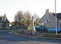
 Avonbridge - geograph.org.uk - 85233.jpg 640 × 423; 70 KB
-
 Avonbridge.jpg 639 × 460; 72 KB
-
 Ayrshire cattle - geograph.org.uk - 1330308.jpg 640 × 480; 127 KB
-
 Babbithill - geograph.org.uk - 1593419.jpg 640 × 480; 115 KB
-
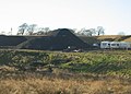 Bankrigg opencast. - geograph.org.uk - 85237.jpg 640 × 460; 60 KB
-
 Beech lined road, Babbithill - geograph.org.uk - 1593426.jpg 640 × 480; 120 KB
-
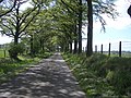 Beech-lined lane - geograph.org.uk - 184194.jpg 640 × 480; 140 KB
-
 Blackston Junction Station site of 1821148 994083ed.jpg 640 × 346; 113 KB
-
 Central Scotland Forest, Drumtassie Burn - geograph.org.uk - 1330289.jpg 640 × 480; 120 KB
-
 Craig-marrie Farm near Avonbridge - geograph.org.uk - 168700.jpg 640 × 480; 66 KB
-
 Derelict Weighbridge - geograph.org.uk - 416237.jpg 640 × 480; 94 KB
-
 Drumtassie Forest clearing - geograph.org.uk - 416209.jpg 640 × 480; 123 KB
-
 Farmland, Gowanbank - geograph.org.uk - 1120226.jpg 640 × 480; 114 KB
-
 Forest edge - geograph.org.uk - 179897.jpg 640 × 480; 126 KB
-
 Former opencast workings - geograph.org.uk - 179893.jpg 640 × 480; 121 KB
-
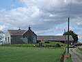
 Fortified manor house. - geograph.org.uk - 85263.jpg 640 × 480; 109 KB
-

-
 Gingerbread House Avonbridge - geograph.org.uk - 168703.jpg 640 × 480; 145 KB
-
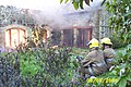 Gowanbank fire - geograph.org.uk - 170679.jpg 640 × 427; 94 KB
-
 Greencraig. - geograph.org.uk - 85240.jpg 640 × 480; 64 KB
-
 Grown out shelterbelt. - geograph.org.uk - 85249.jpg 640 × 480; 110 KB
-
 Kennels - geograph.org.uk - 179953.jpg 640 × 480; 99 KB
-
 Minor road, Rigghead - geograph.org.uk - 1120236.jpg 640 × 480; 91 KB
-
 Mobile phone mast - geograph.org.uk - 179946.jpg 480 × 640; 107 KB
-
 New forest - geograph.org.uk - 184190.jpg 640 × 480; 122 KB
-

-
 New houses, Avonbridge - geograph.org.uk - 85230.jpg 639 × 463; 83 KB
-
 Old cottage - geograph.org.uk - 179891.jpg 640 × 480; 124 KB
-
 Part of Central Scotland Forest - geograph.org.uk - 100040.jpg 640 × 480; 80 KB
-
 Rashy land, Standburn. - geograph.org.uk - 90372.jpg 640 × 480; 97 KB
-
 Replanted opencast workings - geograph.org.uk - 184193.jpg 640 × 480; 115 KB
-
 River Avon - geograph.org.uk - 184195.jpg 640 × 480; 151 KB
-
 Road from Wester Whin, Greenhill - geograph.org.uk - 1330274.jpg 640 × 480; 116 KB
-
 Road through Burnhead Wood - geograph.org.uk - 184187.jpg 640 × 480; 136 KB
-
 Rough grazing, Broom. - geograph.org.uk - 85247.jpg 640 × 480; 80 KB
-
 Rough ground, Avonbridge - geograph.org.uk - 2833781.jpg 640 × 360; 201 KB
-
 Sheep pasture, Broom. - geograph.org.uk - 85257.jpg 640 × 480; 72 KB
-
 Sheep pasture, Greenhill - geograph.org.uk - 1330263.jpg 640 × 480; 110 KB
-
 Slamannan Co-operative store in Avonbridge, Falkirk.jpg 1,200 × 786; 208 KB
-
 Summerhouse - geograph.org.uk - 179958.jpg 640 × 480; 77 KB
-
 The post industrial plateau. - geograph.org.uk - 85218.jpg 640 × 462; 60 KB
-
 Track to Boagstown. - geograph.org.uk - 85255.jpg 640 × 480; 104 KB
-
 Wind-swept beeches - geograph.org.uk - 179929.jpg 640 × 480; 123 KB
-
 Woodland, Easter Rigghead - geograph.org.uk - 1120229.jpg 640 × 480; 164 KB


