Category:Bäretswil
Jump to navigation
Jump to search
Deutsch: Bäretswil ist eine de:politische Gemeinde im Bezirk Hinwil des Kantons Zürich in der Schweiz.
English: Bäretswil is a municipality in the district of Hinwil in the canton of Zürich in Switzerland.
municipality in the canton of Zürich in Switzerland | |||||
| Upload media | |||||
| Instance of | |||||
|---|---|---|---|---|---|
| Location |
| ||||
| Official language | |||||
| Population |
| ||||
| Area |
| ||||
| Elevation above sea level |
| ||||
| official website | |||||
 | |||||
Subcategories
This category has the following 7 subcategories, out of 7 total.
Media in category "Bäretswil"
The following 75 files are in this category, out of 75 total.
-
Aabach Stöcktobel.jpg 4,000 × 6,000; 21.91 MB
-
Abwartshaus DSC1756.JPG 1,600 × 1,067; 1,024 KB
-
Baeretswil Weissenbachbruecke DVZO.jpg 3,332 × 2,221; 3.79 MB
-
Bauernhaus DSC1752.JPG 1,600 × 1,066; 1.3 MB
-
Bauernhaus DSC1753.JPG 1,600 × 971; 1,015 KB
-
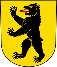
Bäretswil-blazon.svg 222 × 260; 13 KB
-
CHE Bäretswil COA.svg 620 × 726; 14 KB
-
Bäretswil - Ehemalige Baumwollspinnerei, Neuthal 2011-09-23 13-54-50 ShiftN.jpg 4,100 × 2,734; 3.75 MB
-
Bäretswil - Hinterburg im Tösstal 2011-09-23 12-52-50.JPG 4,288 × 2,848; 6.4 MB
-
Bäretswil - Neuthal & Hinterburg im Tösstal 2011-09-23 13-29-40.jpg 4,288 × 2,848; 3.67 MB
-
Bäretswil - Neuthal 2011-09-23 12-53-02.jpg 4,288 × 2,848; 3.08 MB
-
Bäretswil - Neuthal 2011-09-23 13-48-36.JPG 4,288 × 2,848; 5.21 MB
-
Bäretswil - Neuthal im Tösstal 2011-09-23 12-44-04.jpg 4,000 × 2,667; 2.89 MB
-
Bäretswil 2024-03.jpg 4,032 × 2,268; 3 MB
-
Bäretswil Adetswil von Osten.jpg 6,000 × 4,000; 19.75 MB
-
Bäretswil Dächer.jpg 3,110 × 2,073; 3.05 MB
-
Bürgerhaus DSC1764.JPG 1,500 × 1,170; 1.45 MB
-
CHE Bäretswil Flag.svg 512 × 512; 23 KB
-
Doppelbauernhaus DSC1781.JPG 1,500 × 1,183; 1.72 MB
-
DVZO Be 4-4 bei Neuthal.jpg 3,211 × 1,982; 1.37 MB
-
Eisenbahnbrücke DSC1777.JPG 1,920 × 1,239; 2.95 MB
-
ETH-BIB-Adetswil, Heilpädagogisches Institut St. Michael-LBS H1-010910.tif 6,851 × 4,732; 92.88 MB
-
ETH-BIB-Adetswil, Heilpädagogisches Institut St. Michael-LBS H1-010911.tif 6,849 × 4,729; 92.87 MB
-
ETH-BIB-Adetswil, Heilpädagogisches Institut St. Michael-LBS H1-013899.tif 6,409 × 4,751; 87.29 MB
-
ETH-BIB-Adetswil, Heilpädagogisches Institut St. Michael-LBS H1-013900.tif 6,693 × 4,834; 92.68 MB
-
ETH-BIB-Adetswil, Heilpädagogisches Institut St. Michael-LBS H1-013901.tif 5,286 × 4,671; 70.83 MB
-
ETH-BIB-Adetswil-Bäretswil, vom Rosinli-Dia 247-13087.tif 3,591 × 2,803; 9.7 MB
-
ETH-BIB-Adetswil-LBS H1-010909.tif 6,160 × 4,716; 83.37 MB
-
ETH-BIB-Adetswil-LBS H1-019814.tif 6,464 × 4,553; 84.25 MB
-
ETH-BIB-Adetswil-LBS H1-019815.tif 6,486 × 4,565; 84.76 MB
-
ETH-BIB-Bäretswil aus 400 m-Inlandflüge-LBS MH01-002922.tif 6,549 × 4,456; 83.64 MB
-
Flag of Bäretswil.gif 216 × 216; 5 KB
-
Flarz 1 DSC1771.JPG 1,072 × 1,600; 1.41 MB
-
Flarz 3 DSC1769.JPG 916 × 1,600; 1.09 MB
-
Flarz 4 DSC1768.JPG 1,210 × 1,600; 1.37 MB
-
Flarz 5 DSC1766.JPG 890 × 1,600; 945 KB
-
Flarz «Chloster» in Kleinbäretswil.jpg 1,920 × 1,274; 689 KB
-
Gemeindehaus DSC1763.JPG 1,600 × 1,067; 1.48 MB
-
Giessen am Zeller-Guyer-Weg - panoramio.jpg 2,511 × 2,860; 6.82 MB
-
GWBRG-027.jpg 1,920 × 1,440; 1.16 MB
-
Hauptgebäude DSC1775.JPG 1,500 × 1,196; 1.19 MB
-
Hausteil DSC1784.JPG 728 × 1,080; 284 KB
-
Herbstliches Rüeggental - panoramio.jpg 3,988 × 1,847; 5.23 MB
-
Hinterburg, Bäretswil - panoramio.jpg 3,648 × 2,736; 2.13 MB
-
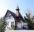
Kapelle DSC1772.JPG 1,500 × 1,403; 1.74 MB
-
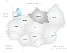
Karte Gemeinde Bäretswil 2007.png 1,476 × 1,343; 489 KB
-
Karte Gemeinde Bäretswil.png 1,062 × 846; 222 KB
-
Klassentrakt DSC1757.JPG 1,600 × 909; 971 KB
-
Mülichramweiher.JPG 4,000 × 3,000; 3.81 MB
-
NEUTHAL - panoramio.jpg 640 × 480; 111 KB
-
NEUTHAL BRÜCKE UND SPINNEREI - panoramio.jpg 640 × 480; 129 KB
-
Pfarrhaus DSC1760.JPG 1,600 × 1,120; 1.09 MB
-
Rosinli im Herbstlicht - panoramio.jpg 4,020 × 3,305; 10.19 MB
-
Rüetswil 2.jpg 4,000 × 6,000; 20.59 MB
-
Rüetswil Naturschutzgebiet Trockenstandort.jpg 6,000 × 4,000; 9.34 MB
-
Rüetswil.jpg 4,032 × 2,268; 2.85 MB
-
Sagi DSC1755.JPG 1,600 × 1,173; 2.06 MB
-
Schulhaus DSC1754.JPG 1,600 × 1,147; 1.19 MB
-
Skilift Bäretswil von oben.jpg 4,000 × 6,000; 16.88 MB
-
Skilift Bäretswil.jpg 6,000 × 4,000; 18.38 MB
-
Stockrütiweiher.JPG 4,000 × 3,000; 3.79 MB
-
Stollen, Bäretswil - panoramio.jpg 4,475 × 2,215; 7.21 MB
-
Sägeweiher Bäretswil.JPG 4,000 × 3,000; 3.15 MB
-
Tisenwaldsberg.jpg 6,000 × 4,000; 15.16 MB
-
Trockenstandort Rüetswil.jpg 4,032 × 2,268; 3.93 MB
-
Turnhalle DSC1758.JPG 1,600 × 1,278; 1.6 MB
-
Unterer Neuthal-Weiher.JPG 4,000 × 3,000; 2.26 MB
-
Wappenswil Bachtel 2.jpg 6,000 × 4,000; 18.47 MB
-
Wappenswil Bachtel 3.jpg 6,000 × 4,000; 19.25 MB
-
Waschhaus DSC1761.JPG 1,600 × 1,479; 1.72 MB
-
Weiher Sandbüel 2.jpg 4,032 × 2,268; 3.86 MB
-
Weiher Sandbüel.jpg 3,879 × 2,040; 1.91 MB
-
Wissenbachried und JosenhofJPG.jpg 6,000 × 4,000; 20.75 MB
-
Wohnhaus DSC1773.JPG 1,389 × 1,500; 1.31 MB
-
Äusserer Neuthal-Weiher.JPG 4,000 × 3,000; 3.77 MB


