Category:Ballyhalbert
Vai alla navigazione
Vai alla ricerca
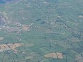
English: Ballyhalbert (Ulster Scots: Talbotstoun) is a small village in County Down, Northern Ireland. It is on the east (Irish Sea) coast of the Ards Peninsula between Ballywalter and Portavogie.
Nederlands: Ballyhalbert is een plaats in het Noord-Ierse graafschap County Down. De plaats telt 447 inwoners.
village in United Kingdom  | |||||
| Carica un file multimediale | |||||
| Istanza di | |||||
|---|---|---|---|---|---|
| Luogo | Irlanda del Nord | ||||
 | |||||
Sottocategorie
Questa categoria contiene un'unica sottocategoria, indicata di seguito.
B
- Burr Point (12 F)
File nella categoria "Ballyhalbert"
Questa categoria contiene 46 file, indicati di seguito, su un totale di 46.
-
 "E" sculpture, Ballyhalbert harbour - geograph.org.uk - 3151562.jpg 640 × 371; 53 KB
-
 "High Street" sign, Ballyhalbert - geograph.org.uk - 3151228.jpg 640 × 384; 63 KB
-
 "Shore Road" sign, Ballyhalbert - geograph.org.uk - 3151356.jpg 640 × 436; 86 KB
-
 Back Road near Ballyhalbert - geograph.org.uk - 806617.jpg 640 × 486; 231 KB
-
 Ballyhalbert gospel hall - geograph.org.uk - 3151397.jpg 640 × 392; 69 KB
-
 Ballyhalbert harbour - geograph.org.uk - 3151638.jpg 640 × 370; 87 KB
-
 Ballyhalbert Harbour - geograph.org.uk - 751126.jpg 640 × 480; 71 KB
-
 Ballyhalbert Pier - geograph.org.uk - 3856.jpg 640 × 480; 40 KB
-
 Ballyhalbert Pier - geograph.org.uk - 806583.jpg 640 × 480; 248 KB
-
 Ballyhalbert Sunrise.jpg 4 608 × 3 456; 2,21 MB
-
 Bush Farm, Ballyhalbert - geograph.org.uk - 751124.jpg 640 × 480; 62 KB
-
 Coastline north of Ballyhalbert - geograph.org.uk - 1183070.jpg 640 × 480; 247 KB
-

-
 Derelict houses, Ballyhalbert - geograph.org.uk - 3151423.jpg 640 × 358; 57 KB
-

-

-
 Harbour Road, Ballyhalbert - geograph.org.uk - 3748642.jpg 1 024 × 730; 109 KB
-
 Houses at Sandylands, Ballyhalbert - geograph.org.uk - 751145.jpg 640 × 480; 61 KB
-
 Jack-up rig, Ballyhalbert - geograph.org.uk - 3151445.jpg 640 × 503; 58 KB
-
 Letter box, Ballyhalbert - geograph.org.uk - 3150910.jpg 640 × 398; 43 KB
-
 Letter box, Ballyhalbert - geograph.org.uk - 3151253.jpg 640 × 526; 77 KB
-
 Picnic table, Ballyhalbert Harbour - geograph.org.uk - 751128.jpg 640 × 480; 56 KB
-
 RAF Ballyhalbert.jpg 320 × 240; 34 KB
-
 Rocks off the foreshore north of Ballyhalbert - geograph.org.uk - 3748530.jpg 1 024 × 749; 129 KB
-
 Roddans Road near Ballyhalbert - geograph.org.uk - 1183067.jpg 640 × 480; 200 KB
-
 Roddans Road near Ballyhalbert - geograph.org.uk - 1183078.jpg 640 × 480; 308 KB
-

-
 Seaweed, Ballyhalbert (1) - geograph.org.uk - 3151507.jpg 640 × 424; 92 KB
-
 Seaweed, Ballyhalbert (2) - geograph.org.uk - 3151518.jpg 640 × 376; 93 KB
-
 Seaweed, Ballyhalbert (3) - geograph.org.uk - 3151527.jpg 640 × 465; 122 KB
-
 Shore at Ballyhalbert - geograph.org.uk - 806576.jpg 640 × 468; 227 KB
-
 Shore Road, Ballyharbert - geograph.org.uk - 3673970.jpg 3 648 × 2 736; 4,54 MB
-
 Shoreline to the harbour - geograph.org.uk - 3673976.jpg 3 648 × 2 736; 4,68 MB
-
 Street sign, Ballyhalbert - geograph.org.uk - 184556.jpg 640 × 426; 145 KB
-
 The Clydesburn, Ballyhalbert (1) - geograph.org.uk - 3151306.jpg 640 × 437; 113 KB
-
 The foreshore at Quay Rocks, Ballyhalbert - geograph.org.uk - 3748531.jpg 1 024 × 768; 142 KB
-
 The foreshore on the north side of Ballyhalbert - geograph.org.uk - 3748513.jpg 1 024 × 745; 134 KB
-
 The foreshore south of Burn Houses, Ballyhalbert - geograph.org.uk - 3748517.jpg 1 024 × 750; 135 KB
-
 The Lade, Ballyhalbert - geograph.org.uk - 3151325.jpg 640 × 420; 121 KB
-
 The Moat Road, Ballyhalbert - geograph.org.uk - 3151173.jpg 640 × 418; 74 KB
-
 The Shore Road, Ballyhalbert - geograph.org.uk - 562803.jpg 640 × 426; 85 KB
-
 Victoria Primary School, Ballyhalbert - geograph.org.uk - 3749518.jpg 1 024 × 590; 144 KB
-
 Victoria Road near Ballyhalbert - geograph.org.uk - 1183281.jpg 640 × 544; 299 KB
-

-

-
 Windmill Hill - geograph.org.uk - 751110.jpg 640 × 480; 58 KB


_-_geograph.org.uk_-_3151507.jpg)
_-_geograph.org.uk_-_3151518.jpg)
_-_geograph.org.uk_-_3151527.jpg)


_-_geograph.org.uk_-_3151306.jpg)


