Category:Barmouth
Zur Navigation springen
Zur Suche springen
Asturianu: Abermaw (Barmouth n'inglés) ye una villa de 2.500 habitantes del condáu alministrativu de Gwynedd (condáu tradicional de Sir Feirionnydd) nel noroeste de Gales.
Cymraeg: Mae Abermaw (Y Bermo neu Abermo yn lleol) yn dref arfordirol yng Ngwynedd; Cyfeirnod OS: SH 60584 18935. Mae pont reilffordd fawr yn croesi'r afon yn ymyl y dref.
Deutsch: Barmouth ( Walisisch: Abermaw) ist eine Stadt in der Grafschaft Gwynedd in Nord-Wales. Sie liegt an der Cardigan Bay, auf der Nordseite der Flussmündung des Mawddach.
English: Barmouth ( (formal); Y Bermo ( colloquial)) is a town in the county of Gwynedd, north-western Wales, lying on the estuary of the River Mawddach and Cardigan Bay.
Español: Barmouth (Abermaw en galés) es una localidad de aproximadamente 2.500 habitantes en el condado preservado de Gwynedd al noroeste de Gales.
Suomi: Barmouth on kaupunki Walesissa, Gwyneddin läänissä. Se sijaitsee Mawddach-joen suulla. Barmouth on perinteinen kotimaan rantalomakohde. Siellä on noin 2500 ympärivuotista asukasta.1700- ja 1800-luvulla se oli merkittävä laivanrakennuspaikkakunta.
Français : Barmouth ( Gallois: Abermaw ou Y Bermo) est une ville de l'ancien comté de Meirionnydd, aujourd'hui fondu dans la région de Gwynedd, située au Nord-Ouest du Pays de Galles, dans l'estuaire formé par la rivière Mawddach et Cardigan Bay.
Euskara: Barmouth (galeseraz Abermaw edo Y Bermo) Gales ipar-mendebaldeko Gwynedd eskualdean dagoen 2.500 biztanleko udalerria da.
Galego: Barmouth (Abermaw ou Y Bermo en galés) é unha vila de 2.500 habitantes do condado administrativo de Gwynedd (condado tradicional de Merionethshire) no noroeste de Gales, localízase no esteiro do río Mawddach, na baía de Cardigan.
Latina: Barmouth ( Cambrice Abermaw) est Regni Uniti accurate Cambriae oppidum circiter 2000 incolarum .
Norsk bokmål: Barmouth (på walisisk formelt Abermaw og i dagligtale Y Bermo) er en by i Gwynedd i Wales. Den ligger ved fjorden som elven Mawddach renner ut i og Cardigan Bay, i et av de mest naturskjønne områdene i Wales. William Wordsworth besøkte Barmouth i det 19. århundre, og beskrev byen og dens omegn i rosende ordelag.
Ortschaft in Gwynedd, Wales   | |||||
| Medium hochladen | |||||
| Aussprache (Audiodatei) | |||||
|---|---|---|---|---|---|
| Ist ein(e) | |||||
| Liegt in Schutzgebiet | |||||
| Ort | Gwynedd, Wales | ||||
| Einwohnerzahl |
| ||||
| Fläche |
| ||||
| offizielle Website | |||||
 | |||||
Unterkategorien
Es werden 15 von insgesamt 15 Unterkategorien in dieser Kategorie angezeigt:
In Klammern die Anzahl der enthaltenen Kategorien (K), Seiten (S), Dateien (D)
*
1
- Barmouth in the 1950s (3 D)
A
- Aberamffra Harbour (13 D)
- Barmouth in art (28 D)
B
- Barmouth Beach (44 D)
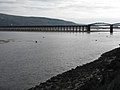
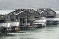
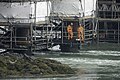
- Barmouth Bridge (255 D)
H
- High Street, Barmouth (14 D)
L
P
- Porkington Terrace, Barmouth (15 D)
Q
R
S
Medien in der Kategorie „Barmouth“
Folgende 200 Dateien sind in dieser Kategorie, von 1.237 insgesamt.
(vorherige Seite) (nächste Seite)-
 " THE CAMBRIAN "DSC 3867c-Edit.jpg 1.500 × 1.032; 200 KB
-
 " The Last Haul " - geograph.org.uk - 3183625.jpg 1.074 × 806; 168 KB
-
 'The Royal' - geograph.org.uk - 4726228.jpg 480 × 640; 154 KB
-
 'Wall to wall caravans' - geograph.org.uk - 4717321.jpg 640 × 480; 185 KB
-
 (Almost) empty car park at Barmouth - geograph.org.uk - 4926984.jpg 640 × 480; 137 KB
-
 17.05.90 Barmouth 150.118 (6710344021).jpg 1.560 × 1.023; 375 KB
-
 A 'TrawsCymru' bus at Barmouth - geograph.org.uk - 4814906.jpg 640 × 480; 173 KB
-
 A Bumpy Ride - geograph.org.uk - 220237.jpg 640 × 480; 46 KB
-
 A channel buoy and Y Perch - geograph.org.uk - 4551553.jpg 1.600 × 1.200; 305 KB
-
 A classic at the seaside - geograph.org.uk - 1315965.jpg 640 × 480; 98 KB
-
 A new angle on Barmouth - geograph.org.uk - 667235.jpg 427 × 640; 49 KB
-
 A train and Dinas Oleu - geograph.org.uk - 4551566.jpg 1.600 × 1.200; 593 KB
-
 A train for Pwllheli entering Barmouth - geograph.org.uk - 6228830.jpg 1.024 × 576; 338 KB
-

-
 A view along the promenade at Barmouth - geograph.org.uk - 4814843.jpg 640 × 480; 147 KB
-
 A view from Llanaber - geograph.org.uk - 2869161.jpg 3.264 × 2.448; 4,8 MB
-

-

-

-
 A windswept Barmouth beach - geograph.org.uk - 1329243.jpg 640 × 480; 40 KB
-
 A496 at Llanaber - geograph.org.uk - 3006295.jpg 3.075 × 2.328; 2,9 MB
-
 A496 at Llanaber - geograph.org.uk - 3006306.jpg 2.094 × 1.637; 1,18 MB
-

-
 A496 Porkington Terrace - Barmouth, Gwynedd - geograph.org.uk - 4891700.jpg 3.072 × 2.304; 2,23 MB
-
 A496 road into Barmouth - geograph.org.uk - 1555124.jpg 640 × 480; 112 KB
-
 A496, Abermaw-Barmouth - geograph.org.uk - 4728706.jpg 1.024 × 768; 159 KB
-
 Abandoned farm. - geograph.org.uk - 23130.jpg 640 × 480; 128 KB
-
 Aberamffra Gardens - Barmouth, Gwynedd - geograph.org.uk - 4891684.jpg 3.072 × 2.304; 2,92 MB
-
-
-

-
 Aberamffra Rd looking East - geograph.org.uk - 597326.jpg 640 × 480; 47 KB
-
 Abermaw from the mountain steps - geograph.org.uk - 1890563.jpg 640 × 428; 137 KB
-
 Access to the sea - geograph.org.uk - 4722087.jpg 640 × 480; 156 KB
-

-
 Across Barmouth Beach - geograph.org.uk - 5991363.jpg 1.024 × 683; 380 KB
-

-
 Across the harbour mouth - geograph.org.uk - 4588499.jpg 640 × 428; 67 KB
-
 Across the Mawddach estuary - geograph.org.uk - 3207426.jpg 640 × 377; 58 KB
-
 Admiralty Chart No 1484 Plans in Cardigan Bay, Published 1966 New Edition 1967.jpg 11.056 × 16.232; 38,34 MB
-
 Admiralty Chart No 1484 Plans of Anchorages in Cardigan Bay, Published 1892.jpg 10.903 × 16.203; 72,4 MB
-
 Admiralty Chart No 368 Wales Barmouth to South Stack, Published 1896.jpg 9.517 × 12.093; 16,97 MB
-

-
 Against the tide - geograph.org.uk - 683146.jpg 640 × 480; 46 KB
-
 Along Barmouth Bridge - geograph.org.uk - 4576645.jpg 428 × 640; 99 KB
-
 An Ancient Way - geograph.org.uk - 525307.jpg 640 × 480; 126 KB
-
 An Arriva train arriving at Barmouth - geograph.org.uk - 5089773.jpg 640 × 480; 188 KB
-
 An historic bridge - geograph.org.uk - 1908589.jpg 640 × 428; 94 KB
-
 Another great idea... - geograph.org.uk - 4722185.jpg 480 × 640; 122 KB
-
 Another view - Barmouth Bridge, Gwynedd - geograph.org.uk - 4891719.jpg 3.072 × 2.304; 1,93 MB
-
 Approaching Barmouth Bridge - geograph.org.uk - 1084427.jpg 640 × 480; 167 KB
-
 Approaching farm - geograph.org.uk - 6082086.jpg 768 × 1.024; 141 KB
-

-
 Approaching the Llawlech Col - geograph.org.uk - 220248.jpg 640 × 480; 36 KB
-
 Arbour Hotel beyond sand dunes - geograph.org.uk - 5896660.jpg 1.500 × 906; 1,29 MB
-
 Arousal - geograph.org.uk - 2699117.jpg 3.872 × 2.592; 2,33 MB
-
 At the crossing - geograph.org.uk - 3086823.jpg 1.255 × 1.147; 364 KB
-
 Autumnal evening seascape - geograph.org.uk - 2105972.jpg 640 × 480; 117 KB
-

-
 Banishment for the summer - geograph.org.uk - 1908574.jpg 1.600 × 1.071; 644 KB
-
 158840 , Barmouth (7012217269).jpg 3.625 × 2.397; 6,11 MB
-
 Barmouth & Mawddach viaduct (49505381772).jpg 4.608 × 3.456; 11,08 MB
-
 Barmouth - geograph.org.uk - 1431271.jpg 640 × 425; 83 KB
-
 Barmouth - geograph.org.uk - 232511.jpg 640 × 479; 53 KB
-
 Barmouth - geograph.org.uk - 303402.jpg 640 × 480; 75 KB
-
 Barmouth - geograph.org.uk - 4532699.jpg 5.471 × 3.032; 1,75 MB
-
 Barmouth - panoramio (10).jpg 4.000 × 3.000; 3,95 MB
-
 Barmouth - panoramio (16).jpg 3.713 × 2.348; 2,43 MB
-
 Barmouth - panoramio (18).jpg 4.608 × 3.456; 3,95 MB
-
 Barmouth - panoramio (19).jpg 4.608 × 3.456; 4,7 MB
-
 Barmouth - panoramio (20).jpg 4.608 × 3.456; 3,58 MB
-
 Barmouth - panoramio (21).jpg 4.608 × 3.456; 4,92 MB
-
 Barmouth - panoramio (22).jpg 4.608 × 3.456; 4,58 MB
-
 Barmouth - panoramio (23).jpg 4.608 × 3.456; 4,29 MB
-
 Barmouth - panoramio (24).jpg 4.320 × 3.240; 4,59 MB
-
 Barmouth - panoramio (25).jpg 4.442 × 3.332; 4,14 MB
-
 Barmouth - panoramio (27).jpg 4.608 × 3.456; 5,69 MB
-
 Barmouth - panoramio (28).jpg 4.608 × 3.456; 4,93 MB
-
 Barmouth - panoramio (29).jpg 4.608 × 3.456; 4,27 MB
-
 Barmouth - panoramio (30).jpg 4.608 × 3.456; 4,71 MB
-
 Barmouth - panoramio (31).jpg 4.608 × 3.456; 4,86 MB
-
 Barmouth - panoramio (32).jpg 4.608 × 3.456; 4,96 MB
-
 Barmouth - panoramio (33).jpg 4.608 × 3.456; 4,64 MB
-
 Barmouth - panoramio (34).jpg 4.608 × 3.456; 5,18 MB
-
 Barmouth - panoramio (36).jpg 4.608 × 3.456; 5,38 MB
-
 Barmouth - panoramio (37).jpg 4.608 × 3.456; 4,52 MB
-
 Barmouth - panoramio (38).jpg 4.608 × 3.456; 4,62 MB
-
 Barmouth - panoramio (4).jpg 4.000 × 3.000; 3,2 MB
-
 Barmouth - panoramio (41).jpg 4.608 × 3.456; 4,61 MB
-
 Barmouth - panoramio (42).jpg 4.222 × 3.166; 3,48 MB
-
 Barmouth - panoramio (9).jpg 4.000 × 3.000; 3,6 MB
-
 Barmouth and the hillside beyond - geograph.org.uk - 1329253.jpg 640 × 480; 80 KB
-
 Barmouth Bay (22739846284).jpg 5.472 × 3.648; 11,83 MB
-
 Barmouth Bay - geograph.org.uk - 1413182.jpg 640 × 480; 26 KB
-
 Barmouth Bay - geograph.org.uk - 2268052.jpg 1.600 × 1.049; 276 KB
-
 Barmouth Bay - May 2013 - panoramio.jpg 4.000 × 1.997; 856 KB
-
 Barmouth Bay and bars in Meirioneth Shire.gif 1.000 × 749; 191 KB
-
 Barmouth Bay by Lewis Morris 02348.jpg 2.839 × 2.106; 5,08 MB
-
 Barmouth beach (51698382372).jpg 4.000 × 2.208; 1,47 MB
-
 Barmouth Beach - 29th May 2013 - panoramio.jpg 3.988 × 2.984; 952 KB
-
 Barmouth Beach - geograph.org.uk - 1988787.jpg 4.000 × 3.000; 2,3 MB
-
 Barmouth beach - geograph.org.uk - 2109050.jpg 640 × 480; 128 KB
-
 Barmouth Beach - geograph.org.uk - 2415324.jpg 2.560 × 1.920; 2,02 MB
-
 Barmouth Beach - geograph.org.uk - 2438322.jpg 800 × 569; 64 KB
-
 Barmouth Beach - geograph.org.uk - 2438366.jpg 800 × 598; 124 KB
-
 Barmouth Beach - geograph.org.uk - 2438370.jpg 800 × 576; 100 KB
-
 Barmouth Beach - geograph.org.uk - 3234135.jpg 640 × 425; 313 KB
-
 Barmouth Beach - geograph.org.uk - 3234150.jpg 425 × 640; 370 KB
-
 Barmouth Beach - geograph.org.uk - 3234156.jpg 640 × 425; 372 KB
-
 Barmouth Beach - geograph.org.uk - 3234171.jpg 640 × 425; 322 KB
-
 Barmouth Beach - geograph.org.uk - 3234193.jpg 640 × 425; 316 KB
-
 Barmouth Beach - geograph.org.uk - 4576632.jpg 640 × 428; 82 KB
-
 Barmouth Beach - geograph.org.uk - 6025811.jpg 1.280 × 960; 741 KB
-

-
 Barmouth beacon - geograph.org.uk - 4588501.jpg 640 × 428; 76 KB
-
 Barmouth Bonfire - geograph.org.uk - 2708383.jpg 1.000 × 730; 419 KB
-
 Barmouth Bowling Club - geograph.org.uk - 2302743.jpg 2.048 × 1.536; 1,88 MB
-
 Barmouth Bridge - geograph.org.uk - 2438302.jpg 800 × 578; 109 KB
-
 Barmouth Bridge - geograph.org.uk - 2532773.jpg 640 × 480; 74 KB
-
 Barmouth Bridge - geograph.org.uk - 2615712.jpg 3.264 × 2.448; 2,35 MB
-
 Barmouth Bridge - geograph.org.uk - 2919221.jpg 640 × 427; 59 KB
-
 Barmouth Bridge - geograph.org.uk - 3404844.jpg 800 × 539; 133 KB
-
 Barmouth Bridge - geograph.org.uk - 4513699.jpg 5.407 × 2.717; 2,02 MB
-
 Barmouth Bridge - geograph.org.uk - 4582213.jpg 428 × 640; 88 KB
-
 Barmouth Bridge - geograph.org.uk - 4662470.jpg 1.600 × 1.200; 400 KB
-
 Barmouth Bridge - geograph.org.uk - 4716227.jpg 1.024 × 768; 146 KB
-
 Barmouth Bridge - geograph.org.uk - 4900985.jpg 640 × 480; 71 KB
-
 Barmouth Bridge - geograph.org.uk - 5603218.jpg 640 × 414; 82 KB
-
 Barmouth Bridge - geograph.org.uk - 6082080.jpg 1.024 × 768; 80 KB
-
 Barmouth Bridge across Mawddach Estuary - geograph.org.uk - 4151353.jpg 1.280 × 828; 807 KB
-
 Barmouth Bridge and Braich Ddu - geograph.org.uk - 2379544.jpg 1.280 × 853; 363 KB
-

-
 Barmouth Bridge from Porth Aberamffra - geograph.org.uk - 2869219.jpg 3.264 × 2.448; 3,43 MB
-
 Barmouth Bridge from the A496 - geograph.org.uk - 5992546.jpg 1.024 × 683; 481 KB
-
 Barmouth Bridge from the harbour. - geograph.org.uk - 588466.jpg 640 × 480; 93 KB
-
 Barmouth Bridge in 1987 - geograph.org.uk - 2308883.jpg 848 × 613; 83 KB
-
 Barmouth Bridge in February - geograph.org.uk - 1713670.jpg 2.848 × 2.136; 1,72 MB
-
 Barmouth Bridge Refurbishment IMG 4537c-Edit.jpg 1.500 × 1.000; 267 KB
-
 Barmouth Bridge Refurbishment IMG 4548c-Edit.jpg 1.500 × 1.000; 292 KB
-
 Barmouth Bridge Refurbishment IMG 4551c-Edit.jpg 1.500 × 1.000; 297 KB
-
 Barmouth Bridge Renovation DSC08043c-Edit.jpg 1.500 × 1.000; 233 KB
-
 Barmouth Bridge Renovation DSC08259c-Edit.jpg 1.500 × 1.000; 422 KB
-
 Barmouth Bridge Renovation DSC08260c-Edit.jpg 1.500 × 1.000; 428 KB
-
 Barmouth Bridge Renovation DSC08265c-Edit.jpg 1.500 × 1.000; 379 KB
-
 Barmouth Bridge Renovation Project IMG 3189c copy.jpg 1.500 × 1.125; 256 KB
-

-
 Barmouth Bridge-Pont Abermaw - geograph.org.uk - 2416681.jpg 3.504 × 2.336; 1,91 MB
-
 Barmouth cemetery - geograph.org.uk - 4722189.jpg 640 × 480; 190 KB
-
 Barmouth channel - geograph.org.uk - 4588502.jpg 640 × 428; 58 KB
-
 Barmouth city 01.jpg 4.160 × 3.120; 3,63 MB
-
 Barmouth city harbor.jpg 4.160 × 3.120; 3,62 MB
-
 Barmouth city view.jpg 4.160 × 3.120; 2,56 MB
-
 Barmouth Coastguard station - geograph.org.uk - 4718223.jpg 640 × 480; 142 KB
-
 Barmouth coastline.JPG 1.600 × 1.200; 681 KB
-
 Barmouth donkeys - geograph.org.uk - 4588481.jpg 640 × 428; 101 KB
-
 Barmouth Elim Church - geograph.org.uk - 5293082.jpg 640 × 497; 76 KB
-
 Barmouth estuary.JPG 1.600 × 1.200; 693 KB
-
 Barmouth from Cefn Hir - geograph.org.uk - 709488.jpg 640 × 480; 110 KB
-
 Barmouth from Cyfannedd-fawr - geograph.org.uk - 1413200.jpg 640 × 480; 75 KB
-
 Barmouth from Dinas Oleu - geograph.org.uk - 5149837.jpg 800 × 533; 450 KB
-

-
 Barmouth from the dunes - geograph.org.uk - 232532.jpg 479 × 640; 116 KB
-
 Barmouth from the sea (29215284912).jpg 5.016 × 3.344; 7,45 MB
-
 Barmouth gets the sunshine^ - geograph.org.uk - 1087616.jpg 640 × 480; 145 KB
-
 Barmouth Harbor.jpg 4.160 × 3.120; 2,84 MB
-
 Barmouth harbour - geograph.org.uk - 2041466.jpg 3.008 × 2.000; 1,65 MB
-
 Barmouth harbour - geograph.org.uk - 2041505.jpg 640 × 426; 79 KB
-
 Barmouth Harbour - geograph.org.uk - 2105147.jpg 640 × 480; 148 KB
-
 Barmouth Harbour - geograph.org.uk - 2423834.jpg 3.504 × 1.821; 1,39 MB
-
 Barmouth Harbour - geograph.org.uk - 2664699.jpg 800 × 493; 157 KB
-
 Barmouth Harbour - geograph.org.uk - 2664706.jpg 813 × 800; 242 KB
-
 Barmouth Harbour - geograph.org.uk - 2912716.jpg 640 × 480; 111 KB
-
 Barmouth Harbour - geograph.org.uk - 3234206.jpg 425 × 640; 281 KB
-
 Barmouth Harbour - geograph.org.uk - 3234220.jpg 640 × 425; 277 KB
-
 Barmouth Harbour - geograph.org.uk - 3234253.jpg 640 × 425; 256 KB
-
 Barmouth Harbour - geograph.org.uk - 4582216.jpg 640 × 428; 76 KB
-
 Barmouth Harbour - geograph.org.uk - 4588505.jpg 640 × 428; 77 KB
-
 Barmouth Harbour - geograph.org.uk - 4900978.jpg 640 × 470; 45 KB
-
 Barmouth Harbour - geograph.org.uk - 5905068.jpg 1.024 × 632; 98 KB
-
 Barmouth Harbour - geograph.org.uk - 6026675.jpg 1.280 × 960; 783 KB
-
 Barmouth harbour and bridge - geograph.org.uk - 4811955.jpg 640 × 480; 75 KB
-
 Barmouth Harbour and Dinas Oleu - geograph.org.uk - 603763.jpg 640 × 480; 75 KB
-

-

-
 Barmouth Harbour at low tide - geograph.org.uk - 4456712.jpg 2.592 × 1.456; 1,1 MB
-
 Barmouth harbour at low tide - geograph.org.uk - 468133.jpg 640 × 480; 131 KB
-

-

-

-
 Barmouth Harbour from Porkington Terrace - geograph.org.uk - 572192.jpg 640 × 480; 138 KB
-

-
 Barmouth harbour from the railway - geograph.org.uk - 2713628.jpg 640 × 480; 46 KB
-
-

-
 Barmouth High Street - geograph.org.uk - 4587287.jpg 428 × 640; 90 KB
-
 Barmouth hillside view.jpg 4.160 × 3.120; 3,03 MB
-
 Barmouth houses.jpg 4.160 × 3.120; 2,22 MB
-
 Barmouth Lifeboat - geograph.org.uk - 4222852.jpg 640 × 424; 49 KB
-
 Barmouth Lifeboat Station - geograph.org.uk - 6026143.jpg 1.280 × 1.132; 914 KB
-
 Barmouth Merionethshire.jpeg 900 × 658; 297 KB


.jpg)


_from_Panorama_Road,_Barmouth_-_geograph.org.uk_-_611362.jpg)


.jpg)
.jpg)


.jpg)
.jpg)
.jpg)
.jpg)
.jpg)
.jpg)
.jpg)
.jpg)
.jpg)
.jpg)
.jpg)
.jpg)
.jpg)
.jpg)
.jpg)
.jpg)
.jpg)
.jpg)
.jpg)
.jpg)
.jpg)
.jpg)
.jpg)
.jpg)
.jpg)

.jpg)


.jpg)


.jpg)


_empty_car_park_at_Barmouth_-_geograph.org.uk_-_4926984.jpg)