Category:Batley
Направо към навигацията
Направо към търсенето
town in Yorkshire, England  | |||||
| Качване на файл | |||||
| Екземпляр на | |||||
|---|---|---|---|---|---|
| Местоположение | Кърклийс, Западен Йоркшър, Йоркшър и Хъмбър, Англия | ||||
| Население |
| ||||
| официален уебсайт | |||||
 | |||||
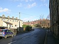
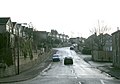
English: Batley is a town within the Metropolitan Borough of Kirklees, in West Yorkshire, England. It lies north of Dewsbury, near the M62 motorway. It has a population of 49,448. Other nearby towns include Morley to the northeast, Ossett to the southeast and Brighouse westsouthwest. After undergoing a period of major growth in the 19th century due to the success of the shoddy trade, Batley has more recently undergone a period of decline. Batley is part of a special EU transformation zone.
Подкатегории
Показани са 23 от общо 23 подкатегории на тази категория.
B
- Batley Beck (0 К, 0 С, 3 Ф)
- Batley War Memorial (0 К, 0 С, 4 Ф)
C
F
- Flags in Batley (0 К, 0 С, 1 Ф)
G
H
M
P
S
- Signs in Batley (0 К, 0 С, 3 Ф)
- Skopos Motor Museum (0 К, 0 С, 4 Ф)
T
U
- Union Mill Viaduct, Batley (0 К, 0 С, 6 Ф)
Файлове в категория „Batley“
Показани са 200 от общо 269 файла в тази категория.
(предишна страница) (следваща страница)-
 "Marshfield" Upper Batley - geograph.org.uk - 771416.jpg 640 × 480; 133 КБ
-
 40 Station Road, Batley, June 2018.jpg 1536 × 2048; 855 КБ
-

-
 Auckland Opticians - Well Lane - geograph.org.uk - 1816736.jpg 480 × 640; 61 КБ
-

-
 Bagshaw Museum.JPG 1920 × 2560; 1,55 МБ
-
 Batley - geograph.org.uk - 31043.jpg 640 × 480; 79 КБ
-
 Batley Cricket Club - Purlwell Hall Road (geograph 3403909).jpg 640 × 480; 48 КБ
-

-

-
 Beck - Church Lane - geograph.org.uk - 1123396.jpg 640 × 382; 291 КБ
-
 Beck - Church Lane - geograph.org.uk - 1123403.jpg 640 × 480; 348 КБ
-
 Belle Vue Street - Healey Lane - geograph.org.uk - 1190562.jpg 640 × 475; 203 КБ
-

-
 Beverley Gardens - Upper Batley Low Lane - geograph.org.uk - 1464644.jpg 640 × 480; 226 КБ
-
 Birchwood Avenue - Sandal Way - geograph.org.uk - 1464514.jpg 640 × 480; 269 КБ
-
 Birchwood Avenue - Sycamore Way - geograph.org.uk - 1464520.jpg 640 × 480; 233 КБ
-

-

-

-

-
 Boundary stone No. 4, Batley.jpg 450 × 600; 274 КБ
-
 Brearleys Solicitors - Chapel Lane - geograph.org.uk - 1747491.jpg 480 × 640; 56 КБ
-

-
 Brookroyd Lane - Bradford Road - geograph.org.uk - 1124428.jpg 640 × 478; 210 КБ
-
 Brookroyd Lane - Huddersfield Road - geograph.org.uk - 1124077.jpg 640 × 448; 173 КБ
-
 Brownhill Close - Brownhill Road - geograph.org.uk - 1124452.jpg 640 × 443; 191 КБ
-
 Brownhill Garth - Brownhill Road - geograph.org.uk - 1124448.jpg 640 × 460; 200 КБ
-
 Brownhill Road - Brookroyd Lane - geograph.org.uk - 1124445.jpg 640 × 458; 218 КБ
-
 Brownhill Road - Upper Batley Lane - geograph.org.uk - 1464508.jpg 640 × 480; 239 КБ
-
 Brunswick Street - Commercial Street - geograph.org.uk - 1191446.jpg 640 × 480; 244 КБ
-
 Carpets Direct - Gelderd Road - geograph.org.uk - 1747478.jpg 640 × 480; 67 КБ
-
 Carr Street - Bradford Road - geograph.org.uk - 1748078.jpg 640 × 480; 71 КБ
-
 Cemetery Road - Mayman Lane - geograph.org.uk - 1191421.jpg 640 × 446; 202 КБ
-
 Centenary Way - Bradford Road - geograph.org.uk - 1189407.jpg 640 × 437; 177 КБ
-
 Chaster Street - Healey Lane - geograph.org.uk - 1190620.jpg 640 × 480; 245 КБ
-

-
 Church Road - Huddersfield Road - geograph.org.uk - 1124075.jpg 640 × 489; 191 КБ
-
 Church Road - near St Saviour's Church - geograph.org.uk - 1124443.jpg 640 × 435; 194 КБ
-
 Clerk Green Road - Wellington Street - geograph.org.uk - 1190651.jpg 640 × 480; 239 КБ
-
 Clough Drive - Leeds Road - geograph.org.uk - 1464631.jpg 640 × 454; 204 КБ
-
 Clough House - Leeds Road - geograph.org.uk - 1464627.jpg 640 × 480; 304 КБ
-
 Colbeck Avenue - West Park Grove - geograph.org.uk - 1190614.jpg 640 × 444; 197 КБ
-
 Colbeck Terrace - West Park Grove - geograph.org.uk - 1190618.jpg 640 × 450; 201 КБ
-
 College Street - Kirkgate - geograph.org.uk - 1123132.jpg 640 × 474; 207 КБ
-
 College Street - Whewell Street - geograph.org.uk - 1123426.jpg 640 × 480; 229 КБ
-
 Commercial Hotel - Wellington Street - geograph.org.uk - 1190655.jpg 640 × 473; 209 КБ
-
 Coniston Road - Bennett Lane - geograph.org.uk - 1419559.jpg 640 × 480; 235 КБ
-
 Copley Hill - Leeds Road - geograph.org.uk - 1464511.jpg 640 × 480; 248 КБ
-
 Copley Street - Bradford Road - geograph.org.uk - 1189380.jpg 640 × 453; 231 КБ
-
 Crown Bowling Green - Wilton Park - geograph.org.uk - 491782.jpg 640 × 413; 50 КБ
-
 Crowther Street - Healey Lane - geograph.org.uk - 1190568.jpg 640 × 459; 198 КБ
-
 D'Licious Cafe - Market Street - geograph.org.uk - 1748016.jpg 418 × 640; 71 КБ
-
 Dale Lane - White Lee Road - geograph.org.uk - 1190034.jpg 640 × 402; 158 КБ
-
 Deighton Lane - Healey Lane - geograph.org.uk - 1190587.jpg 518 × 640; 230 КБ
-
 Delmont Close - White Lee Road - geograph.org.uk - 1190033.jpg 640 × 480; 228 КБ
-
 Denham Street - Bradford Road - geograph.org.uk - 1189388.jpg 640 × 458; 255 КБ
-

-

-
 Dudley Avenue - Leeds Road - geograph.org.uk - 1464623.jpg 640 × 480; 235 КБ
-
 Ealand Road - viewed from Ings Road - geograph.org.uk - 1189425.jpg 640 × 415; 171 КБ
-
 Ealing Court - Ings Road - geograph.org.uk - 1189418.jpg 640 × 480; 238 КБ
-
 East of Lamplands - geograph.org.uk - 4624468.jpg 640 × 426; 43 КБ
-
 Electricity Pylon Line - geograph.org.uk - 1350656.jpg 480 × 640; 72 КБ
-
 Elm Way - Ashfield Road - geograph.org.uk - 1464534.jpg 640 × 480; 227 КБ
-
 Emerald Street - Bradford Road - geograph.org.uk - 1189400.jpg 640 × 480; 235 КБ
-
 Ennerdale Avenue - Ennerdale Road - geograph.org.uk - 1419303.jpg 640 × 480; 225 КБ
-
 Entrance To Showcase Cinema Car Park - geograph.org.uk - 917284.jpg 640 × 480; 78 КБ
-
 Fairfield School - geograph.org.uk - 280166.jpg 640 × 480; 96 КБ
-
 Field Head Lane - viewed from Nova Lane - geograph.org.uk - 1123191.jpg 640 × 480; 295 КБ
-
 Footpath - Brookroyd Lane - geograph.org.uk - 1124432.jpg 640 × 480; 299 КБ
-
 Footpath - Healey Lane - geograph.org.uk - 1190576.jpg 480 × 640; 224 КБ
-
 Footpath - Staincliffe Hall Road - geograph.org.uk - 707004.jpg 474 × 640; 73 КБ
-

-
 Footpath into part of Soothill Wood - geograph.org.uk - 1746868.jpg 640 × 480; 135 КБ
-
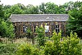
 Former workhouse in Gomersal - geograph.org.uk - 1037007.jpg 640 × 427; 59 КБ
-
 Four Seasons Photos - Bond Street - geograph.org.uk - 1750350.jpg 480 × 640; 67 КБ
-
 Fox's Biscuits Factory, Batley - geograph.org.uk - 54778.jpg 640 × 480; 94 КБ
-
 Fox's Biscuits Stadium.jpg 2340 × 3111; 1,18 МБ
-

-
 Hampson Street - Bradford Road - geograph.org.uk - 1189392.jpg 640 × 461; 206 КБ
-

-

-
 Healey Street - Healey Lane - geograph.org.uk - 1190571.jpg 640 × 480; 246 КБ
-
 High Street - viewed from Nova Lane - geograph.org.uk - 1123185.jpg 640 × 449; 199 КБ
-
 High Wood Road - Gelderd Road - geograph.org.uk - 1464679.jpg 640 × 480; 223 КБ
-

-
 Hill Crescent - Leeds Road - geograph.org.uk - 1464617.jpg 640 × 480; 231 КБ
-
 Hillhead Drive - Upper Batley Lane - geograph.org.uk - 1464507.jpg 640 × 477; 197 КБ
-
 Hollywood......Batley - geograph.org.uk - 413024.jpg 640 × 480; 103 КБ
-
 Horse Trough Memorial - Healey Lane - geograph.org.uk - 1190648.jpg 640 × 372; 225 КБ
-
-
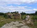 Howley Hall - geograph.org.uk - 31041.jpg 640 × 480; 80 КБ
-

-
 Ings Rise - Ings Road - geograph.org.uk - 1189416.jpg 640 × 480; 232 КБ
-
 Intake Lane - Brookroyd Lane - geograph.org.uk - 1124437.jpg 640 × 493; 220 КБ
-

-

-

-
 Jack Lane Railway Bridge, Batley - geograph.org.uk - 1764636.jpg 2553 × 3150; 7,04 МБ
-
 Jail Road - White Lee Road - geograph.org.uk - 1190121.jpg 480 × 640; 272 КБ
-
 John Nelson Close - Brookroyd Lane - geograph.org.uk - 1124454.jpg 640 × 444; 171 КБ
-
 Junction on Middlegate - geograph.org.uk - 1378534.jpg 640 × 480; 58 КБ
-
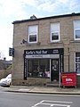 Karlies Nail Bar - Chapel Lane - geograph.org.uk - 1747471.jpg 480 × 640; 66 КБ
-
 Kings Court - Middlegate - geograph.org.uk - 1123206.jpg 640 × 455; 220 КБ
-
 Kings Drive - Middlegate - geograph.org.uk - 1123203.jpg 640 × 444; 206 КБ
-
 Kings Drive - Nova Lane - geograph.org.uk - 1123176.jpg 640 × 480; 193 КБ
-
 Kingsway - Nova Lane - geograph.org.uk - 1123180.jpg 640 × 462; 216 КБ
-

-
 Lady Ann Level Crossing, Batley - geograph.org.uk - 92606.jpg 640 × 472; 111 КБ
-
 Larch Close - Sycamore Way - geograph.org.uk - 1464523.jpg 640 × 480; 240 КБ
-
 Law Street - Bradford Road - geograph.org.uk - 1124426.jpg 640 × 480; 266 КБ
-
 Lea Road - Bradford Road - geograph.org.uk - 1124424.jpg 640 × 480; 237 КБ
-
 Lea View - Brookroyd Lane - geograph.org.uk - 1124434.jpg 640 × 445; 225 КБ
-
 Leeds Old Road - White Lee Road - geograph.org.uk - 1190026.jpg 640 × 396; 189 КБ
-
 Leeds Road - viewed from Nab Lane - geograph.org.uk - 1464641.jpg 640 × 480; 249 КБ
-
 Leeside Road - White Lee Road - geograph.org.uk - 1190031.jpg 640 × 406; 175 КБ
-
 Leylands Road - Kirkgate - geograph.org.uk - 1123212.jpg 640 × 453; 183 КБ
-
 Linton Avenue - Healey Lane - geograph.org.uk - 1190639.jpg 640 × 435; 194 КБ
-
 Local Electronics - Church Street - geograph.org.uk - 1746378.jpg 640 × 469; 78 КБ
-
 Local Properties - Chapel Lane - geograph.org.uk - 1747468.jpg 640 × 550; 69 КБ
-
 Market Street - Smithies Lane - geograph.org.uk - 1124409.jpg 640 × 446; 201 КБ
-
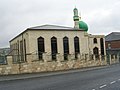 Masjid E Mahmoodiyah - Taylor Street - geograph.org.uk - 1827229.jpg 640 × 480; 56 КБ
-
 Masjid e Noor Dark Lane Batley.jpg 320 × 205; 15 КБ
-
 Mayman Close - Mayman Lane - geograph.org.uk - 1191432.jpg 640 × 480; 227 КБ
-

-
 Milestone, Halifax Road, Batley - geograph.org.uk - 344388.jpg 442 × 640; 110 КБ
-
 Mill Street - Huddersfield Road - geograph.org.uk - 1750341.jpg 640 × 480; 74 КБ
-
 Milroyd Crescent - Leeds Road - geograph.org.uk - 1464618.jpg 640 × 480; 251 КБ
-
 Moat Hill - Leeds Road - geograph.org.uk - 1464512.jpg 640 × 428; 170 КБ
-
 Moat Hill Farm Drive - Leeds Road - geograph.org.uk - 1464615.jpg 640 × 480; 257 КБ
-
 Moon Close - off Leeds Road - geograph.org.uk - 1464388.jpg 640 × 480; 222 КБ
-
 Mortimer Avenue - Healey Lane - geograph.org.uk - 1190573.jpg 640 × 442; 201 КБ
-
 Mud on playing field - geograph.org.uk - 76652.jpg 640 × 480; 82 КБ
-
 Nab Lane - Leeds Road - geograph.org.uk - 1464655.jpg 640 × 480; 226 КБ
-
 Nab Lane - Pennine View - geograph.org.uk - 1464670.jpg 640 × 480; 244 КБ
-
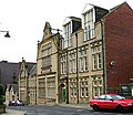
 National School - Bradford Road - geograph.org.uk - 486810.jpg 640 × 536; 56 КБ
-
 New Ing Mills - opposite Wood Street - geograph.org.uk - 487193.jpg 599 × 640; 70 КБ
-
 Newley Avenue - Bradford Road - geograph.org.uk - 1124416.jpg 640 × 480; 277 КБ
-
 Nice view^ - geograph.org.uk - 412958.jpg 640 × 480; 88 КБ
-
 Norwood Drive - Intake Lane - geograph.org.uk - 1124441.jpg 640 × 476; 214 КБ
-
 Oakhill Road - Bradford Road - geograph.org.uk - 1189373.jpg 640 × 480; 256 КБ
-
 Oakwell Taxis - Nelson Street - geograph.org.uk - 1747352.jpg 640 × 547; 87 КБ
-
 Occasions - Low La - geograph.org.uk - 1748029.jpg 640 × 480; 77 КБ
-
 Oxford Road - Church Street - geograph.org.uk - 1123210.jpg 640 × 449; 197 КБ
-
 Park Drive - Bradford Road - geograph.org.uk - 1189370.jpg 640 × 480; 259 КБ
-
 Pearl Street - Bradford Road - geograph.org.uk - 1189399.jpg 640 × 475; 216 КБ
-
 Pearl Street - Ealand Road - geograph.org.uk - 1189427.jpg 640 × 480; 258 КБ
-
 Peel Avenue - Upper Commercial Street - geograph.org.uk - 1191440.jpg 640 × 480; 252 КБ
-

-
 Petals floral design - Market Street - geograph.org.uk - 1747501.jpg 480 × 640; 65 КБ
-
 Pheasant Drive - Gelderd Road - geograph.org.uk - 1464672.jpg 640 × 480; 241 КБ
-
 Pheasant Drive - viewed from Nab Lane - geograph.org.uk - 1464664.jpg 640 × 480; 225 КБ
-
 Pheasant Drive - viewed from Nab Lane - geograph.org.uk - 1464666.jpg 640 × 448; 178 КБ
-
 Playing Fields - Leeds Road - geograph.org.uk - 1464629.jpg 640 × 480; 231 КБ
-

-
 Railway Bridge off Primrose Hill, Batley - geograph.org.uk - 92622.jpg 640 × 474; 116 КБ
-
 Railway retaining walls - geograph.org.uk - 1396512.jpg 640 × 480; 141 КБ
-
 Railway Subway, Lady Anne Road, Batley.jpg 480 × 640; 94 КБ
-
 Riding Street - White Lee Road - geograph.org.uk - 1190029.jpg 640 × 443; 212 КБ
-
 Road junction - geograph.org.uk - 1350648.jpg 640 × 480; 94 КБ
-
 Roberto Hair Design - Smithies Lane - geograph.org.uk - 1747514.jpg 480 × 640; 74 КБ
-
 Roebuck Street - Leeds Road - geograph.org.uk - 1464509.jpg 640 × 480; 269 КБ
-
 Roman Road - Lea View - geograph.org.uk - 1124435.jpg 640 × 480; 252 КБ
-
 Rosedale Close - Nab Lane - geograph.org.uk - 1464662.jpg 640 × 480; 214 КБ
-
 Rowan Close - Ashfield Road - geograph.org.uk - 1464530.jpg 640 × 480; 274 КБ
-
 Ruby Street - Bradford Road - geograph.org.uk - 1189396.jpg 640 × 480; 251 КБ
-
 Ruby Street - Ealand Street - geograph.org.uk - 1189430.jpg 640 × 480; 276 КБ
-
-

-
 Sandal Way - Moat Hill - geograph.org.uk - 1464513.jpg 640 × 480; 249 КБ
-
 Sandwich and Co - Market Street - geograph.org.uk - 1747509.jpg 480 × 640; 68 КБ
-
 School Street - Huddersfield Road - geograph.org.uk - 1124076.jpg 640 × 480; 339 КБ
-
 School Street - Smithies Lane - geograph.org.uk - 1124402.jpg 640 × 480; 235 КБ
-

-
 Sedgewick Street - College Street - geograph.org.uk - 1123416.jpg 640 × 480; 267 КБ
-
 Set 2 DIY - Nelson Street - geograph.org.uk - 1747346.jpg 640 × 591; 89 КБ
-

-
 Sinatra's - Low La - geograph.org.uk - 1748019.jpg 548 × 640; 68 КБ
-

-
 Smithies Moor Lane - White Lee Road - geograph.org.uk - 1190024.jpg 640 × 428; 182 КБ
-
 South View - off Leeds Road - geograph.org.uk - 1464387.jpg 480 × 640; 199 КБ
-
 Sovereign Close - off Leeds Road - geograph.org.uk - 1464383.jpg 640 × 480; 267 КБ
-
 Spa Street - Well Lane - geograph.org.uk - 1191450.jpg 640 × 406; 152 КБ
-
 Spinning Woollen Yarn at the C.W.S. Batley Mills.png 1735 × 1445; 2,28 МБ
-
 Springfield Avenue - Mayman Lane - geograph.org.uk - 1191431.jpg 640 × 409; 159 КБ
-

-
 Staincliffe Mill Yard - Halifax Road - geograph.org.uk - 707011.jpg 640 × 449; 49 КБ
-

-
 Stockwell Drive, Batley - geograph.org.uk - 92602.jpg 640 × 469; 114 КБ
-
 Summerbridge Close - Ealand Road - geograph.org.uk - 1189435.jpg 640 × 423; 221 КБ
-
 Sunnymount Terrace - off Leeds Road - geograph.org.uk - 1464384.jpg 480 × 640; 228 КБ
-
 Sunnymount Terrace - off Leeds Road - geograph.org.uk - 1464503.jpg 640 × 480; 242 КБ
-
 Sycamore Way - viewed from Sandal Way - geograph.org.uk - 1464516.jpg 640 × 480; 218 КБ
-
 Sycamore Way - viewed from Sandal Way - geograph.org.uk - 1464518.jpg 640 × 480; 227 КБ
-
 Sykes Road, Batley - geograph.org.uk - 1671551.jpg 640 × 480; 70 КБ
-
 Technical School - Cambridge School - geograph.org.uk - 487186.jpg 640 × 553; 64 КБ
-
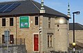
 Telephone kiosks next to Batley Library.jpg 3024 × 4032; 3,5 МБ
-

-
 Tesco Express - Smithies Lane - geograph.org.uk - 1750346.jpg 640 × 480; 84 КБ


%27_(11227553715).jpg)


.jpg)


.jpg)


