Category:Bay of Plenty Region
跳转到导航
跳转到搜索
Regions of New Zealand: Auckland · Bay of Plenty · Canterbury · Gisborne · Hawke's Bay · Manawatu-Whanganui · Marlborough · Nelson · Otago · Northland · Southland · Taranaki · Tasman · Waikato · Wellington · West Coast
Outlying islands, territories and dependencies: Antipodes Islands · Auckland Islands · Bounty Islands · Chatham Islands · Kermadec Islands · Snares Islands · Three Kings Islands · Tokelau – Territory with specific status: Ross Dependency
Associated countries: Cook Islands · Niue
Outlying islands, territories and dependencies: Antipodes Islands · Auckland Islands · Bounty Islands · Chatham Islands · Kermadec Islands · Snares Islands · Three Kings Islands · Tokelau – Territory with specific status: Ross Dependency
Associated countries: Cook Islands · Niue
纽西兰   | |||||
| 上传媒体 | |||||
| 隶属于 | |||||
|---|---|---|---|---|---|
| 名称由来 | |||||
| 位置 | 新西兰 | ||||
| 行政中心 | |||||
| 重大事件 |
| ||||
| 人口 |
| ||||
| 面积 |
| ||||
| 海拔 |
| ||||
 | |||||
子分类
本分类有以下36个子分类,共有36个子分类。
!
*
1
- 1987 Edgecumbe earthquake (10 F)
B
- Bay of Plenty Polytechnic (5 F)
C
D
F
- Fairview, Bay of Plenty (2 F)
G
K
- Kauri Point (5 F)
M
- Matahina Dam (1 F)
O
- Ongare Point (5 F)
P
- Pahoia (2 F)
R
S
T
- Tanners Point (1 F)
- Te Whaiti (15 F)
W
分类“Bay of Plenty Region”中的媒体文件
以下38个文件属于本分类,共38个文件。
-
 01 New Zealand-7200001.jpg 1,000 × 750;460 KB
-
 01 New Zealand-7200004.jpg 1,000 × 750;416 KB
-
 Bay of Plenty (Fedarb) Sheet, Te Tiriti o Waitangi (12195488783).jpg 605 × 1,743;154 KB
-
 Bay of Plenty Earthquake, 1987 (16552691561).jpg 1,787 × 1,188;1.28 MB
-
 Bay of Plenty farmlands.jpg 1,000 × 750;335 KB
-
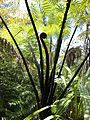 Black tree fern (6706317875).jpg 3,000 × 4,000;4.95 MB
-
 Camping Ground New Zealand-7200005.jpg 1,000 × 750;474 KB
-
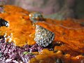
 Coelotrochus viridis 77547090.jpg 1,600 × 1,200;729 KB
-
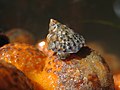
 Coelotrochus viridis 77547700.jpg 1,600 × 1,200;698 KB
-
 Coelotrochus viridis 77547761.jpg 1,600 × 1,200;690 KB
-
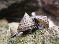
 Crisius binotatus.jpg 1,932 × 1,128;343 KB
-
 Flag of the Bay of Plenty.png 519 × 347;72 KB
-
 Hinemoa's Steps near Tutea Falls (Kaituna River).jpg 3,264 × 4,896;6.93 MB
-
 Ian and a puffer fish. (5644350938).jpg 3,456 × 5,184;10.22 MB
-
 Kaveinga bellorum.jpg 731 × 1,195;96 KB
-
 Kayakers at Okere Falls (Kaituna River).jpg 4,896 × 3,264;6.63 MB
-
 Kupeus arcuatus.jpg 610 × 1,198;102 KB
-
 Minden lookout.jpg 3,854 × 2,770;3.96 MB
-
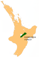 NZ-Kaingaroa F.png 405 × 590;117 KB
-
 Okere Falls (Kaituna River).jpg 4,896 × 3,264;6.01 MB
-
 On Gisborne-Opotiki road.jpg 1,520 × 1,468;260 KB
-
 Onepu Farm.jpg 1,024 × 768;97 KB
-
 Otanewainuku Reserve.jpg 3,888 × 2,592;9.38 MB
-
 Paracatops acantharius male topotype dorsal.jpg 821 × 1,066;91 KB
-
 Paracatops acantharius male topotype ventral.jpg 484 × 872;64 KB
-
 Paromalia vestita 2.jpg 2,054 × 1,310;464 KB
-
 Ptinella propria spermatheca.jpg 714 × 701;139 KB
-
 Ptinella propria.jpg 642 × 1,044;245 KB
-
 Rangitaiki.jpg 7,332 × 3,783;16.52 MB
-
 River crossing, Opotiki motor road, Bay of Plenty (21040292094).jpg 4,711 × 6,456;4.27 MB
-
 Rural New Zealand-3771.jpg 675 × 900;553 KB
-
 Sailing in New Zealand PC156351.JPG 3,648 × 2,736;1.91 MB
-
 Silvanus lateritius.jpg 886 × 1,346;165 KB
-

-

-
 Tree between Taupo and Rotorua.jpg 1,024 × 519;194 KB
-
 Upper cascade of Kaiate Falls.jpg 3,264 × 4,860;6.68 MB
-
 Waiaua Bridge Junction on the main East Coast Road, Bay of Plenty (21687557405).jpg 6,498 × 4,731;3.96 MB


.jpg)

.jpg)


.jpg)
.jpg)

.jpg)


.jpg)


.jpg)


.jpg)
_Sheet,_Te_Tiriti_o_Waitangi_(12195488783).jpg)