Category:Beaconsfield
Направо към навигацията
Направо към търсенето
English: Beaconsfield is a market town in Buckinghamshire, England.
Deutsch: Beaconsfield, Stadt in Buckinghamshire, UK
town in Buckinghamshire, England | |||||
| Качване на файл | |||||
| Екземпляр на | |||||
|---|---|---|---|---|---|
| Местоположение | Buckinghamshire, Бъкингамшър, Югоизточна Англия, Англия | ||||
| Население |
| ||||
| Площ |
| ||||
| Същото като | Beaconsfield (Wikimedia duplicated page, civil parish) | ||||
| официален уебсайт | |||||
 | |||||
Beaconsfield, White Hart Inn was an exterior film location for the Rosemary & Thyme episode "And No Birds Sing". The Old School House featured as a (closed) police station in the Rosemary & Thyme episode "The Gooseberry Bush" and has a similar function in the Agatha Christie's Poirot episode "After the Funeral" (2005).
Подкатегории
Показани са 16 от общо 16 подкатегории на тази категория.
B
- Beaconsfield railway station (0 К, 0 С, 15 Ф)
- Beaconsfield Studios (0 К, 0 С, 4 Ф)
- Beaconsfield War Memorial (0 К, 0 С, 2 Ф)
- Buildings in Beaconsfield (0 К, 0 С, 1 Ф)
G
- Grave of Edmund Waller (0 К, 0 С, 3 Ф)
H
- Holtspur Bank (0 К, 0 С, 11 Ф)
K
- Knotty Green (0 К, 0 С, 8 Ф)
- Kofi Lockhart-Adams (0 К, 0 С, 2 Ф)
M
- St Michael and All Angels Church, Beaconsfield (0 К, 0 С, 13 Ф)
S
T
- Beaconsfield Town Hall (0 К, 0 С, 4 Ф)
U
- Beaconsfield URC (0 К, 0 С, 2 Ф)
Файлове в категория „Beaconsfield“
Показани са 200 от общо 616 файла в тази категория.
(предишна страница) (следваща страница)-
 Tekening van Joh. Waller - Beacowsfield - 20317943 - RCE.jpg 1200 × 946; 234 КБ
-
 "I wonder how much that one costs" - geograph.org.uk - 2663795.jpg 480 × 640; 83 КБ
-
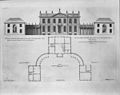
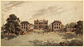 Gregories Estate near Beaconsfield Buckinghamshire 1792.jpg 4000 × 2222; 2,47 МБ
-

-
 360º Living, Warwick Road - geograph.org.uk - 2637805.jpg 640 × 480; 69 КБ
-
-
 A sunny Saturday in London End - geograph.org.uk - 2197015.jpg 640 × 480; 97 КБ
-
 A sunny Saturday in Malthouse Square - geograph.org.uk - 2197002.jpg 640 × 480; 69 КБ
-
 A sunny Saturday in Wycombe End - geograph.org.uk - 2196039.jpg 640 × 480; 107 КБ
-
 A355 at Dorney Hill - geograph.org.uk - 4862384.jpg 640 × 480; 65 КБ
-
 A355 crossing railway bridge - geograph.org.uk - 4857414.jpg 640 × 481; 62 КБ
-
 A355 towards Beaconsfield - geograph.org.uk - 5646208.jpg 640 × 428; 91 КБ
-
 A40 approaching old Beaconsfield - geograph.org.uk - 5478901.jpg 640 × 480; 174 КБ
-
 A40 at Birchland Wood - geograph.org.uk - 2831412.jpg 640 × 480; 99 КБ
-
 A40 Chalfont St Peter - geograph.org.uk - 2299646.jpg 1600 × 1200; 599 КБ
-
 A40 Oxford Road at Bellhouse Hotel - geograph.org.uk - 2831413.jpg 640 × 481; 64 КБ
-
 A40 roundabout with Windsor End, Beaconsfield - geograph.org.uk - 2355888.jpg 1600 × 1200; 522 КБ
-
 A40 towards Beaconsfield - geograph.org.uk - 6130863.jpg 800 × 600; 198 КБ
-
 A40 Wycombe End at The Old Bengal - geograph.org.uk - 4857411.jpg 640 × 481; 65 КБ
-

-
 Across the field to the M40 - geograph.org.uk - 5675553.jpg 3488 × 2616; 977 КБ
-
 AgeUK, Station Parade - geograph.org.uk - 2637831.jpg 480 × 640; 83 КБ
-
 Al fresco dining in Penn Road - geograph.org.uk - 2663807.jpg 480 × 640; 73 КБ
-
 Albemarle in London End - geograph.org.uk - 2197088.jpg 640 × 480; 65 КБ
-
 All shut - geograph.org.uk - 3207258.jpg 640 × 427; 207 КБ
-
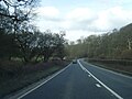
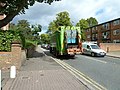
 Amersham Road (A355) - geograph.org.uk - 6121439.jpg 800 × 600; 170 КБ
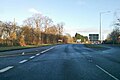
-
 Amersham Road (A355) - geograph.org.uk - 6131318.jpg 800 × 600; 139 КБ
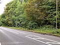
-
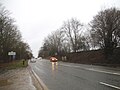
 Amersham Road (A355) - geograph.org.uk - 852052.jpg 640 × 480; 74 КБ
-
 Another Old Curiosity Shop - geograph.org.uk - 2196044.jpg 480 × 640; 104 КБ
-

-

-

-

-
 Artsmart in London End - geograph.org.uk - 2197048.jpg 480 × 640; 89 КБ
-
 Artwork in London End - geograph.org.uk - 2197080.jpg 640 × 480; 83 КБ
-
 Autumn in Brown's Wood - geograph.org.uk - 5206770.jpg 4900 × 3027; 4,66 МБ
-
 Avenue to the Grange - geograph.org.uk - 5206805.jpg 4932 × 2957; 4,45 МБ
-
 Aylesbury End in Beaconsfield - geograph.org.uk - 6123679.jpg 2700 × 2025; 342 КБ
-
 Aylesbury End, Beaconsfield - geograph.org.uk - 4539622.jpg 3872 × 2388; 1,95 МБ
-
 Aylesbury End, Beaconsfield - geograph.org.uk - 691251.jpg 640 × 480; 77 КБ
-
 Aylesbury End, Beaconsfield - geograph.org.uk - 988609.jpg 640 × 480; 94 КБ
-
 B4440 Bridge, M40 - geograph.org.uk - 2693347.jpg 640 × 430; 47 КБ
-
 B4440 crosses the M40 (looking east) - geograph.org.uk - 3007747.jpg 2560 × 1920; 1,06 МБ
-
 Bank in Penn Road - geograph.org.uk - 2663809.jpg 480 × 640; 77 КБ
-
 Barclays, Baring Road - geograph.org.uk - 2637829.jpg 640 × 480; 59 КБ
-
 Bargains in Beaconsfield - geograph.org.uk - 4531270.jpg 3576 × 2424; 1,78 МБ
-
 Baring Road in early September - geograph.org.uk - 2637824.jpg 640 × 480; 63 КБ
-
 Barn at Castleman's Farm - geograph.org.uk - 3458819.jpg 800 × 600; 153 КБ
-
 Basketball Court and Youth Centre - geograph.org.uk - 4553702.jpg 3259 × 2054; 1,17 МБ
-
 Be Be's, Penn Road - geograph.org.uk - 2637813.jpg 480 × 640; 74 КБ
-
 Beaconsfield - 2013 - geograph.org.uk - 4104764.jpg 3648 × 2736; 1023 КБ
-
 Beaconsfield - London (3616967947).jpg 2816 × 1584; 1,97 МБ
-
 Beaconsfield - London (3617782056).jpg 2816 × 2112; 3,67 МБ
-
 Beaconsfield - London (3617785152).jpg 2816 × 1584; 2,82 МБ
-
 Beaconsfield - Upmarket Shopping - geograph.org.uk - 1126657.jpg 480 × 640; 95 КБ
-
 Beaconsfield Carpets, Burkes Parade - geograph.org.uk - 2663750.jpg 480 × 640; 96 КБ
-
 Beaconsfield cricket pavilion, Buckinghamshire.jpg 640 × 480; 144 КБ
-
 Beaconsfield fire station - geograph.org.uk - 279995.jpg 640 × 427; 221 КБ
-
 Beaconsfield Fish and Chips - geograph.org.uk - 1495071.jpg 640 × 480; 87 КБ
-
 Beaconsfield MSA.jpg 2048 × 1536; 1,2 МБ
-
 Beaconsfield old fire station - geograph.org.uk - 584025.jpg 640 × 427; 196 КБ
-
 Beaconsfield Old Rectory-geograph.org.uk-2747515.jpg 761 × 1024; 474 КБ
-
 Beaconsfield railway station - geograph.org.uk - 3877600.jpg 3264 × 2448; 1,94 МБ
-
 Beaconsfield recycling centre - geograph.org.uk - 910042.jpg 640 × 480; 69 КБ
-
 Beaconsfield Rugby Club Pitches - geograph.org.uk - 853485.jpg 640 × 480; 49 КБ
-
 Beaconsfield Station - geograph.org.uk - 5395573.jpg 640 × 426; 81 КБ
-
 Beaconsfield street - geograph.org.uk - 691250.jpg 640 × 480; 72 КБ
-
 Beaconsfield Telephone Exchange - geograph.org.uk - 1356513.jpg 640 × 480; 63 КБ
-
 Beaconsfield Tennis Club - geograph.org.uk - 4535402.jpg 3960 × 2684; 1,98 МБ
-
 Beaconsfield Themed Fencing - geograph.org.uk - 1386378.jpg 640 × 480; 150 КБ
-
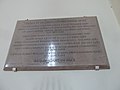
 Beaconsfield Town Hall opening plaque.jpg 2740 × 3971; 2,19 МБ
-
 Beaconsfield War Memorial - geograph.org.uk - 1840949.jpg 640 × 480; 121 КБ
-
 Beaconsfield, 1962 - geograph.org.uk - 4739511.jpg 2354 × 1376; 2,12 МБ
-
 Beaconsfield, 1962 geograph-3378401-by-Ben-Brooksbank.jpg 1179 × 650; 1,15 МБ
-
 Beaconsfield, Burkes Parade - geograph.org.uk - 4096825.jpg 640 × 480; 67 КБ
-
 Beaconsfield, Footpath to Hedgerley - geograph.org.uk - 1858206.jpg 640 × 480; 148 КБ
-

-
 Beaconsfield, NatWest Bank - geograph.org.uk - 4091072.jpg 640 × 473; 65 КБ
-
 Beaconsfield, Old Coaching Centre - geograph.org.uk - 1126666.jpg 640 × 480; 85 КБ
-
 Beaconsfield, One Tree Lane - geograph.org.uk - 4093430.jpg 640 × 480; 87 КБ
-
 Beaconsfield, Pyebush Lane - geograph.org.uk - 1858188.jpg 640 × 480; 130 КБ
-

-
 Beaconsfield, Railway towards London - geograph.org.uk - 4093411.jpg 640 × 480; 101 КБ
-
 Beaconsfield, St Michael's Green - geograph.org.uk - 4093459.jpg 640 × 480; 118 КБ
-
 Beaconsfield, Station Road looking south - geograph.org.uk - 3335706.jpg 1024 × 768; 147 КБ
-
 Beaconsfield, The Baptist Church - geograph.org.uk - 4096791.jpg 640 × 480; 77 КБ
-
-

-
-
-
 Beeches near Hillmotts Farm - geograph.org.uk - 162819.jpg 640 × 480; 562 КБ
-
 Beechwood Road, Beaconsfield - geograph.org.uk - 149803.jpg 640 × 480; 136 КБ
-
 Beechwood, John Crosfield 1931.jpg 2625 × 3126; 1,79 МБ
-
 Bekonscot Model Village - geograph.org.uk - 3932038.jpg 640 × 395; 87 КБ
-
 Bend in Grenfell Road - geograph.org.uk - 2637785.jpg 640 × 480; 80 КБ
-
 Between Jennings Wood and Hangings Wood - geograph.org.uk - 162845.jpg 640 × 480; 328 КБ
-
 Bin lorry in Maxwell Road - geograph.org.uk - 2643932.jpg 640 × 480; 76 КБ
-
 Birchen Spring - geograph.org.uk - 6121447.jpg 800 × 533; 161 КБ
-
 Birchen Spring forestry path - geograph.org.uk - 5206819.jpg 4883 × 2946; 4,34 МБ
-
 Birchen Spring wood - geograph.org.uk - 5206823.jpg 4802 × 3000; 3,94 МБ
-
 Bluebells in Dipple Wood - geograph.org.uk - 3458805.jpg 800 × 600; 225 КБ
-
-
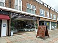 Board outside James ^ Wallis - geograph.org.uk - 2663814.jpg 640 × 480; 93 КБ
-

-
 Boots, Gregories Road - geograph.org.uk - 2644358.jpg 640 × 480; 73 КБ
-
 Bower Wood Cottage Bridge, M40 - geograph.org.uk - 2698741.jpg 640 × 430; 45 КБ
-
 Bradleys in London End - geograph.org.uk - 2197051.jpg 480 × 640; 81 КБ
-
 Brasserie Blanc - geograph.org.uk - 4532475.jpg 4000 × 2664; 1,94 МБ
-
 Bridleway in Great Beards Wood - geograph.org.uk - 2004960.jpg 3072 × 2304; 1,21 МБ
-
 Bridleway in Owlsears Wood - geograph.org.uk - 2004971.jpg 3072 × 2304; 1,12 МБ
-
 Bridleway towards Blue Close Wood - geograph.org.uk - 5000142.jpg 640 × 480; 140 КБ
-
 Broad Lane Bridge, M40 - geograph.org.uk - 2693353.jpg 640 × 430; 44 КБ
-
 Broad Lane Bridge, M40 - geograph.org.uk - 5653993.jpg 640 × 291; 43 КБ
-
 Broad Lane crosses the M40 - geograph.org.uk - 2869136.jpg 640 × 480; 51 КБ
-
 Broadway Auto Centre, Warwick Road - geograph.org.uk - 2637807.jpg 640 × 480; 60 КБ
-
 Browns Wood - geograph.org.uk - 5206765.jpg 4624 × 2903; 4,76 МБ
-
 Buck House in Wycombe End - geograph.org.uk - 2196026.jpg 480 × 640; 119 КБ
-
 Buildings along the A40, Old Beaconsfield - geograph.org.uk - 2355884.jpg 1600 × 1200; 552 КБ
-

-
 Burkes Court.jpg 4032 × 2268; 1,84 МБ
-
 Burkes Parade - Lloyds TSB - geograph.org.uk - 2643858.jpg 480 × 640; 62 КБ
-
 Burkes Parade- Coral-Ashington Page - geograph.org.uk - 2643855.jpg 480 × 640; 66 КБ
-
 Burkes Parade- Smallbone-White Stuff - geograph.org.uk - 2643870.jpg 480 × 640; 74 КБ
-
 Burkes Parade- The Frost partnership - geograph.org.uk - 2643851.jpg 480 × 640; 61 КБ
-
 Burnham Road near Fairview House - geograph.org.uk - 4862387.jpg 640 × 480; 85 КБ
-
 Bus shelter in Maxwell Road - geograph.org.uk - 2643923.jpg 640 × 480; 56 КБ
-
 Bus stop in Station Road - geograph.org.uk - 2643871.jpg 480 × 640; 64 КБ
-
 Bus stop in Station Road - geograph.org.uk - 2663798.jpg 480 × 640; 58 КБ
-
 Butlers Court Road, Beaconsfield - geograph.org.uk - 4539826.jpg 4000 × 2664; 1,93 МБ
-
 Butlers Court Road, Beaconsfield - geograph.org.uk - 913973.jpg 640 × 480; 74 КБ
-
 Campbell Drive - geograph.org.uk - 4533676.jpg 3388 × 2572; 1,31 МБ
-

-
 Car park in Beaconsfield - geograph.org.uk - 2196055.jpg 640 × 480; 95 КБ
-
 Car park, Beaconsfield Station - geograph.org.uk - 4534682.jpg 640 × 426; 68 КБ
-
 Car park, Beaconsfield Station - geograph.org.uk - 4534683.jpg 640 × 426; 62 КБ
-
 Car park, Beaconsfield Station - geograph.org.uk - 5395572.jpg 640 × 426; 55 КБ
-
-

-
-

-

-
-

-

-

-

-

-

-

-

-

-
-

-

-

-

-
-
-
 Cherry Tree Road - geograph.org.uk - 4735259.jpg 640 × 640; 87 КБ
-
 Chiltern Hills Road, Beaconsfield - geograph.org.uk - 150498.jpg 640 × 480; 149 КБ
-

-
 Circular plantation - geograph.org.uk - 5273129.jpg 4608 × 3456; 4,47 МБ
-
 Classic car passing Zoom - geograph.org.uk - 2643939.jpg 480 × 640; 65 КБ
-
 Club in London End - geograph.org.uk - 2197108.jpg 480 × 640; 64 КБ
-

-
 Collinswood Road, Beaconsfield - geograph.org.uk - 5664413.jpg 2048 × 1536; 1,49 МБ
-
 Copperfields, Beaconsfield - geograph.org.uk - 4536647.jpg 1024 × 713; 174 КБ
-
 Corner of Wattleton Road, Beaconsfield - geograph.org.uk - 4539829.jpg 1600 × 1110; 451 КБ
-
 Costa, Gregories Road - geograph.org.uk - 2643882.jpg 640 × 480; 68 КБ
-
 Cottage at Beaconsfield.jpg 2014 × 1392; 604 КБ
-
 Country House, Station Road - geograph.org.uk - 2644293.jpg 480 × 640; 81 КБ
-
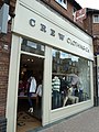 Crew Clothing Co, Station Road - geograph.org.uk - 2643895.jpg 480 × 640; 79 КБ
-
 Crop field beside Peggs Wood - geograph.org.uk - 6121442.jpg 800 × 600; 95 КБ
-
 Cross in Beaconsfield Churchyard - geograph.org.uk - 2196931.jpg 640 × 462; 95 КБ
-
 Cross Keys, Beaconsfield - geograph.org.uk - 988604.jpg 640 × 480; 73 КБ
-
 Crossing Burkes Road from Costa - geograph.org.uk - 2644319.jpg 480 × 640; 75 КБ
-
 Crowne Plaza Hotel, Gerrards Cross - geograph.org.uk - 6121404.jpg 800 × 507; 140 КБ
-
 Cutting, Hogsty Wood - geograph.org.uk - 4535764.jpg 640 × 268; 76 КБ
-
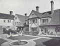
 Davenies, Beaconsfield (01).png 1052 × 692; 1,24 МБ
-
 Davenies, Beaconsfield (02).png 938 × 716; 1,11 МБ
-
 Davenies, Beaconsfield. The Entrance Hall 01.png 703 × 850; 1,09 МБ
-
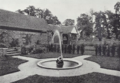 Davenies, Beaconsfield. The Sunken Garden.png 1073 × 738; 1,41 МБ
-
 DaveniesSchool.jpg 4320 × 3240; 5,4 МБ
-
 David Shuttle in Penn Road - geograph.org.uk - 2663849.jpg 480 × 640; 75 КБ
-
 Desborough Pets, Warwick Road - geograph.org.uk - 2637803.jpg 480 × 640; 72 КБ
-
 Dipple Wood in Autumn - geograph.org.uk - 2149132.jpg 640 × 409; 171 КБ
-
 Disused utility building - geograph.org.uk - 5675548.jpg 3488 × 2616; 1,57 МБ
-
 Dorney Hill North, Beaconsfield - geograph.org.uk - 5664418.jpg 2048 × 1536; 1,52 МБ
-
 Dry cleaners in Station Parade - geograph.org.uk - 2637834.jpg 480 × 640; 83 КБ
-
 Ducks and pond by Castleman's Farm (1) - geograph.org.uk - 3458822.jpg 800 × 600; 160 КБ
-
 Ducks and pond by Castleman's Farm (2) - geograph.org.uk - 3458824.jpg 800 × 528; 138 КБ
-
 Dust cart in Penn Road - geograph.org.uk - 2663826.jpg 640 × 480; 102 КБ
-
 Early September in Maxwell Road - geograph.org.uk - 2643927.jpg 640 × 480; 89 КБ
-
 Edge of Brown's Wood - geograph.org.uk - 5206778.jpg 4246 × 3114; 4,46 МБ
-
 Emile de Londres Beaconsfield - geograph.org.uk - 2644272.jpg 480 × 640; 92 КБ
-
En-uk-Beaconsfield.ogg 1,9 сек; 38 КБ
-
 Entering Beaconsfield - geograph.org.uk - 6131313.jpg 800 × 547; 144 КБ
-
 Entering Beaconsfield on London Road - geograph.org.uk - 5665238.jpg 2304 × 1728; 1,41 МБ
-
 Entrance to Wilton Park - geograph.org.uk - 4536493.jpg 3824 × 2492; 1,89 МБ
-


_-_geograph.org.uk_-_6121439.jpg)
_-_geograph.org.uk_-_6131318.jpg)
_-_geograph.org.uk_-_852052.jpg)


_-_geograph.org.uk_-_3007747.jpg)


_-_geograph.org.uk_-_2614752.jpg)
_-_geograph.org.uk_-_2614948.jpg)
_-_geograph.org.uk_-_2614950.jpg)
_-_geograph.org.uk_-_2615542.jpg)
_-_geograph.org.uk_-_2615549.jpg)


_-_geograph.org.uk_-_3458822.jpg)
_-_geograph.org.uk_-_3458824.jpg)


.jpg)
.jpg)
.jpg)
.png)
.png)