Category:Bermondsey
Jump to navigation
Jump to search
district in south London, England  | |||||
| Upload media | |||||
| Instance of | |||||
|---|---|---|---|---|---|
| Part of |
| ||||
| Location | London Borough of Southwark, Greater London, London, England | ||||
| Located in or next to body of water | |||||
 | |||||
Bermondsey is a London district on the south bank of the river Thames, and forms part of the London Borough of Southwark.
Subcategories
This category has the following 48 subcategories, out of 48 total.
A
- Alaska Building, Bermondsey (12 F)
B
- Bermondsey Market (3 F)
- Bermondsey Spa Gardens (8 F)
- Bermondsey War Memorial (17 F)
C
- Cherry Garden Pier (11 F)
- Clements Road, Bermondsey (1 F)
D
- Dr Salter's Daydream (43 F)
F
- Fashion and Textile Museum (18 F)
G
- Grange Road, Bermondsey (7 F)
- Grange Walk (22 F)
J
- Jacob's Island (11 F)
K
- Kagyu Samye Dzong London (20 F)
- Kirby Estate, Bermondsey (4 F)
M
- Marine Street, London (9 F)
P
- Peek Freans Museum (5 F)
R
S
- St James's Road, Bermondsey (16 F)
- South Bermondsey railway station (22 F)
- Spa Road railway station (21 F)
- St Hugh’s Church, Bermondsey (14 F)
T
Media in category "Bermondsey"
The following 200 files are in this category, out of 232 total.
(previous page) (next page)-
 1-19 Bartholomew Street (geograph 4831864).jpg 640 × 535; 179 KB
-
-
 185A3479.jpg 6,720 × 4,480; 23.36 MB
-
 Image taken from page 717 of 'Old and New London, etc' (11188568405).jpg 1,892 × 1,645; 1.1 MB
-
 Image taken from page 729 of 'Old and New London, etc' (11187614234).jpg 1,892 × 1,596; 1.09 MB
-
 Image taken from page 734 of 'Old and New London, etc' (11190382915).jpg 1,892 × 1,591; 1.1 MB
-
 Image taken from page 735 of 'Old and New London, etc' (11188180243).jpg 1,892 × 2,817; 1.92 MB
-
 195 New Kent Road - geograph.org.uk - 1766341.jpg 640 × 480; 143 KB
-
 2-4 Leathermarket Street (geograph 4984980).jpg 640 × 491; 215 KB
-
 4-22 Falmouth Road (geograph 4832341).jpg 640 × 533; 209 KB
-
 7 Snowsfields, Bermondsey (I).jpg 3,448 × 4,592; 7.73 MB
-
 7 Snowsfields, Bermondsey (II).jpg 3,448 × 4,592; 7.74 MB
-
 7 Snowsfields, Bermondsey (III).jpg 4,592 × 3,448; 8.11 MB
-
 A Bermondsey Rest Centre Art.IWMARTLD1376.jpg 800 × 545; 102 KB
-
 Abbey Street, Bermondsey - geograph.org.uk - 4385676.jpg 1,024 × 768; 204 KB
-

-
 Afternoon tea tour buses huddle together.jpg 4,032 × 3,024; 3.1 MB
-
 Albert McKenzie memorial.jpg 3,550 × 2,852; 2.52 MB
-
 Albion Channel - geograph.org.uk - 228456.jpg 640 × 480; 94 KB
-
 Alma Grove, Bermondsey - geograph.org.uk - 4369708.jpg 2,272 × 1,704; 818 KB
-

-
 Arancia (2932704900).jpg 1,006 × 792; 185 KB
-
 Archie Street, London - geograph.org.uk - 2418757.jpg 4,000 × 3,000; 3.6 MB
-
 Bacon's Free School (7691699740).jpg 2,736 × 3,648; 4.51 MB
-
 Balaclava Road, Bermondsey - geograph.org.uk - 4368692.jpg 2,272 × 1,704; 1,014 KB
-
 Barges and Canaries - geograph.org.uk - 766358.jpg 640 × 203; 38 KB
-
 BBC 1935.jpg 2,592 × 1,944; 1.21 MB
-
 Benches in Bermondsey.jpg 1,024 × 768; 240 KB
-
 Bermondsey - geograph.org.uk - 295.jpg 640 × 383; 40 KB
-
 Bermondsey bombing damage 1915 IWM HO 13.jpg 610 × 800; 80 KB
-
 Bermondsey Central Baths Wellcome L0070003.jpg 7,396 × 5,432; 14.22 MB
-
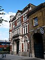
 Bermondsey fire station - geograph.org.uk - 197062.jpg 640 × 480; 110 KB
-
 Bermondsey from the air - geograph.org.uk - 2804685.jpg 640 × 480; 144 KB
-
 Bermondsey from the air - geograph.org.uk - 5078425.jpg 640 × 480; 191 KB
-
 Bermondsey Long Walk meeting house.jpg 396 × 430; 68 KB
-
 Bermondsey Medical Mission Hospital, London, 1929 Wellcome L0038385.jpg 3,757 × 2,521; 4 MB
-
 Bermondsey Met. B Ward Map 1916.svg 1,222 × 819; 75 KB
-
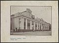
 Bermondsey Town Hall circa 1909.jpg 352 × 241; 40 KB
-
 Bermondsey, London aerial view.jpg 3,648 × 2,736; 4.75 MB
-
 Block of Flats, Bermondsey - geograph.org.uk - 1483743.jpg 586 × 640; 117 KB
-
 Blue Anchor Lane, SE16 - geograph.org.uk - 468113.jpg 640 × 480; 106 KB
-
 Bonded Warehouse- Bermondsey.jpg 2,048 × 1,536; 848 KB
-
 Boutcher School (7691705578).jpg 3,648 × 2,736; 3.72 MB
-
 Carmarthen Place (3486558075).jpg 533 × 800; 140 KB
-
 Carmarthen Place (3487372668).jpg 526 × 800; 136 KB
-
 Carmarthen Place window (3487373036).jpg 799 × 602; 118 KB
-
 Charles Dickens quoted in Bermondsey 2024-03-23.jpg 4,032 × 3,024; 6.93 MB
-
 Charles III Coronation Flag in Market Place, Bermondsey.jpg 3,885 × 3,100; 7.59 MB
-

-
 Cherry Gardens, Bermondsey - geograph.org.uk - 507985.jpg 640 × 480; 108 KB
-
 City Cruises - geograph.org.uk - 197063.jpg 640 × 480; 79 KB
-
 Clements Road, Bermondsey - geograph.org.uk - 3996667.jpg 640 × 480; 108 KB
-
 Coat of Arms Met borough of Bermondsey.jpg 1,944 × 2,592; 1.86 MB
-
 Coffee (3487373164).jpg 292 × 756; 67 KB
-
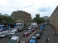
 Collingwood Street - geograph.org.uk - 1024293.jpg 480 × 640; 106 KB
-
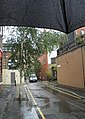 Copperfield Street in the rain - geograph.org.uk - 2540438.jpg 729 × 1,024; 215 KB
-
 Detail of the Cross Bones Shrine.jpg 4,896 × 2,752; 7.63 MB
-
 Detail, New Salomons Centre - geograph.org.uk - 1029632.jpg 480 × 640; 121 KB
-
 Deverall Street - geograph.org.uk - 4757823.jpg 1,600 × 1,200; 691 KB
-
 Deverell Street - geograph.org.uk - 4385298.jpg 1,024 × 768; 188 KB
-
 Deverell Street, Bermondsey - geograph.org.uk - 4376407.jpg 1,024 × 768; 168 KB
-
 Diners by the Thames Path - geograph.org.uk - 3352699.jpg 1,500 × 996; 184 KB
-
 Dockhead fire station 2024-03-23.jpg 4,032 × 3,024; 4.37 MB
-
 Dockhead Fire Station.jpg 3,264 × 2,448; 2.78 MB
-
 Dockhead Stores (7691663928).jpg 3,648 × 2,736; 3.42 MB
-
 Drinking Fountain in Webb Street, Bermondsey (01).jpg 4,198 × 3,057; 11.23 MB
-
 Drinking fountain, Bermondsey - geograph.org.uk - 197064.jpg 640 × 480; 146 KB
-
 East Lane in Bermondsey - geograph.org.uk - 3352775.jpg 1,500 × 1,000; 169 KB
-
 Enid Street, Bermondsey - geograph.org.uk - 4385755.jpg 1,024 × 768; 172 KB
-
 Fair Street, Bermondsey - geograph.org.uk - 3785967.jpg 640 × 480; 134 KB
-
 FisherFCCrest.png 512 × 512; 91 KB
-
-
 Flats in South Bermondsey - geograph.org.uk - 3932257.jpg 640 × 413; 46 KB
-
 Flats in South Bermondsey - geograph.org.uk - 3932263.jpg 640 × 419; 64 KB
-
 Flats, Bermondsey - geograph.org.uk - 4461412.jpg 640 × 426; 48 KB
-
 Flats, Bermondsey - geograph.org.uk - 4461416.jpg 640 × 355; 51 KB
-
 Flats, Bermondsey - geograph.org.uk - 4466340.jpg 640 × 430; 55 KB
-
 Flats, Bermondsey - geograph.org.uk - 4513613.jpg 640 × 426; 55 KB
-
 Flats, Bermondsey - geograph.org.uk - 4526927.jpg 640 × 426; 55 KB
-
 Flats, Bermondsey - geograph.org.uk - 4685304.jpg 640 × 426; 55 KB
-
 Flockton Street, Bermondsey - geograph.org.uk - 4386016.jpg 1,024 × 768; 156 KB
-
 Folly Ditch.jpg 1,712 × 1,756; 705 KB
-
 Former Fire Station (8179865669).jpg 2,736 × 3,648; 4.04 MB
-
 Former Leather Market, Weston Street (geograph 2645727).jpg 640 × 530; 206 KB
-
 Former Peek Freans factory 2024-03-23.jpg 4,032 × 3,024; 3.69 MB
-
 Former Police Station and Magistrates Court (7691660958).jpg 3,648 × 2,736; 4.15 MB
-
 Fountain for Violet Alice Tritton.jpg 4,032 × 3,024; 3.65 MB
-
 Frean Street, Bermondsey - geograph.org.uk - 2963549.jpg 1,024 × 768; 199 KB
-
 Gasometer, Rotherhithe - geograph.org.uk - 197071.jpg 640 × 480; 90 KB
-
 Globe Wharf, London SE16 - geograph.org.uk - 1404243.jpg 640 × 480; 70 KB
-
 Graffiti in Surrey Canal Road, South Bermondsey.jpg 4,592 × 3,448; 7.96 MB
-
 Guinness Trust Buildings (7691683246).jpg 3,648 × 2,736; 4.33 MB
-
 Haddon Hall and Green Walk Mission.png 567 × 416; 178 KB
-
 Houses on Clements Road, Bermondsey - geograph.org.uk - 3996671.jpg 640 × 480; 158 KB
-
 Housing on Webster Road, Bermondsey - geograph.org.uk - 4385882.jpg 1,024 × 768; 97 KB
-

-
 Insurance Plan of City of London Vol. IV; Key Plan 1 (BL 150240).tiff 3,163 × 3,729; 33.75 MB
-
 Insurance Plan of City of London Vol. IV; sheet 83-2 (BL 150303).tiff 3,184 × 3,769; 34.33 MB
-
 Insurance Plan of City of London Vol. IV; sheet 85 (BL 150306).tiff 3,171 × 3,754; 34.06 MB
-
 Insurance Plan of City of London Vol. IV; sheet 94-1 (BL 150323).tiff 3,139 × 3,754; 33.71 MB
-
 Insurance Plan of City of London Vol. IV; sheet 95-1 (BL 150325).tiff 3,195 × 3,754; 34.32 MB
-
 Jacob's Island blue plaque.jpg 2,816 × 2,112; 3.11 MB
-
 King Edward III Manor House (8179858661).jpg 3,648 × 2,736; 4.54 MB
-
 King Edward III mansion house site - geograph.org.uk - 197066.jpg 640 × 480; 97 KB
-
 Lafone Street (7691627040).jpg 2,736 × 3,648; 3.99 MB
-
 LBC 1165 bridge.jpg 3,024 × 4,032; 3.02 MB
-
 Leather Market, Bermondsey (01).jpg 4,312 × 3,166; 10.37 MB
-
 Leather Market, Bermondsey (02).jpg 4,281 × 3,310; 11.69 MB
-
 Leather Market, Bermondsey (03).jpg 4,440 × 3,227; 14.65 MB
-
 Leather Market, Bermondsey (04).jpg 4,332 × 3,214; 12.17 MB
-
 London Leather, Hide and Wool Exchange (7691685578).jpg 2,736 × 3,648; 2.87 MB
-
 London Leather, Hide and Wool Exchange Public House, Bermondsey (01).jpg 3,448 × 4,592; 12.41 MB
-
 London Leather, Hide and Wool Exchange Public House, Bermondsey (02).jpg 3,347 × 4,292; 11.59 MB
-
 London Leather, Hide and Wool Exchange Public House, Bermondsey (03).jpg 4,460 × 3,057; 11.34 MB
-
 London-Greenwich viaduct.jpg 839 × 614; 233 KB
-
 Long Lane (3486558725).jpg 533 × 800; 80 KB
-
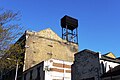 Long Lane water tank (3486558877).jpg 800 × 533; 89 KB
-
 Lynton Road, adjacent to Paterson Park - geograph.org.uk - 2427019.jpg 640 × 460; 122 KB
-
 Lynton Road, Bermondsey - geograph.org.uk - 2395298.jpg 640 × 480; 101 KB
-
 Lynton Road, Bermondsey - geograph.org.uk - 4368679.jpg 2,272 × 1,704; 907 KB
-
 Manor Methodist Church, Bermondsey - rear - geograph.org.uk - 2427031.jpg 1,024 × 768; 411 KB
-
 Marcus Gheeraerts the Elder - Festival at Bermondsey.png 2,598 × 1,871; 8.31 MB
-
 Marigold Street, Bermondsey - geograph.org.uk - 4385911.jpg 1,024 × 768; 153 KB
-
 Marigold Street, Bermondsey - geograph.org.uk - 507895.jpg 640 × 480; 135 KB
-
 Memorial to Flo Weller.jpg 4,032 × 3,024; 5.15 MB
-
 Microcosm of London Plate 061 - Philanthropic Society, the Chapel (tone).jpg 1,794 × 1,386; 887 KB
-
 Microcosm of London Plate 061 - Philanthropic Society, the Chapel.jpg 1,794 × 1,386; 797 KB
-
 Mr Whippy ice cream van (rear).jpg 6,000 × 4,000; 5 MB
-
 Mr Whippy ice cream van with customers (side).jpg 6,000 × 4,000; 5.23 MB
-
 Neckinger Estate (7691707586).jpg 3,648 × 2,736; 3.83 MB
-
 Newham's Row (3486559023).jpg 533 × 800; 101 KB
-
 Newham's Row - geograph.org.uk - 4985483.jpg 486 × 640; 142 KB
-
 Old Jamaica Road, Bermondsey - geograph.org.uk - 2963556.jpg 1,024 × 768; 263 KB
-
 Old Jamaica Road, London SE1 - geograph.org.uk - 4380413.jpg 1,238 × 929; 952 KB
-
 Old Jamaica Road, London SE1 - geograph.org.uk - 4380419.jpg 740 × 987; 649 KB
-
 Oxley Close, Bermondsey - geograph.org.uk - 2020311.jpg 640 × 480; 90 KB
-
 Peter Butler House, Bermondsey.jpg 4,592 × 3,448; 14.02 MB
-
 Pfettendach, Marktplatz von London-Bermondsey (2024).jpg 2,209 × 1,608; 951 KB
-
 Piece of the House of Commons on housing block 2024-03-23.jpg 4,032 × 3,024; 2.39 MB
-
 Potters Field and Tower Bridge (7691657940).jpg 3,648 × 2,736; 4.73 MB
-

-
 Public Health, Bermondsey Wellcome L0070018.jpg 5,507 × 7,096; 6.47 MB
-
 Public Health, Bermondsey Wellcome L0070019.jpg 5,453 × 7,121; 6.39 MB
-
 Public Health, Bermondsey Wellcome L0070028.jpg 7,304 × 5,607; 6.4 MB
-
 Public Health; Bermondsey Wellcome L0070020.jpg 5,474 × 7,159; 6.59 MB
-
 Public Health; Bermondsey Wellcome L0070021.jpg 5,527 × 7,159; 6.38 MB
-
 Public Health; Bermondsey Wellcome L0070022.jpg 5,526 × 7,159; 6.9 MB
-
 Public Health; Bermondsey Wellcome L0070023.jpg 5,527 × 7,180; 6.79 MB
-
 Public Health; Bermondsey Wellcome L0070024.jpg 5,526 × 7,181; 6.56 MB
-
 Public Health; Bermondsey Wellcome L0070025.jpg 5,432 × 7,181; 6.68 MB
-
 Public Health; Bermondsey Wellcome L0070036.jpg 6,562 × 4,784; 4.96 MB
-
 Public Health; Bermondsey Wellcome L0070039.jpg 6,359 × 4,585; 5.93 MB
-
 Public Health; Bermondsey Wellcome L0070040.jpg 6,938 × 5,132; 6.1 MB
-
 Railway arch by Raymouth Road.jpg 640 × 480; 96 KB
-
 Railway Arches, Bermondsey.jpg 5,079 × 3,386; 13.54 MB
-
 Randolph Schwabe - Schwabe-98147 - Bermondsey, Bridge House, 64 George Row - 1934.jpg 1,335 × 1,950; 732 KB
-
 Ribbons on the Gates of the Cross Bones Graveyard.jpg 4,896 × 2,752; 8.12 MB
-
 Riley Road, Bermondsey - geograph.org.uk - 4385692.jpg 1,024 × 768; 205 KB
-
 RIP Mr.T sign.jpg 2,367 × 3,024; 2.28 MB
-
 Riverside Primary School (7691718722).jpg 3,648 × 2,736; 3.86 MB
-
-
 SAM 1925 (7691680492).jpg 2,736 × 3,648; 2.88 MB
-
 SAM 1926 (7691634038).jpg 3,648 × 2,736; 3.45 MB
-
 SAM 1927 (7691635084).jpg 3,648 × 2,736; 3.71 MB
-
 SAM 1928 (7691681252).jpg 2,736 × 3,648; 4.05 MB
-
 Samson's Castle (7691637338).jpg 2,736 × 3,648; 3.31 MB
-
 Sculpture on the Waterfront, Bermondsey (geograph 2098015).jpg 3,872 × 2,592; 5.21 MB
-
 Seaford House (7691647530).jpg 3,648 × 2,736; 4.42 MB
-
 Seaford House (7691648194).jpg 3,648 × 2,736; 3.51 MB
-
 Shuters Wharf (7691667858).jpg 2,736 × 3,648; 3.96 MB
-
 Snowfields Primary School (7691684006).jpg 3,648 × 2,736; 3.92 MB
-
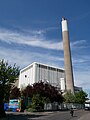 South East London Combined Heat and Power, South Bermondsey.jpg 3,448 × 4,592; 10.58 MB
-

-
 Spa Road Railway Bridge (7691708422).jpg 3,648 × 2,736; 3.62 MB
-
 Spa Road Railway Bridge (7691709252).jpg 2,736 × 3,648; 3.63 MB
-
 Spa Road, Bermondsey - geograph.org.uk - 2963526.jpg 1,024 × 768; 249 KB
-
 St Andrew's Wharf (3450559668).jpg 2,592 × 3,888; 4.17 MB
-
 St Andrew's Wharf, St Saviour's Wharf and St George's Wharf (7691667014).jpg 2,736 × 3,648; 3.36 MB
-
 St Andrews Wharf (5535005954).jpg 1,952 × 2,592; 1.97 MB
-
 St John's park, Bermondsey - geograph.org.uk - 332342.jpg 640 × 480; 133 KB
-
 St John's Vicarage (7691625828).jpg 3,648 × 2,736; 4.7 MB
-
 St Olave's Union (7691663128).jpg 3,648 × 2,736; 4.33 MB
-
 St Saviours Dock (7691668364).jpg 2,736 × 3,648; 3.84 MB
-
 Stork's Road, Bermondsey Wellcome L0070004.jpg 7,439 × 5,917; 6.61 MB
-
 Tanner Street Warehouses (7691691194).jpg 3,648 × 2,736; 4.4 MB
-
 Tapley House, Bermondsey.jpg 4,177 × 3,101; 12.55 MB
-
 Tentazioni, Bermondsey, London (4285472167).jpg 3,102 × 2,068; 2.55 MB
-
 Tentazioni, Bermondsey, London (4285476737).jpg 2,964 × 1,976; 2.29 MB
-
 Tentazioni, Bermondsey, London (4286215724).jpg 2,981 × 1,986; 2.22 MB
-

-
 Thames Developments (geograph 5663982).jpg 5,472 × 3,648; 2.71 MB
-
 Thames Firework Display VJ-Day 50 Years - geograph.org.uk - 40078.jpg 687 × 1,050; 914 KB
-
 Thames Path, Butler's Wharf - geograph.org.uk - 2583726.jpg 2,560 × 1,920; 2.21 MB
-
 The Anchor Brewery (7691628778).jpg 2,736 × 3,648; 3.9 MB
-
 The location of the Cross Bones Graveyard.jpg 4,896 × 2,752; 7.74 MB
-
 The London City Mission - geograph.org.uk - 521528.jpg 640 × 447; 80 KB
-
 The Morocco Store (7691636024).jpg 2,736 × 3,648; 3.05 MB
-
 The Neckinger Estate (7691639820).jpg 3,648 × 2,736; 4.5 MB
-
 The Old Rectory (7691694422).jpg 2,736 × 3,648; 3.47 MB
-

.jpg)

.jpg)
.jpg)
.jpg)
.jpg)

.jpg)
.jpg)
.jpg)
.jpg)
.jpg)


,_Rotherhithe_Street,_London,_SE16_-_geograph.org.uk_-_1509019.jpg)


,_Rotherhithe_Street,_London,_SE16_-_geograph.org.uk_-_1508935.jpg)
.jpg)

.jpg)


.jpg)
.jpg)
.jpg)
.jpg)


.jpg)
.jpg)


.jpg)
.jpg)

.jpg)


.jpg)


.jpg)

.jpg)

.jpg)
.jpg)
.jpg)
.jpg)
.jpg)
.jpg)
.jpg)
.jpg)

.jpg)
.jpg)


.jpg)

.jpg)
.jpg)
.jpg)
.jpg)


.jpg)

.jpg)
.jpg)


.jpg)

.jpg)
.jpg)
.jpg)
.jpg)
.jpg)
.jpg)
.jpg)
.jpg)
.jpg)
.jpg)

.jpg)
.jpg)

.jpg)
.jpg)
.jpg)

.jpg)
.jpg)
.jpg)

.jpg)

.jpg)
.jpg)
.jpg)

.jpg)


.jpg)


.jpg)
.jpg)
.jpg)

.jpg)