Category:Birkin
Jump to navigation
Jump to search
village in United Kingdom  | |||||
| Upload media | |||||
| Instance of | |||||
|---|---|---|---|---|---|
| Location | Selby, North Yorkshire, Yorkshire and the Humber, England | ||||
| Population |
| ||||
 | |||||
English: Birkin is a village and civil parish in the south-west of the Selby district of North Yorkshire, England. It is north of the River Aire, near Beal. The closest town is Knottingley, in West Yorkshire, four miles to the south-west. According to the 2001 census the parish had a population of 146.
Français : Birkin est un village anglais au sud-ouest du district de Selby dans le Yorkshire du Nord et au nord de la rivière Aire. La ville la plus proche est Knottingley dans la région du Yorkshire de l'Ouest, à sept kilomètres au sud-ouest. En 2001, Birkin comptait 146 habitants.
Media in category "Birkin"
The following 137 files are in this category, out of 137 total.
-
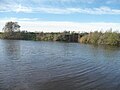
 After the flood - geograph.org.uk - 3173610.jpg 2,048 × 1,536; 623 KB
-

-
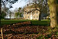
 At the back of Birkin House - geograph.org.uk - 6345277.jpg 1,280 × 801; 470 KB
-
 Beet field near Hillam - geograph.org.uk - 6345308.jpg 1,280 × 960; 382 KB
-
 Bench mark, Birkin Church - geograph.org.uk - 3799106.jpg 1,280 × 960; 466 KB
-
 Birkin Grange, Birkin - geograph.org.uk - 2155437.jpg 800 × 600; 344 KB
-
 Birkin Grange.jpg 1,280 × 960; 577 KB
-
 Birkin Hall gatepiers - geograph.org.uk - 1611532.jpg 640 × 426; 95 KB
-
 Birkin Holme House - geograph.org.uk - 1459182.jpg 640 × 480; 56 KB
-
 Birkin House - geograph.org.uk - 6345281.jpg 1,280 × 884; 536 KB
-
 Birkin House.jpg 1,280 × 870; 551 KB
-
 Birkin Lane - geograph.org.uk - 2397125.jpg 1,600 × 1,200; 383 KB
-
 Birkin Lane - geograph.org.uk - 5774620.jpg 640 × 427; 221 KB
-
 Birkin Lane on a winter's afternoon - geograph.org.uk - 1620952.jpg 640 × 480; 60 KB
-
 Birkin Lane, Birkin - geograph.org.uk - 2155435.jpg 800 × 600; 183 KB
-
 Birkin Lane, looking south-west - geograph.org.uk - 1621627.jpg 640 × 480; 37 KB
-

-
 Birkin Post Office and general Store - geograph.org.uk - 244146.jpg 640 × 480; 100 KB
-
 Birkin Village.jpg 640 × 427; 81 KB
-
 Birkin, Drain next to Birkin Lane - geograph.org.uk - 5930427.jpg 5,234 × 3,489; 6.27 MB
-
 Birkin, Drain next to Birkin Lane, outflow control - geograph.org.uk - 5930433.jpg 5,526 × 3,683; 7.37 MB
-
 Birkin, Footpath next to Church Farm - geograph.org.uk - 5930424.jpg 5,958 × 3,972; 7.68 MB
-
 Birkin, Northfield Farm, A harvested field - geograph.org.uk - 5930455.jpg 7,669 × 5,112; 7.02 MB
-
 Birkin, Northfield Farm, A harvested field - geograph.org.uk - 5930456.jpg 4,490 × 2,994; 2.39 MB
-
 Birkin, Where Main Street, Birkin Lane and Intake Lane join - geograph.org.uk - 5930457.jpg 5,628 × 3,752; 4.34 MB
-
 Bower's House Farm - geograph.org.uk - 1265613.jpg 640 × 480; 74 KB
-
 Burton Common Farm - geograph.org.uk - 3410279.jpg 2,048 × 1,536; 563 KB
-
 Burton Common Farm - geograph.org.uk - 3410285.jpg 2,048 × 1,536; 641 KB
-
 Burton Common Lane - geograph.org.uk - 742570.jpg 600 × 400; 222 KB
-
 Bus stop, Haddlesey Road, Birkin - geograph.org.uk - 1621635.jpg 640 × 480; 73 KB
-
 Cormorants overlooking the River Aire - geograph.org.uk - 4118133.jpg 992 × 782; 153 KB
-
 Drain near Hillam - geograph.org.uk - 6345297.jpg 1,280 × 891; 452 KB
-
 Drain on the river bank, Birkin Holme - geograph.org.uk - 4729613.jpg 984 × 738; 100 KB
-
 Drain outlet and pumping station at Wood Holmes - geograph.org.uk - 4734905.jpg 1,024 × 768; 161 KB
-

-

-
 Entrance to Birkin - geograph.org.uk - 3799098.jpg 1,280 × 960; 419 KB
-

-

-
 Farm building, Smeathalls Farm - geograph.org.uk - 284645.jpg 640 × 480; 84 KB
-

-
 Farm buildings in Birkin - geograph.org.uk - 5774613.jpg 640 × 427; 218 KB
-
 Farm buildings on Roe Lane - geograph.org.uk - 3068772.jpg 800 × 600; 121 KB
-
 Farm track near Fleet drain - geograph.org.uk - 1265583.jpg 640 × 480; 65 KB
-
 Farm track off Haddlesey Road - geograph.org.uk - 2397109.jpg 1,600 × 1,200; 449 KB
-
 Farm track to Northfield Farm - geograph.org.uk - 1265601.jpg 640 × 480; 61 KB
-
 Farmland beside Birkin Lane - geograph.org.uk - 2397123.jpg 1,600 × 1,200; 431 KB
-
 Farmland beside Roe Lane - geograph.org.uk - 5774605.jpg 640 × 427; 223 KB
-
 Farmland near Birkin - geograph.org.uk - 2397121.jpg 1,600 × 1,200; 388 KB
-
 Farmland near Birkin - geograph.org.uk - 2714475.jpg 640 × 475; 160 KB
-
 Farmland near Northfield Farm - geograph.org.uk - 2397118.jpg 1,600 × 1,200; 371 KB
-
 Farmland off Birkin Lane - geograph.org.uk - 2397127.jpg 1,600 × 1,200; 654 KB
-
 Farmland off Birkin Lane - geograph.org.uk - 5774623.jpg 640 × 427; 223 KB
-
 Ferrybridge power station - geograph.org.uk - 4021977.jpg 3,435 × 2,535; 1.64 MB
-
 Field and house at Birkin - geograph.org.uk - 2748664.jpg 1,024 × 768; 191 KB
-
-
 Fields north of Birkin - geograph.org.uk - 5774611.jpg 640 × 427; 249 KB
-
 Fishing on the River near Birkin - geograph.org.uk - 250922.jpg 640 × 480; 101 KB
-
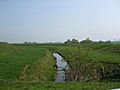
 Fleet Drain - geograph.org.uk - 1265574.jpg 640 × 480; 142 KB
-
 Flood defences at Birkin - geograph.org.uk - 3799120.jpg 1,280 × 935; 281 KB
-
 Footpath near Birkin - geograph.org.uk - 6345272.jpg 1,280 × 960; 456 KB
-
 Footpath sign beside Roe Lane - geograph.org.uk - 5774610.jpg 427 × 640; 256 KB
-
 Gate across a farm track - geograph.org.uk - 3617634.jpg 1,024 × 768; 152 KB
-
 Gate piers at Birkin - geograph.org.uk - 2748659.jpg 1,024 × 768; 207 KB
-
 Grassland near Little Ing Clough - geograph.org.uk - 1459179.jpg 640 × 480; 79 KB
-
 Green Lane - geograph.org.uk - 1265561.jpg 640 × 480; 71 KB
-
 Haddlesey Road near Birkin - geograph.org.uk - 2714485.jpg 640 × 460; 116 KB
-
 Haddlesey Road, Birkin - geograph.org.uk - 2153549.jpg 800 × 600; 221 KB
-

-
 Hard-standing at Viner's Station - geograph.org.uk - 1621664.jpg 640 × 480; 41 KB
-
 Heading for Gateforth Wood - geograph.org.uk - 2153564.jpg 800 × 600; 285 KB
-
 Horses in Birkin - geograph.org.uk - 5774618.jpg 640 × 427; 217 KB
-
 Houses in Birkin - geograph.org.uk - 5774616.jpg 640 × 427; 225 KB
-
 How nows brown cows - geograph.org.uk - 4021973.jpg 3,675 × 2,479; 2.51 MB
-
 Intake Road - geograph.org.uk - 1611534.jpg 640 × 426; 97 KB
-
 J.E Hartley Vining Station - geograph.org.uk - 1265608.jpg 640 × 480; 60 KB
-
 Lane towards Bywater Wood and Hillam - geograph.org.uk - 3410299.jpg 2,048 × 1,536; 592 KB
-
 Looking along Roe Lane - geograph.org.uk - 5774607.jpg 640 × 427; 222 KB
-
 Looking east along Birkin Lane - geograph.org.uk - 1620926.jpg 640 × 480; 48 KB
-
 Maize stubble, Birkin - geograph.org.uk - 6345275.jpg 1,280 × 843; 522 KB
-
 Maspin Moor Drain from Roe Lane - geograph.org.uk - 3068817.jpg 800 × 600; 145 KB
-
 Maspin Moor Road - geograph.org.uk - 3068786.jpg 800 × 600; 85 KB
-

-

-
 Northern edge of Birkin - geograph.org.uk - 5774609.jpg 640 × 427; 239 KB
-

-
 Now I'm confused - geograph.org.uk - 2155457.jpg 800 × 600; 391 KB
-
 Old Eye - geograph.org.uk - 686009.jpg 640 × 427; 37 KB
-
 Old Eye footpath - geograph.org.uk - 1611518.jpg 640 × 426; 73 KB
-
 Old Eye from Old Eye Bridge - geograph.org.uk - 1265625.jpg 640 × 480; 55 KB
-
 Old Eye from Old Eye Bridge - geograph.org.uk - 5774629.jpg 640 × 427; 254 KB
-
 Old Eye pumping station - geograph.org.uk - 4732489.jpg 1,024 × 768; 118 KB
-
 Park Farm - geograph.org.uk - 177427.jpg 640 × 480; 112 KB
-
 Power line crossing Birkin Lane - geograph.org.uk - 1620960.jpg 480 × 640; 36 KB
-
-
 Power lines over the River Aire - geograph.org.uk - 4118076.jpg 1,064 × 1,600; 432 KB
-
 Pumping station on Mearley Drain - geograph.org.uk - 6001005.jpg 2,499 × 1,875; 1.01 MB
-
 Pylon at dusk, Roe Lane - geograph.org.uk - 1621670.jpg 640 × 480; 53 KB
-
 River Aire at Kellingley Crook - geograph.org.uk - 3173609.jpg 2,048 × 1,536; 559 KB
-
 Road from Haddlesey to Birkin - geograph.org.uk - 685935.jpg 640 × 427; 59 KB
-
 Road to Northfield Farm - geograph.org.uk - 5774606.jpg 640 × 427; 225 KB
-
 Road to Northfield Farm - geograph.org.uk - 6344799.jpg 1,280 × 960; 385 KB
-
 Roadside benches, Haddlesey Road, Birkin - geograph.org.uk - 1621637.jpg 640 × 480; 112 KB
-
 Roadside row of poplars, Roe Lane - geograph.org.uk - 1621667.jpg 640 × 480; 96 KB
-
 Roe Lane, Birkin - geograph.org.uk - 6344795.jpg 1,280 × 960; 294 KB
-
 Row of poplars, Roe Lane - geograph.org.uk - 1621677.jpg 640 × 480; 63 KB
-

-
 Sluice Gates on the River Aire - geograph.org.uk - 4118073.jpg 1,600 × 1,064; 547 KB
-
 South bank of the River Aire at Kellingley Scalp - geograph.org.uk - 4734931.jpg 1,024 × 768; 129 KB
-
 Speed limit on Roe Lane, Birkin - geograph.org.uk - 1621647.jpg 640 × 480; 53 KB
-
 Starlings on the power lines, Birkin Holme - geograph.org.uk - 4729620.jpg 1,024 × 768; 116 KB
-
 The Entrance to North Field Farm - geograph.org.uk - 3068765.jpg 800 × 600; 97 KB
-
 The footpath starts here - geograph.org.uk - 6345293.jpg 1,280 × 960; 502 KB
-

-
 The pumping station at Mearley Drain - geograph.org.uk - 3068743.jpg 800 × 600; 122 KB
-
 The pumping station at Mearley Drain - geograph.org.uk - 3068757.jpg 800 × 600; 146 KB
-
 The River Aire rounding Kellingley Crook - geograph.org.uk - 4734934.jpg 1,024 × 615; 127 KB
-
 The River Aire, looking south (upstream) - geograph.org.uk - 4734912.jpg 1,024 × 768; 124 KB
-
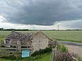
 The village hall at Birkin - geograph.org.uk - 2155441.jpg 800 × 600; 298 KB
-
 The way to Woodhouse Farm - geograph.org.uk - 2153558.jpg 800 × 600; 354 KB
-
 Tinkler's Lane, Birkin - geograph.org.uk - 6345285.jpg 1,280 × 849; 387 KB
-
 Towards Beal - geograph.org.uk - 1459175.jpg 640 × 480; 72 KB
-
 Towards Old Eye - geograph.org.uk - 5774627.jpg 640 × 427; 208 KB
-

-
 Track leading to Park House off Birkin Lane - geograph.org.uk - 6228987.jpg 1,600 × 1,102; 513 KB
-
 Track to Smeathalls farm - geograph.org.uk - 1446268.jpg 640 × 480; 55 KB
-
 Track to the River Aire and pumping station - geograph.org.uk - 3617628.jpg 1,024 × 768; 120 KB
-
 Track to Woodhouse Farm (Tinkler's Lane) - geograph.org.uk - 2397116.jpg 1,600 × 1,200; 707 KB
-
 Two sluice mechanisms on the Fleet Drain - geograph.org.uk - 1621631.jpg 640 × 480; 103 KB
-

-
 Vining Station - geograph.org.uk - 1265621.jpg 640 × 480; 48 KB
-
 Wall Close Wood, off Birkin Lane - geograph.org.uk - 1620903.jpg 640 × 480; 79 KB
-

-
 Weeping willow in a Birkin garden - geograph.org.uk - 1621646.jpg 640 × 480; 71 KB
-
 Wind turbine and Eggborough power station - geograph.org.uk - 4021956.jpg 4,096 × 2,941; 2.17 MB
-

-


_-_geograph.org.uk_-_4734912.jpg)


_-_geograph.org.uk_-_2397116.jpg)


