Category:Blochets de la charpente de l'église des Trois-Marie de Cardroc
Jump to navigation
Jump to search
| Object location | | View all coordinates using: OpenStreetMap |
|---|
|
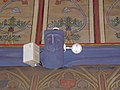
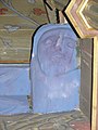
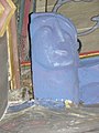
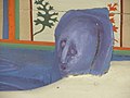
This building is indexed in the base Mérimée, a database of architectural heritage maintained by the French Ministry of Culture, under the reference IA00007926
|
Media in category "Blochets de la charpente de l'église des Trois-Marie de Cardroc"
The following 32 files are in this category, out of 32 total.
-
 Cardroc (35) Église des Trois-Marie Blochet 01.jpg 1,488 × 1,984; 1.52 MB
-
 Cardroc (35) Église des Trois-Marie Blochet 02.jpg 1,984 × 1,488; 1.64 MB
-
 Cardroc (35) Église des Trois-Marie Blochet 03.jpg 1,984 × 1,488; 1.51 MB
-
 Cardroc (35) Église des Trois-Marie Blochet 04.jpg 1,984 × 1,488; 1.67 MB
-
 Cardroc (35) Église des Trois-Marie Blochet 05.jpg 1,984 × 1,488; 1.59 MB
-
 Cardroc (35) Église des Trois-Marie Blochet 06.jpg 1,488 × 1,984; 1.71 MB
-
 Cardroc (35) Église des Trois-Marie Blochet 07.jpg 1,488 × 1,984; 1.71 MB
-
 Cardroc (35) Église des Trois-Marie Blochet 08.jpg 1,488 × 1,984; 1.91 MB
-
 Cardroc (35) Église des Trois-Marie Blochet 09.jpg 1,488 × 1,984; 1.88 MB
-
 Cardroc (35) Église des Trois-Marie Blochet 10.jpg 1,984 × 1,488; 1.5 MB
-
 Cardroc (35) Église des Trois-Marie Blochet 11.jpg 1,984 × 1,488; 1.75 MB
-
 Cardroc (35) Église des Trois-Marie Blochet 12.jpg 1,488 × 1,984; 1.66 MB
-
 Cardroc (35) Église des Trois-Marie Blochet 13.jpg 1,984 × 1,488; 1.88 MB
-
 Cardroc (35) Église des Trois-Marie Blochet 14.jpg 1,488 × 1,984; 1.41 MB
-
 Cardroc (35) Église des Trois-Marie Blochet 15.jpg 1,984 × 1,488; 1.81 MB
-
 Cardroc (35) Église des Trois-Marie Blochet 16.jpg 1,488 × 1,984; 1.54 MB
-
 Cardroc (35) Église des Trois-Marie Blochet 17.jpg 2,100 × 1,400; 966 KB
-
 Cardroc (35) Église des Trois-Marie Blochet 18.jpg 2,100 × 1,400; 906 KB
-
 Cardroc (35) Église des Trois-Marie Blochet 19.jpg 1,400 × 2,100; 879 KB
-
 Cardroc (35) Église des Trois-Marie Blochet 20.jpg 1,400 × 2,100; 770 KB
-
 Cardroc (35) Église des Trois-Marie Blochet 21.jpg 1,400 × 2,100; 871 KB
-
 Cardroc (35) Église des Trois-Marie Blochet 22.jpg 1,400 × 2,100; 981 KB
-
 Cardroc (35) Église des Trois-Marie Blochet 23.jpg 1,400 × 2,100; 906 KB
-
 Cardroc (35) Église des Trois-Marie Blochet 24.jpg 1,400 × 2,100; 921 KB
-
 Cardroc (35) Église des Trois-Marie Blochet 25.jpg 1,400 × 2,100; 854 KB
-
 Cardroc (35) Église des Trois-Marie Blochet 26.jpg 1,400 × 2,100; 834 KB
-
 Cardroc (35) Église des Trois-Marie Blochet 27.jpg 2,100 × 1,400; 834 KB
-
 Cardroc (35) Église des Trois-Marie Blochet 28.jpg 1,400 × 2,100; 871 KB
-
 Cardroc (35) Église des Trois-Marie Blochet 29.jpg 1,400 × 2,100; 871 KB
-
 Cardroc (35) Église des Trois-Marie Blochet 30.jpg 1,400 × 2,100; 862 KB
-
 Cardroc (35) Église des Trois-Marie Blochet 31.jpg 2,100 × 1,400; 1.01 MB
-
 Cardroc (35) Église des Trois-Marie Blochet 32.jpg 1,400 × 2,100; 934 KB
_%C3%89glise_des_Trois-Marie_Blochet_01.jpg)
_%C3%89glise_des_Trois-Marie_Blochet_02.jpg)
_%C3%89glise_des_Trois-Marie_Blochet_03.jpg)
_%C3%89glise_des_Trois-Marie_Blochet_04.jpg)
_%C3%89glise_des_Trois-Marie_Blochet_05.jpg)
_%C3%89glise_des_Trois-Marie_Blochet_06.jpg)
_%C3%89glise_des_Trois-Marie_Blochet_07.jpg)
_%C3%89glise_des_Trois-Marie_Blochet_08.jpg)
_%C3%89glise_des_Trois-Marie_Blochet_09.jpg)
_%C3%89glise_des_Trois-Marie_Blochet_10.jpg)
_%C3%89glise_des_Trois-Marie_Blochet_11.jpg)
_%C3%89glise_des_Trois-Marie_Blochet_12.jpg)
_%C3%89glise_des_Trois-Marie_Blochet_13.jpg)
_%C3%89glise_des_Trois-Marie_Blochet_14.jpg)
_%C3%89glise_des_Trois-Marie_Blochet_15.jpg)
_%C3%89glise_des_Trois-Marie_Blochet_16.jpg)
_%C3%89glise_des_Trois-Marie_Blochet_17.jpg)
_%C3%89glise_des_Trois-Marie_Blochet_18.jpg)
_%C3%89glise_des_Trois-Marie_Blochet_19.jpg)
_%C3%89glise_des_Trois-Marie_Blochet_20.jpg)
_%C3%89glise_des_Trois-Marie_Blochet_21.jpg)
_%C3%89glise_des_Trois-Marie_Blochet_22.jpg)
_%C3%89glise_des_Trois-Marie_Blochet_23.jpg)
_%C3%89glise_des_Trois-Marie_Blochet_24.jpg)
_%C3%89glise_des_Trois-Marie_Blochet_25.jpg)
_%C3%89glise_des_Trois-Marie_Blochet_26.jpg)
_%C3%89glise_des_Trois-Marie_Blochet_27.jpg)
_%C3%89glise_des_Trois-Marie_Blochet_28.jpg)
_%C3%89glise_des_Trois-Marie_Blochet_29.jpg)
_%C3%89glise_des_Trois-Marie_Blochet_30.jpg)
_%C3%89glise_des_Trois-Marie_Blochet_31.jpg)
_%C3%89glise_des_Trois-Marie_Blochet_32.jpg)