Category:Blockley
Saltar para a navegação
Saltar para a pesquisa
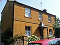
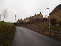
English: Blockley is a village and civil parish in the Cotswold district of Gloucestershire, England, about northwest of Moreton-in-Marsh. Until 1931 Blockley was in Worcestershire. The parish boundaries include the hamlets of Draycott, Paxford and Aston Magna, the residential development at Northwick and the deserted hamlets of Upton and Upper Ditchford.
village and civil parish in Gloucestershire, England, UK  | |||||
| Carregar ficheiro | |||||
| Instância de | |||||
|---|---|---|---|---|---|
| Localização | Cotswold, Gloucestershire, Sudoeste da Inglaterra, Inglaterra | ||||
 | |||||
Subcategorias
Esta categoria contém as seguintes 12 subcategorias (de um total de 12).
- Draycott, Cotswold (20 F)
B
- Blockley railway station (2 F)
- Blockley War Memorial (1 F)
H
N
- Northwick Park, Blockley (12 F)
P
T
W
Multimédia na categoria "Blockley"
Esta categoria contém os seguintes 200 ficheiros (de um total de 463).
(página anterior) (página seguinte)-
 Bell Lane, Blockley-geograph-3762325.jpg 402 × 640; 53 kB
-
 Blockley - geograph.org.uk - 554071.jpg 640 × 480; 58 kB
-
 Blockley Main Street, Glos - geograph.org.uk - 51781.jpg 640 × 480; 140 kB
-
 Blockley, Gloucestershire-Geograph-3517219-by-David-Purchase.jpg 2 592 × 1 944; 1,48 MB
-
 Colebrook Cottage - geograph.org.uk - 1436219.jpg 600 × 450; 91 kB
-
 Little Village Hall, Blockley - geograph.org.uk - 1604367.jpg 640 × 480; 76 kB
-
 Mill Row - geograph.org.uk - 1730315.jpg 4 000 × 3 000; 2,56 MB
-
 Mill Row - geograph.org.uk - 242636.jpg 640 × 480; 92 kB
-
 Paxton House, Blockley - geograph.org.uk - 554068.jpg 640 × 480; 67 kB
-
 Pear Tree Cottage - geograph.org.uk - 1436239.jpg 600 × 450; 91 kB
-
 St George's Hall, Blockley-geograph-2131964-by-David-P-Howard.jpg 2 000 × 1 500; 227 kB
-
 The old Boys' School - geograph.org.uk - 1436274.jpg 600 × 450; 65 kB
-
 The old Girls' School - geograph.org.uk - 1436250.jpg 600 × 450; 66 kB
-
 The Old Mill - geograph.org.uk - 243266.jpg 640 × 480; 111 kB
-
 Wellacres Farm house - geograph.org.uk - 1585202 (cropped).jpg 390 × 390; 31 kB
-
 Wellacres Farm house - geograph.org.uk - 1585202.jpg 640 × 480; 62 kB
-
 ...gone tomorrow - geograph.org.uk - 236423.jpg 407 × 640; 69 kB
-
 A Cotswold Quarry - geograph.org.uk - 236408.jpg 640 × 480; 96 kB
-
 A field of pasture - geograph.org.uk - 6174673.jpg 1 024 × 768; 255 kB
-
 A growing field of barley - geograph.org.uk - 6174479.jpg 1 024 × 768; 276 kB
-
 A growing wheatfield - geograph.org.uk - 4480099.jpg 800 × 531; 162 kB
-
 A twisty A429 heading north - geograph.org.uk - 3399080.jpg 640 × 480; 75 kB
-
 A view of Blockley - geograph.org.uk - 1591024.jpg 640 × 480; 89 kB
-
 A woodland footpath - geograph.org.uk - 4480092.jpg 531 × 800; 220 kB
-
 A44 at the Diamond Way crossing - geograph.org.uk - 2381142.jpg 640 × 480; 94 kB
-
 A44 at the junction for Blockley - geograph.org.uk - 2381151.jpg 640 × 480; 92 kB
-
 A44 at Upton Wold Farm entrance - geograph.org.uk - 3132691.jpg 640 × 480; 81 kB
-

-

-

-
 A44 Five Mile Drive Turning For Blockley - geograph.org.uk - 5330319.jpg 640 × 480; 126 kB
-
 A44 southeast of The Foresters Cottage - geograph.org.uk - 3471668.jpg 3 250 × 2 502; 1,51 MB
-
 Across the brook - geograph.org.uk - 1585179.jpg 640 × 480; 151 kB
-
 Across the field - geograph.org.uk - 1605206.jpg 640 × 480; 86 kB
-
 Across the field - geograph.org.uk - 1728800.jpg 4 000 × 3 000; 2,34 MB
-
 Across the field - geograph.org.uk - 1730251.jpg 4 000 × 3 000; 4,53 MB
-
 Across the field - geograph.org.uk - 1730273.jpg 4 000 × 3 000; 4,43 MB
-
 Across the field - geograph.org.uk - 1919700.jpg 4 000 × 3 000; 2,65 MB
-
 Across the road - geograph.org.uk - 1730322.jpg 4 000 × 3 000; 2,83 MB
-
 Albert Cottages on Park Road, Blockley - geograph.org.uk - 6241585.jpg 1 920 × 1 280; 1,23 MB
-
 Alongside the stream - geograph.org.uk - 1728762.jpg 4 000 × 3 000; 3,56 MB
-
 Alongside the wood - geograph.org.uk - 1588041.jpg 640 × 480; 117 kB
-
 Another footpath - geograph.org.uk - 1939846.jpg 4 000 × 3 000; 2,48 MB
-
 Approaching Kettle's Barn - geograph.org.uk - 1585138.jpg 640 × 480; 96 kB
-
 Arable field near Blockley - geograph.org.uk - 4478538.jpg 800 × 531; 136 kB
-
 Arable land at Aston Magna - geograph.org.uk - 3774706.jpg 1 024 × 680; 307 kB
-
 Arable land near Blockley - geograph.org.uk - 889322.jpg 640 × 426; 101 kB
-
 Arable land near Paxford - geograph.org.uk - 3778658.jpg 1 024 × 680; 241 kB
-
 Aston Magna Manor House - geograph.org.uk - 6092559.jpg 1 600 × 1 200; 449 kB
-
 Aston Magna-Former Church of St. John the Evangelist - geograph.org.uk - 6092557.jpg 1 600 × 1 200; 464 kB
-
 At the edge of the wood - geograph.org.uk - 1938961.jpg 4 000 × 3 000; 3,35 MB
-
 Attractive flower in Draycott, Moreton in Marsh - geograph.org.uk - 6171926.jpg 1 024 × 768; 383 kB
-
 Avenue along drive - geograph.org.uk - 2250071.jpg 480 × 640; 108 kB
-
 Bale tomb, Blockley churchyard - geograph.org.uk - 4485278.jpg 800 × 531; 192 kB
-
 Barn st Warren Farm, Blockley-geograph-4478594-by-Philip-Halling.jpg 800 × 531; 168 kB
-
 Batsford Timber yard - geograph.org.uk - 1730699.jpg 4 000 × 3 000; 2,98 MB
-
 Beech by path - geograph.org.uk - 2250075.jpg 640 × 480; 103 kB
-
 Beech trees in an avenue - geograph.org.uk - 4480108.jpg 800 × 531; 166 kB
-
 Bell Lane, Blockley - geograph.org.uk - 6228748.jpg 1 920 × 1 280; 953 kB
-
 Blocked footpath - geograph.org.uk - 1728776.jpg 4 000 × 3 000; 3,8 MB
-
 Blockley (45132406321).jpg 3 072 × 2 304; 2,45 MB
-
 Blockley - Russell Spring - geograph.org.uk - 3762248.jpg 427 × 640; 94 kB
-
 Blockley Bowls Club-geograph-3517233-by-David-Purchase.jpg 2 592 × 1 944; 1,52 MB
-
 Blockley Brook - geograph.org.uk - 243306.jpg 640 × 480; 137 kB
-
 Blockley Brook, Gloucestershire-geograph-1939831-by-Michael-Dibb.jpg 3 000 × 4 000; 3,67 MB
-
 Blockley church - geograph.org.uk - 4485269.jpg 680 × 1 024; 219 kB
-
 Blockley church - geograph.org.uk - 4485272.jpg 531 × 800; 107 kB
-
 Blockley does posh - geograph.org.uk - 5308639.jpg 1 024 × 768; 197 kB
-
 Blockley features (1) (geograph 7039810).jpg 3 240 × 4 320; 3,52 MB
-
 Blockley Green in Winter-geograph-5310130-by-Anthony-Vosper.jpg 1 024 × 768; 192 kB
-
 Blockley High Street - geograph.org.uk - 6093029.jpg 1 600 × 1 200; 496 kB
-
 Blockley houses (5) (geograph 7039805).jpg 3 940 × 2 954; 1,86 MB
-
 Blockley houses (6) (geograph 7039806).jpg 4 135 × 3 101; 2,19 MB
-
 Blockley houses (7) (geograph 7039811).jpg 3 889 × 2 917; 2,11 MB
-
 Blockley houses (8) (geograph 7039812).jpg 3 532 × 2 649; 1,44 MB
-
 Blockley in bloom^ - geograph.org.uk - 4503767.jpg 2 304 × 3 456; 4,11 MB
-
 Blockley in winter sunshine-geograph-2842836.jpg 640 × 480; 71 kB
-
 Blockley level crossing - geograph.org.uk - 4442577.jpg 1 500 × 995; 196 kB
-
 Blockley level crossing - geograph.org.uk - 4442581.jpg 1 800 × 964; 187 kB
-
 Blockley Little Village Hall - geograph.org.uk - 4481757.jpg 800 × 531; 106 kB
-
 Blockley Telephone Exchange, Glous - geograph.org.uk - 5999630.jpg 2 592 × 1 944; 1,38 MB
-
 Blockley viewed from the south-east - geograph.org.uk - 889317.jpg 640 × 426; 97 kB
-
 Blockley village shop and cafe - geograph.org.uk - 2002564.jpg 640 × 480; 83 kB
-
 Blockley, Malvern Mill-geograph-3762236.jpg 427 × 640; 109 kB
-
 Blockley, The Diamond Way - geograph.org.uk - 4502284.jpg 640 × 480; 107 kB
-
 Blockley-3259022038.jpg 2 304 × 1 728; 1,66 MB
-
 Blockley-The Great Western Arms - geograph.org.uk - 6093024.jpg 1 600 × 1 200; 409 kB
-
 Blockley-The road to Bourton on the Hill - geograph.org.uk - 6093034.jpg 1 600 × 1 200; 759 kB
-
 Bluebells in Bourton Woods - geograph.org.uk - 4478508.jpg 680 × 1 024; 233 kB
-
 Bourton Woods - geograph.org.uk - 240851.jpg 640 × 480; 105 kB
-
 Bourton Woods - geograph.org.uk - 4478555.jpg 800 × 531; 129 kB
-
 Bridge at the southern end of The Dingles wood - geograph.org.uk - 4959211.jpg 1 600 × 1 200; 794 kB
-
 Bridge over the brook - geograph.org.uk - 1728741.jpg 4 000 × 3 000; 3,68 MB
-
 Bridge over the brook - geograph.org.uk - 1728748.jpg 4 000 × 3 000; 5,3 MB
-
 Bridge over the brook - geograph.org.uk - 1728766.jpg 4 000 × 3 000; 3,21 MB
-
 Bridleway and track near Northwick Hill - geograph.org.uk - 4480697.jpg 800 × 531; 200 kB
-
 Bridleway in Bourton Woods - geograph.org.uk - 4478461.jpg 1 024 × 680; 430 kB
-
 Bridleway through Dovedale - geograph.org.uk - 4478429.jpg 680 × 1 024; 402 kB
-
 Bridleway through Dovedale - geograph.org.uk - 4478626.jpg 800 × 531; 222 kB
-
 Bridleway through the woods - geograph.org.uk - 4446720.jpg 1 066 × 1 600; 835 kB
-
 Bridleway to Blockley - geograph.org.uk - 1939797.jpg 4 000 × 3 000; 3,89 MB
-
 Bridleway to Blockley - geograph.org.uk - 1939824.jpg 4 000 × 3 000; 2,93 MB
-
 By the line - geograph.org.uk - 2016217.jpg 4 000 × 3 000; 3,71 MB
-
 Chimneys at Northcot Brick Works, - geograph.org.uk - 4657608.jpg 531 × 800; 82 kB
-
 Church of SS Peter and Paul, Blockley - geograph.org.uk - 6173647.jpg 1 024 × 768; 234 kB
-
 Church of St Peter and St Paul in Blockley - geograph.org.uk - 4500581.jpg 2 304 × 3 456; 3,16 MB
-

-

-

-

-
 Churchill memorial plaques - geograph.org.uk - 4485299.jpg 1 024 × 680; 173 kB
-
 Colours in a Cotswold Landscape - geograph.org.uk - 4480061.jpg 1 024 × 680; 216 kB
-
 Combined paths - geograph.org.uk - 1586934.jpg 640 × 480; 97 kB
-
 Communication facilities in Draycott - geograph.org.uk - 5552754.jpg 1 600 × 1 200; 756 kB
-
 Contour path - geograph.org.uk - 1591032.jpg 640 × 480; 151 kB
-
 Cottage on the Fosse Way - geograph.org.uk - 3399076.jpg 640 × 480; 95 kB
-
 Country road between Aston Magna and Paxford - geograph.org.uk - 6174495.jpg 1 024 × 768; 220 kB
-
 Country road to Paxford - geograph.org.uk - 4657859.jpg 800 × 531; 150 kB
-
 Country road to Paxford - geograph.org.uk - 4659048.jpg 800 × 531; 132 kB
-
 Country road to Paxford - geograph.org.uk - 6174490.jpg 1 024 × 768; 232 kB
-
 Countryside at Knee Bridge - geograph.org.uk - 2608359.jpg 640 × 500; 74 kB
-
 Cows in the sun - geograph.org.uk - 1922104.jpg 4 000 × 3 000; 5,35 MB
-
 Crossing the railway - geograph.org.uk - 1583381.jpg 640 × 480; 127 kB
-
 Crossroads in Draycott - geograph.org.uk - 5040662.jpg 800 × 600; 163 kB
-
 Daisies on the Diamond Way - geograph.org.uk - 4478633.jpg 800 × 531; 199 kB
-
 Day's Lane, Blockley-geograph-1939828-by-Michael-Dibb.jpg 4 000 × 3 000; 2,99 MB
-
 Depot Lodge - geograph.org.uk - 1585199.jpg 640 × 480; 78 kB
-
 Derelict shed - geograph.org.uk - 1939788.jpg 4 000 × 3 000; 2,39 MB
-
 Diamond Way - geograph.org.uk - 6407297.jpg 800 × 450; 143 kB
-
 Diamond Way - geograph.org.uk - 6407302.jpg 800 × 450; 103 kB
-
 Diamond Way - geograph.org.uk - 6407306.jpg 800 × 450; 125 kB
-
 Diamond Way - geograph.org.uk - 6407316.jpg 800 × 450; 115 kB
-
 Diamond Way - geograph.org.uk - 6407323.jpg 800 × 450; 103 kB
-
 Diamond Way - geograph.org.uk - 6407326.jpg 800 × 450; 135 kB
-
 Diamond Way - geograph.org.uk - 6407328.jpg 800 × 450; 92 kB
-
 Diamond Way - geograph.org.uk - 6417305.jpg 800 × 450; 95 kB
-
 Diamond Way - geograph.org.uk - 6417311.jpg 800 × 450; 87 kB
-
 Diamond Way - geograph.org.uk - 6417324.jpg 800 × 450; 132 kB
-
 Diamond Way - geograph.org.uk - 6417335.jpg 800 × 450; 117 kB
-
 Diamond Way - geograph.org.uk - 6417824.jpg 800 × 450; 98 kB
-
 Diamond Way - geograph.org.uk - 6417828.jpg 800 × 450; 146 kB
-
 Diamond Way - geograph.org.uk - 6417831.jpg 800 × 450; 118 kB
-
 Diamond Way - geograph.org.uk - 6417835.jpg 800 × 450; 92 kB
-
 Diamond Way and track above Blockley - geograph.org.uk - 4478617.jpg 800 × 531; 135 kB
-
 Ditchford Hill - geograph.org.uk - 1920011.jpg 4 000 × 3 000; 2,62 MB
-
 Ditchford Mill Farm (1) - geograph.org.uk - 1922079.jpg 4 000 × 3 000; 3,4 MB
-
 Ditchford Mill Farm (2) - geograph.org.uk - 1922081.jpg 4 000 × 3 000; 2,72 MB
-
 Ditchford on Fosse Farm - geograph.org.uk - 1920038.jpg 4 000 × 3 000; 2,25 MB
-
 Ditchford on Fosse Farm Cottages - geograph.org.uk - 1920056.jpg 4 000 × 3 000; 3,69 MB
-
 Cottages in Blockley-geograph-1939835-by-Michael-Dibb.jpg 4 000 × 3 000; 4,36 MB
-
 Donkey Lane, Blockley-geograph-3762338.jpg 640 × 427; 105 kB
-
 Dovedale Farm - geograph.org.uk - 1604414.jpg 640 × 480; 62 kB
-
 Dovedale Farmhouse, near to Blockley, Gloucestershire-geograph-1939821-by-Michael-Dibb.jpg 4 000 × 3 000; 2,34 MB
-
 Downhill into Aston Magna - geograph.org.uk - 1455589.jpg 640 × 427; 82 kB
-
 Downs Farm - geograph.org.uk - 1591039.jpg 640 × 480; 86 kB
-
 Downs Farm - geograph.org.uk - 242633.jpg 640 × 480; 91 kB
-
 Draycott-Home Farm - geograph.org.uk - 6093018.jpg 1 600 × 1 200; 504 kB
-
 Driveway to Hailstone Farm - geograph.org.uk - 242625.jpg 640 × 480; 98 kB
-
 Driveway to Lambs' Cottage - geograph.org.uk - 240845.jpg 640 × 480; 95 kB
-
 Driveway to Middle Ditchford Farm - geograph.org.uk - 1919705.jpg 4 000 × 3 000; 1,91 MB
-
 Driveway to the barns - geograph.org.uk - 1920033.jpg 4 000 × 3 000; 2,64 MB
-
 Driveway to Upton Wold Farm - geograph.org.uk - 240846.jpg 640 × 480; 61 kB
-
 Dry stone wall by the A44 - geograph.org.uk - 4446719.jpg 1 600 × 1 066; 737 kB
-
 Dual carriageway drive - geograph.org.uk - 1939808.jpg 4 000 × 3 000; 2,23 MB
-
 Duck Racing at Blockley Ford - geograph.org.uk - 2891278.jpg 3 872 × 2 592; 2,37 MB
-
 End of the road - geograph.org.uk - 1588067.jpg 640 × 480; 116 kB
-
 Entrance to Northwick Business Centre - geograph.org.uk - 5040649.jpg 800 × 600; 132 kB
-
 Entrance to the Business Centre - geograph.org.uk - 5552738.jpg 1 600 × 1 200; 411 kB
-
 Farm and barns - geograph.org.uk - 1920020.jpg 4 000 × 3 000; 2,51 MB
-
 Farm drive - geograph.org.uk - 2016281.jpg 4 000 × 3 000; 2,98 MB
-
 Farm road on Northwick Estate - geograph.org.uk - 4480656.jpg 1 024 × 680; 404 kB
-
 Farm track - geograph.org.uk - 3774701.jpg 1 024 × 680; 267 kB
-
 Farm track above Warren Farm - geograph.org.uk - 4478611.jpg 800 × 531; 152 kB
-
 Farmhouse garden - geograph.org.uk - 1920044.jpg 4 000 × 3 000; 2,33 MB
-
 Farmland at Draycott - geograph.org.uk - 5040660.jpg 800 × 600; 176 kB
-
 Farmland beside Five Mile Drive - geograph.org.uk - 5044716.jpg 800 × 600; 112 kB
-
 Farmland near Knee Bridge - geograph.org.uk - 3399081.jpg 640 × 480; 98 kB
-
 Farmland near Paxford - geograph.org.uk - 3778681.jpg 1 024 × 680; 158 kB
-
 Farmland off the Fosse Way - geograph.org.uk - 3399092.jpg 640 × 480; 63 kB
-
 Farmland on Ditchford Hill - geograph.org.uk - 4659044.jpg 800 × 531; 184 kB
-
 Farmland towards Dittchford Mill - geograph.org.uk - 3399085.jpg 640 × 480; 65 kB
-
 Farmland track - geograph.org.uk - 5040657.jpg 800 × 600; 155 kB
-
 Farmland, Middle Ditchford - geograph.org.uk - 3399088.jpg 640 × 480; 86 kB
-
 Fava or field beans - geograph.org.uk - 6174691.jpg 1 024 × 768; 309 kB
-
 Field barn - geograph.org.uk - 1922315.jpg 4 000 × 3 000; 3,52 MB
-
 Field Barn - geograph.org.uk - 2250055.jpg 640 × 480; 96 kB
-
 Field edge path - geograph.org.uk - 1604378.jpg 640 × 480; 110 kB
-
 Field edge path - geograph.org.uk - 1938873.jpg 4 000 × 3 000; 3,72 MB
-
 Field entrance in Paxford - geograph.org.uk - 6241627.jpg 1 920 × 1 280; 1,46 MB
-
 Field path behind houses - geograph.org.uk - 2250038.jpg 640 × 480; 85 kB
-
 Fields at Holt Farm - geograph.org.uk - 3517203.jpg 2 592 × 1 944; 1,41 MB
-

-
 First Great Western express passes Northcot Brick Works - geograph.org.uk - 2097777.jpg 2 000 × 1 495; 178 kB
-
 Five Mile Drive - geograph.org.uk - 2054192.jpg 640 × 480; 73 kB
-
 Five Mile Drive - geograph.org.uk - 236341.jpg 480 × 640; 97 kB
-
 Five Mile Drive - geograph.org.uk - 4478475.jpg 800 × 531; 219 kB
-
 Five Mile Drive near Upton village - geograph.org.uk - 2381144.jpg 640 × 480; 95 kB
-
 Five Mile Drive, Blockley - geograph.org.uk - 6180598.jpg 1 920 × 1 280; 1,41 MB
-
 Five Mile Drive, Blockley - geograph.org.uk - 6180600.jpg 1 920 × 1 280; 1,97 MB
-
 Footpath bifurcation - geograph.org.uk - 4481609.jpg 1 024 × 680; 420 kB


.jpg)


.jpg)


_(geograph_7039810).jpg)


_(geograph_7039805).jpg)
_(geograph_7039806).jpg)
_(geograph_7039811).jpg)
_(geograph_7039812).jpg)


_-_geograph.org.uk_-_3939588.jpg)


_-_geograph.org.uk_-_1922079.jpg)
_-_geograph.org.uk_-_1922081.jpg)


