Category:Bohlenwand bei Saalfeld
Zur Navigation springen
Zur Suche springen
Diese Kategorie enthält Dateien zum Schutzgebiet in der World Database on Protected Areas (WDPA) mit der Nummer 162484
|
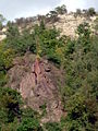
geologische Aufschlusswand bei Saalfeld  | |||||
| Medium hochladen | |||||
| Ist ein(e) | |||||
|---|---|---|---|---|---|
| Liegt in Schutzgebiet | |||||
| Ort | Saalfeld/Saale, Landkreis Saalfeld-Rudolstadt, Thüringen, Deutschland | ||||
| Verschieden von | |||||
 | |||||
Medien in der Kategorie „Bohlenwand bei Saalfeld“
Folgende 7 Dateien sind in dieser Kategorie, von 7 insgesamt.
-
 Devonian shale with nodular limestone layers.jpg 1.334 × 828; 824 KB
-
 Die Saale und die Bohlenwand - geo.hlipp.de - 14287.jpg 640 × 480; 232 KB
-
 Nationales Geotop Bohlen 1.JPG 1.280 × 960; 786 KB
-
 Nationales Geotop Bohlenwand 2.JPG 960 × 1.280; 477 KB
-
 Nationales Geotop Bohlenwand 3.JPG 1.280 × 960; 452 KB
-
 Nationales Geotop Bohlenwand 4.JPG 960 × 1.280; 459 KB
-
 Naturschutzgebiet Nr. 160 Bohlen WDPA ID 162484 Sublocation DE-TH , Bohlenwand.jpg 3.365 × 2.522; 7,2 MB


Kategorien:
- Tourism in Saalfeld/Saale
- Nature of Saalfeld/Saale
- Geology of Thuringia
- National geotopes in Thuringia
- Naturschutzgebiet Bohlen
- Geopark Schieferland
- Devonian geology of Germany
- Carboniferous geology of Germany
- Stratigraphy of Thuringia
- Schwärzschiefer-Formation
- Hirtenrangen-Formation
- Bohlen-Formation (type locality)
- Plattenbruch-Subformation
- Gositzfelsen-Subformation
- Gleitsch-Formation
- Leutenberg-Gruppe
- Rußschiefer-Subformation
- Lehesten-Gruppe
- Hasenthal-Formation
- Zechstein in Germany