Category:Borrowby, Hambleton
Jump to navigation
Jump to search
village and civil parish in Hambleton, North Yorkshire, England  | |||||
| Upload media | |||||
| Instance of | |||||
|---|---|---|---|---|---|
| Location | Hambleton, North Yorkshire, Yorkshire and the Humber, England | ||||
| Population |
| ||||
| Area |
| ||||
| Different from | |||||
 | |||||
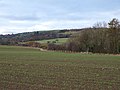
English: Borrowby is a village and civil parish in the Hambleton district of North Yorkshire, England. It is situated halfway between Thirsk and Northallerton, about north of York, in an area called the Vale of Mowbray, a low-lying agricultural landscape shaped by the last glaciation, that lies between two national parks, the North York Moors to the east and the Yorkshire Dales to the west.
Media in category "Borrowby, Hambleton"
The following 77 files are in this category, out of 77 total.
-
 A rabbit that didn't run away - geograph.org.uk - 3645408.jpg 3,872 × 2,592; 5.51 MB
-
 A19 Bridge near Borrowby. - geograph.org.uk - 403259.jpg 640 × 480; 108 KB
-
 A19 heading north - geograph.org.uk - 4824679.jpg 640 × 428; 100 KB
-
 A19 heading north near Borrowby - geograph.org.uk - 4824872.jpg 640 × 428; 82 KB
-
 A19 northbound - geograph.org.uk - 2648218.jpg 640 × 428; 92 KB
-

-
 Barrowby Grange - geograph.org.uk - 2718621.jpg 640 × 480; 60 KB
-
 Barrowby Market Cross.jpg 640 × 480; 98 KB
-
 Borrowby Grange farm and pylons - geograph.org.uk - 127599.jpg 640 × 480; 41 KB
-
 Borrowby main street - top end - geograph.org.uk - 1947159.jpg 3,264 × 2,448; 2.14 MB
-
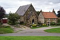 Borrowby Methodist Church - geograph.org.uk - 3645379.jpg 3,872 × 2,592; 4.14 MB
-
 Borrowby Methodist Church - geograph.org.uk - 496179.jpg 640 × 480; 67 KB
-
 Borrowby Primary School - geograph.org.uk - 403216.jpg 640 × 480; 108 KB
-
 Borrowby view - geograph.org.uk - 5771637.jpg 2,048 × 1,536; 883 KB
-
 Borrowby Village - geograph.org.uk - 849091.jpg 640 × 444; 82 KB
-
 Borrowby, From Park Lane - geograph.org.uk - 260457.jpg 640 × 384; 84 KB
-
 Boundary Stone - geograph.org.uk - 857247.jpg 640 × 470; 125 KB
-
 Bridge over Cowesby Beck - geograph.org.uk - 3645460.jpg 3,872 × 2,592; 4.15 MB
-
 Bridge over Cowesby Beck - geograph.org.uk - 403271.jpg 480 × 640; 136 KB
-
 Broad Beck - geograph.org.uk - 2797155.jpg 2,448 × 3,264; 2.7 MB
-
 Broadbeck House - geograph.org.uk - 2797147.jpg 3,148 × 1,632; 1.31 MB
-
 Chestnut Bank, Borrowby - geograph.org.uk - 198860.jpg 480 × 640; 120 KB
-
 Cod Beck - geograph.org.uk - 1947100.jpg 2,448 × 3,264; 3.18 MB
-
 Cophill Lane - geograph.org.uk - 89961.jpg 640 × 480; 59 KB
-

-
 Cottages in Borrowby - geograph.org.uk - 1947150.jpg 2,448 × 3,264; 2.25 MB
-
 Cottages on Kirby Close, Borrowby - geograph.org.uk - 3645361.jpg 3,872 × 2,592; 3.77 MB
-
 Cowesby Beck - geograph.org.uk - 89945.jpg 640 × 480; 91 KB
-
 Cowesby Beck Bridge - geograph.org.uk - 857248.jpg 640 × 480; 97 KB
-
 Cows on Masty Bank - geograph.org.uk - 3645327.jpg 3,872 × 2,592; 3.71 MB
-
 Decorations - geograph.org.uk - 515058.jpg 480 × 601; 98 KB
-
 Decrepit signpost at the bottom of Cophill Lane - geograph.org.uk - 3645534.jpg 3,872 × 2,592; 5.36 MB
-
 Dog that wanted to walk with me - geograph.org.uk - 3645473.jpg 3,872 × 2,592; 4.79 MB
-
 Drive to Carroby Farm North Yorkshire - geograph.org.uk - 1876682.jpg 2,048 × 1,536; 812 KB
-
 Farmhouse at Borrowby Grange - geograph.org.uk - 2901657.jpg 2,831 × 2,189; 929 KB
-
 Farmland near Barrowby - geograph.org.uk - 2718618.jpg 640 × 480; 76 KB
-
 Farmland near Borrowby Dale - geograph.org.uk - 622189.jpg 640 × 480; 96 KB
-
 Field with trig point - geograph.org.uk - 3155055.jpg 1,500 × 1,125; 1.48 MB
-
 Field-side Path near Bishop Ings - geograph.org.uk - 4209663.jpg 4,000 × 3,000; 3.75 MB
-
 Fields near Leake Greens Farm - geograph.org.uk - 3645292.jpg 3,872 × 2,592; 4.32 MB
-
 Footpath in the snow - geograph.org.uk - 2797135.jpg 3,264 × 2,448; 1.94 MB
-
 Footpath to Borrowby - geograph.org.uk - 2797104.jpg 2,448 × 3,264; 1.85 MB
-
 Footpath to Crosby Grange - geograph.org.uk - 403380.jpg 640 × 480; 98 KB
-
 Former A19 at Borrowby - geograph.org.uk - 403225.jpg 640 × 480; 70 KB
-
 Hagar House - geograph.org.uk - 2797141.jpg 3,228 × 1,632; 1.24 MB
-
 Hell Kettle Weir - geograph.org.uk - 4709369.jpg 4,208 × 2,368; 4.2 MB
-
 Kirby Close, Borrowby - geograph.org.uk - 3645353.jpg 3,872 × 2,592; 3.72 MB
-
 Knayton - geograph.org.uk - 89942.jpg 640 × 480; 55 KB
-
 Lane into Borrowby - geograph.org.uk - 496172.jpg 640 × 480; 94 KB
-
 Long Lane view - geograph.org.uk - 5771639.jpg 2,048 × 1,536; 946 KB
-

-
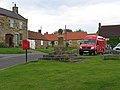 Mobile Post Office - geograph.org.uk - 848566.jpg 640 × 480; 72 KB
-
 Moor Lane - geograph.org.uk - 515043.jpg 640 × 480; 123 KB
-
 Old boundary stone - south side - geograph.org.uk - 6028685.jpg 3,239 × 4,319; 4.25 MB
-
 Old boundary stone - west side - geograph.org.uk - 6028681.jpg 3,239 × 4,319; 4.96 MB
-
 Ostentation of Peacocks - geograph.org.uk - 90012.jpg 640 × 480; 82 KB
-
 Park Lane towards Barrowby - geograph.org.uk - 2718620.jpg 640 × 480; 46 KB
-
 Path and Stile on Barrowby Bank - geograph.org.uk - 4209670.jpg 4,000 × 3,000; 5.49 MB
-
 Public Bridleway to Low House - geograph.org.uk - 475958.jpg 640 × 480; 36 KB
-
 Roses round the door - geograph.org.uk - 1947165.jpg 2,728 × 2,290; 1.51 MB
-
 Snow,sheep and pylons - geograph.org.uk - 2797127.jpg 2,380 × 3,214; 1.38 MB
-
 St Helen's Cottage Borrowby North Yorkshire - geograph.org.uk - 1876677.jpg 2,048 × 1,536; 644 KB
-
 Telephone Box, Borrowby - geograph.org.uk - 261082.jpg 640 × 384; 63 KB
-
 The A19 near Leake - geograph.org.uk - 3645273.jpg 3,872 × 2,592; 4.29 MB
-
 The lane from Cowesby to Borrowby - geograph.org.uk - 496175.jpg 640 × 480; 86 KB
-

-
 The Wheatsheaf Inn, Borrowby - geograph.org.uk - 3645398.jpg 3,872 × 2,592; 3.68 MB
-
 Track to Borrowby - geograph.org.uk - 3645307.jpg 3,872 × 2,592; 5.56 MB
-
 Track to Crosby Court Grange - geograph.org.uk - 260159.jpg 480 × 640; 152 KB
-
 Track to East Woundales Farm - geograph.org.uk - 3645551.jpg 3,872 × 2,592; 4.33 MB
-
 Tramway Trackbed - geograph.org.uk - 734404.jpg 480 × 640; 87 KB
-
 View from Cophill Lane - geograph.org.uk - 5981017.jpg 2,048 × 1,536; 850 KB
-
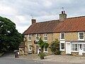 Wheatsheaf Inn - geograph.org.uk - 849084.jpg 640 × 485; 87 KB
-
 Wheatsheaf Inn, Borrowby - geograph.org.uk - 198841.jpg 640 × 480; 128 KB
-
 Winter Sunset over Brawith - geograph.org.uk - 21537.jpg 480 × 640; 124 KB
-
 Woundales Beck - geograph.org.uk - 3645420.jpg 3,872 × 2,592; 4.23 MB
-
 Woundales Lane - geograph.org.uk - 3645414.jpg 3,872 × 2,592; 5.73 MB


