Category:Bowland Forest Low
Jump to navigation
Jump to search
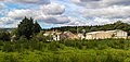
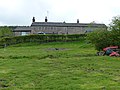
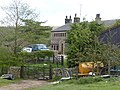
English: Bowland Forest Low is a civil parish in the Ribble Valley district of Lancashire, England, covering part of the Forest of Bowland. According to the 2001 census, the parish had a population of 168. The parish includes the hamlets of Whitewell and Cow Ark. From northwards clockwise, it borders the civil parishes of Newton, Bashall Eaves, Aighton, Bowland-with-Leagram and Bowland Forest High. Prior to 1974, it formed part of Bowland Rural District in the West Riding of Yorkshire.

civil parish in Lancashire, UK  | |||||
| Upload media | |||||
| Instance of | |||||
|---|---|---|---|---|---|
| Location | Ribble Valley, Lancashire, North West England, England | ||||
 | |||||
Subcategories
This category has the following 4 subcategories, out of 4 total.
Media in category "Bowland Forest Low"
The following 200 files are in this category, out of 433 total.
(previous page) (next page)-
 A barn in a field - geograph.org.uk - 5836932.jpg 4,592 × 2,983; 7.9 MB
-
 A line of Copper Beeches at Whitewell - geograph.org.uk - 5400926.jpg 1,024 × 768; 312 KB
-
 A long straight road - geograph.org.uk - 5834510.jpg 4,592 × 3,056; 7.79 MB
-
 A small stream - geograph.org.uk - 5570401.jpg 3,000 × 4,500; 5.57 MB
-
 Access Lane beside Elm Clough - geograph.org.uk - 4278273.jpg 5,179 × 3,451; 5.99 MB
-
 Across Bashall Brook to Hareclough Farm - geograph.org.uk - 4209982.jpg 4,288 × 3,216; 3.65 MB
-
 An Oystercatcher at Hodder Bank - geograph.org.uk - 3489932.jpg 3,796 × 3,098; 3.01 MB
-
 Approaching a Farm by Pale Wood - geograph.org.uk - 4657213.jpg 1,600 × 1,067; 603 KB
-
 Approaching a road junction near Cow Ark - geograph.org.uk - 4652423.jpg 1,024 × 767; 838 KB
-

-
 Approaching Higher Park Gate from the East - geograph.org.uk - 4280103.jpg 5,179 × 3,451; 7.21 MB
-
 Approaching Higher Park Gate from the West - geograph.org.uk - 4280109.jpg 5,070 × 3,255; 7.66 MB
-
 Approaching Thorneyholme Hall - geograph.org.uk - 2466320.jpg 3,872 × 2,592; 4.58 MB
-
 Aqueduct over the Hodder - geograph.org.uk - 2802398.jpg 1,000 × 680; 160 KB
-

-
 At Risk, near Middle Lees - geograph.org.uk - 3089530.jpg 3,887 × 2,915; 3.02 MB
-
 Barn by the River Hodder - geograph.org.uk - 3489858.jpg 4,608 × 3,456; 3.57 MB
-
 Barns south of Burholme Bridge - geograph.org.uk - 4504359.jpg 2,000 × 1,190; 381 KB
-
 Beech trees in a hayfield - geograph.org.uk - 4977655.jpg 1,280 × 960; 1.11 MB
-

-

-
 Blooming heather on Kitcham Hill - geograph.org.uk - 4127892.jpg 800 × 600; 159 KB
-
 Bridge over minor beck - geograph.org.uk - 5570391.jpg 4,500 × 3,000; 7.28 MB
-
 Bridge over the River Hodder - geograph.org.uk - 3490895.jpg 4,608 × 3,456; 3.34 MB
-
 Bridge over the River Hodder - Thorneyholme - geograph.org.uk - 2870057.jpg 4,000 × 3,000; 1.88 MB
-
 Brownsholme Hall - geograph.org.uk - 4541606.jpg 4,582 × 3,050; 7.81 MB
-
 Brownsholme Hall Lodge - geograph.org.uk - 4068942.jpg 3,309 × 2,682; 3.39 MB
-
 Brownsholme Heights - geograph.org.uk - 4543824.jpg 4,592 × 3,056; 7.06 MB
-
 Browsholme Hall - geograph.org.uk - 4647172.jpg 4,908 × 3,067; 1.94 MB
-
 Browsholme Hall Lodge - geograph.org.uk - 3642972.jpg 2,560 × 1,920; 2.58 MB
-
 Browsholme Hall Lodge - geograph.org.uk - 4279444.jpg 5,184 × 3,456; 6.78 MB
-
 Browsholme Hall Lodge from road - geograph.org.uk - 4248037.jpg 640 × 481; 59 KB
-
 Browsholme Heights Wood - geograph.org.uk - 4280097.jpg 5,184 × 3,456; 7.13 MB
-
 Browsholme Heights, Cow Ark - geograph.org.uk - 2150784.jpg 640 × 480; 144 KB
-
 Browsholme Spire.jpg 5,179 × 3,451; 5.21 MB
-
 Burholme - geograph.org.uk - 697946.jpg 640 × 480; 89 KB
-
 Burholme Bridge - geograph.org.uk - 3356528.jpg 2,560 × 1,920; 2.72 MB
-
 Burholme Bridge - geograph.org.uk - 3489853.jpg 4,608 × 3,456; 3.28 MB
-
 Burholme Bridge - geograph.org.uk - 4974249.jpg 1,280 × 960; 1 MB
-
 Burholme Bridge - geograph.org.uk - 5083534.jpg 1,600 × 1,200; 225 KB
-
 Burholme Bridge - geograph.org.uk - 5250657.jpg 3,840 × 2,160; 3.79 MB
-
 Burholme Bridge - geograph.org.uk - 5836980.jpg 4,426 × 2,946; 7.29 MB
-
 Burholme Bridge over the River Hodder - geograph.org.uk - 4504369.jpg 2,000 × 1,500; 536 KB
-
 Burholme Bridge, near Whitewell, Lancs - geograph.org.uk - 3767532.jpg 640 × 426; 226 KB
-
 Burholme Farm - geograph.org.uk - 3489848.jpg 4,428 × 2,711; 2.37 MB
-
 Burholme Farm Ford - geograph.org.uk - 5642107.jpg 4,032 × 3,024; 4.92 MB
-
 Burholme Farmhouse.jpg 4,000 × 3,000; 1.2 MB
-
 Burholme Ford - geograph.org.uk - 3489845.jpg 4,608 × 3,456; 3.44 MB
-
 Burholme Moor - geograph.org.uk - 2994955.jpg 640 × 480; 74 KB
-
 Burholme Moor - geograph.org.uk - 4977650.jpg 1,280 × 960; 979 KB
-
 Cattle at pasture - geograph.org.uk - 4974264.jpg 1,280 × 958; 1.03 MB
-

-
 Chopped Tree Trunk by the River Hodder - geograph.org.uk - 3489942.jpg 4,608 × 3,456; 3.09 MB
-
 Church of St. Michael, Altar - geograph.org.uk - 5560873.jpg 4,320 × 2,880; 4.85 MB
-
 Church of St. Michael, chancel arch - geograph.org.uk - 5560877.jpg 4,320 × 2,880; 4.53 MB
-
 Church of St. Michael, churchyard and view - geograph.org.uk - 5560880.jpg 4,320 × 2,880; 5.16 MB
-
 Church of St. Michael, garlanded porch - geograph.org.uk - 5560029.jpg 2,016 × 3,024; 4.75 MB
-
 Church of St. Michael, Looking down from the Balcony - geograph.org.uk - 5561272.jpg 4,320 × 2,880; 4.47 MB
-
 Church of St. Michael, Name board - geograph.org.uk - 5560879.jpg 4,320 × 2,880; 6.16 MB
-
 Church of St. Michael, Pews - geograph.org.uk - 5560881.jpg 4,320 × 2,880; 5.17 MB
-
 Church of St. Michael, Pews below the balcony - geograph.org.uk - 5561266.jpg 4,320 × 2,880; 5 MB
-
 Church of St. Michael, The Balcony - geograph.org.uk - 5561284.jpg 4,320 × 2,880; 4.81 MB
-
 Church of St. Michael, the font - geograph.org.uk - 5560875.jpg 2,880 × 4,320; 4.95 MB
-
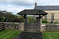 Church of St. Michael, the Lych Gate - geograph.org.uk - 5561292.jpg 4,320 × 2,880; 5.85 MB
-
 Church of St. Michael, the organ - geograph.org.uk - 5560874.jpg 2,880 × 4,320; 4.7 MB
-
 Church of St. Michael, the pulpit - geograph.org.uk - 5561288.jpg 2,880 × 4,320; 5.91 MB
-
 Church of St. Michael, the reading desk - geograph.org.uk - 5561278.jpg 2,880 × 4,320; 4.19 MB
-
 Church of St. Michael, up in the balcony - geograph.org.uk - 5560882.jpg 4,320 × 2,880; 4.52 MB
-
 Church of St. Michael, Whitewell - geograph.org.uk - 5560028.jpg 4,320 × 2,880; 6.68 MB
-

-
 Common Mouse-ear (Cerastium fontanum) - geograph.org.uk - 4527477.jpg 3,386 × 2,680; 6.2 MB
-
 Confluence of the Hodder ^ Landgen Brook - geograph.org.uk - 3489814.jpg 4,608 × 3,047; 2.96 MB
-
 Confluence of the River Hodder and Langden Brook - geograph.org.uk - 5486030.jpg 2,592 × 1,944; 705 KB
-

-
 Copper beech trees - geograph.org.uk - 4977623.jpg 1,280 × 960; 1.39 MB
-
 Cow Ark - geograph.org.uk - 4647165.jpg 3,392 × 4,590; 1.65 MB
-
 Cow Ark Bridge - geograph.org.uk - 4248031.jpg 640 × 480; 84 KB
-
 Cow Ark Bridge - geograph.org.uk - 4524764.jpg 4,592 × 2,477; 7.09 MB
-
 Cow Ark Bridge - geograph.org.uk - 806957.jpg 640 × 480; 203 KB
-
 Cow Ark Farm - geograph.org.uk - 806961.jpg 640 × 480; 193 KB
-
 Crane Wood House - geograph.org.uk - 2034277.jpg 640 × 480; 111 KB
-
 Crane Wood House - geograph.org.uk - 4647509.jpg 4,896 × 2,329; 1.52 MB
-
 Crane Wood House - geograph.org.uk - 5834174.jpg 640 × 420; 76 KB
-
 Crimpton Brook - geograph.org.uk - 2994929.jpg 640 × 480; 72 KB
-
 Crimpton Farm - geograph.org.uk - 119051.jpg 640 × 426; 127 KB
-
 Crimpton Farm 01.jpg 4,000 × 3,000; 4.95 MB
-
 Crimpton Farm 02.jpg 4,000 × 3,000; 5.03 MB
-
 Crimpton Farm retains its privacy - geograph.org.uk - 4543885.jpg 4,592 × 2,423; 7.64 MB
-
 Crossroads at Cow Ark - geograph.org.uk - 806968.jpg 640 × 480; 180 KB
-
 Crossroads at Cow Ark - geograph.org.uk - 806981.jpg 640 × 480; 189 KB
-
 Date stamp on bridge - geograph.org.uk - 153615.jpg 640 × 480; 67 KB
-
 Datestone - geograph.org.uk - 6008198.jpg 4,896 × 3,672; 6.74 MB
-
 Derelict bridge buttress on the banks of the Hodder - geograph.org.uk - 3489892.jpg 4,608 × 3,456; 3.43 MB
-
 Derelict building - geograph.org.uk - 2034279.jpg 640 × 480; 217 KB
-
 Derelict outbuilding near Spire Farm - geograph.org.uk - 5894803.jpg 720 × 540; 139 KB
-
 Detail of barn door, workmanship. - geograph.org.uk - 1247028.jpg 640 × 480; 101 KB
-
-
 Diamond Jubilee Plantation - geograph.org.uk - 4647507.jpg 3,618 × 1,930; 1.96 MB
-
 Dilapidated Gate on Hillside above The Hodder - geograph.org.uk - 2519577.jpg 3,000 × 4,000; 3.57 MB
-
 Distressed Wall on Duckpit Hill - geograph.org.uk - 3744601.jpg 4,320 × 3,240; 2.85 MB
-
 Disused lime kiln - geograph.org.uk - 3074088.jpg 4,000 × 3,000; 5.68 MB
-
 Disused quarry - geograph.org.uk - 5836023.jpg 4,592 × 3,056; 6.27 MB
-
 Doeford Bridge - geograph.org.uk - 1285106.jpg 640 × 427; 135 KB
-
 Doeford Bridge - geograph.org.uk - 2965187.jpg 4,000 × 3,000; 6.17 MB
-
 Doeford Bridge - geograph.org.uk - 4522837.jpg 4,592 × 2,351; 6.8 MB
-
 Doeford Bridge - geograph.org.uk - 5480302.jpg 5,184 × 3,456; 5.94 MB
-
 Doeford Bridge - geograph.org.uk - 993356.jpg 640 × 617; 132 KB
-
 Doeford Bridge over the River Hodder - geograph.org.uk - 4504233.jpg 2,000 × 1,500; 837 KB
-
 Dry stone wall near Dunsop Bridge - geograph.org.uk - 4974267.jpg 1,280 × 960; 1.13 MB
-
 Dry valley below Whitewell Cave - geograph.org.uk - 4125886.jpg 640 × 480; 65 KB
-
 Eastward from Burholme Moor - geograph.org.uk - 4125957.jpg 800 × 600; 113 KB
-
 Entrance to Browsholme Hall - geograph.org.uk - 2802281.jpg 1,000 × 750; 319 KB
-
 Far Barn - geograph.org.uk - 4647163.jpg 4,440 × 3,216; 1.68 MB
-
 Far Barn, Middle Lees - geograph.org.uk - 2975040.jpg 640 × 480; 137 KB
-
 Farmland above the Hodder - geograph.org.uk - 2965175.jpg 4,000 × 3,000; 5.29 MB
-
 Farmland at Burholme - geograph.org.uk - 4974235.jpg 1,280 × 960; 1.09 MB
-
 Farmland at Dunsop Bridge - geograph.org.uk - 4974149.jpg 640 × 480; 82 KB
-
 Fences on Browsholme Moor - geograph.org.uk - 3744593.jpg 4,320 × 3,240; 3.64 MB
-
 Fingerpost and stile - geograph.org.uk - 5834630.jpg 4,592 × 3,056; 7.17 MB
-
 Fingerpost on path to Whitewell - geograph.org.uk - 5400904.jpg 1,024 × 768; 266 KB
-
 Footbridge and ford at Burholme - geograph.org.uk - 2065665.jpg 1,600 × 1,198; 845 KB
-
 Footbridge below Lees House - geograph.org.uk - 5892761.jpg 720 × 540; 229 KB
-
 Footbridge carrying footpath over a stream - geograph.org.uk - 4130965.jpg 4,000 × 3,000; 4.51 MB
-
 Footbridge in Limes Wood - geograph.org.uk - 4652144.jpg 1,600 × 1,067; 854 KB
-
 Footbridge on the edge of Porter Wood - geograph.org.uk - 3489882.jpg 4,608 × 3,456; 3.38 MB
-
 Footbridge over a stream feeding the River Hodder - geograph.org.uk - 5834670.jpg 4,372 × 2,808; 7.84 MB
-
 Footbridge over Stream Limes Wood - geograph.org.uk - 2492358.jpg 3,648 × 2,736; 4 MB
-
 Footbridge over Stream Limes Wood - geograph.org.uk - 2492445.jpg 3,648 × 2,736; 3.62 MB
-
 Footbridge over the Hodder - geograph.org.uk - 4974162.jpg 1,280 × 960; 1.25 MB
-
 Footbridge Whitewell - geograph.org.uk - 4866540.jpg 640 × 480; 99 KB
-
 Footbridge ^ aqueduct over the River Hodder - geograph.org.uk - 3489799.jpg 3,122 × 4,285; 2.65 MB
-
 Footpath above Whitewell - geograph.org.uk - 4131566.jpg 800 × 600; 129 KB
-
 Footpath above Whitewell - geograph.org.uk - 4977617.jpg 1,280 × 960; 1.09 MB
-
 Footpath avoiding the yard of Crimpton Farm - geograph.org.uk - 4541931.jpg 4,592 × 3,056; 6.57 MB
-
 Footpath beside the Hodder - geograph.org.uk - 4128976.jpg 640 × 480; 97 KB
-
 Footpath by Middle Lees - geograph.org.uk - 5892749.jpg 720 × 540; 101 KB
-
 Footpath by the Hodder - geograph.org.uk - 3073768.jpg 4,000 × 3,000; 6.94 MB
-
 Footpath heading for Browsholme Heights - geograph.org.uk - 4279463.jpg 5,184 × 3,456; 6.01 MB
-
 Footpath leading into Limes Wood - geograph.org.uk - 4652106.jpg 1,600 × 1,067; 840 KB
-
 Footpath near Hell Hole - geograph.org.uk - 4125900.jpg 640 × 480; 76 KB
-

-
 Footpath stile and signpost for path to Marl Hill - geograph.org.uk - 2067223.jpg 1,600 × 1,198; 639 KB
-

-
 Footpath to Lower Lees - geograph.org.uk - 5834745.jpg 4,592 × 3,056; 6.99 MB
-
 Ford and footbridge at Burholme Farm - geograph.org.uk - 1373364.jpg 640 × 480; 119 KB
-
 Ford near Lower Lees Farm - geograph.org.uk - 2519562.jpg 4,000 × 3,000; 4.24 MB
-
 Foxglove (Digitalis purpurea) - geograph.org.uk - 4543590.jpg 3,056 × 4,592; 6.7 MB
-
 Gardens at Browsholme Hall - geograph.org.uk - 5767845.jpg 1,280 × 960; 1.3 MB
-
 Gate - geograph.org.uk - 111711.jpg 640 × 480; 150 KB
-
 Gate near Nursery Plantation - geograph.org.uk - 2958367.jpg 640 × 480; 145 KB
-
 Gate, Stile, Fence and Wall on Seed Hill - geograph.org.uk - 4130960.jpg 4,000 × 3,000; 3.27 MB
-
 Gateway north of Browsholme Hall - geograph.org.uk - 5894796.jpg 720 × 540; 85 KB
-
 Germander Speedwell (Veronica chamaedrys) - geograph.org.uk - 4527331.jpg 3,438 × 2,408; 7.84 MB
-
 Hall Hill - geograph.org.uk - 3903512.jpg 4,320 × 3,240; 5.82 MB
-

-
 Helpful steps down to the River Hodder - geograph.org.uk - 5835562.jpg 2,611 × 3,957; 7.97 MB
-
 Here comes the rain again^ - geograph.org.uk - 4129014.jpg 640 × 480; 62 KB
-
 Higher Lees Farm (geograph 4647508).jpg 3,639 × 2,330; 2.05 MB
-
 Higher Lees Farm - geograph.org.uk - 4282159.jpg 5,179 × 3,295; 5.51 MB
-
 Higher Park Gate - geograph.org.uk - 4543626.jpg 4,123 × 2,342; 5.9 MB
-
 Higher Top Barn - geograph.org.uk - 4281035.jpg 5,179 × 3,447; 4.88 MB
-
 Higher Whitewell Farm - geograph.org.uk - 3489870.jpg 4,608 × 3,456; 3.22 MB
-
 Higher Whitewell farm - geograph.org.uk - 4977651.jpg 1,280 × 926; 1.05 MB
-
 Hillside grazing in the Hodder Valley - geograph.org.uk - 1939026.jpg 1,024 × 768; 191 KB
-
 Hodder Bank Farm - geograph.org.uk - 3489921.jpg 4,151 × 3,104; 2.56 MB
-
 Hodder Bank Farm - geograph.org.uk - 4435184.jpg 4,511 × 2,469; 1.6 MB
-
 Hodder Bank Farm - geograph.org.uk - 5837037.jpg 4,301 × 2,879; 7.94 MB
-
 Hodder Bank Farm Ford - geograph.org.uk - 5642119.jpg 4,032 × 3,024; 4.37 MB
-
 Hodder Bank Farm in the Forest of Bowland - geograph.org.uk - 4504434.jpg 2,000 × 1,459; 427 KB
-
 Hunting scenes - geograph.org.uk - 5559512.jpg 5,220 × 3,480; 7.85 MB
-
 Ing Wood - geograph.org.uk - 4647514.jpg 4,754 × 3,149; 1.92 MB
-
 Ing Wood - geograph.org.uk - 5835450.jpg 4,535 × 2,914; 7.94 MB
-

-
 Iron bridge over the River Hodder - geograph.org.uk - 3668103.jpg 2,833 × 2,063; 1.82 MB
-
 It's all downhill now - geograph.org.uk - 5835984.jpg 4,512 × 2,940; 7.8 MB
-
 Junction at the wonderfully named Cow Ark - geograph.org.uk - 2802283.jpg 1,000 × 750; 228 KB
-
 Kissing gate at start of path over Hodder Bank Fell - geograph.org.uk - 2065655.jpg 1,600 × 1,198; 752 KB
-
 Kitcham Hill - geograph.org.uk - 1541678.jpg 640 × 445; 60 KB
-
 Kitcham Hill - geograph.org.uk - 3356515.jpg 2,560 × 1,920; 3.59 MB
-
 Lane at Cow Ark - geograph.org.uk - 5767832.jpg 1,280 × 958; 1.39 MB
-
 Lane from Stakes Farm - geograph.org.uk - 2519600.jpg 4,000 × 3,000; 4.33 MB
-
 Langden Brook - geograph.org.uk - 3489974.jpg 4,608 × 3,456; 3.26 MB
-
 Langden Brook - geograph.org.uk - 409785.jpg 640 × 480; 222 KB
-
 Langden Holme Farm - geograph.org.uk - 2958366.jpg 640 × 480; 172 KB
-
 Langden Holme Farm - geograph.org.uk - 4435169.jpg 5,183 × 2,404; 1.5 MB
-
 Langden Holme Farm - geograph.org.uk - 4656239.jpg 5,184 × 2,995; 1.79 MB
-
 Langden Holme Farm in the Forest of Bowland - geograph.org.uk - 4504454.jpg 2,000 × 1,539; 441 KB
-
 Leap in the Park - geograph.org.uk - 4281043.jpg 5,184 × 3,456; 5.67 MB
-
 Leaving Lees House Farm - geograph.org.uk - 4652120.jpg 1,600 × 1,067; 788 KB
-
 Lodge, Browsholme Hall - geograph.org.uk - 2975620.jpg 640 × 480; 161 KB
-
 Looking into Blackhill Wood from track to Hare Clough Farm - geograph.org.uk - 4209986.jpg 4,288 × 3,216; 3.59 MB
-
 Looking North towards Loud Wood - geograph.org.uk - 4504277.jpg 2,000 × 1,500; 457 KB
-
 Looking towards Cat Knot Plantation - geograph.org.uk - 4281037.jpg 5,179 × 3,451; 5.67 MB
-
 Lorry at Middle Lees - geograph.org.uk - 5570400.jpg 4,500 × 3,000; 5.91 MB
-
 Lower Lees Farm (geograph 4657220).jpg 1,600 × 1,067; 624 KB
-
 Mellor Knoll - geograph.org.uk - 4974223.jpg 1,280 × 960; 1.14 MB
-
 Middle Lees - geograph.org.uk - 2034286.jpg 640 × 480; 184 KB
-
 Middle Lees Farm south of Whitewell - geograph.org.uk - 4504269.jpg 2,000 × 1,536; 731 KB
-
 Milk Tanker Arrives - geograph.org.uk - 3342529.jpg 2,560 × 1,920; 2.89 MB
-
 Mill Brook Bridge - geograph.org.uk - 3940822.jpg 3,648 × 2,736; 3.92 MB


_-_geograph.org.uk_-_4527477.jpg)


_-_geograph.org.uk_-_4543590.jpg)


_-_geograph.org.uk_-_4527331.jpg)


.jpg)


.jpg)


