Category:Brännskär, Norrtälje Municipality
Jump to navigation
Jump to search
| Object location | | View all coordinates using: OpenStreetMap |
|---|
island in Norrtälje Municipality and the Stockholm archipelago, Sweden | |||||
| Upload media | |||||
| Instance of | |||||
|---|---|---|---|---|---|
| Part of | |||||
| Location | Norrtälje Municipality, Stockholm County, Sweden | ||||
| Elevation above sea level |
| ||||
 | |||||
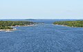
English: Media relating to the island of Brännskär, in Norrtälje Municipality and the Stockholm archipelago, Sweden
Media in category "Brännskär, Norrtälje Municipality"
This category contains only the following file.
-
 Sundskär.jpg 2,400 × 1,500; 950 KB
