Category:Bridges in Virginia
둘러보기로 이동
검색으로 이동
States of the United States: 네바다주 · 네브래스카주 · 노스다코타주 · 노스캐롤라이나주 · 뉴멕시코주 · 뉴욕주 · 뉴저지주 · 뉴햄프셔주 · 델라웨어주 · 로드아일랜드주 · 루이지애나주 · 매사추세츠주 · 메릴랜드주 · 메인주 · 몬태나주 · 미네소타주 · 미시간주 · 미시시피주 · 미주리주 · 버몬트주 · 버지니아주 · 사우스다코타주 · 사우스캐롤라이나주 · 아이다호주 · 아이오와주 · 아칸소주 · 알래스카주 · 애리조나주 · 앨라배마주 · 오리건주 · 오클라호마주 · 오하이오주 · 와이오밍주 · 워싱턴주 · 웨스트버지니아주 · 위스콘신주 · 유타주 · 인디애나주 · 일리노이주 · 조지아주 · 캔자스주 · 캘리포니아주 · 켄터키주 · 코네티컷주 · 콜로라도주 · 테네시주 · 텍사스주 · 펜실베이니아주 · 플로리다주 · 하와이주 – 워싱턴 D.C.
괌 · 푸에르토리코
괌 · 푸에르토리코
위키미디어 분류 | |||||
| 미디어 올리기 | |||||
| 다음 종류에 속함 | |||||
|---|---|---|---|---|---|
| 다음 주제들의 교집합 분류임 | |||||
| 버지니아주 | |||||
미국의 주  someja satełtar in marso     | |||||
| 발음 (음성 파일) | |||||
| 다음 종류에 속함 | |||||
| 다음의 한 부분임 |
| ||||
| 명칭의 유래 |
| ||||
| 위치 | 미국 | ||||
| 다음 유역을 끼고 있음 | |||||
| 정부 소재지 | |||||
| 입법부 | |||||
| 행정부 | |||||
| 최고 사법 기관 | |||||
| 공용어 | |||||
| 국가 |
| ||||
| 행정부 수반 |
| ||||
| 만들어진 날 |
| ||||
| 가장 높은 곳 | |||||
| 인구 수 |
| ||||
| 면적 |
| ||||
| 해발고도 |
| ||||
| 다음에서 이어받음 |
| ||||
| 다음과 다름 | |||||
| 최고 온도 |
| ||||
| 최저 온도 |
| ||||
| 공식 웹사이트 | |||||
 | |||||
하위 분류
다음은 이 분류에 속하는 하위 분류 22개 가운데 22개입니다.
*
- Overpass bridges in Virginia (19 F)
B
D
H
- Hatcher Island Bridge (1 F)
P
R
S
U
V
- Views from bridges in Virginia (17 F)
"Bridges in Virginia" 분류에 속하는 미디어
다음은 이 분류에 속하는 파일 133개 가운데 133개입니다.
-
 16288 Virginia State Route 49 - panoramio.jpg 2,592 × 1,944; 1.27 MB
-
 2007 04 25 - WWB 03.JPG 2,589 × 1,465; 620 KB
-
 2013.VA.HighBridgeTrailSP.DeborahHolohan (8338391065).png 577 × 600; 758 KB
-
-

-
 Abraham Lincoln and the battles of the Civil War (1887) (14576408628).jpg 2,106 × 888; 397 KB
-
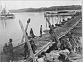 Benham's Wharf, Belle Plain, Va - NARA - 530559.jpg 3,000 × 2,261; 2.13 MB
-
 Blacks Run Creek Harrisonburg VA March 2008.jpg 2,128 × 2,848; 1.55 MB
-
 Blue Ridge Parkway - Stone-arched Bridges of the Parkway - NARA - 7717430.jpg 2,100 × 1,527; 1.19 MB
-
 Bridge across Pamunkey River, Va. at White House Landing - NARA - 526916.jpg 3,000 × 2,305; 1.85 MB
-
 Bridge across the Chickahominy. (3110839678).jpg 760 × 633; 272 KB
-
 Bridge at White House Landing, Pamunkey River - NARA - 529301.jpg 3,000 × 2,281; 1.52 MB
-
 Bridge for Appalachian Trail, crossing the James River, Virginia, Fall 2017.jpg 5,616 × 3,744; 3.52 MB
-
 Bridge in Rapidan, Virginia - panoramio.jpg 3,264 × 2,118; 1.13 MB
-
 Bridge John H Kerr (6076959233).jpg 3,872 × 2,592; 1.11 MB
-
 Bridge on Black Creek (7797535638).jpg 5,550 × 4,350; 1.7 MB
-
 Bridge Out on Rt. 626 (7797524728).jpg 5,550 × 4,350; 1.91 MB
-
 Bridge Out to Rural Home (7797551428).jpg 5,550 × 4,350; 1.89 MB
-
 Bridge over "The River Styx," Quantico, 1929 (8048267554).jpg 968 × 634; 79 KB
-
 Bridge over a river in winter.jpg 4,032 × 3,024; 7.2 MB
-
 Bridge south of Shady Woods NBG LR.jpg 5,488 × 3,659; 10.83 MB
-
 Bridge to NATO Tower - fm north NBG LR.jpg 6,000 × 4,000; 17.12 MB
-
 Bridge to NATO Tower NBG LR.jpg 6,000 × 4,000; 14.66 MB
-

-
 Bull Run Stone Bdge - NARA - 530538.jpg 1,965 × 3,000; 1.43 MB
-
 Cars Like Weeds public art by Ripp Smith Our Community Place Harrisonburg VA March 2009.jpg 2,048 × 1,536; 1.39 MB
-
 Chad shelton nt email 3 (16176477541).jpg 960 × 960; 183 KB
-
 Charles Hardaway Marks Bridges, Hopewell, VA.jpg 15,040 × 1,893; 7.62 MB
-
-

-

-
 Colonial Parkway - Bridge to Nowhere - NARA - 7717676.jpg 2,780 × 2,048; 571 KB
-
 Creepertrail2.jpg 1,200 × 1,600; 1,014 KB
-

-

-
-

-
 East of Massies Mill (7797543206).jpg 5,550 × 4,350; 1.54 MB
-
 Edward E. Willey Bridge, 2014.jpg 720 × 390; 76 KB
-
 Flooding Along Rt. 626 (7797524996).jpg 5,550 × 4,350; 1.87 MB
-
 FriesJunctionTrestle (12481590293).jpg 4,288 × 3,216; 3.35 MB
-
-
 Grapewine bridge.jpg 1,341 × 1,000; 837 KB
-
 Great Bridge view Lossing.png 1,521 × 668; 544 KB
-
 GW Parkway.jpg 610 × 410; 211 KB
-

-
 High Bridge Trail State Park DSC04870 (24013062289).jpg 4,592 × 3,056; 6.89 MB
-
 Howardsville Bridge Out (7797526062).jpg 5,550 × 4,350; 1.37 MB
-
 Howardsville Bridge Washed Out (7797531338).jpg 5,550 × 4,350; 1.26 MB
-

-
 Indian Field Creek Bridge on the Colonial Parkway.jpg 5,472 × 3,648; 4.29 MB
-
 Interstate 95 - Virginia (8112238716).jpg 3,072 × 2,304; 535 KB
-
 James River Bridge.svg 1,152 × 684; 2.95 MB
-
 James River.jpg 432 × 269; 73 KB
-
 Locke's Ford Bridge - circa 1917.jpg 640 × 400; 68 KB
-
 Lorton Road Arch Bridge - panoramio.jpg 3,789 × 2,913; 4.63 MB
-
 Massies Mill Bridge (7797542358).jpg 5,550 × 4,350; 1.68 MB
-
 Massies Mill Bridge, II (7797542906).jpg 5,550 × 4,350; 1.85 MB
-
 Mechanicsville, bridge over Chickahominy.jpg 1,330 × 1,000; 531 KB
-
 Military bridge across the Chickahominy (Va.). (3110007901).jpg 760 × 606; 229 KB
-
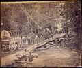
 Military bridge, Haupt Truss, Bull Run, Va., April 1863 - NARA - 524718.jpg 3,000 × 2,329; 1.74 MB
-
-
 Morgan Ford Low Water Bridge 2015.JPG 4,608 × 3,456; 4.12 MB
-
 New Bailey Bridge Construction (7797549376).jpg 5,550 × 4,350; 1.79 MB
-
 New Fieldale Bridge.jpg 5,184 × 3,888; 4.57 MB
-
-

-

-

-

-

-
 Old-bridge.jpg 400 × 267; 62 KB
-
 Panorama of James River from Pedestrian Bridge - Richmond - Virginia - USA (47003344594).jpg 4,912 × 1,080; 1.97 MB
-
 Petersburg Canal aqueduct.jpg 971 × 980; 796 KB
-
 Pontoon bridges across the James, looking toward Manchester.jpg 953 × 957; 360 KB
-
 Pontoon bridges at Fredericksburg, Va. (3110839080).jpg 760 × 601; 185 KB
-

-

-

-
 Powhite Parkway Bridge.jpg 3,024 × 4,032; 3.11 MB
-
 Quantico Creek culvert replacement (25733522230).jpg 4,896 × 3,672; 6.68 MB
-
 Railroad Bridge over Tye River (7797536258).jpg 5,550 × 4,350; 1.96 MB
-
 Reconstruction of the Rt. 626 Bridge (7797548718).jpg 5,550 × 4,350; 1.75 MB
-
 Reused segment of the historic Fieldale Iron Bridge in Fieldale Park.jpg 5,184 × 3,888; 5.38 MB
-
 Richmond's Belt Line Bridge.jpg 3,128 × 1,960; 2 MB
-
 RivannaRiver.jpg 800 × 533; 179 KB
-
 Roanoke River low water crossing.jpg 600 × 450; 100 KB
-
 Rockfish River at Howardsville (7797541166).jpg 5,550 × 4,350; 1.58 MB
-
 Rose Garden - NATO Vista Bridge 2 NBG LR.jpg 6,000 × 4,000; 18.45 MB
-
 Rose Garden - NATO Vista Bridge 3 NBG LR.jpg 7,966 × 5,311; 40.59 MB
-
 Rose Garden - NATO Vista Bridge NBG LR.jpg 6,000 × 4,000; 15.99 MB
-
 Rt. 151 Bridge over Tye River (7797534650).jpg 5,550 × 4,350; 1.57 MB
-
 Rt. 56 at Massies Mill (7797541660).jpg 5,550 × 4,350; 1.88 MB
-
 Rt. 602 over the James (7797548424).jpg 5,550 × 4,350; 1.86 MB
-
 Rt. 626 Bridge Demolished (7797540448).jpg 5,550 × 4,350; 1.65 MB
-
 Rt. 626 Bridge Out (7797528890).jpg 5,550 × 4,350; 1.51 MB
-
 Rt. 626 Bridge Remnants (7797529266).jpg 5,550 × 4,350; 1.89 MB
-
 Ruins of Stone Bridge, Bull Run (March 1862).jpg 998 × 775; 332 KB
-
 Ruins of stone bridge, Bull Run, Va - NARA - 527397.jpg 1,595 × 3,000; 1.4 MB
-
 Ruins of stone bridge, Bull Run, Va - NARA - 527397.tif 1,595 × 3,000; 4.56 MB
-
 Schuyler, VA, USA - panoramio.jpg 3,195 × 2,389; 3.04 MB
-
 Snowville bridge.jpg 1,024 × 768; 201 KB
-

-

-
-
 Southern Railroad on Tye River (7797532630).jpg 5,550 × 4,350; 1.53 MB
-

-

-
 Supports for the Norfolk Light Rail Bridge (2714728103).jpg 800 × 600; 113 KB
-
 Tangier, VA (27020126545).jpg 5,184 × 3,456; 5.8 MB
-

-

-
 The James and Rockfish Rivers (7797547848).jpg 5,550 × 4,350; 1.58 MB
-
 The new South Norfolk Jordan Bridge.jpg 3,888 × 2,592; 4.19 MB
-

-

-

-

-

-

-
 Torg Bridge.jpg 2,560 × 1,665; 2.73 MB
-
 Torgersen Bridge - Virginia Tech - panoramio.jpg 3,264 × 2,448; 2.32 MB
-
 Trail under the Humpback Bridge (db75c4ca-8811-4f1b-b46d-8e3679abcb2b).jpg 2,726 × 3,647; 528 KB
-
 Trail under the Humpback Bridge (dd9f5072-52d5-41c5-b73e-9f81f07c2624).jpg 1,751 × 2,750; 550 KB
-
 Train bridge over St Marys River - panoramio.jpg 3,264 × 2,448; 1.94 MB
-
 Under the Bridge (32309938494).jpg 2,446 × 2,731; 1.68 MB
-

-

-
 Virginia, Bull Run. Ruins of Stone Bridge - NARA - 533281.jpg 3,000 × 2,383; 2.52 MB
-
-
 Why it is call Rockbridge County - panoramio.jpg 1,056 × 1,476; 844 KB
-
 Wilson creek bridge.jpeg 800 × 339; 75 KB
-
 World War II Veterans Memorial Bridge.jpg 2,538 × 1,657; 877 KB


.png)
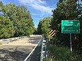
_crossing_Cedar_Creek_from_Shenandoah_County,_Virginia_into_Warren_County,_Virginia.jpg)
_crossing_the_Rappahannock_River_from_Remington,_Fauquier_County,_Virginia_into_Culpeper_County,_Virginia.jpg)
_(14576408628).jpg)


.jpg)


.jpg)
.jpg)
.jpg)
.jpg)
.jpg)


.jpg)
.jpg)
.jpg)
.jpg)


.jpg)

.jpg)
.jpg)


.jpg)
.jpg)
.jpg)
.jpg)

.jpg)


.jpg)
.jpg)

._(3110007901).jpg)


.jpg)

_(NYPL_Hades-256681-EM15028).jpg)


.jpg)

.jpg)
.jpg)
.jpg)


.jpg)


.jpg)
.jpg)
.jpg)
.jpg)
.jpg)
.jpg)
.jpg)


.jpg)
.jpg)
.jpg)
.jpg)
.jpg)
.jpg)

_(14576133758).jpg)
_(14576138670).jpg)
_(14759520711).jpg)
_(14762669205).jpg)
_(14782687693).jpg)
_(14782736023).jpg)


.jpg)
.jpg)

.jpg)


.jpg)