Category:Brugstraat 10, Grave
Jump to navigation
Jump to search
| Object location | | View all coordinates using: OpenStreetMap |
|---|
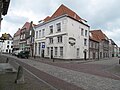
house in Grave, Netherlands  | |||||
| Upload media | |||||
| Instance of | |||||
|---|---|---|---|---|---|
| Location | Grave, Land van Cuijk, North Brabant, Netherlands | ||||
| Street address |
| ||||
| Located on street | |||||
| Heritage designation |
| ||||
 | |||||
|
This is a category about rijksmonument number 17219
|
| Address |
|
Media in category "Brugstraat 10, Grave"
The following 7 files are in this category, out of 7 total.
-
 5361 Grave, Netherlands - panoramio (11) - Brugstraat 2 - 10.jpg 2,048 × 1,148; 286 KB
-
 Grave Rijksmonument 17219 Brugstraat 10 hoek Oliestraat.jpg 2,736 × 3,648; 2.93 MB
-
 Grave Rijksmonument 17219 Oliestraat hoek Brugstraat 8-10.JPG 2,736 × 3,648; 3.04 MB
-
 Grave, straatzicht Brugstraat 2-10 bij Oranjehotel foto1 2010-04-10 11.02.jpg 3,456 × 2,592; 996 KB
-
 Overzicht Brugstraat, hoek Oliestraat - Grave - 20330135 - RCE - Brugstraat 2 - 10.jpg 1,197 × 1,200; 273 KB
-
 Overzicht voorgevel - Grave - 20330141 - RCE.jpg 956 × 1,200; 228 KB
-
 Overzicht zijgevel aan de Oliestraat - Grave - 20330142 - RCE.jpg 1,195 × 1,200; 275 KB
_-_Brugstraat_2_-_10.jpg)


