Category:Bunbeg
Перейти к навигации
Перейти к поиску
English: Bunbeg (, also the official name, meaning "the small river mouth") is a small townland in the parish of Gweedore, Co Donegal, Ireland. It is officially the smallest townland in Gaoth Dobhair (Gweedore), but today the name Bunbeg is used to describe a large region of the parish. It is situated between Derrybeg and Dore and is home to many of Gweedore's amenities and businesses.
Italiano: An Bun Beag (in inglese: Bunbeg è una cittadina Gaeltacht nella contea di Donegal, in Irlanda.
gaeltacht village in County Donegal, Ireland  | |||||
| Медиафайл | |||||
| Это частный случай понятия | |||||
|---|---|---|---|---|---|
| Местонахождение |
| ||||
| Площадь |
| ||||
 | |||||
Подкатегории
В этой категории отображается 3 подкатегории из имеющихся 3.
B
- Boats in Bunbeg (22 Ф)
- Bunbeg Beach (3 Ф)
M
- Magheragallon Cemetery (13 Ф)
Файлы в категории «Bunbeg»
Показаны 56 файлов из 56, находящихся в данной категории.
-
 Abandoned hotel at Bunbeg - geograph.org.uk - 5858956.jpg 2000 × 1500; 818 Кб
-

-
 An Bosca Mistéir (The Mystery Box) - geograph.org.uk - 2424757.jpg 640 × 480; 38 Кб
-
 Anbunbeag2.jpg 2047 × 1317; 354 Кб
-
 Boats, Bunbeg harbour - geograph.org.uk - 2424722.jpg 640 × 480; 46 Кб
-
 Bun Beagh - panoramio.jpg 2592 × 1944; 2,36 Мб
-
 Bunbeg (An Bunbeag) - geograph.org.uk - 501578.jpg 640 × 479; 60 Кб
-

-
-
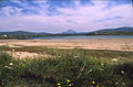
 Bunbeg - Field and Gweedore Bay - geograph.org.uk - 1354947.jpg 640 × 427; 122 Кб
-
 Bunbeg - Field and Gweedore Bay - geograph.org.uk - 1354953.jpg 640 × 426; 123 Кб
-

-

-
 Bunbeg - R258 - geograph.org.uk - 1177841.jpg 639 × 426; 349 Кб
-
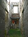
 Bunbeg - Ruins of large building - geograph.org.uk - 1354958.jpg 640 × 426; 123 Кб
-
 Bunbeg harbour - geograph.org.uk - 2424727.jpg 640 × 480; 54 Кб
-

-

-

-
 Bunbeg Harbour Road - Coastal scenery - geograph.org.uk - 1176566.jpg 640 × 426; 130 Кб
-
 Bunbeg Harbour Road - Derelict buildings - geograph.org.uk - 1176546.jpg 639 × 426; 161 Кб
-
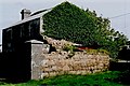
 Bunbeg Harbour Road - Derelict house - geograph.org.uk - 1176547.jpg 640 × 426; 136 Кб
-
 Bunbeg Harbour Road - House - geograph.org.uk - 1176564.jpg 640 × 426; 246 Кб
-
 Bunbeg Harbour Road - House - geograph.org.uk - 1176572.jpg 640 × 426; 332 Кб
-
-

-
 Bunbeg Harbour Road - New house - geograph.org.uk - 1176559.jpg 640 × 426; 206 Кб
-
 Bunbeg Harbour Road - New house - geograph.org.uk - 1176571.jpg 639 × 426; 275 Кб
-
-

-

-
 Bunbeg Harbour Road - Road scene - geograph.org.uk - 1176552.jpg 639 × 426; 222 Кб
-
 Bunbeg Harbour Road - Road scene - geograph.org.uk - 1176553.jpg 640 × 426; 283 Кб
-
 Bunbeg Harbour Road - Road scene - geograph.org.uk - 1176560.jpg 640 × 426; 326 Кб
-
 Bunbeg Harbour Road - Road scene - geograph.org.uk - 1176565.jpg 640 × 426; 350 Кб
-
 Bunbeg Harbour Road - Road Scene - geograph.org.uk - 1176568.jpg 639 × 426; 267 Кб
-
 Bunbeg Harbour Road - Road Scene - geograph.org.uk - 1176570.jpg 639 × 426; 403 Кб
-

-
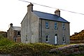
 Bunbeg House - geograph.org.uk - 501739.jpg 640 × 479; 53 Кб
-
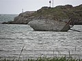 Bád Eddie (Eddie's boat) - geograph.org.uk - 2426077.jpg 640 × 480; 56 Кб
-
 Coastguard station, Bunbeg - geograph.org.uk - 2424725.jpg 640 × 480; 41 Кб
-
 Machairechlochair2.JPG 3072 × 1728; 2,29 Мб
-
 Maitiú Ó Cnaimsit, Bunbeg - geograph.org.uk - 2424751.jpg 640 × 480; 45 Кб
-
 Near Bunberg - geograph.org.uk - 2424915.jpg 640 × 480; 58 Кб
-
 Preparing to land at Donegal - geograph.org.uk - 1159594.jpg 639 × 426; 308 Кб
-
 Quay at Bunbeg - geograph.org.uk - 308681.jpg 640 × 480; 71 Кб
-
 Road near Bunbeg - geograph.org.uk - 2424909.jpg 640 × 480; 41 Кб
-

-
 Stream on the beach, Bunbeg - geograph.org.uk - 5858962.jpg 2000 × 1500; 726 Кб
-
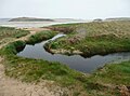 Stream on the shore at Bunbeg - geograph.org.uk - 5858940.jpg 2000 × 1485; 890 Кб
-
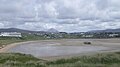
 The beach at Bunbeg - geograph.org.uk - 5858945.jpg 2000 × 1500; 709 Кб
-

-
-

-
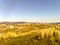 Viewofgweedore.jpg 1280 × 960; 110 Кб
-


_-_geograph.org.uk_-_2424757.jpg)


_-_geograph.org.uk_-_501578.jpg)


_-_geograph.org.uk_-_2426077.jpg)


_-_geograph.org.uk_-_1010893.jpg)