Category:Bureau of Land Management
Saltar para a navegação
Saltar para a pesquisa
agency within the United States Department of the Interior   | |||||
| Carregar ficheiro | |||||
| Instância de | |||||
|---|---|---|---|---|---|
| Localização | Washington, D.C., Distrito de Colúmbia, EUA | ||||
| Pertencente à jurisdição | |||||
| Sede | |||||
| Composto de |
| ||||
| Data de criação ou fundação |
| ||||
| Precedido por |
| ||||
| Diferente de | |||||
| sítio web oficial | |||||
| |||||
Subcategorias
Esta categoria contém as seguintes 28 subcategorias (de um total de 28).
*
- PD US BLM (15274 F)
A
B
D
F
G
L
- Las Cruces District (2 F)
M
N
- BLM National Training Center (5 F)
P
- BLM photo contest (372 F)
R
S
- Seymour Antelope (6 F)
Y
Multimédia na categoria "Bureau of Land Management"
Esta categoria contém os seguintes 137 ficheiros (de um total de 137).
-
 America's priceless heritage - cultural and fossil resources on public lands, Utah. (IA americaspriceles00unit 6).pdf 1 635 × 2 156, 20 páginas; 13,09 MB
-
 Annual report on performance and accountability - fiscal year 2006 (IA annualreportonpe2006unit).pdf 1 314 × 1 785, 132 páginas; 62,46 MB
-
 Annual report on performance and accountability - fiscal year 2002 (IA annualreportonpe4480unit).pdf 1 216 × 1 612, 384 páginas; 82,78 MB
-
 Areas of Critical Environmental Concern (ACEC's) - policy and procedures guidelines (IA areasofcriticale1417unit).pdf 1 220 × 1 602, 36 páginas; 1,41 MB
-
 Areas of Critical Environmental Concern (IA areasofcriticale33unit).pdf 1 266 × 1 610, 14 páginas; 4,55 MB
-
-
 Beaufort Sea Withdrawal NPR-A Special Areas.jpg 1 224 × 792; 265 kB
-
 BIG BEN 2 LODE Highland Pines.jpg 1 275 × 2 100; 1,51 MB
-
 Big game populations and habitats on BLM in Idaho - Idaho wildlife, 2000 (IA biggamepopulatio42thom).pdf 1 304 × 1 700, 82 páginas; 10,97 MB
-
 Bitterbrush rehabilitation - Squaw Butte fire complex (IA bitterbrushrehab36matt).pdf 633 × 829, 78 páginas; 9,66 MB
-
 Bureau of Land Management logo 1946.jpg 186 × 186; 23 kB
-
 Bureau of Land Management Rivers and Trails Editing Workshop 2018.pdf 1 500 × 843, 40 páginas; 5,37 MB
-
 Bureau of Land Management Shield on Expedition.jpg 4 272 × 2 848; 2,75 MB
-
 The Bureau of Land Management (IA bureauoflandmana00olse).pdf 637 × 822, 168 páginas; 18,99 MB
-
 The Bureau of Land Management's role in managing America's wilderness (IA bureauoflandmanag00unit).pdf 2 960 × 3 352, 4 páginas; 2,7 MB
-
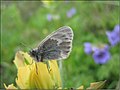 Butterfly Image for CCSC SchoolProetc.jpg 1 083 × 813; 540 kB
-
 Cattle trampling at edge of Lepidium davisii playa in SW Idaho.jpg 1 024 × 768; 260 kB
-
-
 Daniel-Morgan-Boone-Jackson-County-Land-Patent-1833-STA Patent MO0170 .404.png 1 795 × 1 115; 435 kB
-
 Daniel-Morgan-Boone-Jackson-County-Land-Patent-1833-STA Patent MO0180 .032.png 1 471 × 985; 401 kB
-

-
-
 Dispose of Human Waste graphic from BLM.png 1 024 × 512; 179 kB
-
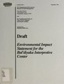 Draft environmental impact statement for the Bal'diyaka Interpretive Center (IA draftenvironmentunit 9).pdf 1 250 × 1 641, 342 páginas; 69,96 MB
-
 Eastern focus, 31 (IA easternfocus3100unit).pdf 1 308 × 860, 24 páginas; 827 kB
-
 Ecology and management of the South Fork Snake River cottonwood forest (IA ecologymanagemen26meri).pdf 1 281 × 1 662, 108 páginas; 27,51 MB
-
 Ecosystem management in the BLM - from concept to commitment (IA ecosystemmanageme00unit).pdf 1 302 × 1 768, 24 páginas; 5,33 MB
-
 Endangered amphibians and reptiles of seven southwestern New Mexico counties (IA endangeredamphib6029belf).pdf 633 × 831, 124 páginas; 31,36 MB
-
-
 Facts and background about the Bureau of Land Management (IA factsbackgrounda00unit).pdf 1 275 × 1 681, 22 páginas; 1,1 MB
-
-

-
 File Management System - user manual - GIS data transition (IA filemanagementsy9600usbu).pdf 1 262 × 1 656, 232 páginas; 39,99 MB
-
 Final environmental impact statement- proposed Federal coal leasing program (IA finalenvironment015unit).pdf 585 × 797, 428 páginas; 151,83 MB
-

-
 Final programmatic environmental impact statement for geothermal leasing in the western United States (IA finalprogrammati03unse).pdf 1 275 × 1 650, 784 páginas; 13,48 MB
-
 Four Corners Monument Marker 2012.jpg 640 × 640; 293 kB
-
 FourCornersByPhilKonstantin.jpg 1 842 × 1 674; 704 kB
-
 Freeze branded mustang.png 2 080 × 1 594; 3,45 MB
-
 General Land Office logo.jpg 178 × 178; 20 kB
-
 Glossary of public-land terms (IA glossaryofpublic5408unit).pdf 712 × 1 043, 64 páginas; 2,66 MB
-
 Graphic notes on the public domain (IA graphicnotesonpu00unit).pdf 1 502 × 1 193, 48 páginas; 2,19 MB
-
 Homestead Act 01 (7268337922).jpg 1 022 × 999; 359 kB
-
-

-

-

-
-

-

-

-

-
 Johnny horizon.jpg 500 × 630; 83 kB
-
 Lahontan resource management plan - record of decision and management decisions summary (IA lahontanresource16unit).pdf 1 235 × 1 666, 56 páginas; 7,54 MB
-
 Landmarks in public land management (IA landmarksinpubli00unit).pdf 1 308 × 1 741, 48 páginas; 14,19 MB
-
-
 Land planning and classification report of the public domain lands in the upper Cheyenne River Basin, Wyoming. (IA landplanningchey00unit).pdf 1 112 × 1 564, 107 páginas; 6,86 MB
-
-
-
 Land planning and classification report of the public domain lands in the Sun River-Teton area, Montana (IA landplanningclas5963unit).pdf 1 133 × 1 554, 94 páginas; 18,96 MB
-
 Land planning and classification report of the public domain lands in the Marias River area, Montana (IA landplanningclas5969unit).pdf 1 141 × 1 539, 116 páginas; 23,28 MB
-
-
 Land planning and classification report for public domain lands in North Dakota (IA landplanningclas6034unit).pdf 1 166 × 1 541, 44 páginas; 8,74 MB
-
-
-
-
-
-
 Land planning and classification report of the public domain lands in Moreau River Basin, South Dakota. (IA landplanningmore00unit).pdf 1 141 × 1 560, 34 páginas; 1,25 MB
-
 Land planning and classification report of the public domain lands in the Moreau River basin, South Dakota. (IA landplanningmore00usbu).pdf 1 120 × 1 562, 68 páginas; 3,34 MB
-
 Lepidium davisii long term monitoring on playa in SW Idaho 3.jpg 1 024 × 768; 270 kB
-
 Logo of the United States Bureau of Land Management.svg 720 × 627; 22 kB
-

-
 Management of land boundaries (IA managementofland00cada).pdf 1 275 × 1 650, 8 páginas; 25,55 MB
-
 Management of land boundaries (IA managementofland00cada 0).pdf 1 275 × 1 650, 8 páginas; 25,55 MB
-
 Map symbol handbook (IA mapsymbolhandboo00unit).pdf 600 × 793, 256 páginas; 8,58 MB
-
 My Public Lands (18224087772).jpg 240 × 240; 24 kB
-
 My Public Lands Magazine, Summer 2015 (19352418918).jpg 5 100 × 3 300; 6,26 MB
-
 My Public Lands Magazine, Summer 2015 (19540364475).jpg 5 100 × 3 300; 6,39 MB
-
 My Public Lands Roadtrip (17691773223).jpg 1 200 × 246; 287 kB
-

-

-
 National Environmental Policy Act handbook (IA nationalenvironm16unit).pdf 633 × 831, 156 páginas; 27,31 MB
-
 National scenic and historic trails strategy and work plan (IA nationalscenichi7692unit).pdf 1 235 × 1 622, 36 páginas; 2,68 MB
-
 NV-BARNM-MapREV.png 2 400 × 3 224; 6,95 MB
-
 Official file of comments received on Alaska Natural Gas Transportation System draft environmental impact statement (IA officialfileofco00unit).pdf 1 591 × 2 104, 900 páginas; 194,85 MB
-
 Oldest map.jpg 1 936 × 2 592; 1,23 MB
-
 Our heritage, our future - the BLM and America's public lands (IA ourheritageourfuture).pdf 1 650 × 1 275, 107 páginas; 625,95 MB
-
 Our public land heritage - from the GLO to the BLM (IA ourpubliclandher00unse).pdf 3 333 × 1 516, 2 páginas; 2,22 MB
-
 Planning area analysis - the Schell Resource Area (IA planningareaanal7629haye).pdf 633 × 829, 170 páginas; 26,85 MB
-
-
 Polluted water in mini playa from cattle in SW Idaho.jpg 1 024 × 768; 243 kB
-
-
-

-
 Programmatic EISs for fuel breaks and fuels reduction and restoration in the Great Basin - scoping report (IA programmaticeiss00unse).pdf 1 275 × 1 650, 90 páginas; 4,24 MB
-
-
 Project Twenty-Twelve - a long range program for our public lands (IA projecttwentytwe00unit).pdf 1 329 × 1 681, 76 páginas; 6,79 MB
-
 Proposed development of coal resources, west-central Colorado - draft environmental statement, v. 2 (IA proposeddevelopm5907unit).pdf 662 × 893, 450 páginas; 130,38 MB
-
 Proposed Three Rivers resource management plan - final impact statement (IA proposedthreeriv02unit).pdf 864 × 1 143, 422 páginas; 21,54 MB
-
 Proposed Three Rivers resource management plan - final environmental impact statement (IA proposedthreeriv13unit).pdf 625 × 829, 422 páginas; 74,69 MB
-
 Public Land Law Review Commission - information source book for H.R. 8070 (IA publiclandlawrev6021unit).pdf 600 × 839, 39 páginas; 7,82 MB
-
 Public land opportunities - fiscal year 2002. (IA publiclandopport00unse).pdf 1 662 × 2 170, 376 páginas; 17,87 MB
-
 Public lands bibliography (IA publiclandsbibli5420unit).pdf 837 × 1 358, 116 páginas; 7,55 MB
-
 Public lands bibliography (IA publiclandsbibli6346unit).pdf 1 152 × 1 560, 46 páginas; 1,92 MB
-
 Public land statistics (IA publiclandstatis1986unit).pdf 870 × 1 339, 136 páginas; 7,31 MB
-
 Public land statistics (IA publiclandstatis1988unit).pdf 883 × 1 341, 136 páginas; 6,94 MB
-
 Public land statistics (IA publiclandstatis1989unit).pdf 860 × 1 343, 142 páginas; 6,86 MB
-
 Public land statistics (IA publiclandstatis1990unit).pdf 889 × 1 337, 148 páginas; 7,43 MB
-
 Public land statistics (IA publiclandstatis1992unit).pdf 868 × 1 331, 156 páginas; 8,26 MB
-
 Public land statistics (IA publiclandstatis1993unit).pdf 864 × 1 304, 156 páginas; 8,01 MB
-
 R42346 Federal Land Ownership Overview and Data (IA R42346FederalLandOwnershipOverviewandData-crs).pdf 1 275 × 1 650, 27 páginas; 537 kB
-
-
 R43267 Commercial Filming and Photography on Federal Lands (IA R43267CommercialFilmingandPhotographyonFederalLands-crs).pdf 1 275 × 1 650, 9 páginas; 252 kB
-
-
 Record of decision - Robinson Project (IA recordofdecision00robi).pdf 602 × 810, 16 páginas; 1,93 MB
-
 Regional Mitigation Strategy for the Dry Lake Solar Energy Zone (March 2014).pdf 1 275 × 1 650, 86 páginas; 3,82 MB
-

-
 Riparian-wetland soils - riparian area management (IA riparianwetlands00unse).pdf 1 275 × 1 650, 124 páginas; 3,07 MB
-
 RL30755 Forest Fire Wildfire Protection (IA RL30755ForestFireWildfireProtection-crs).pdf 1 275 × 1 650, 27 páginas; 363 kB
-
-
 Rock springs fo.JPG 606 × 792; 252 kB
-
 RS21232 Grazing Fees Overview and Issues (IA RS21232GrazingFeesOverviewandIssues-crs).pdf 1 275 × 1 650, 11 páginas; 248 kB
-
-
-
 Southern Appalachian regional coal environmental impact statement II, v. 2 (IA southernappalach6016unit).pdf 1 216 × 1 604, 62 páginas; 10,12 MB
-
 Strategy plan for training personnel in BLM's wildlife, fisheries, and special status plants program (IA strategyplanfort25mccl).pdf 1 235 × 1 662, 50 páginas; 7,86 MB
-
 Surveying our public lands (IA surveyingourpublunit).pdf 1 229 × 1 608, 24 páginas; 4,24 MB
-
 Three Rivers resource management plan - record of decision, and rangeland program summary (IA threeriversresouunit).pdf 622 × 829, 452 páginas; 129,89 MB
-
 Transportation and the Bureau of Land Management (IA transportationbu00unkn).pdf 1 329 × 2 100, 32 páginas; 2,45 MB
-
 United States Grazing Service logo.jpg 582 × 608; 67 kB
-
-
 US-DOI-BLM-logo.png 486 × 423; 17 kB
-
 USBLM meridian map Arizona.jpg 592 × 420; 99 kB
-
 Waterfowl and wetlands workshop-Alaska (IA WaterfowlandWetlandsWorkshopAlaska).pdf 1 200 × 1 631, 274 páginas; 14,65 MB
-
 Willow Development Lease Map.jpg 1 044 × 651; 281 kB
-
 A window to the past, a view to the future - a guide to photodocumenting historic places (IA windowtopastview00athe).pdf 1 189 × 1 583, 120 páginas; 4,45 MB


.jpg)

_State_Offices_and_Their_Administrative_Jurisdictions_(20351805978).jpg)


.jpg)


.jpg)
.jpg)
.jpg)
_or_Jackson_Hotshots_(18293480150).jpg)
.jpg)


_(IA_lookingbackceleb5807unit)_(page_55_crop).jpg)
.jpg)