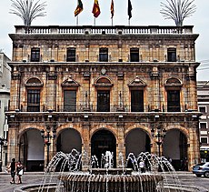
Category:Castellón de la Plana Town Hall
Jump to navigation
Jump to search
This is a category about a monument indexed in the Valencian and Spanish heritage registers of Béns d'Interés Cultural / Bienes de Interés Cultural under the reference RI-51-0012163. |
| Object location | | View all coordinates using: OpenStreetMap |
|---|
cultural property in Castellón de la Plana, Spain | |||||
| Upload media | |||||
| Instance of | |||||
|---|---|---|---|---|---|
| Location | Castelló de la Plana, Plana Alta, Castellón, Valencian Community, Spain | ||||
| Located on street | |||||
| Architectural style | |||||
| Owned by | |||||
| Occupant | |||||
| Heritage designation | |||||
| Inception |
| ||||
 | |||||
Media in category "Castellón de la Plana Town Hall"
The following 27 files are in this category, out of 27 total.
-
2018-07-20, Pedro Sánchez y Amparo Marco.jpg 2,592 × 1,728; 2.94 MB
-
3Enfarola2016.jpg 4,160 × 2,336; 2.71 MB
-
Ajuntament Castelló de la Plana.jpg 1,824 × 3,648; 2.03 MB
-
Ajuntament de Castelló de la Plana - 1.jpg 2,982 × 2,736; 5.39 MB
-
Ajuntament de Castelló de la Plana des del Fadrí.jpg 3,584 × 2,735; 2.31 MB
-
Ajuntament de Castelló de la Plana vist des del Fadrí.jpg 3,664 × 2,748; 2.32 MB
-
Ajuntament de Castelló de la Plana.jpg 3,072 × 2,304; 2.78 MB
-
Ajuntament de Castelló, vist des del Fadrí.jpg 3,664 × 2,748; 2.27 MB
-
Arcades de l'ajuntament de Castelló de la Plana.jpg 3,664 × 2,748; 1.66 MB
-
Ayuncasmagdalena07.jpg 1,536 × 2,048; 1.36 MB
-
Ayuntamiento de Castellón de la Plana, Castellón.JPG 3,072 × 2,304; 2.59 MB
-
Ayuntamiento de Castellón de la Plana.jpg 3,072 × 2,304; 2.47 MB
-
Ayuntamiento de Castellón.JPG 3,072 × 2,304; 2.6 MB
-
Castellon de la Plana - 004 (30577255654).jpg 3,072 × 2,304; 2 MB
-
Castellon de la Plana. Casa Consistorial.jpg 567 × 467; 184 KB
-
Castelló - 21.jpeg 3,264 × 2,448; 2.22 MB
-
Castellón 7.JPG 3,648 × 2,736; 9.89 MB
-
Castellón de la Plana City Hall.jpg 4,750 × 3,800; 11.7 MB
-
Castellón de la Plana. Ayuntamiento.jpg 2,736 × 2,736; 7.25 MB
-
Escala de l'ajuntament de Castelló de la Plana.jpg 3,559 × 2,746; 1.59 MB
-
Escala de l'ajuntament de Castelló.jpg 2,748 × 3,664; 1.53 MB
-
Fuegoayuntamiento.jpg 3,000 × 4,000; 2.25 MB
-
Plaça Major de Castelló de la Plana i ajuntament.JPG 3,664 × 2,748; 1.83 MB
-
Portada d'accés a l'ajuntament de Castelló de la Plana.jpg 2,550 × 3,658; 1.39 MB
-
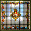
Vitrall a l'ajuntament de Castelló de la Plana amb l'escut de la ciutat.jpg 3,145 × 3,132; 2.29 MB
-
Vitrall amb l'escut de la ciutat a l'ajuntament de Castelló de la Plana.jpg 3,530 × 2,746; 2.03 MB


