Category:Cattle in Cumbria
Jump to navigation
Jump to search
Ceremonial counties of England: Bedfordshire · Berkshire · Buckinghamshire · Cambridgeshire · Cheshire · Cornwall · Cumbria · Derbyshire · Devon · Dorset · Durham · East Riding of Yorkshire · East Sussex · Essex · Gloucestershire · Greater London · Greater Manchester · Hampshire · Herefordshire · Hertfordshire · Isle of Wight · Kent · Lancashire · Leicestershire · Lincolnshire · Merseyside · Norfolk · North Yorkshire · Northamptonshire · Northumberland · Nottinghamshire · Oxfordshire · Rutland · Shropshire · Somerset · South Yorkshire · Staffordshire · Suffolk · Surrey · Tyne and Wear · Warwickshire · West Midlands · West Sussex · West Yorkshire · Wiltshire · Worcestershire
City-counties:
Former historic counties:
Other former counties:
City-counties:
Former historic counties:
Other former counties:

Media in category "Cattle in Cumbria"
The following 124 files are in this category, out of 124 total.
-
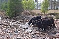 "Wild Ennerdale" - geograph.org.uk - 428339.jpg 640 × 427; 166 KB
-

-
 Belted Galloway Cattle - geograph.org.uk - 460742.jpg 640 × 427; 91 KB
-
 Belted Galloways - geograph.org.uk - 289541.jpg 640 × 460; 74 KB
-
 Black and white Bulls - geograph.org.uk - 461141.jpg 640 × 480; 93 KB
-
 Black Cattle near Hows Farm - geograph.org.uk - 1338883.jpg 640 × 430; 54 KB
-
 Bull, Blaze Fell - geograph.org.uk - 843632.jpg 640 × 480; 53 KB
-
 Bullocks in dappled shade - geograph.org.uk - 269414.jpg 640 × 480; 242 KB
-
 Burgh Marsh - geograph.org.uk - 858402.jpg 640 × 480; 110 KB
-
 Burgh Marsh - geograph.org.uk - 858423.jpg 640 × 480; 121 KB
-
 Burgh Marsh - geograph.org.uk - 858437.jpg 640 × 480; 130 KB
-
 Burgh Marsh - geograph.org.uk - 858454.jpg 640 × 480; 105 KB
-
 Burgh Marsh - geograph.org.uk - 858468.jpg 640 × 480; 122 KB
-
 Burgh Marsh - geograph.org.uk - 858470.jpg 640 × 480; 93 KB
-
 Burgh Marsh - geograph.org.uk - 858504.jpg 640 × 480; 90 KB
-
 Burgh Marsh - geograph.org.uk - 858604.jpg 640 × 480; 93 KB
-
 Burgh Marsh - geograph.org.uk - 858617.jpg 640 × 480; 92 KB
-
 Burgh Marsh - geograph.org.uk - 858628.jpg 640 × 480; 129 KB
-
 Burgh Marsh - geograph.org.uk - 858643.jpg 640 × 480; 103 KB
-
 Burgh Marsh - geograph.org.uk - 858658.jpg 640 × 480; 111 KB
-
 Burgh Marsh - geograph.org.uk - 858666.jpg 640 × 480; 109 KB
-
 Burgh Marsh - geograph.org.uk - 858676.jpg 640 × 480; 102 KB
-
 Burgh Marsh - geograph.org.uk - 858679 (cropped).jpg 269 × 480; 68 KB
-
 Burgh Marsh - geograph.org.uk - 858679.jpg 640 × 480; 116 KB
-
 Burgh Marsh - geograph.org.uk - 858687.jpg 640 × 480; 110 KB
-
 Calf and mother in Grassgarth - geograph.org.uk - 3384692.jpg 3,872 × 2,592; 4.54 MB
-
 Calves, Blaze Fell - geograph.org.uk - 843482.jpg 640 × 480; 61 KB
-
 Cattle - geograph.org.uk - 462545.jpg 640 × 480; 103 KB
-
 Cattle - geograph.org.uk - 527624.jpg 640 × 480; 217 KB
-
 Cattle - geograph.org.uk - 578295.jpg 640 × 480; 210 KB
-
 Cattle - geograph.org.uk - 821077.jpg 640 × 480; 230 KB
-
 Cattle above Wasdale - geograph.org.uk - 528332.jpg 640 × 426; 96 KB
-
 Cattle along "The Struggle" - panoramio (cropped).jpg 1,728 × 1,728; 818 KB
-
 Cattle along "The Struggle" - panoramio.jpg 2,304 × 1,728; 1.16 MB
-
 Cattle and Sheep - geograph.org.uk - 1483224.jpg 640 × 397; 69 KB
-
 Cattle at Colstons Farm - geograph.org.uk - 232422.jpg 640 × 426; 152 KB
-

-

-
 Cattle Feeding - geograph.org.uk - 118213.jpg 640 × 480; 124 KB
-

-
 Cattle grazing inside Mayburgh Henge - geograph.org.uk - 4008682.jpg 640 × 480; 175 KB
-
 Cattle grazing near the River Ehen - geograph.org.uk - 1348506.jpg 640 × 335; 39 KB
-
 Cattle grazing rough land - geograph.org.uk - 1336264.jpg 640 × 430; 54 KB
-
 Cattle in field near High Green Hill - geograph.org.uk - 506042.jpg 640 × 480; 132 KB
-
 Cattle in Field near Lincowell - geograph.org.uk - 252237.jpg 640 × 426; 279 KB
-
 Cattle jam north of Sleagill - geograph.org.uk - 4029329.jpg 800 × 600; 115 KB
-
 Cattle near Flakebridge - geograph.org.uk - 220682.jpg 640 × 480; 79 KB
-
 Cattle near Glendowlin - geograph.org.uk - 4024258.jpg 640 × 480; 522 KB
-
 Cattle near Whitrigg, Kirkbride - geograph.org.uk - 291910.jpg 640 × 426; 125 KB
-
 Cattle on Irton Fell - geograph.org.uk - 837401.jpg 640 × 427; 128 KB
-
 Cattle on the Solway Marshes - geograph.org.uk - 933250.jpg 640 × 480; 66 KB
-
 Cattle, Allithwaite - geograph.org.uk - 1548792.jpg 640 × 480; 71 KB
-
 Cattle, Beckside Farm - geograph.org.uk - 366326.jpg 1,024 × 683; 183 KB
-
 Cattle, Cocklakes (geograph 4314489).jpg 800 × 600; 369 KB
-
 Cattle, Newton Arlosh - geograph.org.uk - 1302054.jpg 640 × 480; 138 KB
-
 Clarghyll Hall - geograph.org.uk - 135234.jpg 640 × 480; 91 KB
-
 Concrete hut, Burgh Marsh - geograph.org.uk - 858444.jpg 640 × 480; 123 KB
-
 Cows - geograph.org.uk - 1618435.jpg 640 × 480; 57 KB
-
 Cows - geograph.org.uk - 251310.jpg 640 × 480; 202 KB
-
 Cows - geograph.org.uk - 474439.jpg 640 × 480; 144 KB
-
 Cows - geograph.org.uk - 474512.jpg 640 × 480; 228 KB
-
 Cows - geograph.org.uk - 975563.jpg 640 × 480; 75 KB
-
 Cows After Milking at Cross Fell View - geograph.org.uk - 242883.jpg 640 × 426; 112 KB
-
 Cows at Ashness Farm - geograph.org.uk - 947060.jpg 640 × 480; 102 KB
-
 Cows by the path - geograph.org.uk - 1753693.jpg 2,272 × 1,712; 1.59 MB
-
 Cows grazing - geograph.org.uk - 507285.jpg 640 × 480; 109 KB
-
 Cows grazing near the Gilsland Spa Hotel - geograph.org.uk - 1554323.jpg 640 × 480; 108 KB
-

-
 Cows in rough pasture near Caldbeck - geograph.org.uk - 1567587.jpg 640 × 480; 146 KB
-
 Cows in the Eden Valley - geograph.org.uk - 1398526.jpg 640 × 480; 109 KB
-
 Cows near Carlisle Airport - geograph.org.uk - 1309049.jpg 640 × 480; 47 KB
-
 Cows, Haybergill - geograph.org.uk - 1532912.jpg 640 × 479; 60 KB
-
 Cumbrian Beef^ - geograph.org.uk - 668650.jpg 640 × 457; 89 KB
-
 Curious but non-threatening cattle - geograph.org.uk - 849086.jpg 640 × 480; 384 KB
-
 Curious cattle near Tarn Hows - geograph.org.uk - 1230820.jpg 640 × 426; 65 KB
-
 Field of cows at Ashness farm - geograph.org.uk - 947059.jpg 640 × 413; 60 KB
-
 Fields at Thorney Scale - geograph.org.uk - 858776.jpg 640 × 480; 56 KB
-
 Highland cattle - geograph.org.uk - 461207.jpg 640 × 480; 98 KB
-

-
 Highland Cows by the road to Kentmere - geograph.org.uk - 5688269.jpg 3,264 × 2,448; 1.61 MB
-
 Lone Cow near Keld Farm - geograph.org.uk - 153732.jpg 640 × 480; 147 KB
-
 Meadow at Stable Hills - geograph.org.uk - 629973.jpg 640 × 415; 67 KB
-
 Milking Time over - geograph.org.uk - 453096.jpg 640 × 480; 156 KB
-
 Pasture, Northsceugh - geograph.org.uk - 379734.jpg 640 × 480; 136 KB
-
 Pastures, Far Hornsby Gate - geograph.org.uk - 378679.jpg 640 × 478; 188 KB
-
 Pastures, Melkinthorpe - geograph.org.uk - 900501.jpg 640 × 480; 112 KB
-
 River Mint at Ivy Bridge - geograph.org.uk - 5565018.jpg 640 × 480; 95 KB
-
 Sheep and cattle - geograph.org.uk - 461158.jpg 640 × 480; 94 KB
-
 Slack - geograph.org.uk - 214401.jpg 640 × 478; 125 KB
-
-
 The ruins of Hall Foss - geograph.org.uk - 493736.jpg 640 × 426; 116 KB
-
 View across fields to Roddingheads - geograph.org.uk - 569758.jpg 640 × 467; 151 KB
-

-
 Belted Galloway - geograph.org.uk - 645915.jpg 640 × 480; 68 KB
-
 Belted Galloways - geograph.org.uk - 844410.jpg 640 × 480; 130 KB
-
 Bull at Burnmoor Lodge. - geograph.org.uk - 536736.jpg 640 × 426; 197 KB
-
 Bullocks at Cumcrook Farm - geograph.org.uk - 547802.jpg 640 × 480; 102 KB
-
 Cattle - geograph.org.uk - 462290.jpg 640 × 480; 147 KB
-
 Cattle - geograph.org.uk - 558900.jpg 640 × 480; 116 KB
-
 Cattle - geograph.org.uk - 558903.jpg 640 × 480; 132 KB
-
 Cattle - geograph.org.uk - 558992.jpg 640 × 406; 98 KB
-
 Cattle - geograph.org.uk - 559057.jpg 640 × 480; 126 KB
-
 Cattle - geograph.org.uk - 564851.jpg 640 × 480; 134 KB
-
 Cattle - geograph.org.uk - 577807.jpg 640 × 480; 218 KB
-
 Cattle - geograph.org.uk - 583687.jpg 640 × 480; 151 KB
-
 Cattle - geograph.org.uk - 601820.jpg 640 × 480; 188 KB
-
 Cattle - geograph.org.uk - 601823.jpg 640 × 480; 226 KB
-
 Cattle - geograph.org.uk - 601832.jpg 618 × 462; 136 KB
-
 Cattle at Thrushbank - geograph.org.uk - 554584.jpg 480 × 640; 172 KB
-
 Cattle grazing under a tree - geograph.org.uk - 457560.jpg 640 × 480; 114 KB
-
 Cattle near Crookdake Mill - geograph.org.uk - 572614.jpg 640 × 480; 240 KB
-
 Cattle near Knock Cross - geograph.org.uk - 258804.jpg 640 × 480; 80 KB
-
 Cattle on Tallentire Hill - geograph.org.uk - 578589.jpg 640 × 480; 200 KB
-
 Cool Cow - geograph.org.uk - 561542.jpg 640 × 426; 19 KB
-
 Cow - geograph.org.uk - 283689.jpg 619 × 640; 106 KB
-
 Cows - geograph.org.uk - 251649.jpg 640 × 480; 214 KB
-
 Cows Near Ulverston - geograph.org.uk - 189134.jpg 640 × 480; 121 KB
-
 Cows next to footpath to Far Sawrey - geograph.org.uk - 219133.jpg 640 × 479; 127 KB
-
 Curious Calf at Burnmoor Lodge. - geograph.org.uk - 536759.jpg 640 × 426; 243 KB
-
 Grazing Cattle, Easdale - geograph.org.uk - 445683.jpg 640 × 480; 101 KB
-
 Happy - geograph.org.uk - 204685.jpg 640 × 480; 214 KB
-
 Herding Cattle - geograph.org.uk - 63949.jpg 640 × 480; 86 KB
-
 Matching pair of earrings - geograph.org.uk - 601826.jpg 640 × 480; 182 KB
-
 Road Block at Bewcastle - geograph.org.uk - 460763.jpg 640 × 427; 93 KB


.jpg)


.jpg)


.jpg)


_-_geograph.org.uk_-_3075732.jpg)


