Category:Cecil County, Maryland
Jump to navigation
Jump to search
Counties of Maryland: Allegany · Anne Arundel · Baltimore · Calvert · Caroline · Carroll · Cecil · Charles · Dorchester · Frederick · Garrett · Harford · Howard · Kent · Montgomery · Prince George's · Queen Anne's · Somerset · St. Mary's · Talbot · Washington · Wicomico · Worcester · Independent city: Baltimore
county in Maryland, United States .jpg)    | |||||
| Upload media | |||||
| Instance of | |||||
|---|---|---|---|---|---|
| Named after | |||||
| Location |
| ||||
| Located in or next to body of water |
| ||||
| School district | |||||
| Capital | |||||
| Inception |
| ||||
| Population |
| ||||
| Area |
| ||||
| Different from | |||||
| official website | |||||
 | |||||
Mga ubos-nga-kaarangay
Ini nga kaarangay mayda han mga nasunod nga 15 nga mga ubos-nga-kaarangay, tikang hin 15 nga kabug-osan.
Media ha kaarangay nga "Cecil County, Maryland"
An mga nasunod nga 33 ka mga fayl aada han hini nga kaarangay, tikang hin 33 nga kabug-osan.
-

-
 Beer at Woody's Crab House.jpg 3,648 × 2,736; 4.22 nga MB
-
 Choptank Electric Co-op 69kV - Cecil County, MD (40578211382).jpg 4,608 × 3,456; 5.38 nga MB
-
 Elk Mills, Maryland (2894725402).jpg 1,280 × 960; 149 nga KB
-
 Elk Neck, Maryland (2894725298).jpg 1,280 × 960; 104 nga KB
-
 Flag of Cecil County, Maryland.gif 400 × 240; 11 nga KB
-
 Flag of Cecil County, Maryland.png 400 × 240; 25 nga KB
-
 Gilpin's Falls covered bridge in Cecil County, Maryland, was built about 1860 LCCN2011631716.tif 6,901 × 5,462; 215.71 nga MB
-
 Happy Valley Port Deposit Plate III WBClark 1898.jpg 2,054 × 1,348; 331 nga KB
-
 Historical Reenactors at Rodger's Tavern (26618405026).jpg 1,479 × 1,040; 128 nga KB
-
 Little Bohemia Creek.jpg 4,992 × 3,328; 1.74 nga MB
-
 Maryland - Perry Point - NARA - 23941163.jpg 4,385 × 3,382; 3.81 nga MB
-
 Maryland - Perry Point - NARA - 23941165.jpg 4,385 × 3,382; 3.58 nga MB
-
 Maryland - Perry Point - NARA - 23941167.jpg 4,385 × 3,382; 3.71 nga MB
-
 Maryland - Perry Point - NARA - 23941169.jpg 4,385 × 3,382; 3.94 nga MB
-
 Maryland - Perry Point - NARA - 23941171.jpg 4,385 × 3,382; 4.33 nga MB
-
 Mt. Harmon Archaeological Field School 2010 (21415387658).jpg 3,648 × 2,056; 3.81 nga MB
-

-
 The poets and poetry of Cecil County, Maryland (IA poetspoetryofcec00john).pdf 760 × 1,225, 316 mga pakli; 16.24 nga MB
-

-
 Rail on the water. (50387507756).jpg 7,888 × 5,916; 58.48 nga MB
-
 Report (1908) (14598307660).jpg 4,032 × 2,520; 880 nga KB
-
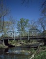 Rolling Mill Road Bridge over Northeast Creek, Cecil County, Maryland LCCN2011633735.tif 4,737 × 6,016; 163.09 nga MB
-
 Seal of Cecil County, Maryland (1674–1968).png 518 × 578; 424 nga KB
-
 Seal of Cecil County, Maryland (1968–2008).png 362 × 376; 137 nga KB
-
 Seal of Cecil County, Maryland.png 1,901 × 1,904; 2.33 nga MB
-
 So that's What's Over the Tree Line (49903936062).jpg 4,000 × 2,250; 9.84 nga MB
-
 The Cecil County Seal, A Study of the Historical Record (2013).pdf 1,275 × 1,650, 5 mga pakli; 117 nga KB
-
 The Elk Mills Monster, elk mills, maryland.jpg 383 × 640; 50 nga KB
-
 Tolchester folio Maryland Plate IV.jpg 984 × 1,149; 655 nga KB
-
 US Route 1 - Maryland (4132199348).jpg 1,024 × 768; 305 nga KB
-
 USA Cecil County, Maryland age pyramid.svg 520 × 600; 7 nga KB
-
 USS Commodore 401B Bow.jpg 587 × 325; 41 nga KB

.jpg)
.jpg)
.jpg)


.jpg)


.jpg)
.jpg)
_(14598307660).jpg)
.png)
.png)
.jpg)


.jpg)

