Category:Cegléd
Vai alla navigazione
Vai alla ricerca
| Posizione del soggetto | | Mappa di tutte le coordinate: OpenStreetMap |
|---|
comune ungherese    | |||||
| Carica un file multimediale | |||||
| Istanza di |
| ||||
|---|---|---|---|---|---|
| Luogo | Distretto di Cegléd, contea di Pest, Ungheria | ||||
| Distretto scolastico |
| ||||
| Popolazione |
| ||||
| Superficie |
| ||||
| sito web ufficiale | |||||
 | |||||
Sottocategorie
Questa categoria contiene le 18 sottocategorie indicate di seguito, su un totale di 18.
2
- 2015 in Cegléd (255 F)
A
- Aerial photographs of Cegléd (3 F)
B
C
- Cegléd in art (2 F)
- Cegléd utca, Debrecen (2 F)
G
- Gates in Cegléd (7 F)
H
M
- Maps of Cegléd (3 F)
P
- Plaques in Cegléd (20 F)
- Products of Cegléd (1 F)
S
- Signs in Cegléd (12 F)
- Stolpersteine in Cegléd (1 F)
- Symbols of Cegléd (8 F)
T
File nella categoria "Cegléd"
Questa categoria contiene 5 file, indicati di seguito, su un totale di 5.
-
 Cegléd k.u.k. Husaren-Kaserne.jpg 700 × 447; 38 KB
-
 Evangelische Kirche in Cegléd.jpg 3 024 × 4 032; 2,39 MB
-

-
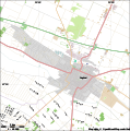 Map of Cegléd.svg 743 × 752; 1,17 MB
-
 Rathaus in Cegléd.jpg 4 032 × 3 024; 4,48 MB


