Category:Chalford
Saltar para a navegação
Saltar para a pesquisa
a village located in Stroud District, United Kingdom  | |||||
| Carregar ficheiro | |||||
| Instância de | |||||
|---|---|---|---|---|---|
| Localização | Stroud, Gloucestershire, Sudoeste da Inglaterra, Inglaterra | ||||
| População |
| ||||
| Diz-se ser o mesmo que | Chalford (página Wikimedia duplicada, paróquia civil) | ||||
 | |||||
Subcategorias
Esta categoria contém as seguintes 7 subcategorias (de um total de 7).
B
C
- Chalford railway station (3 F)
- Chalford Round House (6 F)
- Christ Church, Chalford (2 F)
F
S
- St Mary's Mill, Chalford (10 F)
Multimédia na categoria "Chalford"
Esta categoria contém os seguintes 134 ficheiros (de um total de 134).
-
 ... Chalford Hill, former post office ... right this time R.? (3349246304).jpg 2 048 × 1 536; 1,27 MB
-
 Across the (disused) Thames & Severn Canal - geograph.org.uk - 5361573.jpg 2 504 × 1 878; 1,33 MB
-
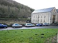 Belvedere Mill - geograph.org.uk - 1054671.jpg 640 × 480; 68 kB
-
 Belvedere Mill, Chalford - geograph.org.uk - 2922356.jpg 640 × 427; 99 kB
-
 Belvedere Mill, Chalford - geograph.org.uk - 2926610.jpg 640 × 427; 67 kB
-
 Belvedere Mill, Chalford - geograph.org.uk - 6632019.jpg 640 × 419; 99 kB
-
 Belvedere Mill, Chalford - geograph.org.uk - 6632027.jpg 640 × 427; 101 kB
-
 Belvedere Mill, Chalford - geograph.org.uk - 6632037.jpg 640 × 409; 117 kB
-
 Beside the Thames and Severn Canal, Chalford - geograph.org.uk - 5492510.jpg 2 592 × 1 944; 1,94 MB
-
 Blackness - geograph.org.uk - 2847794.jpg 1 024 × 680; 217 kB
-
 Bliss Mill, Chalford - geograph.org.uk - 2922365.jpg 640 × 419; 93 kB
-
 Bliss Mill, Chalford - geograph.org.uk - 2926628.jpg 640 × 417; 105 kB
-
 Bliss Mill, Chalford Industrial Estate - geograph.org.uk - 6633589.jpg 640 × 419; 101 kB
-

-
 Bottom of the gardens, Chalford Bottom - geograph.org.uk - 281618.jpg 480 × 640; 126 kB
-
 Bridge over railway line near Valley Corner - geograph.org.uk - 3934178.jpg 4 320 × 3 240; 4,86 MB
-

-
 Brownhills Road - geograph.org.uk - 2847807.jpg 1 024 × 680; 215 kB
-

-
 Buildings on High Street, Chalford - geograph.org.uk - 4893939.jpg 1 024 × 614; 197 kB
-
 Burcombe Road - geograph.org.uk - 5013589.jpg 1 600 × 901; 721 kB
-
 Burcombe Way, Chalford Hill - geograph.org.uk - 5013573.jpg 1 600 × 901; 670 kB
-
 Chalford - geograph.org.uk - 1054675.jpg 640 × 480; 57 kB
-
 Chalford Arches - geograph.org.uk - 1054676.jpg 640 × 480; 94 kB
-
 Chalford Bottom - geograph.org.uk - 144340.jpg 639 × 470; 251 kB
-
 Chalford from railway line - geograph.org.uk - 4697482.jpg 800 × 518; 98 kB
-

-
 Chalford Hill recreation ground - geograph.org.uk - 5013583.jpg 1 600 × 901; 737 kB
-
 Chalford Hill, Chalford - geograph.org.uk - 1020406.jpg 640 × 480; 139 kB
-
 Chalford Waterworks - geograph.org.uk - 1054678.jpg 640 × 480; 79 kB
-
 Chalford, Gloucestershire. (2593180892).jpg 640 × 480; 138 kB
-
 Chalford, postbox № GL6 1, High Street - geograph.org.uk - 3268872.jpg 480 × 640; 103 kB
-
 Chalford.jpg 1 536 × 2 048; 1,31 MB
-
 Chalford8329.JPG 2 048 × 1 536; 794 kB
-
 Chalford8330.JPG 2 048 × 1 536; 818 kB
-
 Chalford8331.JPG 2 048 × 1 536; 835 kB
-
 Chalford8408.JPG 2 048 × 1 536; 780 kB
-
 Chalford8410.JPG 2 048 × 1 536; 827 kB
-
 Chalford8411.JPG 2 048 × 1 536; 827 kB
-
 Chalford8412.JPG 2 048 × 1 536; 821 kB
-
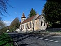 Christ Church, Chalford - geograph.org.uk - 3934373.jpg 4 320 × 3 240; 4,82 MB
-
 Churchyard cross, France Lynch - geograph.org.uk - 4554248.jpg 2 997 × 5 114; 4,14 MB
-
 Clayfields Mill, Chalford - geograph.org.uk - 2971272.jpg 427 × 640; 93 kB
-
 Clayfields Mill, Chalford - geograph.org.uk - 4964204.jpg 1 024 × 768; 283 kB
-
 Clock, France Meeting, Chalford - geograph.org.uk - 1020558.jpg 640 × 479; 129 kB
-
 Coppice Hill, Chalford - geograph.org.uk - 1020398.jpg 640 × 480; 130 kB
-
 Country lane.jpg 2 048 × 1 536; 1,91 MB
-
 Cowcombe Hill Bridge at Chalford - geograph.org.uk - 1597747.jpg 640 × 407; 92 kB
-
 Cowcombe Hill Bridge at Chalford - geograph.org.uk - 1597748.jpg 640 × 431; 102 kB
-
 Culverted Thames ^ Severn Canal, Chalford - geograph.org.uk - 4893956.jpg 1 024 × 768; 198 kB
-
 Dark Lane, Golden Valley - geograph.org.uk - 2647612.jpg 640 × 480; 112 kB
-
 Down the Golden Valley towards Stroud - geograph.org.uk - 1597751.jpg 640 × 427; 118 kB
-

-
 Drystone wall under repair, Chalford - geograph.org.uk - 1020597.jpg 640 × 480; 117 kB
-
 Drystone wall, Brantwood Road, Chalford - geograph.org.uk - 1020615.jpg 640 × 395; 149 kB
-
 EarlySpring.jpg 2 048 × 1 536; 2,81 MB
-

-
 Entrance to Bussage C of E Primary School - geograph.org.uk - 5816555.jpg 4 128 × 2 322; 2,75 MB
-
 Field north of Abnash - geograph.org.uk - 5013597.jpg 1 600 × 901; 659 kB
-
 Footpath across Blackness - geograph.org.uk - 2847801.jpg 1 024 × 680; 233 kB
-
 Footpath in Dimmel's Dale - geograph.org.uk - 5417690.jpg 3 264 × 2 448; 3,27 MB
-
 Footpath, Rack Hill, Chalford - geograph.org.uk - 1020156.jpg 640 × 480; 185 kB
-
 Four storey buildings on the A419, Chalford - geograph.org.uk - 4894808.jpg 1 024 × 768; 492 kB
-
 France Congregational Church and Hall - geograph.org.uk - 2847853.jpg 1 024 × 680; 231 kB
-
 France Meeting, Chalford - geograph.org.uk - 1020552.jpg 640 × 480; 102 kB
-
 Frith Wood, 1 - geograph.org.uk - 5013612.jpg 1 600 × 1 200; 995 kB
-
 Frith Wood, 2 - geograph.org.uk - 5013619.jpg 1 600 × 1 200; 975 kB
-
 Going over Chalford Arches - geograph.org.uk - 1597739.jpg 640 × 427; 89 kB
-
 Golden valley autumn.jpg 1 833 × 1 527; 851 kB
-
 Graves, France Meeting, Chalford - geograph.org.uk - 1020566.jpg 640 × 480; 150 kB
-

-
 House on the London Road, Chalford - geograph.org.uk - 4894013.jpg 768 × 1 024; 523 kB
-
 Houses above the A419 (London Road) - geograph.org.uk - 4894697.jpg 1 024 × 768; 209 kB
-
 Houses adjacent to the Thames and Severn Canal - geograph.org.uk - 3934173.jpg 4 320 × 3 240; 4,73 MB
-
 Houses in Chalford - geograph.org.uk - 2847286.jpg 1 024 × 680; 188 kB
-
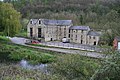
 Iles Lock, Thames & Severn Canal, from the east - geograph.org.uk - 4894646.jpg 1 024 × 768; 264 kB
-
 Iles Lock, Thames & Severn Canal, from the west - geograph.org.uk - 4894653.jpg 1 024 × 768; 220 kB
-

-
 Lynch Road, France Lynch - geograph.org.uk - 5417683.jpg 3 264 × 2 448; 2,92 MB
-
 Marle Hill, Chalford - geograph.org.uk - 1020124.jpg 640 × 480; 169 kB
-
 Marley Lane Bridge at Chalford - geograph.org.uk - 1597731.jpg 640 × 427; 103 kB
-
 Middle Hill - geograph.org.uk - 1969611.jpg 1 200 × 1 600; 301 kB
-
 Middle Hill - geograph.org.uk - 2843556.jpg 1 024 × 680; 173 kB
-
 Mill pond sluices, Belvedere Mill, Chalford - geograph.org.uk - 4894815.jpg 1 024 × 768; 195 kB
-
 Northern Slopes of Golden Valley - geograph.org.uk - 2648332.jpg 640 × 480; 111 kB
-
 Old barn in Golden valley - geograph.org.uk - 4266163.jpg 800 × 531; 132 kB
-
 Oolite.png 2 048 × 1 536; 5,87 MB
-
 Ordnance Survey Cut Mark - geograph.org.uk - 4053358.jpg 480 × 640; 148 kB
-
 Path at Bussage - geograph.org.uk - 5816552.jpg 4 128 × 2 322; 2,58 MB
-
 Pathway at Farmcote Close - geograph.org.uk - 5816559.jpg 4 128 × 2 322; 2 MB
-
 Picturesque Gloucestershire, Chalford. (NBY 440364).jpg 3 600 × 2 334; 1,94 MB
-
 Probable clothier's house, Chalford - geograph.org.uk - 2922244.jpg 640 × 402; 120 kB
-
 Railway overbridge, Chalford - geograph.org.uk - 5802268.jpg 4 000 × 3 000; 4,62 MB
-
 Road Bridge over Railway Line - geograph.org.uk - 1539191.jpg 640 × 348; 63 kB
-
 Road in the Golden Valley - geograph.org.uk - 4262065.jpg 1 024 × 680; 365 kB
-

-
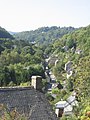
 South across the Frome valley, Chalford - geograph.org.uk - 1020381.jpg 640 × 480; 137 kB
-
 Spout, near Marle Hill, Chalford - geograph.org.uk - 1020521.jpg 640 × 480; 148 kB
-
 Spout, near Marle Hill, Chalford - geograph.org.uk - 1020528.jpg 640 × 480; 209 kB
-
 Steep Path in Oldhills Wood - geograph.org.uk - 5417693.jpg 2 448 × 3 264; 3,54 MB
-
 Taking advantage of steep sided valley, Chalford - geograph.org.uk - 4894805.jpg 1 024 × 768; 150 kB
-
 Thames & Severn Canal, below Iles Lock - geograph.org.uk - 4894649.jpg 1 024 × 768; 204 kB
-
 The down line's getting overgrown - geograph.org.uk - 1597745.jpg 640 × 427; 92 kB
-
 The Frith, Bussage - geograph.org.uk - 5013630.jpg 1 600 × 1 200; 878 kB
-
 The Lamb Inn, Eastcombe - geograph.org.uk - 250134.jpg 640 × 480; 94 kB
-
 The line to Stroud - geograph.org.uk - 1597753.jpg 640 × 407; 102 kB
-
 The River Frome at Chalford Bottom - geograph.org.uk - 4894658.jpg 1 024 × 768; 514 kB
-

-

-
 The Thames & Severn canal, near Belvedere Mill - geograph.org.uk - 4893981.jpg 1 024 × 768; 196 kB
-

-
 The Thames and Severn Canal, at Chalford - geograph.org.uk - 5492507.jpg 2 592 × 1 944; 1,89 MB
-
 The Thames ^ Severn Canal, culverted - geograph.org.uk - 4894168.jpg 1 024 × 768; 218 kB
-
 The Thames ^ Severn Canal, looking westwards - geograph.org.uk - 4894156.jpg 1 024 × 768; 215 kB
-
-
 Tree at Blackness - geograph.org.uk - 2848903.jpg 680 × 1 024; 241 kB
-
 Vatch Lane, Toadsmoor Valley - geograph.org.uk - 5805466.jpg 4 000 × 3 000; 4,88 MB
-

-

-
 View towards Avenis Green, near Chalford - geograph.org.uk - 1020450.jpg 640 × 480; 131 kB
-
 Walking east beside the (disused) Thames and Severn Canal - geograph.org.uk - 5361579.jpg 2 592 × 1 944; 2,22 MB
-

-
 A cotswold wall - geograph.org.uk - 319052.jpg 640 × 480; 127 kB
-
 Aston Down Polo Grounds - geograph.org.uk - 321711.jpg 640 × 480; 86 kB
-
 Charley Barnett's house - geograph.org.uk - 23394.jpg 426 × 640; 25 kB
-
 Hangars - geograph.org.uk - 321714.jpg 640 × 480; 106 kB
-
 House by the lake - geograph.org.uk - 281623.jpg 640 × 480; 100 kB
-
 Lane to Chalford - geograph.org.uk - 115632.jpg 640 × 427; 106 kB
-
 Mixed woodland - geograph.org.uk - 318992.jpg 640 × 480; 183 kB
-
 Near Chapman's Cross - geograph.org.uk - 321716.jpg 640 × 480; 111 kB
-
 Over the rooftops, Eastcombe - geograph.org.uk - 250137.jpg 640 × 480; 120 kB
-
 Stubble field - geograph.org.uk - 273342.jpg 640 × 480; 88 kB
-

-
 Toadsmoor Valley - geograph.org.uk - 46799.jpg 640 × 480; 176 kB
.jpg)
_Thames_%26_Severn_Canal_-_geograph.org.uk_-_5361573.jpg)


.jpg)


_-_geograph.org.uk_-_4894697.jpg)


.jpg)


_Thames_and_Severn_Canal_-_geograph.org.uk_-_5361579.jpg)


