Category:Cheshire
ナビゲーションに移動
検索に移動

イングランドの典礼カウンティ:Bedfordshire · Berkshire · Buckinghamshire · Cambridgeshire · Cheshire · Cornwall · Cumbria · Derbyshire · Devon · Dorset · Durham · East Riding of Yorkshire · East Sussex · Essex · Gloucestershire · Greater London · Greater Manchester · Hampshire · Herefordshire · Hertfordshire · Isle of Wight · Kent · Lancashire · Leicestershire · Lincolnshire · Merseyside · Norfolk · North Yorkshire · Northamptonshire · Northumberland · Nottinghamshire · Oxfordshire · Rutland · Shropshire · Somerset · South Yorkshire · Staffordshire · Suffolk · Surrey · Tyne and Wear · Warwickshire · West Midlands · West Sussex · West Yorkshire · Wiltshire · Worcestershire
City-counties:Bristol · City of London
Former historic counties:Cumberland · Huntingdonshire · London · Middlesex · North Riding of Yorkshire · Sussex · West Riding of Yorkshire · Westmorland · Yorkshire
Other former counties:Avon · Cambridgeshire and Isle of Ely · Cleveland · East Suffolk · Hereford and Worcester · Hexhamshire · Humberside · Huntingdon and Peterborough · Isle of Ely · Parts of Holland · Parts of Kesteven · Parts of Lindsey · Soke of Peterborough · West Suffolk
イングランドの州      | |||||
| メディアをアップロード | |||||
| 分類 |
| ||||
|---|---|---|---|---|---|
| 場所 | |||||
| 行政中心地 | |||||
| 人口 |
| ||||
| 面積 |
| ||||
| 以下と異なる | |||||
| 同一とされる事物 | チェシャー (イングランドの歴史的カウンティ, イングランドの典礼カウンティ, 1844年) | ||||
 | |||||
下位カテゴリ
このカテゴリに属する 46 個のサブカテゴリのうち、 46 個を表示しています。
!
- Featured pictures of Cheshire (5ファイル)
?
A
B
C
- Charities of Cheshire (1ファイル)
- Cheshire cheese (3ファイル)
- Earthworks in Cheshire (2ファイル)
E
F
- Flower decorations in Cheshire (2ファイル)
G
- Gallery pages of Cheshire (7ページ)
H
I
M
N
- Night in Cheshire (48ファイル)
P
- Picnic tables in Cheshire (5ファイル)
S
T
V
カテゴリ「Cheshire」にあるメディア
このカテゴリに属する 66 個のファイルのうち、 66 個を表示しています。
-
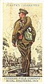 Cheshire Field Company, Royal Engineers Cigarette Card.jpg 412 × 792;120キロバイト
-
 Cheshire Golden Triangle.jpg 2,350 × 1,554;154キロバイト
-
 Cheshire in 1830.jpg 833 × 527;185キロバイト
-
 Cheshire jungle, UK, 2021. (51095214568).jpg 3,888 × 3,888;23.18メガバイト
-
 Cheshire Plain (8695597767).jpg 4,594 × 2,566;3.59メガバイト
-
 CheshireCheese.gif 438 × 99;8キロバイト
-
 A glossary of words used in the dialect of Cheshire (IA cu31924026612717).pdf 697 × 1,143、288 ページ;5.65メガバイト
-
En-Cheshire.oga 1.1秒;11キロバイト
-
 ENWL logo.jpg 228 × 55;14キロバイト
-
 Farmland, Barrows Green © N Chadwick.jpg 640 × 426;46キロバイト
-
 Field (9287358413).jpg 2,848 × 4,272;6.69メガバイト
-
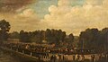 Francis Dukinfield Astley in Procession as High Sheriff (1806-07).jpg 1,000 × 573;78キロバイト
-
 Grassland - geograph.org.uk - 793841.jpg 640 × 480;63キロバイト
-
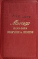 A handbook for residents and travellers in Shropshire and Cheshire (IA handbookforresid00unse 1).pdf 1,118 × 1,716、281 ページ;23.71メガバイト
-
 Howley Lock on the Mersey Way path - geograph.org.uk - 1009587.jpg 640 × 479;128キロバイト
-
 Junction of the A50 and the B5081 - geograph.org.uk - 1617507.jpg 640 × 480;114キロバイト
-
 Le mangie.png 806 × 744;27キロバイト
-
 Lea-by-Backford, Cheshire, UK, 2021. (51446643868).jpg 3,209 × 1,404;3.79メガバイト
-
 Little Leigh02LB.jpg 4,608 × 3,456;3.47メガバイト
-
 Marton Oak, Cheshire.jpg 4,618 × 3,464;3.14メガバイト
-
 Medieval silver-gilt finger ring.jpg 2,048 × 1,536;832キロバイト
-
 Midwinter farmland, mud and ice - geograph.org.uk - 1102320.jpg 640 × 480;165キロバイト
-
 Noctilucent Clouds.jpg 4,608 × 3,456;9.87メガバイト
-
 Old Pale Hill (22779570870).jpg 3,264 × 1,840;1.94メガバイト
-
 Old Pale Hill (22978713131).jpg 3,264 × 1,840;1.89メガバイト
-
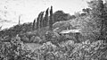 Oldfield, Dunham (1882).jpg 1,000 × 562;179キロバイト
-
 OultonSmithy.jpg 4,871 × 2,121;1.5メガバイト
-
 Pale Hill (30107732442).jpg 4,000 × 3,000;2.7メガバイト
-
 Pale Hill (30107747272).jpg 4,000 × 3,000;3.07メガバイト
-
 Pale Hill (30107754752).jpg 4,000 × 3,000;2.71メガバイト
-
 Pale Hill (30222636625).jpg 4,000 × 3,000;2.88メガバイト
-
 Pasture near Hollin Green - geograph.org.uk - 823039.jpg 640 × 427;115キロバイト
-
-
 Steam pipes (30222562375).jpg 4,000 × 3,000;3.7メガバイト
-

-
 Sunrise over Cheshire.jpg 4,096 × 1,310;1.23メガバイト
-
 The A559 looking South at Lower Stretton - geograph.org.uk - 1110706.jpg 640 × 426;60キロバイト
-
 The other side of the hedge - geograph.org.uk - 795228.jpg 640 × 480;80キロバイト
-
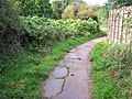
 Track to Northwoods Farm - geograph.org.uk - 793475.jpg 640 × 480;67キロバイト
-
 Transpennine Trail and landfill access bridge - geograph.org.uk - 1705699.jpg 1,600 × 1,200;609キロバイト
-
 Transpennine Trail signpost - geograph.org.uk - 1705721.jpg 1,600 × 1,200;417キロバイト
-
 Tree in field boundary, near Egerton Green - geograph.org.uk - 712379.jpg 515 × 640;168キロバイト
-
 Trees at Roaring Brook Park. - panoramio.jpg 2,048 × 1,536;882キロバイト
-
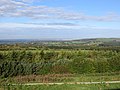
 View from Weston Hill - geograph.org.uk - 1003222.jpg 640 × 422;75キロバイト
-
 View of Dukinfield Lodge (1795).jpg 697 × 484;222キロバイト
-
 Voyager at Ackers Crossing - geograph.org.uk - 1528295.jpg 640 × 367;47キロバイト
-
 Y ffin ger Caer Border between Wales and England twixt Chester and Sealand 01.jpg 3,264 × 1,836;1.69メガバイト
-
 Y ffin ger Caer Border between Wales and England twixt Chester and Sealand 02.jpg 3,264 × 1,836;1.71メガバイト
-
 Y ffin ger Caer Border between Wales and England twixt Chester and Sealand 03.jpg 3,264 × 1,836;2.97メガバイト
-
 Y ffin ger Caer Border between Wales and England twixt Chester and Sealand 04.jpg 3,264 × 1,836;3.45メガバイト
-

-
 Across Cheshire to Lancashire - geograph.org.uk - 146087.jpg 640 × 426;62キロバイト
-
 Aston Heath, Aston - geograph.org.uk - 153143.jpg 640 × 480;82キロバイト
-
 Bate Mill - geograph.org.uk - 35833.jpg 640 × 480;97キロバイト
-
 Cuddington mill pool - geograph.org.uk - 216800.jpg 640 × 480;100キロバイト
-
-
 Holly Bush Lane, Rixton Moss - geograph.org.uk - 33234.jpg 640 × 480;113キロバイト
-
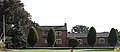
 Kenyon Hall - geograph.org.uk - 58336.jpg 640 × 480;98キロバイト
-
 Meadow at The Devisdale - geograph.org.uk - 113353.jpg 480 × 640;125キロバイト
-
 Meadowbank Mine - geograph.org.uk - 60311.jpg 480 × 640;47キロバイト
-
 More Maize - geograph.org.uk - 45600.jpg 640 × 480;188キロバイト
-
 Old mines near Eagle and Child - geograph.org.uk - 59812.jpg 640 × 480;65キロバイト
-
 Oulton Mill Pool - geograph.org.uk - 177797.jpg 640 × 512;147キロバイト
-
 Pool next to Whitegate Way - geograph.org.uk - 432.jpg 512 × 640;64キロバイト
-
 Salt dome, Meadowbank Mine - geograph.org.uk - 60312.jpg 640 × 480;95キロバイト
-
 Satanic Mills - geograph.org.uk - 158564.jpg 640 × 480;97キロバイト


.jpg)
.jpg)

.jpg)
.jpg)


.jpg)


.jpg)
.jpg)
.jpg)

.jpg)
.jpg)
.jpg)
.jpg)


.jpg)


.jpg)


