Category:Chhindwara district
Jump to navigation
Jump to search
Districts of Madhya Pradesh: Agar Malwa · Alirajpur · Anuppur · Ashoknagar · Balaghat · Barwani · Betul · Bhind · Bhopal · Burhanpur · Chhatarpur · Chhindwara · Damoh · Datia · Dewas · Dhar · Dindori · Guna · Gwalior · Harda · Indore · Jabalpur · Jhabua · Katni · Khandwa · Khargone · Maihar · Mandla · Mandsaur · Mauganj · Morena · Narmadapuram · Narsinghpur · Neemuch · Niwari · Pandhurna · Panna · Raisen · Rajgarh · Ratlam · Rewa · Sagar · Satna · Sehore · Seoni · Shahdol · Shajapur · Sheopur · Shivpuri · Sidhi · Singrauli · Tikamgarh · Ujjain · Umaria · Vidisha
district of Madhya Pradesh, India    | |||||
| Upload media | |||||
| Instance of | |||||
|---|---|---|---|---|---|
| Location |
| ||||
| Capital | |||||
| Population |
| ||||
| Area |
| ||||
| official website | |||||
 | |||||

Subcategories
This category has the following 9 subcategories, out of 9 total.
C
- Chhindwara (9 F)
D
K
- Kali Bari Chhindwara (1 F)
L
- Lodhikheda (7 F)
- Lohangi (3 F)
M
- Mohi Dam (3 F)
P
S
- Sausar (5 F)
Media in category "Chhindwara district"
The following 18 files are in this category, out of 18 total.
-
 A small hut in a farm of small village of Chhindwara.jpg 3,840 × 2,160; 2.95 MB
-
 A Temple on Highway - panoramio.jpg 4,018 × 3,001; 3.78 MB
-
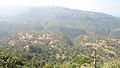 An aerial view of Patalkot.jpg 4,320 × 2,432; 3.43 MB
-
 Bandar Wala Dhaba on Betul Highway - panoramio.jpg 5,184 × 3,456; 4.9 MB
-
 Bandariya wala Dhaba on Betul Highway - panoramio.jpg 5,184 × 3,456; 6.53 MB
-
 Chhindwara-dist.JPG 600 × 480; 221 KB
-
 Government Primary School, Mohkheda-Mau - panoramio - Kailash Mohankar.jpg 4,608 × 3,456; 2.86 MB
-
 Government Primary School, Mohkheda-Mau - panoramio.jpg 4,608 × 3,456; 3.15 MB
-
 Jam Sawali Hanuman temple - panoramio.jpg 4,608 × 3,456; 3.79 MB
-
 Jamsavli Temple.jpg 738 × 475; 68 KB
-
 Kanhan River near Ramakona.jpg 1,600 × 1,200; 802 KB
-
 Keruphul (Assamese- কেৰুফুল) (9937727063).jpg 4,000 × 3,000; 4.5 MB
-
 Late Chandrabhaga Pethe Government Excellence School, Mohkhed - panoramio.jpg 4,608 × 3,456; 3.54 MB
-
 Madhya Pradesh district location map Chhindwara.svg 1,639 × 1,852; 744 KB
-

-
 Panchvalley Express Logo.jpg 1,024 × 768; 119 KB
-
 Parts of Hoshangabad, Betul and Chhindwara, Indian Atlas, sheets 71, 72, 53, 54 (15214002).jpg 27,201 × 17,902; 268.24 MB
-
 दायीं तट मुख्य नहर.jpg 3,071 × 3,628; 5.53 MB


_(9937727063).jpg)


.jpg)
