Category:Clapham, West Sussex
Jump to navigation
Jump to search
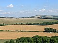
English: Clapham is a village and civil parish in the Arun District of West Sussex, England. The parish has a population of 317 (2001 census) in an area of . It lies three miles north of Angmering on the A280 road and north of the A27 crossroads. It is adjacent to the village of Patching.
village and civil parish in West Sussex, UK  | |||||
| Upload media | |||||
| Instance of | |||||
|---|---|---|---|---|---|
| Location | Arun, West Sussex, South East England, England | ||||
| Area |
| ||||
| Said to be the same as | Clapham (Wikimedia duplicated page, civil parish) | ||||
| official website | |||||
 | |||||
Subcategories
This category has the following 3 subcategories, out of 3 total.
C
M
- Michelgrove arms (8 F)
Media in category "Clapham, West Sussex"
The following 159 files are in this category, out of 159 total.
-
 A27 Slip Road - geograph.org.uk - 5489590.jpg 467 × 640; 77 KB
-
 A27, eastbound - geograph.org.uk - 3683471.jpg 640 × 430; 53 KB
-
 A280 overbridge, A27 - geograph.org.uk - 3683465.jpg 640 × 430; 46 KB
-
 Approaching Gates on the Bridleway - geograph.org.uk - 5926348.jpg 1,600 × 1,200; 461 KB
-
 Approaching Pot Lane - geograph.org.uk - 5897696.jpg 1,600 × 1,065; 778 KB
-
 Arundel Road - geograph.org.uk - 3535687.jpg 640 × 480; 100 KB
-
 Arundel Road - geograph.org.uk - 5489595.jpg 640 × 480; 72 KB
-
 Arundel Road - geograph.org.uk - 5516110.jpg 640 × 480; 57 KB
-
 Ash Field - geograph.org.uk - 3631225.jpg 640 × 480; 73 KB
-
 Barn Field - geograph.org.uk - 3568198.jpg 640 × 480; 52 KB
-
 Blackpatch Hill - geograph.org.uk - 3499364.jpg 640 × 480; 64 KB
-
 Blackpatch Hill - geograph.org.uk - 3630710.jpg 640 × 480; 93 KB
-
 Blackpatch Hill - geograph.org.uk - 3631322.jpg 640 × 480; 81 KB
-
 Blackpatch Hill - geograph.org.uk - 3642465.jpg 640 × 480; 56 KB
-
 Blackpatch Hill - geograph.org.uk - 3656165.jpg 640 × 480; 115 KB
-
 Blackpatch Hill - geograph.org.uk - 4214422.jpg 640 × 428; 146 KB
-

-
 Brickworks Lane and Clapham Common.JPG 640 × 480; 38 KB
-
 Bridleway 2173 - geograph.org.uk - 4213744.jpg 640 × 428; 270 KB
-
 Bridleway 2173 - geograph.org.uk - 4213757.jpg 640 × 428; 311 KB
-
 Bridleway 2173 climbing the western slope of Blackpatch Hill - geograph.org.uk - 2481618.jpg 4,000 × 3,000; 3.57 MB
-

-
 Bridleway passes Keepers Cottage - geograph.org.uk - 4666214.jpg 800 × 600; 170 KB
-
 Bridleway to Blackpatch Hill - geograph.org.uk - 1985131.jpg 600 × 800; 112 KB
-
 Bush Field - geograph.org.uk - 3568449.jpg 640 × 480; 90 KB
-
 Castle Goring Mews - geograph.org.uk - 3570598.jpg 640 × 480; 71 KB
-
 Cattle troughs, Blackpatch Hill - geograph.org.uk - 1924176.jpg 640 × 428; 96 KB
-
 Church Copse - geograph.org.uk - 1333783.jpg 640 × 480; 184 KB
-
 Church House - geograph.org.uk - 3568406.jpg 480 × 640; 74 KB
-
 Clapham and Patching CE Primary School.JPG 640 × 480; 43 KB
-
 Clapham Church - geograph.org.uk - 6057215.jpg 1,600 × 1,200; 774 KB
-
 Clapham Close - geograph.org.uk - 3568418.jpg 640 × 478; 85 KB
-
 Clapham Common - geograph.org.uk - 1333813.jpg 480 × 640; 183 KB
-
 Clapham Common - geograph.org.uk - 1333816.jpg 640 × 480; 118 KB
-
 Clapham Farm - geograph.org.uk - 1333801.jpg 480 × 640; 95 KB
-
 Clapham Lighthouse.JPG 3,264 × 2,448; 2.19 MB
-
 Clapham Wood - geograph.org.uk - 1333781.jpg 640 × 480; 66 KB
-
 Clearing in Clapham Wood - geograph.org.uk - 870293.jpg 640 × 480; 101 KB
-
 Clearing, Clapham Wood - geograph.org.uk - 3535440.jpg 640 × 480; 74 KB
-
 Cottage on the southern side of the A27 dual carriageway - geograph.org.uk - 2635845.jpg 4,000 × 3,000; 3.1 MB
-
 Crossing Water Lane - geograph.org.uk - 5897688.jpg 1,024 × 640; 184 KB
-
 Dew Pond, Blackpatch Hill - geograph.org.uk - 3630753.jpg 640 × 480; 80 KB
-
 Dual carriageway woodland track - geograph.org.uk - 1736374.jpg 640 × 428; 167 KB
-
 Dumpkins - geograph.org.uk - 3568447.jpg 640 × 480; 84 KB
-
 East Field - geograph.org.uk - 5489577.jpg 640 × 480; 63 KB
-
 Entering Worthing on Titnore Lane - geograph.org.uk - 5817273.jpg 1,990 × 1,454; 1.19 MB
-
 Entering Worthing, A27 - geograph.org.uk - 3683474.jpg 640 × 383; 55 KB
-
 Entrance to Castle Goring Mews - geograph.org.uk - 4843894.jpg 640 × 480; 69 KB
-
 Farmers Mead - geograph.org.uk - 3568412.jpg 640 × 480; 72 KB
-
 Field gate and stile east of Clapham - geograph.org.uk - 4666225.jpg 800 × 600; 105 KB
-
 Field, Clapham Wood - geograph.org.uk - 3535479.jpg 640 × 480; 80 KB
-

-
 Footpath goes past redundant stile - geograph.org.uk - 4666179.jpg 800 × 600; 138 KB
-

-
 Footpath joins bridleway in Clapham Wood - geograph.org.uk - 4666231.jpg 800 × 600; 183 KB
-
 Footpath junction with Grub Ride - geograph.org.uk - 4666200.jpg 800 × 600; 169 KB
-

-
 Furze Field - geograph.org.uk - 3535679.jpg 640 × 480; 82 KB
-
 Gate on bridleway 2173 - geograph.org.uk - 4214000.jpg 640 × 428; 255 KB
-
 Gate on the Monarch’s Way - geograph.org.uk - 6069301.jpg 1,024 × 768; 221 KB
-
 Grub Ride - geograph.org.uk - 3535463.jpg 640 × 480; 115 KB
-
 Grub Ride - geograph.org.uk - 3535471.jpg 640 × 480; 112 KB
-
 Grub Ride, Clapham Wood - geograph.org.uk - 870413.jpg 640 × 480; 99 KB
-
 Harrow Hill - geograph.org.uk - 3630730.jpg 640 × 480; 54 KB
-
 Heading to Clapham - geograph.org.uk - 6057239.jpg 1,600 × 1,200; 441 KB
-
 Holt Farm - geograph.org.uk - 2635824.jpg 4,000 × 3,000; 3.52 MB
-
 Holt Farm - geograph.org.uk - 3535670.jpg 640 × 480; 81 KB
-
 Holt Farm House - geograph.org.uk - 3535675.jpg 480 × 640; 102 KB
-
 Holt Lane - geograph.org.uk - 3568455.jpg 480 × 640; 74 KB
-
 Holt Rough-Holt Parks - geograph.org.uk - 3568454.jpg 640 × 480; 74 KB
-
 Holt West Field - geograph.org.uk - 3535646.jpg 640 × 480; 102 KB
-
 Horses grazing, Longfurlong Farm - geograph.org.uk - 1924120.jpg 640 × 428; 97 KB
-
 Junction of track off Titnore Road - geograph.org.uk - 4684920.jpg 800 × 600; 131 KB
-
 Junction of tracks in Clapham Wood - geograph.org.uk - 870419.jpg 640 × 480; 107 KB
-
 Keepers Cottage - geograph.org.uk - 3535503.jpg 640 × 480; 121 KB
-
 Line of Trees - geograph.org.uk - 5926296.jpg 1,600 × 1,051; 421 KB
-
 Little East House - geograph.org.uk - 3535719.jpg 640 × 480; 93 KB
-
 Little Thatch, The Street - geograph.org.uk - 3568430.jpg 640 × 478; 90 KB
-
 Long Field - geograph.org.uk - 3568445.jpg 640 × 480; 89 KB
-
 Long narrow clearing in Clapham Wood - geograph.org.uk - 2635802.jpg 4,000 × 3,000; 3.45 MB
-
 Long shadow over Longfurlong - geograph.org.uk - 1631624.jpg 640 × 480; 79 KB
-
 Longfurlong - geograph.org.uk - 1736391.jpg 640 × 428; 110 KB
-
 Longfurlong - geograph.org.uk - 3568191.jpg 640 × 480; 69 KB
-
 Longfurlong Barn - geograph.org.uk - 3568194.jpg 640 × 480; 67 KB
-
 Longfurlong Barn - geograph.org.uk - 4213037.jpg 640 × 428; 254 KB
-
 Longfurlong Cottages - geograph.org.uk - 3568192.jpg 480 × 640; 57 KB
-
 Longfurlong Farm - geograph.org.uk - 3642406.jpg 640 × 480; 86 KB
-
 Looking east on the forbidden Grub Ride - geograph.org.uk - 4666195.jpg 800 × 600; 185 KB
-

-
 Looking westwards towards Worthing Lodge - geograph.org.uk - 4843889.jpg 640 × 480; 118 KB
-
 Lower Hammers-Upper Hammers - geograph.org.uk - 3535655.jpg 640 × 480; 82 KB
-
 Middle Field - geograph.org.uk - 3568441.jpg 640 × 480; 94 KB
-
 Middle Field-Barn Field - geograph.org.uk - 3631285.jpg 640 × 469; 65 KB
-
 Monarch's Way - geograph.org.uk - 3656186.jpg 640 × 471; 95 KB
-
 North Vale Field - geograph.org.uk - 3631345.jpg 640 × 480; 70 KB
-
 Oaks on Grub Ride, Clapham - geograph.org.uk - 740765.jpg 640 × 480; 99 KB
-
 Old Chalk Pit - geograph.org.uk - 3568195.jpg 640 × 480; 121 KB
-
 Old Denshire-Barn Field-New Denshire - geograph.org.uk - 3630603.jpg 640 × 480; 88 KB
-
 Old farm cart on bridleway to the A27 - geograph.org.uk - 2635812.jpg 4,000 × 3,000; 3.28 MB
-
 Old Toll House by Long Furlong, Clapham (geograph 6114731).jpg 798 × 600; 131 KB
-
 Old Water Dept stone - geograph.org.uk - 1631637.jpg 640 × 480; 140 KB
-
 Open space in Clapham Wood - geograph.org.uk - 740778.jpg 640 × 480; 76 KB
-
 Outbuilding, Holt Farm - geograph.org.uk - 3568450.jpg 640 × 480; 80 KB
-
 Outer Leper-Inner Leper - geograph.org.uk - 3631274.jpg 640 × 471; 73 KB
-

-
 Path east to bridleway - geograph.org.uk - 4666221.jpg 800 × 600; 133 KB
-
 Path junction in Richardson's Wood - geograph.org.uk - 2635796.jpg 4,000 × 3,000; 3.47 MB
-
 Perfectly rounded Blackpatch Hill - geograph.org.uk - 2481609.jpg 4,000 × 3,000; 3.53 MB
-
 Permissive access, Blackpatch Hill - geograph.org.uk - 4214023.jpg 640 × 428; 282 KB
-
 Pheasant looking for food on Grub Ride - geograph.org.uk - 2635806.jpg 4,000 × 3,000; 3.81 MB
-
 Ponies and riders on Blackpatch Hill - geograph.org.uk - 1985152.jpg 800 × 600; 76 KB
-
 Pot Lane - geograph.org.uk - 5897703.jpg 1,024 × 651; 203 KB
-

-
 Reclaimed Field, Clapham Common - geograph.org.uk - 1333831.jpg 640 × 480; 91 KB
-
 Remains of the Former A27 - geograph.org.uk - 1333821.jpg 480 × 640; 69 KB
-
 Right of way marker on Blackpatch Hill - geograph.org.uk - 1985149.jpg 600 × 800; 141 KB
-
 Sharp bend on the A280 - geograph.org.uk - 2481674.jpg 4,000 × 3,000; 3.3 MB
-
 Sign entering Worthing on Titnore Lane - geograph.org.uk - 5817277.jpg 2,048 × 1,536; 1.44 MB
-
 Silage bales at Holt Farm - geograph.org.uk - 2635820.jpg 4,000 × 3,000; 3.44 MB
-
 Simmonds Green - geograph.org.uk - 3535495.jpg 640 × 480; 82 KB
-
 South Vale Field-Hill Field - geograph.org.uk - 3631333.jpg 640 × 594; 94 KB
-
 Spooky Corner, Church Copse - geograph.org.uk - 1333787.jpg 480 × 640; 133 KB
-
 Stanhope Lodge geograph-3535709-by-Simon-Carey.jpg 640 × 480; 69 KB
-
 Sunflowers ready for harvest by bridleway 2939 - geograph.org.uk - 2635817.jpg 4,000 × 3,000; 3.63 MB
-
 Tennants Down - geograph.org.uk - 3568196.jpg 640 × 480; 81 KB
-
 The Bar Field - geograph.org.uk - 3535661.jpg 640 × 480; 93 KB
-
 The Coach and Horses Inn geograph-3535698-by-Simon-Carey.jpg 640 × 480; 80 KB
-
 The Coach and Horses, nr Worthing - geograph.org.uk - 4377.jpg 640 × 480; 66 KB
-
 The Four Acres-Lanes Field - geograph.org.uk - 3535505.jpg 640 × 480; 101 KB
-
 The Green - geograph.org.uk - 3568392.jpg 640 × 480; 76 KB
-
 The Old Toll Gate - geograph.org.uk - 3568189.jpg 640 × 475; 74 KB
-
 The Street - geograph.org.uk - 3568424.jpg 640 × 480; 79 KB
-
 The Street, Clapham.JPG 480 × 640; 24 KB
-
 The Ten Acre Glebe - geograph.org.uk - 3568202.jpg 640 × 480; 88 KB
-
 The Ten Acres - geograph.org.uk - 3568199.jpg 640 × 480; 87 KB
-
 Track beside Church Copse - geograph.org.uk - 6057203.jpg 1,024 × 768; 315 KB
-
 Track, Clapham Wood - geograph.org.uk - 3535484.jpg 480 × 640; 130 KB
-
 Traffic on road bridge - geograph.org.uk - 611764.jpg 640 × 480; 68 KB
-
 Trig Point S5997, Blackpatch Hill - geograph.org.uk - 3631309.jpg 640 × 480; 85 KB
-
 Turfed Area, Blackpatch Hill - geograph.org.uk - 3630761.jpg 640 × 480; 78 KB
-

-
 View south-west from Blackpatch Hill - geograph.org.uk - 4213772.jpg 640 × 428; 263 KB
-
 Weatherbird by bridleway - geograph.org.uk - 4666212.jpg 800 × 600; 117 KB
-
 Weathercock by bridleway - geograph.org.uk - 4666217.jpg 800 × 600; 105 KB
-
 Wood Barn Field - geograph.org.uk - 3568443.jpg 640 × 480; 83 KB
-
 Woodland Field - geograph.org.uk - 3568439.jpg 640 × 480; 94 KB
-
 Worthing Lodge - geograph.org.uk - 3570594.jpg 640 × 480; 109 KB
-
 Clapham Common - geograph.org.uk - 25562.jpg 640 × 456; 51 KB
-
 Clapham Farm - geograph.org.uk - 28482.jpg 640 × 460; 59 KB
-
 Clapham pathways - geograph.org.uk - 28402.jpg 640 × 480; 104 KB
-
 Clapham Wood - geograph.org.uk - 28472.jpg 640 × 480; 80 KB
-
 Footpath to Clapham - geograph.org.uk - 740739.jpg 640 × 480; 92 KB
-
 Long Furlong - geograph.org.uk - 28403.jpg 640 × 480; 98 KB
-
 Longfurlong Barn - geograph.org.uk - 246501.jpg 640 × 479; 145 KB
-
 Longfurlong Farm - geograph.org.uk - 254976.jpg 640 × 480; 73 KB
-
 Longfurlong Farm - geograph.org.uk - 28473.jpg 640 × 480; 46 KB
-
 Monarchs Way and Longfurlong Farm - geograph.org.uk - 254902.jpg 800 × 547; 104 KB
-
 Myrtle Grove House - geograph.org.uk - 254978.jpg 640 × 480; 121 KB
-
 The Old Tollgate - geograph.org.uk - 270046.jpg 640 × 480; 98 KB


.jpg)


