Category:Clark County, Wisconsin
Zur Navigation springen
Zur Suche springen
Counties of Wisconsin: Adams · Ashland · Barron · Bayfield · Brown · Buffalo · Burnett · Calumet · Chippewa · Clark · Columbia · Crawford · Dane · Dodge · Door · Douglas · Dunn · Eau Claire · Florence · Fond du Lac · Forest · Grant · Green · Green Lake · Iowa · Iron · Jackson · Jefferson · Juneau · Kenosha · Kewaunee · La Crosse · Lafayette · Langlade · Lincoln · Manitowoc · Marathon · Marinette · Marquette · Menominee · Milwaukee · Monroe · Oconto · Oneida · Outagamie · Ozaukee · Pepin · Pierce · Polk · Portage · Price · Racine · Richland · Rock · Rusk · Sauk · Sawyer · Shawano · Sheboygan · St. Croix · Taylor · Trempealeau · Vernon · Vilas · Walworth · Washburn · Washington · Waukesha · Waupaca · Waushara · Winnebago · Wood
County im US-Bundesstaat Wisconsin   | |||||
| Medium hochladen | |||||
| Ist ein(e) | |||||
|---|---|---|---|---|---|
| Benannt nach | |||||
| Ort | Wisconsin | ||||
| Hauptstadt | |||||
| Datum der Gründung, Erstellung, Entstehung, Erbauung |
| ||||
| Einwohnerzahl |
| ||||
| Fläche |
| ||||
| offizielle Website | |||||
 | |||||
English: Media related to Clark County, Wisconsin, a county in Wisconsin, United States.
Unterkategorien
Es werden 10 von insgesamt 10 Unterkategorien in dieser Kategorie angezeigt:
In Klammern die Anzahl der enthaltenen Kategorien (K), Seiten (S), Dateien (D)
Medien in der Kategorie „Clark County, Wisconsin“
Folgende 39 Dateien sind in dieser Kategorie, von 39 insgesamt.
-
 Chili Wisconsin.jpg 3.648 × 2.736; 4,76 MB
-
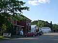
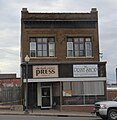 Clark County Press building.jpg 1.437 × 1.476; 727 KB
-
 Clark County Wisconsin fairgrounds grandstands.jpg 2.592 × 1.728; 1,98 MB
-
 Clark County Wisconsin Sign WIS13.jpg 1.936 × 1.288; 760 KB
-
 Clark Wisconsin.jpg 3.364 × 2.728; 3,86 MB
-
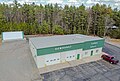 Dewhurst, Wisconsin Town Hall.jpg 3.910 × 2.652; 7,83 MB
-

-

-
-
-

-

-

-
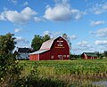 Farm south of Withee Wisconsin.jpg 3.195 × 2.601; 3,7 MB
-
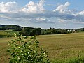 Farmland in Hendren Clark County Wisconsin.jpg 3.565 × 2.675; 1,59 MB
-
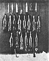 Furs caught by Edwin Krejci in Clark County, Wisconsin, 1917.jpg 910 × 1.138; 948 KB
-
 Globe Wisconsin.jpg 3.648 × 2.504; 1,52 MB
-
 Grant Clark County Wisc soybeans.jpg 3.648 × 2.736; 4,73 MB
-
 Granton Wisconsin Snowy Forest (31313637863).jpg 5.760 × 3.840; 26,83 MB
-
 Granton, Wisconsin.jpg 6.266 × 2.793; 11,37 MB
-
 Hendren Wisconsin Town Shed.jpg 1.569 × 1.026; 477 KB
-
 Highground Park-2.jpg 3.948 × 2.929; 7,67 MB
-
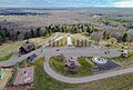 Highground Park.jpg 3.953 × 2.660; 7,4 MB
-
 Humbird Wisconsin.jpg 3.648 × 2.736; 4,68 MB
-
 Lynn, Wisconsin.jpg 4.000 × 3.000; 7,41 MB
-
 Marshfield Medical Center-Neillsville.jpg 6.891 × 1.631; 6,17 MB
-
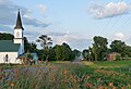
 Nasonville, Wisconsin.jpg 3.889 × 2.579; 6,41 MB
-
 Neillsville airport.jpg 6.497 × 2.868; 11,05 MB
-
 Neillsville High School.jpg 6.128 × 3.000; 10,98 MB
-
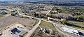
 Neillsville, Wisconsin aerial.jpg 6.863 × 2.749; 11,1 MB
-
 Slovenian National Home hall in Willard Wisconsin.jpg 3.648 × 2.736; 4,69 MB
-
 Sunset Over Levis Mound (154581443).jpeg 2.048 × 1.367; 919 KB
-
 USA Clark County, Wisconsin age pyramid.svg 520 × 600; 7 KB
-
 Warning - Buried Cable or Fiber Optics - TDS Telecom-Neillsville (31304289804).jpg 3.827 × 2.686; 5,26 MB
-
 Weston Amish corn shocks.jpg 4.096 × 3.072; 3,94 MB
-
 White Barn with Three Silos - panoramio.jpg 3.830 × 3.325; 5,9 MB
-
 Willard Wisconsin July 8 2023.jpg 3.615 × 1.824; 892 KB
-
 Wisconsin Highway 95 north terminus.jpg 2.592 × 1.728; 2,3 MB
-
 Wisconsin Highway 98 looking east from west terminuns.jpg 2.142 × 1.356; 746 KB


.jpg)
.jpg)
.jpg)
.jpg)
.jpg)
.jpg)
.jpg)


.jpg)


.jpeg)

.jpg)


