Category:Clifford, West Yorkshire
Jump to navigation
Jump to search
village and civil parish in West Yorkshire, England  | |||||
| Upload media | |||||
| Instance of | |||||
|---|---|---|---|---|---|
| Location | Leeds, West Yorkshire, Yorkshire and the Humber, England | ||||
| Population |
| ||||
 | |||||
Subcategories
This category has the following 8 subcategories, out of 8 total.
B
H
N
S
Media in category "Clifford, West Yorkshire"
The following 111 files are in this category, out of 111 total.
-
 20190707-Transdev-1855.jpg 5,328 × 4,000; 9.53 MB
-
 A1(M) - Clifford Moor - geograph.org.uk - 2646924.jpg 640 × 428; 76 KB
-
 A1(M) - exit at junction 45 - geograph.org.uk - 2646938.jpg 640 × 428; 62 KB
-
 A1(M) heading north - geograph.org.uk - 2040860.jpg 640 × 480; 48 KB
-
 A1(M) near Clifford Moor Farm - geograph.org.uk - 5396299.jpg 640 × 481; 43 KB
-
 A1(M), Clifford Moor - geograph.org.uk - 4806024.jpg 640 × 338; 20 KB
-

-

-
 Albion Terrace - Albion Street - geograph.org.uk - 5202191.jpg 640 × 480; 70 KB
-
 Approaching J45, A1(M) - geograph.org.uk - 3038466.jpg 640 × 430; 37 KB
-
 Ashmead - Willow Lane - geograph.org.uk - 5202140.jpg 640 × 480; 61 KB
-
 Baptismal Well - Bramham Road, Clifford - geograph.org.uk - 949886.jpg 465 × 640; 254 KB
-
 Bar Lane, Boston Spa - geograph.org.uk - 295507.jpg 640 × 458; 68 KB
-
 Bellwood Avenue - Moor Avenue - geograph.org.uk - 5202164.jpg 640 × 480; 66 KB
-
 Bellwood Avenue - Willow Lane - geograph.org.uk - 5202159.jpg 640 × 480; 71 KB
-
 Boston Road - geograph.org.uk - 5613950.jpg 640 × 427; 207 KB
-

-

-
 Boston Road towards Boston Spa - geograph.org.uk - 5614125.jpg 640 × 427; 185 KB
-
 Burns Way - Albion Street - geograph.org.uk - 5202238.jpg 640 × 480; 64 KB
-

-
 Chapel Lane meets High Street - geograph.org.uk - 5614768.jpg 640 × 427; 183 KB
-
 Chestnut End - Grove Road - geograph.org.uk - 5239209.jpg 640 × 504; 98 KB
-
 Church Street - geograph.org.uk - 5613824.jpg 640 × 427; 259 KB
-

-
 Church View Mews - High Street - geograph.org.uk - 5202300.jpg 640 × 480; 77 KB
-

-
 Cinder Lane - High Street - geograph.org.uk - 5202297.jpg 640 × 480; 61 KB
-
 Clifford (25590507570).jpg 2,495 × 2,272; 4.87 MB
-
 Clifford , A1(M) - geograph.org.uk - 6635077.jpg 5,713 × 3,809; 4.52 MB
-
 Clifford - panoramio.jpg 3,456 × 5,184; 2.16 MB
-
 Clifford Catholic Church.jpg 1,200 × 1,600; 601 KB
-
 Clifford Fisheries.jpg 1,600 × 1,200; 613 KB
-

-
 Clifford Moor Road - geograph.org.uk - 3798938.jpg 640 × 480; 75 KB
-
 Clifford Moor Road - geograph.org.uk - 6608871.jpg 1,024 × 683; 294 KB
-

-

-
 Clifford War Memorial - geograph.org.uk - 3798935.jpg 640 × 480; 77 KB
-
 Cottages in Clifford - geograph.org.uk - 3798933.jpg 640 × 480; 53 KB
-
 Court Barton Lane - High Street - geograph.org.uk - 5202248.jpg 640 × 480; 100 KB
-
 Cycle path to Wetherby - geograph.org.uk - 5374504.jpg 640 × 427; 225 KB
-

-

-

-

-
 Farmland beside the Bramham to Wetherby path (geograph 5374510).jpg 640 × 427; 173 KB
-
 Farmland, Helmsley Farm - geograph.org.uk - 3798936.jpg 640 × 480; 56 KB
-
 Field on the Southern Edge of Boston Spa - geograph.org.uk - 5369964.jpg 5,184 × 3,456; 7.51 MB
-
 Fir Green Beck - geograph.org.uk - 6736196.jpg 3,000 × 4,000; 2.59 MB
-
 Footpath - Moor Avenue - geograph.org.uk - 5202177.jpg 480 × 640; 81 KB
-
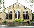
 Former School - Nursery Way, Clifford - geograph.org.uk - 949951.jpg 640 × 480; 242 KB
-
-
 Green Lane - Grove Road - geograph.org.uk - 5239317.jpg 640 × 539; 98 KB
-
 Green Lea Close - Green Lane - geograph.org.uk - 5239327.jpg 640 × 480; 93 KB
-
 Grove Road - Clifford Road - geograph.org.uk - 5239202.jpg 640 × 480; 101 KB
-
 High Street, Clifford - geograph.org.uk - 2411443.jpg 800 × 600; 242 KB
-
 High Street, Clifford - geograph.org.uk - 5614778.jpg 640 × 427; 205 KB
-
 Horses at Clifford Moor Farm - geograph.org.uk - 5374528.jpg 640 × 427; 199 KB
-
 Lairum Rise - Willow Lane, Clifford - geograph.org.uk - 958617.jpg 640 × 441; 193 KB
-
 Line of Trees on Clifford Moor - geograph.org.uk - 5185717.jpg 1,600 × 1,067; 206 KB
-
 Lonsdale Meadows, Boston Spa - geograph.org.uk - 3529841.jpg 640 × 480; 75 KB
-
 Low Way - Moor Avenue - geograph.org.uk - 5202182.jpg 640 × 480; 69 KB
-
 Mill Dam - Springfield - geograph.org.uk - 5202244.jpg 640 × 480; 76 KB
-
 Moor Avenue - Albion Street - geograph.org.uk - 5202188.jpg 640 × 480; 65 KB
-

-

-
 New Mill Lane - High Street - geograph.org.uk - 5202295.jpg 640 × 480; 90 KB
-
 Northbound A1M at Boston Spa Interchange - geograph.org.uk - 6399065.jpg 800 × 533; 191 KB
-
 Nunnery Cottage - Clifford - geograph.org.uk - 949977.jpg 640 × 522; 268 KB
-
 Nunnery House - Clifford - geograph.org.uk - 949982.jpg 640 × 452; 236 KB
-
 Nunnery Way - Bramham Road - geograph.org.uk - 5202125.jpg 640 × 472; 57 KB
-
 Old Mill Lane - Clifford - geograph.org.uk - 949911.jpg 640 × 492; 232 KB
-
 Old Mill Lane - geograph.org.uk - 6608892.jpg 1,024 × 683; 345 KB
-
 Old Mill Lane, Clifford - geograph.org.uk - 2411449.jpg 800 × 600; 273 KB
-
 Old School - Bramham Road, Clifford - geograph.org.uk - 949968.jpg 640 × 419; 192 KB
-
 Our Lady - geograph.org.uk - 2660877.jpg 1,600 × 1,200; 435 KB
-
 Path at Clifford Moor Farm - geograph.org.uk - 5374516.jpg 640 × 427; 208 KB
-
 Path through Clifford Moor Farm - geograph.org.uk - 5374522.jpg 640 × 427; 203 KB
-
 Path to Bramham - geograph.org.uk - 5374506.jpg 640 × 427; 212 KB
-
 Playing Fields - off Nunnery Way - geograph.org.uk - 5202121.jpg 640 × 480; 63 KB
-

-
-
 Rhodes Lane - geograph.org.uk - 5374699.jpg 640 × 427; 180 KB
-
 Roman Catholic church of St. Edward King And Confessor - geograph.org.uk - 2660870.jpg 1,600 × 1,200; 419 KB
-
 Roman Catholic church of St. Edward King And Confessor - geograph.org.uk - 2660881.jpg 1,600 × 1,200; 425 KB
-
 Sports Pavilion - off Nunnery Way - geograph.org.uk - 5202123.jpg 640 × 426; 51 KB
-
 Springfield - High Street - geograph.org.uk - 5202299.jpg 640 × 480; 61 KB
-
 Springfield - Old Mill Lane - geograph.org.uk - 5202243.jpg 640 × 480; 75 KB
-

-

-
 St Edward's Terrace - High Street - geograph.org.uk - 5202302.jpg 640 × 480; 115 KB
-
 St Edward's Wood - High Street - geograph.org.uk - 5202296.jpg 640 × 480; 85 KB
-
 St Edward, King and Confessor Roman Catholic Church - geograph.org.uk - 3209038.jpg 3,008 × 2,000; 706 KB
-

-
 St Luke's Close - Willow Lane - geograph.org.uk - 5202134.jpg 640 × 480; 74 KB
-
 The Albion at Clifford.jpg 1,600 × 1,200; 544 KB
-
 The Old School - Willow Lane - geograph.org.uk - 5202132.jpg 640 × 480; 70 KB
-
 The Old Star Inn - geograph.org.uk - 1974730.jpg 640 × 480; 81 KB
-
 The Old Star Inn - geograph.org.uk - 1974742.jpg 480 × 640; 44 KB
-
 The Old Star Inn, Clifford - geograph.org.uk - 3798926.jpg 640 × 480; 58 KB
-
 Track - Old Mill Lane - geograph.org.uk - 5202247.jpg 640 × 480; 116 KB
-
 Track to St John's Farm - geograph.org.uk - 6608876.jpg 1,024 × 683; 264 KB
-
 Trees on a field boundary, Clifford Moor - geograph.org.uk - 3832961.jpg 3,462 × 1,492; 586 KB
-
 Westfield Lane - Willow Lane - geograph.org.uk - 5202129.jpg 640 × 480; 75 KB
-
 Westwood Cottages - High Street - geograph.org.uk - 5202298.jpg 640 × 480; 82 KB
-
 Willow Avenue - Moor Avenue - geograph.org.uk - 5202173.jpg 640 × 480; 76 KB
-
 Willow Glade - Willow Lane - geograph.org.uk - 5202138.jpg 640 × 480; 81 KB
-
 Willow Grove - Willow Lane - geograph.org.uk - 5202142.jpg 640 × 480; 57 KB
-
 Willow Lane - Clifford - geograph.org.uk - 949983.jpg 640 × 528; 230 KB
-
 Winnow Lane - Clifford Moor Road - geograph.org.uk - 5080570.jpg 640 × 480; 75 KB
_-_Clifford_Moor_-_geograph.org.uk_-_2646924.jpg)
_-_exit_at_junction_45_-_geograph.org.uk_-_2646938.jpg)
_heading_north_-_geograph.org.uk_-_2040860.jpg)
_near_Clifford_Moor_Farm_-_geograph.org.uk_-_5396299.jpg)
,_Clifford_Moor_-_geograph.org.uk_-_4806024.jpg)


_-_geograph.org.uk_-_3038466.jpg)


.jpg)
_-_geograph.org.uk_-_6635077.jpg)


.jpg)


