Category:Colby, Cumbria
Naar navigatie springen
Naar zoeken springen
Cumbria  | |||||
| Media uploaden | |||||
| Is een | |||||
|---|---|---|---|---|---|
| Locatie | Westmorland and Furness, Cumbria, North West England, Engeland | ||||
| Naar verluidt hetzelfde als | Colby (Wikimedia-doublure, civil parish) | ||||
 | |||||
Ondercategorieën
Deze categorie bevat de volgende 4 subcategorieën, van de 4 in totaal.
Media in categorie "Colby, Cumbria"
Deze categorie bevat de volgende 73 bestanden, van in totaal 73.
-
 'Apple Aire' - geograph.org.uk - 4590005.jpg 1.024 × 683; 168 kB
-
 'Kangaroo House' at junction of roads in Colby - geograph.org.uk - 4585761.jpg 1.024 × 683; 164 kB
-
 A distant view of Jerusalem Farm - geograph.org.uk - 6234196.jpg 640 × 480; 79 kB
-
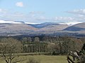
 A prospect of Appleby-in-Westmorland - geograph.org.uk - 6234194.jpg 640 × 480; 76 kB
-
 Bandley Bridge - geograph.org.uk - 5157040.jpg 1.024 × 768; 328 kB
-
 Barn conversion in Colby - geograph.org.uk - 4572846.jpg 640 × 480; 432 kB
-
 Benchmark on 'Apple Aire' - geograph.org.uk - 4589998.jpg 1.024 × 683; 328 kB
-
 Benchmark on 'Kangaroo House' - geograph.org.uk - 4585744.jpg 683 × 1.024; 290 kB
-
 Benchmark on building at Jerusalem Farm - geograph.org.uk - 4589276.jpg 683 × 1.024; 298 kB
-
 Benchmark on Colby Bridge - geograph.org.uk - 4585625.jpg 683 × 1.024; 303 kB
-

-
 Benchmark on south parapet of Teas Bridge - geograph.org.uk - 4589970.jpg 683 × 1.024; 240 kB
-
 Bridleway heading south-west to Long Rigg - geograph.org.uk - 5156849.jpg 768 × 1.024; 170 kB
-
 Bridleway near Bandley Bridge - geograph.org.uk - 5009410.jpg 1.024 × 768; 370 kB
-
 Buildings at Jerusalem Farm - geograph.org.uk - 4589292.jpg 1.024 × 683; 191 kB
-
 Cattle pasture, west bank, Hoff Beck - geograph.org.uk - 5156663.jpg 994 × 746; 115 kB
-

-
 Drystone wall on the road from Colby to Bolton - geograph.org.uk - 5297720.jpg 1.024 × 614; 117 kB
-
 Fallen tree on the west bank of Hoff Beck - geograph.org.uk - 5156831.jpg 1.024 × 768; 153 kB
-
 Farm access track, south of Nether Hoff Farm - geograph.org.uk - 5156652.jpg 1.024 × 768; 135 kB
-

-
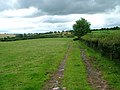
 Farmland north of the Long Rigg bridleway - geograph.org.uk - 5157000.jpg 768 × 1.024; 269 kB
-
 Farmland south of Hawkrigg Farm - geograph.org.uk - 5299788.jpg 1.024 × 768; 135 kB
-
 Farmland south of Nether Hoff Farm - geograph.org.uk - 5156631.jpg 1.024 × 768; 113 kB
-
 Farmland west of Bandley Bridge - geograph.org.uk - 5156978.jpg 1.024 × 768; 218 kB
-
 Field above the west bank of the River Eden - geograph.org.uk - 5297713.jpg 1.024 × 768; 129 kB
-

-
 Field beside the River Eden - geograph.org.uk - 4572848.jpg 640 × 480; 410 kB
-

-
 Field boundary, south of Hawkrigg Farm - geograph.org.uk - 5299785.jpg 1.024 × 768; 145 kB
-
 Field near Colby - geograph.org.uk - 499700.jpg 640 × 480; 94 kB
-
 Fields with cattle, near New Bewley - geograph.org.uk - 4572818.jpg 640 × 480; 446 kB
-
 Gateway to fields of Hawkrigg Farm - geograph.org.uk - 4535999.jpg 1.024 × 683; 224 kB
-
 Hazel coppice near Bandley Bridge - geograph.org.uk - 5009406.jpg 1.024 × 768; 284 kB
-
-
 Hoff Beck from Colby Bridge - geograph.org.uk - 1129826.jpg 640 × 480; 122 kB
-
 Houses in Colby - geograph.org.uk - 5650801.jpg 640 × 480; 58 kB
-

-
 Isolated field barn, south of Nether Hoff Farm - geograph.org.uk - 5156642.jpg 1.024 × 768; 128 kB
-

-
 Large shed on the side of Teas Hill - geograph.org.uk - 5299744.jpg 1.024 × 615; 131 kB
-

-

-
 Minor road at Kings Meaburn - Colby boundary - geograph.org.uk - 4534175.jpg 1.024 × 683; 210 kB
-
 Minor road towards Colby - geograph.org.uk - 4536011.jpg 1.024 × 683; 162 kB
-
 Narrow road, normal-sized lorry - geograph.org.uk - 5299783.jpg 1.024 × 768; 153 kB
-
 Nether Hoff Farm, from the north-west - geograph.org.uk - 5156580.jpg 1.024 × 768; 168 kB
-
 Northern end of Colby village - geograph.org.uk - 5156323.jpg 1.024 × 768; 163 kB
-
 Pasture near Hoff Beck - geograph.org.uk - 5009403.jpg 1.024 × 767; 195 kB
-
 Pipe bridge over Colby Beck - geograph.org.uk - 5156309.jpg 1.024 × 768; 164 kB
-
 Pipe Bridge over Hoff Beck - geograph.org.uk - 1102345.jpg 640 × 426; 154 kB
-
 Plantation along Teas Sike - geograph.org.uk - 5299746.jpg 1.024 × 767; 155 kB
-

-
 Public footpath heading south to Bandley Bridge - geograph.org.uk - 5156617.jpg 1.024 × 768; 143 kB
-

-
 Public footpath to Colby - geograph.org.uk - 5156572.jpg 1.024 × 768; 265 kB
-
 Public footpath to Nether Hoff and Colby - geograph.org.uk - 5156623.jpg 1.024 × 768; 152 kB
-
 Road descending the eastern flank of Teas Hill - geograph.org.uk - 5299742.jpg 1.024 × 768; 146 kB
-
 Sculpture in the grounds of Nether Hoff Farm - geograph.org.uk - 5156568.jpg 1.023 × 768; 152 kB
-
 Semi-detached houses, Colby - geograph.org.uk - 5156330.jpg 1.024 × 768; 166 kB
-
 Sheep grazing at Jerusalem - geograph.org.uk - 5299748.jpg 1.024 × 768; 218 kB
-
 Stone marking Colby - Kings Meaburn boundary - geograph.org.uk - 4534161.jpg 683 × 1.024; 290 kB
-
 Stone marking Kings Meaburn - Colby boundary - geograph.org.uk - 4534169.jpg 683 × 1.024; 274 kB
-
 Teas Bridge taking road over Teas Sike - geograph.org.uk - 4589991.jpg 1.024 × 683; 255 kB
-
 Terraced houses, Colby - geograph.org.uk - 5156552.jpg 1.024 × 768; 132 kB
-
 The road from Bolton to Colby - geograph.org.uk - 5297706.jpg 1.024 × 768; 149 kB
-
 The road south-west out of Colby - geograph.org.uk - 5299779.jpg 1.024 × 768; 133 kB
-
 The valley of Colby Beck - geograph.org.uk - 5156305.jpg 1.024 × 768; 116 kB
-
 Trees on a field boundary in the Eden valley - geograph.org.uk - 5297710.jpg 1.024 × 768; 109 kB
-
 Waymarks on a gate near Bandley Bridge - geograph.org.uk - 5156842.jpg 1.024 × 768; 163 kB
-
 Woodland in the valley of Hoff Beck - geograph.org.uk - 5157029.jpg 1.024 × 768; 173 kB
-
 Young conifer plantation, west of Bandley Bridge - geograph.org.uk - 5156991.jpg 768 × 1.024; 247 kB
-
 Colby Village Hall - geograph.org.uk - 195232.jpg 640 × 480; 75 kB


