Category:Commons map adapted by Ulamm
Jump to navigation
Jump to search
Media in category "Commons map adapted by Ulamm"
The following 175 files are in this category, out of 175 total.
-
 001 Kievan Rus' Kyivan Rus' Ukraine map 1220 1240.jpg 2,301 × 2,856; 4.69 MB
-
 2018-P02-Friesland.png 2,914 × 2,384; 3.58 MB
-
 2018-P08-Zuid-Holland b2.png 2,660 × 2,195; 4.68 MB
-
 2022 France - régions et départements, noms.png 1,842 × 1,696; 619 KB
-
 ACsEV rot.png 1,567 × 911; 3.62 MB
-
 Africa Ortelius Nil Zambesi Zaire.png 1,672 × 2,334; 9.62 MB
-
 ALBA-Mitgliedsstaaten7.png 627 × 807; 14 KB
-
 Altamira Para vs Maranhao.png 1,344 × 1,184; 29 KB
-
 Altmark Jerichow topo.png 2,608 × 1,626; 3.59 MB
-
 ALTMUEHL.gif 831 × 886; 321 KB
-
 Arktik-Grønland.png 329 × 330; 15 KB
-
 Baltic Marine subdivisions.gif 561 × 547; 33 KB
-
 Baltische Stämme um 1200.png 1,980 × 2,180; 473 KB
-
 Bassin Seine.png 3,500 × 3,007; 6.72 MB
-
 Bavaria relief location map.png 1,695 × 1,672; 4.45 MB
-
 Bayern Relief Grenzen Namen.png 1,695 × 1,672; 4.57 MB
-
 Belgien Backsteingotik mit Ortsnamen 2.png 1,856 × 1,400; 165 KB
-
 Belgien plan ohne Südosten.png 877 × 641; 74 KB
-
 Belgien Relief ohne Südosten.png 2,158 × 1,599; 4.99 MB
-
 Bergen boroughs.png 796 × 963; 15 KB
-
 Bielefeld1908,1930-61,1974.png 926 × 1,190; 1.92 MB
-
 Bistum Basel im 15. Jahrhundert0105a.png 780 × 833; 102 KB
-
 Blaeu 1645 - Pomeraniæ Ducatus tabula.png 2,913 × 2,261; 16.08 MB
-
 Bodensee satellit+text.png 1,394 × 864; 2.79 MB
-
 Bourbonnais 12. Jh.png 557 × 494; 141 KB
-
 Brandenburg-Preussen-1701-1806 ohne Westen.png 1,020 × 831; 80 KB
-
 Bremen Groningen blank.png 843 × 559; 105 KB
-
 Bremen Groningen Friesen.png 843 × 559; 205 KB
-
 BSAG-Bahnen2013+H.png 1,799 × 1,353; 102 KB
-
 Burgund 12. Jh.png 1,792 × 1,471; 1,006 KB
-
 Camargue, Petite Camargue et Parc naturel reg.png 1,436 × 792; 63 KB
-
 Canny-sur-Matz, église Saint-Michel.png 3,270 × 2,598; 1.05 MB
-
 Ceremonial Counties of England.png 459 × 560; 159 KB
-
 CH Kantone.png 2,560 × 1,642; 550 KB
-
 Champagne, Île-de-France, Picardie, Artois, Flandre 1789 et 2022.png 800 × 800; 370 KB
-
 Chevincourt position de l'église.png 3,270 × 2,598; 1.46 MB
-
 DanewerkDetailmap.jpg 383 × 384; 178 KB
-
 Delisle Asie3b.png 874 × 890; 204 KB
-
 Deutscher Orden 1260+Farb.png 1,200 × 1,043; 436 KB
-
 Deutscher Orden 1410+Farb.png 1,200 × 1,043; 370 KB
-
 Deutscher Orden 1466+Farb.png 1,200 × 1,043; 321 KB
-
 DK for localizations+placenames.png 1,650 × 1,650; 155 KB
-
 DK Hovedstaden kommuner.png 606 × 666; 283 KB
-
 DK Midtjyllands kommuner.png 1,870 × 1,368; 135 KB
-
 DK Nordjyllands kommuner.png 1,600 × 1,332; 85 KB
-
 DK Sjælland kommuner.png 1,170 × 1,458; 86 KB
-
 DK survey.png 1,650 × 1,650; 178 KB
-
 DK Syddanmarks kommuner.png 1,591 × 1,255; 125 KB
-
 Donau Einzugsgebiet.png 2,130 × 1,137; 4.04 MB
-
 East Midlands counties 00.png 1,723 × 2,047; 295 KB
-
 East of England Counties.png 1,593 × 1,440; 1.06 MB
-
 England 2012 white.png 1,109 × 1,347; 144 KB
-
 England counties 1851 grey.png 1,459 × 1,769; 86 KB
-
 España relieve M.png 2,356 × 2,778; 10.26 MB
-
 EST + LAT 55.5–59.8, 20.5–28.4 blank.png 2,837 × 2,982; 721 KB
-
 EST + LAT 55.5–59.8, 20.5–28.4 relief.png 2,837 × 2,982; 10.84 MB
-
 Euskara percent.png 570 × 443; 33 KB
-
 Finland 59,5–64N 18,83–30E.png 849 × 692; 592 KB
-
 Finland ≤ 62°N 30°E.png 847 × 384; 339 KB
-
 Flusssystemkarte Mosel(Rhein 03Wwasser).png 763 × 1,188; 2.2 MB
-
 France brique gothique1.png 1,842 × 1,696; 484 KB
-
 Frankish Empire 481 to 814-fr.png 2,087 × 1,476; 559 KB
-
 Frankreich 12. Jh (ohne Süd).png 2,607 × 2,640; 2.41 MB
-
 Gelderland gemeenten.png 2,360 × 1,642; 709 KB
-
 Germany Laender 1947 1990 DDR.png 444 × 612; 16 KB
-
 Groningen gemeenten 2018.png 1,336 × 1,528; 98 KB
-
 Großfürstentum Litauen 13.–15. Jh.png 1,379 × 1,533; 517 KB
-
 Gryfino p-gm.png 1,204 × 1,664; 112 KB
-
 HR+HU+SK relief.png 957 × 778; 1.25 MB
-
 Iceland position144.png 1,011 × 856; 55 KB
-
 Italien 1843–1870.png 924 × 953; 215 KB
-
 Italien Regionen Metropolitanstädte.png 1,830 × 2,177; 135 KB
-
 Italien Relief.png 2,949 × 3,743; 8.66 MB
-
 Italien, Verwaltungseinheiten mit gotischer Backsteinarchitektur.png 1,830 × 2,177; 159 KB
-
 Jan Reiners Strecke.png 2,048 × 1,663; 24 KB
-
 KaartLesse.jpg 692 × 500; 537 KB
-
 Karte Bodensee V3.png 2,066 × 1,328; 256 KB
-
 Karte Mark Brandenburg 1320b.png 1,200 × 962; 415 KB
-
 Kingdom of Galicia Volhynia Rus' Ukraine 1245 1349.jpg 2,301 × 2,856; 5.18 MB
-
 Krondomäne 12. Jh.png 1,054 × 1,017; 481 KB
-
 Kyivan Rus' 1220-1240.png 2,301 × 2,856; 6.1 MB
-
 Körös basin.png 400 × 300; 169 KB
-
 La France en 1180 (section).png 3,449 × 3,376; 6.88 MB
-
 Lage altmyhl.png 1,066 × 788; 169 KB
-
 Ligne Dorsale+Tournai.png 535 × 413; 16 KB
-
 Lit + Bela relief.png 3,417 × 2,597; 16.23 MB
-
 Lithuania rel 2002.png 995 × 1,085; 2.1 MB
-
 Lyon StÉtienne Andrézieux Roanne1849.png 768 × 612; 1,018 KB
-
 Malopolska Krakowskie sandomierskie lubelskie1.png 1,932 × 1,755; 279 KB
-
 Map-Hispano.png 1,427 × 628; 42 KB
-
 Mappa dello Stato dei Cavalieri Teutonici 1410.jpg 1,654 × 1,449; 1.65 MB
-
 Mazowsze w.png 3,130 × 3,071; 976 KB
-
 Mecklenburg-Vorpommern Relief Kreise Namen Grenze.png 1,744 × 1,197; 1.67 MB
-
 Mecklenburg-Vorpommern relief location map.png 1,744 × 1,197; 1.62 MB
-
 Moray Firth topo.png 926 × 919; 939 KB
-
 Mudéjar architecture in Spain & Portugal.png 1,195 × 1,024; 193 KB
-
 Municipalities of Lithuania.png 623 × 503; 24 KB
-
 Mureș basin.png 600 × 300; 301 KB
-
 Møre og Romsdal kart1.png 1,098 × 802; 37 KB
-
 Møre og Romsdal vest.png 697 × 710; 26 KB
-
 NDS Kreise + Backsteingotik.png 1,686 × 1,423; 329 KB
-
 NDS Kreise.png 1,686 × 1,423; 325 KB
-
 Neuenhagenerinsel2.gif 1,182 × 872; 110 KB
-
 Niedersachsen Relief Friesen.png 1,786 × 1,509; 3.29 MB
-
 Niedersachsen um 1400.jpg 1,948 × 1,644; 487 KB
-
 Niedersachsen um 1400.png 1,948 × 1,644; 3.38 MB
-
 NL Provinzen, Backsteingotik.png 801 × 949; 375 KB
-
 Noord-Holland gemeenten 2017.png 1,174 × 2,186; 178 KB
-
 Nordfjord.png 930 × 513; 42 KB
-
 Noreg-Grønland.png 2,106 × 1,784; 189 KB
-
 Noreg16-3.png 837 × 1,323; 25 KB
-
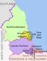 North East England counties 2.2.png 842 × 1,100; 70 KB
-
 North West England counties.png 1,341 × 2,685; 306 KB
-
 NorthSeaCurrents.png 1,300 × 1,700; 3.43 MB
-
 NRW cut 5.834–7.678°E, 50.453–52.515°N.png 529 × 792; 301 KB
-
 NRW cut 5.834–7.9546°E, 50.551–52.277°N2.png 598 × 792; 309 KB
-
 NRW Regierungsbezirke Kreise.png 4,122 × 4,084; 9.88 MB
-
 NRW relief cut 5.834–7.6046°E, 50.551–52.277°N.png 504 × 792; 281 KB
-
 NRW relief cut 5.834–8.718°E, 50.453–52.515°N.png 808 × 948; 634 KB
-
 Oblast Leningrad relief.png 1,000 × 717; 1.08 MB
-

-
 Ostpreussen Preussen1922-1939.png 700 × 594; 22 KB
-
 Ostseegliederung.png 871 × 1,039; 80 KB
-
 Polen - historische Regionen.png 2,430 × 2,596; 891 KB
-
 Polen - historisches Kujawien, heutige Verwaltungsgrenzen.png 1,551 × 1,432; 1.29 MB
-
 Pontigny1180.png 2,664 × 2,456; 4.11 MB
-
 Positionskarte EE + LV 1260.png 794 × 861; 120 KB
-
 Preussen1410.png 502 × 430; 20 KB
-
 PRVSSIA1576Casparo Henneberg.png 2,973 × 2,289; 4.5 MB
-
 Regione Abruzzo mappa2.png 800 × 738; 222 KB
-
 Regions of England - labelled.png 1,230 × 1,484; 387 KB
-
 Reliefkarte Friaul-Julisch Venetien 2020.png 1,913 × 2,014; 4.93 MB
-
 Reliefkarte Ukraine West.png 1,569 × 1,624; 4.31 MB
-
 Rhein-Karte2.png 1,588 × 2,228; 133 KB
-
 Rheinsystem small DE Main.png 2,133 × 2,885; 9.82 MB
-
 River Forth course.png 1,231 × 436; 12 KB
-
 S+M-Schweden.png 611 × 756; 172 KB
-
 Saarland Kreise Namen.png 1,798 × 1,472; 647 KB
-
 Sachsen Kreis- u Amts-Einteilung 1900–1932.gif 1,706 × 996; 658 KB
-
 Sachsen-Anhalt 1665x2047 Kreise.png 1,665 × 2,047; 4.19 MB
-
 Sachsen-Anhalt 1665x2047.png 1,665 × 2,047; 4.27 MB
-
 Saxony-Anhalt location map.png 1,956 × 2,305; 679 KB
-
 Saxony-Anhalt relief location map.png 1,272 × 1,499; 2.75 MB
-
 Schleswig-Holstein relief loc.png 882 × 775; 1,000 KB
-
 Schlewig-Holstein Kreisgrenzen.png 1,059 × 927; 144 KB
-
 Schweden S(72to74)+M(72to68).png 611 × 970; 201 KB
-
 Schweden S+M, h(M)=72to68.png 611 × 938; 209 KB
-
 Scotland (0 Shetland) council areas.png 2,305 × 2,799; 721 KB
-
 Scotland (core) council areas.png 1,420 × 1,153; 265 KB
-
 SevenSisterStates.png 600 × 558; 171 KB
-
 Someș basin.png 400 × 300; 239 KB
-
 South East England counties.png 2,554 × 2,000; 428 KB
-
 South West England counties.png 1,281 × 936; 258 KB
-
 Spanien-Gliederung.png 1,400 × 1,180; 93 KB
-
 Strasbourg Communauté.jpg 848 × 1,156; 135 KB
-
 Straßenbahn-Netzplan Alexandria 1996.png 2,836 × 1,871; 476 KB
-
 SW England +county names.png 1,912 × 1,496; 508 KB
-
 Sweden län få sjöar S+M.png 611 × 951; 208 KB
-
 Sweden S(72to74)+M(72to65).png 611 × 947; 206 KB
-
 Sweden S(72to77)+M(72to65).png 611 × 977; 212 KB
-
 Tisza Karte.png 838 × 821; 1.2 MB
-
 Toledo-catedral-de.png 794 × 841; 484 KB
-
 Topografischer Hintergrund HU + SK.png 728 × 681; 768 KB
-
 Tornealven.jpg 600 × 572; 419 KB
-
 Tornealven.png 600 × 572; 493 KB
-
 Trk72 Köln Porte Weyer.png 2,398 × 1,584; 8.37 MB
-
 Viroin loc.png 692 × 500; 135 KB
-
 Wales counties.png 1,252 × 1,498; 325 KB
-
 Warszawa-Centralna & al2.png 1,409 × 1,024; 54 KB
-
 Weser Einzugsgebiet+Nr.png 791 × 886; 189 KB
-
 West Midlands counties.png 1,160 × 1,306; 166 KB
-
 Western schism 1378–1417 de.png 2,000 × 1,540; 859 KB
-
 Westphaliae Circulus 17. Jh. Misselwarden + Milsum.png 768 × 558; 851 KB
-
 Zimbabwe monomotapa.gif 642 × 706; 47 KB
-
 Åland2topo.png 861 × 494; 148 KB


.png)


.png)


.png)


%2BM(72to68).png)
%3D72to68.png)
_council_areas.png)
_council_areas.png)


%2BM(72to65).png)
%2BM(72to65).png)


