Category:County Carlow
Salti al navigilo
Salti al serĉilo
Graflandoj de la Respubliko de Irlando: Carlow · Cavan · Clare · Cork(1) · Donegal · Dún Laoghaire-Rathdown(2) · Fingal(2) · Galway(3) · Kerry · Kildare · Kilkenny · Laois · Leitrim · Limerick · Longford · Louth · Mayo · Meath · Monaghan · Offaly · Roscommon · Sligo · South Dublin(2) · Tipperary(4) · Waterford · Westmeath · Wexford · Wicklow – Apartaj urboj: Cork(1) · Dublin(2) · Galway(3) – Antaŭaj graflandoj: Dublin(2) · South Tipperary(4) Antaŭaj graflandoj de Nord-Irlando: Antrim · Armagh · Down · Fermanagh · Londonderry · Tyrone
county in Ireland .jpg)    | |||||
| Alŝuti plurmedion | |||||
| Estas | |||||
|---|---|---|---|---|---|
| Loko |
| ||||
| Ĉefurbo | |||||
| Leĝdona aŭtoritato |
| ||||
| Plenuma aŭtoritato |
| ||||
| Loĝantaro |
| ||||
| Areo |
| ||||
| oficiala retejo | |||||
 | |||||
Subkategorioj
Ĉi tiu kategorio havas la 23 jenajn subkategoriojn, el 23 entute.
A
- Altamont Gardens (1 D)
C
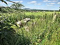
- Countryside in County Carlow (4 D)
E
G
H
M
- Milestones in County Carlow (2 D)
N
P
- Post boxes in County Carlow (1 D)
Q
- Quarries in County Carlow (3 D)
S
T
V
- Village pumps in County Carlow (12 D)
Dosieroj en kategorio “County Carlow”
La jenaj 200 dosieroj estas en ĉi tiu kategorio, el 259 entute.
(antaŭa paĝo) (sekva paĝo)-
 'Nine Stones' Car Park - geograph.org.uk - 3637338.jpg 640 × 480; 70 KB
-

-
 Above the Cloud - geograph.org.uk - 5201507.jpg 640 × 480; 79 KB
-
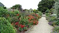 Altamont Gardens, Co Carlow - flower borders - geograph.org.uk - 5616171.jpg 5 184 × 2 920; 6,97 MB
-
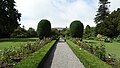 Altamont Gardens, Co Carlow - gravel path leading to house - geograph.org.uk - 5616181.jpg 5 184 × 2 920; 6,13 MB
-
 Altamont Gardens, Co Carlow - path beside R Slaney - geograph.org.uk - 5616174.jpg 5 184 × 2 920; 5,23 MB
-
 Altamont Gardens, Co Carlow - steps up from R Slaney - geograph.org.uk - 5616176.jpg 2 920 × 5 184; 6,2 MB
-
 Antenna mast - geograph.org.uk - 523484.jpg 480 × 640; 66 KB
-
 Badger Prints - geograph.org.uk - 4915599.jpg 600 × 413; 308 KB
-
 Ballintemple House 1891.jpg 733 × 525; 33 KB
-
 Barker's Rd - geograph.org.uk - 6054517.jpg 1 024 × 681; 218 KB
-
 Barker's Rd - geograph.org.uk - 6054533.jpg 1 024 × 655; 188 KB
-
 Barn by rural road - geograph.org.uk - 6054706.jpg 1 024 × 353; 94 KB
-
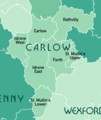 Baronies of County Carlow Map.png 349 × 413; 58 KB
-
 Barrow Queen - panoramio.jpg 2 816 × 2 112; 1,3 MB
-
 Barrow Valley - geograph.org.uk - 4915590.jpg 600 × 450; 317 KB
-
 Boulder Field - geograph.org.uk - 4978631.jpg 600 × 450; 326 KB
-
 Boulders and Bracken - geograph.org.uk - 5897796.jpg 800 × 600; 280 KB
-
 Boulders and Sheep - geograph.org.uk - 6202847.jpg 800 × 600; 1,07 MB
-
 Bracken and Wall - geograph.org.uk - 4978602.jpg 600 × 450; 273 KB
-
 Bridge and Powerlines - geograph.org.uk - 6202874.jpg 800 × 600; 790 KB
-
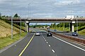 Bridge at Junction 6 of the M9 - geograph.org.uk - 6080680.jpg 800 × 533; 523 KB
-

-
 Bridge over the M9 at Ballybar - geograph.org.uk - 6080479.jpg 800 × 533; 504 KB
-
 Bridge over the M9 near Burtonhall - geograph.org.uk - 6078370.jpg 800 × 533; 466 KB
-
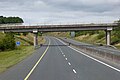
 Bridge over the M9, County Carlow - geograph.org.uk - 6080027.jpg 800 × 534; 534 KB
-
 Bridge over the M9, County Carlow - geograph.org.uk - 6082063.jpg 800 × 533; 476 KB
-
 Bridge over the Northbound M9 - geograph.org.uk - 6082068.jpg 800 × 533; 521 KB
-
 Bridge Parapet - geograph.org.uk - 5808950.jpg 800 × 600; 136 KB
-
 Bridge Parapet - geograph.org.uk - 6196226.jpg 800 × 600; 933 KB
-
 Brownshill Portal Tomb near Carlow - geograph.org.uk - 5616022.jpg 5 184 × 2 920; 4,48 MB
-
 Cairn and Mast - geograph.org.uk - 5652208.jpg 640 × 480; 129 KB
-
 Canal Bridge - geograph.org.uk - 6266096.jpg 800 × 600; 1,07 MB
-
 Canal Lock - geograph.org.uk - 6266067.jpg 800 × 600; 805 KB
-
 Canal Walk - geograph.org.uk - 6265582.jpg 800 × 600; 1,07 MB
-
 Car Park - geograph.org.uk - 5201499.jpg 600 × 800; 175 KB
-

-
 Carlow (Barony).png 216 × 273; 5 KB
-
 Cattle and Bridge Parapet - geograph.org.uk - 6202860.jpg 800 × 537; 695 KB
-
 Church Site - geograph.org.uk - 6060537.jpg 800 × 600; 546 KB
-
 Cloud Layer - geograph.org.uk - 5201063.jpg 640 × 480; 64 KB
-
 Coat of arms of Carlow town.png 1 344 × 1 477; 237 KB
-
 Coolyhune Hill - geograph.org.uk - 2681440.jpg 640 × 480; 70 KB
-
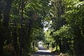
 Country Lane - geograph.org.uk - 6197842.jpg 800 × 600; 1,02 MB
-
 Country Road - geograph.org.uk - 6196158.jpg 800 × 600; 880 KB
-
 Crossroads in County Carlow - geograph.org.uk - 6054710.jpg 1 024 × 602; 138 KB
-
 Cups and Rings - geograph.org.uk - 6073512.jpg 800 × 600; 484 KB
-
 Decorated Gate - geograph.org.uk - 6194425.jpg 800 × 600; 840 KB
-
 Deerpark New, Co. Carlow, Ireland - panoramio.jpg 2 816 × 2 112; 1,35 MB
-
 Deerpark Old - geograph.org.uk - 5201521.jpg 640 × 480; 125 KB
-
 Derreen Bridge - geograph.org.uk - 6042773.jpg 1 024 × 460; 75 KB
-
 Dismantled Railway Line - geograph.org.uk - 6196197.jpg 800 × 600; 1,05 MB
-
 Drainage Channel - geograph.org.uk - 4906559.jpg 600 × 450; 360 KB
-
 Drainage Channel and Forest - geograph.org.uk - 4632719.jpg 480 × 640; 108 KB
-
 Drummin Church - geograph.org.uk - 6059794.jpg 800 × 600; 294 KB
-
 Drummin Church - geograph.org.uk - 6059798.jpg 800 × 600; 260 KB
-
 Duckett's Grove, Co Carlow - Gardens - geograph.org.uk - 5616011.jpg 5 184 × 2 920; 4,79 MB
-
 Duckett's Grove, Co Carlow - geograph.org.uk - 5616009.jpg 5 184 × 2 920; 4,63 MB
-
 Duckett's Grove, Co Carlow - geograph.org.uk - 5616014.jpg 2 920 × 5 184; 4,34 MB
-

-
 Fallen Tree - geograph.org.uk - 6197824.jpg 800 × 600; 968 KB
-
 Farm Entrance - geograph.org.uk - 6196170.jpg 800 × 600; 1,03 MB
-
 Field and Hill - geograph.org.uk - 5897776.jpg 800 × 600; 151 KB
-
 Field Patterns - geograph.org.uk - 5808962.jpg 800 × 600; 136 KB
-
 Flander's Crossroads - geograph.org.uk - 6054676.jpg 1 024 × 806; 206 KB
-
 Floodplain of River Derreen - geograph.org.uk - 6042771.jpg 867 × 1 024; 171 KB
-
 Footpath on Slievebawn - geograph.org.uk - 5249378.jpg 2 240 × 1 488; 1,56 MB
-
 Forest and Heath - geograph.org.uk - 5201059.jpg 480 × 640; 97 KB
-
 Forest and Heath - geograph.org.uk - 5897805.jpg 800 × 600; 237 KB
-
 Forest and Heathland - geograph.org.uk - 5201065.jpg 640 × 480; 84 KB
-
 Forest and Stream - geograph.org.uk - 5897786.jpg 800 × 600; 240 KB
-
 Forest Barrier - geograph.org.uk - 5808964.jpg 800 × 600; 146 KB
-
 Forest Boundary - geograph.org.uk - 5201035.jpg 640 × 480; 103 KB
-
 Forest Clearing - geograph.org.uk - 5808961.jpg 800 × 600; 197 KB
-
 Forest Entrance - geograph.org.uk - 6059812.jpg 800 × 600; 354 KB
-
 Forest Track - geograph.org.uk - 5201045.jpg 640 × 480; 82 KB
-
 Forest Track - geograph.org.uk - 5897778.jpg 800 × 600; 223 KB
-
 Forest Track and Windmill - geograph.org.uk - 5201126.jpg 640 × 521; 77 KB
-
 Forest, Fields and Ruin - geograph.org.uk - 4978596.jpg 600 × 450; 375 KB
-
 Forest, Track and Ruin - geograph.org.uk - 5652287.jpg 640 × 480; 182 KB
-
 Forested slopes of Croaghaun, Carlow - geograph.org.uk - 5249332.jpg 2 240 × 1 488; 1,56 MB
-
 Forth (Barony).png 216 × 273; 4 KB
-
 Fourlakes Retail Park, Dublin Road, Carlow - geograph.org.uk - 5937266.jpg 1 024 × 650; 132 KB
-
 Gate and Hill - geograph.org.uk - 6196167.jpg 800 × 600; 894 KB
-
 Gated Avenue - geograph.org.uk - 6119391.jpg 800 × 600; 544 KB
-
 Gated Lane - geograph.org.uk - 6202834.jpg 800 × 600; 952 KB
-
 Glynn Church - geograph.org.uk - 6194420.jpg 800 × 600; 813 KB
-
 Golf Course Entrance - geograph.org.uk - 6193813.jpg 800 × 600; 843 KB
-
 Greenoge Windfarm - geograph.org.uk - 5201494.jpg 640 × 441; 58 KB
-
 Greenogue Windfarm - geograph.org.uk - 5201080.jpg 640 × 480; 77 KB
-
 Hacketstown Road (R7236), near Carlow - geograph.org.uk - 5942168.jpg 1 024 × 678; 156 KB
-
 Hags and Mast - geograph.org.uk - 6016095.jpg 800 × 600; 85 KB
-
 Heather, Wall and Forest - geograph.org.uk - 5201122.jpg 640 × 480; 148 KB
-
 Hill and Signposts - geograph.org.uk - 5808985.jpg 766 × 573; 116 KB
-
 Hills and Track - geograph.org.uk - 6016584.jpg 800 × 600; 350 KB
-
 Hillside Track - geograph.org.uk - 6023890.jpg 800 × 600; 431 KB
-
 Hollybrook - geograph.org.uk - 6054605.jpg 1 024 × 540; 211 KB
-
 Idrone East (Barony).png 216 × 273; 4 KB
-
 Idrone West (Barony).png 216 × 273; 4 KB
-
 IRELAND 1992 -COUNTY CARLOW - Flickr - woody1778a.jpg 2 686 × 651; 373 KB
-
 John's Hill - geograph.org.uk - 5201124.jpg 640 × 480; 106 KB
-
-
 Killedmond Bridge - geograph.org.uk - 5808981.jpg 800 × 600; 210 KB
-
 L2003 - geograph.org.uk - 6042800.jpg 1 024 × 823; 150 KB
-
 L2003 - geograph.org.uk - 6042804.jpg 888 × 1 024; 225 KB
-
 L2003 - geograph.org.uk - 6042809.jpg 1 024 × 699; 107 KB
-
 L3033 - geograph.org.uk - 6054625.jpg 1 024 × 693; 155 KB
-
 L3033 - geograph.org.uk - 6054642.jpg 1 024 × 704; 119 KB
-
 L3033 - geograph.org.uk - 6054653.jpg 1 024 × 673; 135 KB
-
 Lichen and Bench Mark - geograph.org.uk - 4915565.jpg 600 × 450; 459 KB
-
 Local road to Hacketstown - geograph.org.uk - 6034220.jpg 1 024 × 711; 203 KB
-
 Lone Pine - geograph.org.uk - 6023888.jpg 800 × 600; 275 KB
-
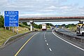
 M9 Motorway towards Junction 5 - geograph.org.uk - 6080484.jpg 800 × 533; 527 KB
-
 M9 Motorway, northbound near Ballybannon - geograph.org.uk - 6080487.jpg 800 × 533; 523 KB
-
 M9 Northbound near to Oldleighlin - geograph.org.uk - 6081883.jpg 800 × 533; 539 KB
-
 Malt House - geograph.org.uk - 5808465.jpg 800 × 600; 108 KB
-
 Mast and Supports - geograph.org.uk - 5652199.jpg 480 × 640; 80 KB
-
 Mast and Track - geograph.org.uk - 5652196.jpg 640 × 480; 89 KB
-
 Meadow and Hill - geograph.org.uk - 6193810.jpg 800 × 600; 846 KB
-
 Medieval Fort - geograph.org.uk - 2681426.jpg 640 × 480; 151 KB
-
 Medieval Fort - geograph.org.uk - 2681433.jpg 450 × 600; 381 KB
-
 Mile Post - geograph.org.uk - 6194445.jpg 600 × 800; 1,06 MB
-
 Milford Lock - geograph.org.uk - 5501360.jpg 640 × 480; 151 KB
-
 Milford Mill - geograph.org.uk - 5501356.jpg 640 × 480; 164 KB
-
 Milford Weir - geograph.org.uk - 5501363.jpg 640 × 480; 114 KB
-
 Minor road, County Carlow - geograph.org.uk - 6034230.jpg 1 024 × 933; 147 KB
-
 Minor road, County Carlow - geograph.org.uk - 6034232.jpg 1 024 × 648; 93 KB
-
 Minor road, County Carlow - geograph.org.uk - 6034243.jpg 1 024 × 769; 170 KB
-
 Mount Leinster Drive - geograph.org.uk - 6054587.jpg 1 024 × 995; 182 KB
-
 Mount Leinster Drive, Corrabut Gap - geograph.org.uk - 6054579.jpg 1 024 × 661; 140 KB
-
 Mount Wolseley Golf Course - geograph.org.uk - 4072849.jpg 2 592 × 1 944; 1,25 MB
-
 Mountain Car Park - geograph.org.uk - 6119412.jpg 800 × 600; 272 KB
-
 Mountain River - geograph.org.uk - 2169662.jpg 600 × 450; 119 KB
-
 Mountain River - geograph.org.uk - 4906550.jpg 600 × 413; 298 KB
-
 Mountain River - geograph.org.uk - 4906554.jpg 480 × 640; 132 KB
-
 Newly Mown Meadow - geograph.org.uk - 6202823.jpg 800 × 600; 887 KB
-
 Nine Stones - geograph.org.uk - 6119420.jpg 800 × 600; 361 KB
-
 Nine Stones panorama.jpg 1 555 × 500; 643 KB
-
 Nine Stones.jpg 1 280 × 960; 1,09 MB
-
 Northbound M9 - geograph.org.uk - 6078077.jpg 800 × 533; 484 KB
-
 Northbound M9 - geograph.org.uk - 6080035.jpg 800 × 534; 558 KB
-
 Northbound M9 - geograph.org.uk - 6082066.jpg 800 × 533; 460 KB
-
 Northbound M9 near Ballynakillbeg - geograph.org.uk - 6079743.jpg 800 × 533; 511 KB
-
 Northbound M9 near Leighlinbridge - geograph.org.uk - 6081880.jpg 800 × 533; 480 KB
-

-
 Northbound M9, Co Carlow - geograph.org.uk - 6080032.jpg 800 × 534; 565 KB
-
 Northbound M9, County Carlow - geograph.org.uk - 6079739.jpg 800 × 533; 627 KB
-
 Northbound M9, LRI 40.5 - geograph.org.uk - 6078380.jpg 800 × 533; 539 KB
-
 Northbound M9, LRI N 52.5 - geograph.org.uk - 6080672.jpg 800 × 450; 354 KB
-
 Northbound M9, LRI N 59.5 - geograph.org.uk - 6082048.jpg 800 × 533; 603 KB
-
 Northbound M9, LRI N 60 - geograph.org.uk - 6082055.jpg 800 × 533; 490 KB
-
 Old Benchmarkpoint - geograph.org.uk - 2291464.jpg 600 × 450; 391 KB
-
 Old Field Boundary - geograph.org.uk - 4906543.jpg 600 × 450; 439 KB
-
 Old Forge - geograph.org.uk - 6196130.jpg 800 × 600; 967 KB
-
 Old Forge - geograph.org.uk - 6202810.jpg 800 × 600; 605 KB
-
 Old Forge - geograph.org.uk - 6202889.jpg 800 × 600; 984 KB
-
 Old Mill and Stone Salmon - geograph.org.uk - 5808472.jpg 800 × 600; 149 KB
-
 Old Pump - geograph.org.uk - 6196214.jpg 600 × 800; 1,27 MB
-
 Old Rail Bed - geograph.org.uk - 6196202.jpg 800 × 600; 966 KB
-
 Old Railway Bridge - geograph.org.uk - 6196186.jpg 800 × 600; 1,09 MB
-
 Old Station House - geograph.org.uk - 6194441.jpg 800 × 600; 792 KB
-
 Overgrown Drainage Channel - geograph.org.uk - 4978625.jpg 600 × 450; 364 KB
-
 Overgrown Laneway - geograph.org.uk - 6197838.jpg 800 × 600; 1,2 MB
-

-
 Pens and Hills - geograph.org.uk - 6196238.jpg 800 × 600; 875 KB
-
 Phantom Mast - geograph.org.uk - 6016581.jpg 571 × 762; 73 KB
-
 Ploughing.JPG 3 852 × 2 265; 3,94 MB
-
 PloughingCarlow.JPG 2 592 × 1 944; 1,33 MB
-
 Pole by L2003 - geograph.org.uk - 6042816.jpg 1 024 × 717; 95 KB
-
 Primary School - geograph.org.uk - 6199914.jpg 800 × 600; 975 KB
-
 Public House - geograph.org.uk - 6194428.jpg 800 × 600; 706 KB
-
 Quartz Boulders - geograph.org.uk - 3637327.jpg 640 × 480; 112 KB
-
 Quartz rocks on Slievebawn - geograph.org.uk - 5249369.jpg 2 240 × 1 488; 1,54 MB
-
 R726 road, Killerig Cross, Killerig, Co. Carlow - geograph.org.uk - 5941932.jpg 1 024 × 678; 187 KB
-
 R727 - geograph.org.uk - 6042684.jpg 1 024 × 639; 85 KB
-
 R727 - geograph.org.uk - 6042703.jpg 1 024 × 649; 122 KB
-
 R727 - geograph.org.uk - 6042712.jpg 1 024 × 689; 113 KB
-
 R727 - geograph.org.uk - 6042725.jpg 1 024 × 678; 156 KB
-
 R727 - geograph.org.uk - 6042735.jpg 1 024 × 781; 78 KB
-
 R727 - geograph.org.uk - 6042751.jpg 1 024 × 804; 127 KB
-
 R727 - geograph.org.uk - 6042762.jpg 1 024 × 756; 156 KB
-
 R727 - geograph.org.uk - 6042786.jpg 1 024 × 782; 167 KB
-
 Raheen River - geograph.org.uk - 5808951.jpg 800 × 600; 184 KB
-
 Railway Bridge - geograph.org.uk - 6059804.jpg 800 × 600; 393 KB
-
 Railway Bridge - geograph.org.uk - 6196181.jpg 800 × 600; 862 KB
-
 Railway bridge on river Barrow - panoramio.jpg 1 600 × 1 200; 595 KB
-
 Rathvilly (Barony).png 216 × 273; 4 KB
-
 Rathvinden Lock - geograph.org.uk - 5501343.jpg 640 × 480; 153 KB
-
 River Barrow - geograph.org.uk - 5169216.jpg 640 × 480; 148 KB
-
 River Barrow - geograph.org.uk - 5349615.jpg 640 × 480; 133 KB
-
 River Barrow - panoramio (1).jpg 2 816 × 2 112; 1,07 MB
-
 River Barrow - panoramio.jpg 2 816 × 2 112; 1,23 MB
-

-
 River Nore - panoramio.jpg 2 816 × 2 112; 1,01 MB
-
 River Scene - geograph.org.uk - 6265581.jpg 800 × 600; 842 KB
-
 Road and Bridge - geograph.org.uk - 6202867.jpg 800 × 564; 777 KB
-
 Road Junction - geograph.org.uk - 6196208.jpg 800 × 600; 822 KB
-
 Road Junction - geograph.org.uk - 6202802.jpg 800 × 600; 761 KB
-
 Road Scene - geograph.org.uk - 6196136.jpg 800 × 600; 1,09 MB
-
 Road Scene - geograph.org.uk - 6196141.jpg 800 × 600; 997 KB


.png)


.png)


,_near_Carlow_-_geograph.org.uk_-_5942168.jpg)


.png)
.png)


.png)


.jpg)


