Category:Dürrenhorn
둘러보기로 이동
검색으로 이동
| 대상 위치 | | View all coordinates using: OpenStreetMap |
|---|
mountain in the Pennine Alps  | |||||
| 미디어 올리기 | |||||
| 다음 종류에 속함 | |||||
|---|---|---|---|---|---|
| 위치 | 발레주, 스위스 | ||||
| 산맥 | |||||
| 돌출높이 |
| ||||
| Topographic isolation |
| ||||
| 해발고도 |
| ||||
| 어미 피크 | |||||
 | |||||
"Dürrenhorn" 분류에 속하는 미디어
다음은 이 분류에 속하는 파일 10개 가운데 10개입니다.
-
 Dirrujoch 2001.jpg 425 × 638; 74 KB
-
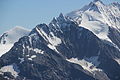
 Dom of Mischabel.jpg 3,527 × 2,352; 4.75 MB
-
 Dom, Nadelhorn, Hohberghorn and Dürrenhorn (15214340430).jpg 5,184 × 3,456; 5.71 MB
-
 Dom, Nadelhorn, Hohberghorn and Dürrenhorn (15222159660).jpg 5,184 × 3,456; 4.93 MB
-
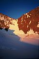
 DuerrenhornFromE.jpg 880 × 1,173; 352 KB
-
 Dürrenhorn (15080660967).jpg 5,184 × 3,456; 5.86 MB
-
-
 Lenzspitze, Nadelhorn, Hohberghorn and Dürrenhorn (15366661916).jpg 5,184 × 3,456; 5.57 MB
-
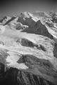
 Nadelgrat 2001.jpg 765 × 514; 93 KB
-
 Nadelgrat.JPG 2,136 × 2,848; 1.58 MB


.jpg)
.jpg)
.jpg)
.jpg)

