Category:DEM maps of Hesse
Jump to navigation
Jump to search
Federal states of Germany:
Deutsch: Das digitale Höhenmodell (DHM) (englisch digital elevation model (DEM)) bzw. digitale Geländemodell (DGM) (engl. digital terrain model (DTM)) basiert auf den numerischen Daten der Geländehöhen. Daraus lassen sich z. B. 3D-Ansichten erstellen.

Subcategories
This category has only the following subcategory.
M
Media in category "DEM maps of Hesse"
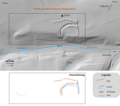
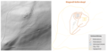
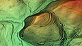
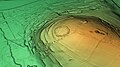
The following 105 files are in this category, out of 105 total.
-
 20240107 Wallanlage Kransberg.png 2,941 × 2,718; 3.42 MB
-
 Ahlberg Digitales Geländemodell.jpg 1,920 × 1,080; 1.41 MB
-
 Alte Schanz (Heidenrod) Digitales Geländemodell.jpg 1,920 × 1,080; 1.33 MB
-
 Alteburg (Biebergemünd) Digitales Geländemodell.jpg 1,920 × 1,080; 1.45 MB
-
 Altenburg (Hanau) Digitales Geländemodell.jpg 1,920 × 1,080; 1.19 MB
-
 Altenburg (Niedenstein) Digitales Geländemodell.jpg 1,920 × 1,080; 1.55 MB
-
 Bilstein (Langenberge) Digitales Geländemodell.jpg 1,920 × 1,080; 1.45 MB
-
 Blücherschanze Digitales Geländemodell.jpg 1,920 × 1,080; 1.09 MB
-
 Brandwall Hohestein Meinhard-Hitzelrode.png 1,543 × 1,143; 1.91 MB
-
 Burg Heiligenburg Digitales Geländemodell.jpg 1,920 × 1,080; 1.32 MB
-
 Burg Holdersberg Digitales Geländemodell.jpg 1,920 × 1,080; 1.4 MB
-
 Burg Hundheim - Umzeichnung.png 2,181 × 3,039; 5.32 MB
-
 Burg Stutz - Relief und Umzeichnung.png 1,782 × 843; 479 KB
-
 Burg und Wüstung Trugelrode.png 1,932 × 1,252; 1.85 MB
-
 Burg Wahlsburg Relief.jpg 718 × 784; 266 KB
-
 Burg Wahlsburg.png 2,216 × 1,249; 2.43 MB
-
 Burgberg (Baunatal) Digitales Geländemodell.jpg 1,920 × 1,080; 1.42 MB
-
 Burgring (Goddelsheim) Digitales Geländemodell.jpg 1,920 × 1,080; 1.35 MB
-
 Burgstall Heimburg - Relief und Umzeichnung.png 1,668 × 2,356; 1.5 MB
-
 Burgstall Nieder-Modau Rekonstruktionsversuch.png 1,784 × 1,165; 1.51 MB
-
 Burgstall Panzenberg - Relief und Umzeichnung.png 2,683 × 1,436; 2.9 MB
-
 Burgstall-Altes-Köpfchen relief und umzeichnung.png 2,916 × 1,327; 2.07 MB
-
 Custine-Schanzen (Oberursel) Digitales Geländemodell.jpg 1,920 × 1,080; 1.58 MB
-
 DEM Reste RWA Baunsberg.png 4,218 × 1,810; 7.04 MB
-
 DEM und Umzeichnung - Burgruine Falkenberg (Zierenberg).png 1,178 × 1,179; 1.02 MB
-
 DEM und Umzeichnung - Ringwallanlage Wilder Stein-Bilstein-Kellerkopf Wetzlar-Nauborn.png 3,140 × 1,629; 4.55 MB
-
 Dornburg (Oppidum) Digitales Geländemodell.jpg 1,920 × 1,080; 1.69 MB
-
 Drusenküppel Digitales Geländemodell.jpg 1,920 × 1,080; 1.18 MB
-
 Eisenberg (Battenberg) Digitales Geländemodell.jpg 1,920 × 1,080; 1.45 MB
-
 FMA Ringwall-Wallburg Laar- Laarer Wand.png 2,272 × 2,880; 3.69 MB
-
 Glauberg Digitales Geländemodell.jpg 1,920 × 1,080; 1.46 MB
-
 Gudenberg-Groß-Klein-Relief-Umrisse.png 2,397 × 2,802; 4.83 MB
-
 Heidetränk-Oppidum Digitales Geländemodell.jpg 1,920 × 1,080; 1.73 MB
-
 Hennethaler Landwehr Digitales Geländemodell.jpg 1,920 × 1,080; 1.42 MB
-
 Heuneburg Odw - Relief und Umzeichnung.png 2,337 × 2,303; 2.89 MB
-
 Hoher Dörnberg Digitales Geländemodell.jpg 1,920 × 1,080; 1.41 MB
-
 Hohlestein Digitales Geländemodell.jpg 1,920 × 1,080; 1.21 MB
-
 Höckelsburg Digitales Geländemodell.jpg 1,920 × 1,080; 1.49 MB
-
 Hünselburg Digitales Geländemodell.jpg 1,920 × 1,080; 930 KB
-
 Kastell Seckmauern Reliefdaten 2022.png 1,940 × 1,215; 2.34 MB
-
 Kloster Hasungen Digitales Geländemodell.jpg 3,840 × 2,160; 2.72 MB
-
 Lage-Relief-Umzeichnung Burg Ermschwerd.png 3,941 × 2,317; 4.5 MB
-
 Lage-Relief-Umzeichnung-Wallanlage Hunrodsberg.png 2,295 × 4,492; 7.79 MB
-
 Milseburg Digitales Geländemodell.jpg 1,920 × 1,080; 1.5 MB
-
 Odenberg Digitales Geländemodell.jpg 1,920 × 1,080; 1.12 MB
-
 Ohlandsburg Digitales Geländemodell.jpg 1,920 × 1,080; 1.51 MB
-
 Oppidum Milseburg Digitales Geländemodell.jpg 1,920 × 1,080; 1.51 MB
-
 Relief Eichburg.png 3,546 × 4,233; 6.74 MB
-
 Relief und Umzeichnung Altes Schloss Nieder-Beerbach.png 1,556 × 1,592; 1.74 MB
-
 Relief und Umzeichnung Burg Jossa.png 4,873 × 2,358; 6.83 MB
-
 Relief-Umzeichnung Hünscheburg (Hofgeismar).png 2,472 × 2,191; 2.41 MB
-
 Reliefbild Burgstall Nieder-Modau.png 1,553 × 1,138; 1.7 MB
-
 Reliefbild Schlösschen Ober-Beerbach.png 1,292 × 965; 1,021 KB
-
 Reliefdaten Kellerburg und Kellerberg.png 3,625 × 3,445; 3.75 MB
-
 Rentmauer Dattenberg Digitales Geländemodell.jpg 1,920 × 1,080; 1.4 MB
-
 Ringwall Alteburg (Lorsbach) Digitales Geländemodell.jpg 1,920 × 1,080; 1.56 MB
-
 Ringwall Altenstein Digitales Geländemodell.jpg 1,920 × 1,080; 1.32 MB
-
 Ringwall Altkönig Digitales Geländemodell.jpg 1,920 × 1,080; 1.62 MB
-
 Ringwall Altschloss Digitales Geländemodell.jpg 1,920 × 1,080; 1.38 MB
-
 Ringwall Bleibeskopf Digitales Geländemodell.jpg 1,920 × 1,080; 1.56 MB
-
 Ringwall Dreibornskopf Digitales Geländemodell.jpg 1,920 × 1,080; 1.51 MB
-
 Ringwall Gickelsburg Digitales Geländemodell.jpg 1,920 × 1,080; 1.29 MB
-
 Ringwall Hinterberg (Lohner Holz; Lohner Kopf).png 1,716 × 1,878; 2.1 MB
-
 Ringwall Holzburg Digitales Geländemodell.jpg 1,920 × 1,080; 1.26 MB
-
 Ringwall Hünenkeller Digitales Geländemodell.jpg 1,920 × 1,080; 1.24 MB
-
 Ringwall Hünerberg Digitales Geländemodell.jpg 1,920 × 1,080; 1.65 MB
-
 Ringwall Kellerskopf Digitales Geländemodell.jpg 1,920 × 1,080; 1.53 MB
-
 Ringwall Kellerskopf.png 3,050 × 1,451; 2.01 MB
-
 Ringwall Kuhardt Digitales Geländemodell.jpg 1,920 × 1,080; 1.32 MB
-
 Ringwall Rentmauer (Weilrod) Digitales Geländemodell.jpg 1,920 × 1,080; 1.56 MB
-
 Ringwall Rittershausen Digitales Geländemodell.jpg 1,920 × 1,080; 1.43 MB
-
 Ringwall Roßkopf Digitales Geländemodell.jpg 1,920 × 1,080; 1.62 MB
-
 Ringwall Scheuernberger Kopf.png 3,536 × 1,670; 5.2 MB
-
 Ringwall Staufen Digitales Geländemodell.jpg 1,920 × 1,080; 1.01 MB
-
 Ringwall Waldems Digitales Geländemodell.jpg 1,920 × 1,080; 1.27 MB
-
 Ringwall Wirtheim Digitales Geländemodell.jpg 1,920 × 1,080; 1.17 MB
-
 Ringwall-Roßkopf-Taunus.png 3,793 × 1,856; 3.2 MB
-
 Ringwallanlage Daubhaus Digitales Geländemodell.jpg 1,920 × 1,080; 1.39 MB
-
 Ringwallanlage Dünsberg Digitales Geländemodell.jpg 1,920 × 1,080; 1.58 MB
-
 Ringwallanlage Kleinberg Digitales Geländemodell.jpg 1,920 × 1,080; 1.32 MB
-
 Ringwallanlage Nack Digitales Geländemodell.jpg 1,920 × 1,080; 1.55 MB
-
 Ringwallanlagen Odenberg Digitales Geländemodell.jpg 1,920 × 1,080; 1.17 MB
-
 Ringwallburg Heunstein Digitales Geländemodell.jpg 1,920 × 1,080; 1.43 MB
-
 RWA Brüler Berg - Relief-Umzeichnung-Lage.png 4,737 × 1,689; 6.76 MB
-
 RWA Brüler Berg - Relief-Umzeichnung.png 2,579 × 1,689; 2.03 MB
-
 RWA Burgberg (Bieber).png 1,906 × 1,940; 2.43 MB
-
 RWA Herrnwäldchen.png 2,768 × 3,835; 6.41 MB
-
 RWA Hünerberg bei Kronberg-Oberhöchstadt (Hessen).png 2,857 × 3,309; 2.19 MB
-
 RWA Lützelburg - Relief und Umzeichnung.png 2,962 × 1,243; 2.91 MB
-
 Schanze Eschbacher Klippen Digitales Geländemodell.jpg 1,920 × 1,080; 1.14 MB
-
 Schanze Lochmühle Digitales Geländemodell.jpg 1,920 × 1,080; 1.26 MB
-
 Schwalenburg Digitales Geländemodell.jpg 1,920 × 1,080; 1.18 MB
-
 Schwedenschanze (Kelsterbach) Digitales Geländemodell.jpg 1,920 × 1,080; 1.26 MB
-
 Siedlungsgeschichte Kapellenberg (Taunus) Digitales Geländemodell.jpg 1,920 × 1,080; 1.66 MB
-
 Sinzigburg Digitales Geländemodell.jpg 1,920 × 1,080; 1.21 MB
-
 Stallberg (Berg) Digitales Geländemodell.jpg 1,920 × 1,080; 1.42 MB
-
 Trutzburg Blideneck - Reliefdaten u Umzeichnung.png 2,497 × 1,211; 2.05 MB
-
 Wallanlage Hirzstein Relief-Umzeichnung.png 2,154 × 1,310; 1.96 MB
-
 Wallanlage Kleine Wich - Relief und Umzeichnung.png 1,977 × 2,068; 2.12 MB
-
 Wallanlage Wildhauskopf.png 1,658 × 957; 941 KB
-
 Wallanlage Würzburg Digitales Geländemodell.jpg 1,920 × 1,080; 1.34 MB
-
 Wallburg Almerskopf Digitales Geländemodell.jpg 1,920 × 1,080; 1.42 MB
-
 Wallburg Großenritte Digitales Geländemodell.jpg 1,920 × 1,080; 1.41 MB
-
 Wüstegarten Digitales Geländemodell.jpg 1,920 × 1,080; 1.46 MB
-
 Wüstung und Burgstall Etzgerode.png 2,135 × 1,167; 1.8 MB


_Digitales_Gel%C3%A4ndemodell.jpg)
_Digitales_Gel%C3%A4ndemodell.jpg)
_Digitales_Gel%C3%A4ndemodell.jpg)
_Digitales_Gel%C3%A4ndemodell.jpg)
_Digitales_Gel%C3%A4ndemodell.jpg)


_Digitales_Gel%C3%A4ndemodell.jpg)
_Digitales_Gel%C3%A4ndemodell.jpg)


_Digitales_Gel%C3%A4ndemodell.jpg)

.png)

_Digitales_Gel%C3%A4ndemodell.jpg)

_Digitales_Gel%C3%A4ndemodell.jpg)


.png)


_Digitales_Gel%C3%A4ndemodell.jpg)


.png)


_Digitales_Gel%C3%A4ndemodell.jpg)


.png)

.png)


_Digitales_Gel%C3%A4ndemodell.jpg)
_Digitales_Gel%C3%A4ndemodell.jpg)

_Digitales_Gel%C3%A4ndemodell.jpg)


