Category:Dailly
Jump to navigation
Jump to search
English: Dailly is a village in South Ayrshire, Scotland. It is located on the Water of Girvan, east of Old Dailly. "New Dailly", as it was originally known, was laid out in the 1760s as a coal-mining village. In 1849 a fire broke out in Dalquharran Colliery, one of the nearby mines, and continued to burn for 50 years.
Español: Dailly ( Gaélico escocés: Dail Mhaol Chiarain), es un pueblo en Ayrshire del Sur, Escocia. Se encuentra en el Water of Girvan, a 8 kilómetros (5,0 millas) al sur de Maybole, y 5 kilómetros (3,1 millas) al este de la Antigua Dailly. "Nueva Dailly", como se llamaba originalmente, fue establecido en la década de 1760 como un pueblo minero de carbón. En 1849 se produjo un incendio en Dalquharran Colliery, una de las minas cercanas, y siguió ardiendo durante 50 años.
Gàidhlig: 'S e baile ann an Comhairle Shiorrachd Àir a Deas a tha ann an Dail Mhaol Chiarain (Beurla: Dailly). Tha e suidhichte air bruach Abhainn Gharbainn. Tha e mu 5 mìltean air àird a deas a’ Mhaigh Baoghail agus mu 3.1.mìltean air àird an ear Old Dailly. 'S e seo na co-chomharran aige: 55° 16′ 12″ Tuath agus 4° 43′ 12″ Iar.
village in South Ayrshire, Scotland, UK  | |||||
| Upload media | |||||
| Instance of | |||||
|---|---|---|---|---|---|
| Location |
| ||||
| Population |
| ||||
| Different from | |||||
 | |||||
Subcategories
This category has the following 2 subcategories, out of 2 total.
D
Media in category "Dailly"
The following 130 files are in this category, out of 130 total.
-
 Adalia decempunctata (2129827582).jpg 800 × 600; 152 KB
-
 Aird Bridge - geograph.org.uk - 185713.jpg 504 × 378; 32 KB
-
 Bugle Flower - geograph.org.uk - 803586.jpg 444 × 600; 81 KB
-
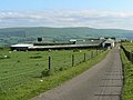
 Cattle On The Hill - geograph.org.uk - 831608.jpg 640 × 414; 85 KB
-

-
 Common Dog Violet (Viola riviniana) - geograph.org.uk - 421761.jpg 640 × 476; 151 KB
-
 Cottages On The B741 - geograph.org.uk - 775794.jpg 640 × 480; 82 KB
-
 Dail Mhaol Chiarain 7757868.jpg 640 × 447; 72 KB
-
 Dailly bridge - geograph.org.uk - 137572.jpg 600 × 450; 94 KB
-
 Dailly Bridge - geograph.org.uk - 137574.jpg 600 × 450; 103 KB
-
 Mining Monument - geograph.org.uk - 775779.jpg 640 × 480; 117 KB
-
 Quarry Walk Corner - geograph.org.uk - 775813.jpg 640 × 480; 143 KB
-
 Railway bridge near Dailly - geograph.org.uk - 334590.jpg 480 × 640; 79 KB
-
 Reflections On The Quarry Walk - geograph.org.uk - 775831.jpg 450 × 600; 96 KB
-
 The Fergusson of Kilkerran Mausoleum & New Dailly Kirk, South Ayrshire.jpg 3,863 × 2,509; 1.71 MB
-
 The Lindsayston Waymarker - geograph.org.uk - 775851.jpg 640 × 480; 143 KB
-
 The Path the Maybole - geograph.org.uk - 464258.jpg 450 × 600; 65 KB
-
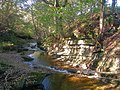
 The Water Of Girvan - geograph.org.uk - 775781.jpg 640 × 480; 93 KB
-
 Tree By The Burn - geograph.org.uk - 775801.jpg 640 × 480; 98 KB
-
 Tytthaspis sedecimpunctata (2129838746).jpg 800 × 600; 148 KB
-
 Up The Burn - geograph.org.uk - 775838.jpg 640 × 480; 96 KB
-
 War Memorial, Dailly, South Ayrshire.jpg 4,632 × 2,221; 1.76 MB
-
 Wood Anemone (Anemone nemorosa) - geograph.org.uk - 421757.jpg 640 × 480; 130 KB
-
 Wood Sorrel (Oxalis acetosella) - geograph.org.uk - 421758.jpg 450 × 600; 91 KB
-
 A Carpet of Wood Anemones - geograph.org.uk - 421755.jpg 480 × 640; 251 KB
-
 Along The Firebreak - geograph.org.uk - 782839.jpg 640 × 480; 98 KB
-
 Autumn Mosaic - geograph.org.uk - 594644.jpg 450 × 600; 91 KB
-
 Bargany Estate, near Old Dailly - geograph.org.uk - 264630.jpg 640 × 480; 68 KB
-
 Below Barony Hill - geograph.org.uk - 57238.jpg 640 × 481; 72 KB
-
 Blair House and Farm - geograph.org.uk - 354793.jpg 640 × 480; 95 KB
-

-
 Brunston Castle Golf Course - geograph.org.uk - 775792.jpg 640 × 480; 78 KB
-

-
 Bus shelter at Kilgrammie - geograph.org.uk - 264486.jpg 640 × 480; 84 KB
-
 By The Forest Track - geograph.org.uk - 779080.jpg 640 × 480; 100 KB
-
 By the Girvan Water - geograph.org.uk - 424744.jpg 640 × 480; 116 KB
-
 Caravan in the Girvan valley - geograph.org.uk - 264494.jpg 480 × 640; 98 KB
-
 Cattle troughs near Dailly - geograph.org.uk - 264632.jpg 640 × 480; 92 KB
-
 Coming Round Delamford Hill - geograph.org.uk - 416877.jpg 640 × 487; 128 KB
-
 Craig Farm - geograph.org.uk - 505192.jpg 450 × 600; 61 KB
-
 Crossing The Burn - geograph.org.uk - 775847.jpg 450 × 600; 94 KB
-
 Dailly Parish Church and War Memorial - geograph.org.uk - 57209.jpg 640 × 481; 71 KB
-
 Dailly Post Office - geograph.org.uk - 683536.jpg 398 × 600; 47 KB
-
 Dailly Primary School - geograph.org.uk - 264500.jpg 640 × 480; 69 KB
-
 Dalquharran Mains, near Dailly - geograph.org.uk - 334592.jpg 640 × 480; 66 KB
-
 Delamford Farm View - geograph.org.uk - 625718.jpg 640 × 480; 54 KB
-

-
 East Threave - geograph.org.uk - 461796.jpg 640 × 480; 146 KB
-
 Farm Track - geograph.org.uk - 775855.jpg 640 × 480; 127 KB
-
 Farmland View - geograph.org.uk - 625708.jpg 640 × 480; 61 KB
-
 Farmland View - geograph.org.uk - 775835.jpg 640 × 412; 78 KB
-
 Farmland View - geograph.org.uk - 775858.jpg 640 × 480; 80 KB
-
 Fields near Wallacetown - geograph.org.uk - 264509.jpg 640 × 480; 69 KB
-
 Forest Edge - geograph.org.uk - 779082.jpg 450 × 600; 66 KB
-
 Forest View - geograph.org.uk - 577538.jpg 444 × 600; 61 KB
-
 Freshwater Mussel Shell - geograph.org.uk - 424761.jpg 640 × 480; 127 KB
-
 Frog Spawn on the Track - geograph.org.uk - 354772.jpg 640 × 480; 195 KB
-
 From Craig Hill - geograph.org.uk - 506292.jpg 450 × 600; 60 KB
-
 From Hadyard Hill - geograph.org.uk - 506376.jpg 450 × 600; 59 KB
-
 From Kirk Hill Trig Point - geograph.org.uk - 464254.jpg 640 × 467; 85 KB
-
 Gateway to the Bargany Estate - geograph.org.uk - 335409.jpg 480 × 640; 85 KB
-
 Girvan Valley - geograph.org.uk - 232537.jpg 640 × 480; 139 KB
-
 Girvan Valley From Craig Hill - geograph.org.uk - 506299.jpg 450 × 600; 78 KB
-
 Girvan valley near Moorston Farm - geograph.org.uk - 233133.jpg 640 × 377; 94 KB
-
 Girvan Valley View - geograph.org.uk - 506363.jpg 640 × 480; 89 KB
-
 Girvan Valley View - geograph.org.uk - 594638.jpg 640 × 466; 139 KB
-
 Glenmard Stables - geograph.org.uk - 354822.jpg 640 × 480; 122 KB
-
 Going Up The Hill - geograph.org.uk - 354787.jpg 480 × 640; 177 KB
-
 Grazing Land - geograph.org.uk - 354806.jpg 640 × 480; 108 KB
-
 Greenhead Hotel, Dailly - geograph.org.uk - 334591.jpg 640 × 480; 56 KB
-

-
 Hadyard Hill Slope - geograph.org.uk - 506369.jpg 446 × 600; 53 KB
-
 Hazelwood Avenue, Dailly - geograph.org.uk - 594631.jpg 640 × 438; 99 KB
-
 Hidden Turbine - geograph.org.uk - 416889.jpg 480 × 640; 164 KB
-
 High Mains - geograph.org.uk - 461771.jpg 640 × 480; 80 KB
-
 High Newlands - geograph.org.uk - 464262.jpg 640 × 465; 103 KB
-
 High, but not so new - geograph.org.uk - 461766.jpg 640 × 480; 68 KB
-
 In the Girvan valley - geograph.org.uk - 264512.jpg 640 × 480; 71 KB
-
 Kirk Hill - geograph.org.uk - 7554.jpg 640 × 442; 63 KB
-
 Kirk Hill trig - geograph.org.uk - 382670.jpg 640 × 480; 99 KB
-
 Kirk Hill View - geograph.org.uk - 464253.jpg 450 × 600; 60 KB
-
 Lindsayston Burn - geograph.org.uk - 594622.jpg 640 × 480; 148 KB
-
 Lindsayston Burn - geograph.org.uk - 594625.jpg 640 × 475; 159 KB
-

-
 Maxwelston, near Dailly - geograph.org.uk - 334589.jpg 640 × 480; 79 KB
-
 Meeting Of The Burns - geograph.org.uk - 625712.jpg 640 × 480; 65 KB
-
 Moorland Burn - geograph.org.uk - 506309.jpg 459 × 600; 65 KB
-
 New building at Wallacetown - geograph.org.uk - 264506.jpg 640 × 480; 61 KB
-
 New trees and old - geograph.org.uk - 461792.jpg 640 × 480; 68 KB
-
 On Glenshalloch Hill - geograph.org.uk - 631608.jpg 640 × 480; 72 KB
-
 On The Lindsayston Walk - geograph.org.uk - 594616.jpg 640 × 480; 136 KB
-
 Overgrown Pond - geograph.org.uk - 464232.jpg 640 × 480; 117 KB
-
 Ox Bow Lake - geograph.org.uk - 424757.jpg 450 × 600; 74 KB
-

-
 Pond - geograph.org.uk - 577534.jpg 640 × 447; 87 KB
-
 Poundland Wood - geograph.org.uk - 57222.jpg 640 × 480; 167 KB
-
 Quarrel Hill Edge - geograph.org.uk - 464237.jpg 450 × 600; 58 KB
-
 Quarrel Hill View - geograph.org.uk - 464241.jpg 640 × 468; 65 KB
-
 Roadside Cottages - geograph.org.uk - 464283.jpg 640 × 480; 121 KB
-
 Shaped by the Wind - geograph.org.uk - 464249.jpg 640 × 472; 99 KB
-
 Sharp Bend - geograph.org.uk - 464222.jpg 640 × 480; 114 KB
-
 Sheep at the Ruined Building - geograph.org.uk - 464223.jpg 640 × 480; 128 KB
-
 Sheep on Craig Hill - geograph.org.uk - 506303.jpg 450 × 600; 65 KB
-
 Sheep on the slopes - geograph.org.uk - 461782.jpg 640 × 436; 58 KB
-
 Small wooded valley near Dailly - geograph.org.uk - 335410.jpg 480 × 640; 96 KB
-

-
 The Craigdow Track - geograph.org.uk - 287075.jpg 640 × 480; 154 KB
-
 The Edge of Hadyard Hill - geograph.org.uk - 505370.jpg 449 × 600; 61 KB
-
 The Girvan valley near Moorston Farm - geograph.org.uk - 233128.jpg 640 × 426; 157 KB
-
 The Track Through Kilgrammie Wood - geograph.org.uk - 354762.jpg 640 × 480; 175 KB
-
 The track to Cosyglen Wood. - geograph.org.uk - 423449.jpg 640 × 480; 168 KB
-
 The View From Blawearie Wood - geograph.org.uk - 354816.jpg 480 × 640; 150 KB
-
 The Water of Girvan - geograph.org.uk - 424741.jpg 640 × 480; 121 KB
-
 To The Turbines - geograph.org.uk - 577530.jpg 450 × 600; 54 KB
-
 Towards Craigdow Farm - geograph.org.uk - 287072.jpg 640 × 480; 204 KB
-
 Towards Craigfin Hill - geograph.org.uk - 287070.jpg 640 × 480; 113 KB
-
 Towards Glenshalloch Wood - geograph.org.uk - 631606.jpg 450 × 600; 60 KB
-
 Towards Lindsayston - geograph.org.uk - 232528.jpg 640 × 480; 127 KB
-
 Towards Moorston - geograph.org.uk - 424760.jpg 640 × 480; 88 KB
-
 Towards Newlands - geograph.org.uk - 464226.jpg 450 × 600; 83 KB
-
 Towards Quarrel Hill - geograph.org.uk - 464229.jpg 450 × 600; 52 KB
-
 Trees by the Track - geograph.org.uk - 464244.jpg 640 × 480; 103 KB
-
 View From Kilgrammie Wood - geograph.org.uk - 354780.jpg 640 × 480; 162 KB
-
 Water of Girvan - geograph.org.uk - 424765.jpg 640 × 480; 127 KB
-
 Wayside seat - geograph.org.uk - 264502.jpg 640 × 480; 86 KB
-
 Whitehill Farm - geograph.org.uk - 57243.jpg 640 × 481; 96 KB
-
 Wind Turbine on Delamford Hill - geograph.org.uk - 416882.jpg 640 × 468; 118 KB
-
 Winding country road - geograph.org.uk - 461760.jpg 640 × 480; 141 KB
-
 Woodland near Kilgrammie - geograph.org.uk - 334249.jpg 480 × 640; 85 KB
-
 Woodland ride near Kilgrammie - geograph.org.uk - 334252.jpg 480 × 640; 101 KB
.jpg)


_-_geograph.org.uk_-_421761.jpg)


.jpg)


_-_geograph.org.uk_-_421757.jpg)
_-_geograph.org.uk_-_421758.jpg)


_360_Panorama_-_geograph.org.uk_-_378623.jpg)