Category:Dalkeith
Перейти к навигации
Перейти к поиску
город в Шотландии (Великобритания), административный центр округа Мидлотиан  | |||||
| Медиафайл | |||||
| Это частный случай понятия |
| ||||
|---|---|---|---|---|---|
| Местонахождение |
| ||||
| Численность населения |
| ||||
 | |||||
Dansk: Dalkeith er en by i Midlothian, Skotland, som ligger ved River North Esk-floden. Den blev kaldet en burgh of barony i 1401 og en burgh of regality i 1540. Atallet af bygninger i Dalkeith voksede sydvest fra i det 12. århundredes slot (nu Dalkeith Palace). Dalkeith har et indbyggertal på 11.566 folk, som blev talt i 2001.
Deutsch: Dalkeith ist eine Stadt in Midlothian, Schottland mit etwa 38.420 Einwohnern (Schätzung 2004).
English: Dalkeith ( Scottish Gaelic: Dail Cheith) is a town in Midlothian, Scotland, lying on the River North Esk. It was granted a burgh of barony in 1401 and a burgh of regality in 1540. The settlement of Dalkeith grew southwestwards from its 12th-century castle (now Dalkeith Palace).
Euskara: Dalkeith ( Eskoziako gaeleraz: Dail Cheith), Eskozia hego-ekialdeko udalerria da, Midlothianen dagoena.
Français : Dalkeith est une ville écossaise située dans le Midlothian, Scotland, située sur la rivière North Esk.
Gàidhlig: 'S e baile ann an Alba mheadhoanach a tha ann an Dail Chè neo Dail Cheith. Tha e faisg air Peighinn na Cuthaige, agus 's e prìomh-bhaile Lodainn Mheadhanach a tha ann. Tha mòran dhaoine an seo ag obair ann an Dùn Èideann.
Norsk bokmål: Dalkeith ( Skotsk gælisk: Dail Cheith) er en by (town) med historisk status som burgh i regionen Midlothian i Skottland. Den ligger sørøst for Edinburgh.
Polski: Dalkeith ( gael. Dail Cheith) - miasto w Szkocji, ośrodek administracyjny hrabstwa Midlothian. Ok. 11,5 tysiąca mieszkańców.
Подкатегории
В этой категории отображается 17 подкатегорий из имеющихся 17.
A
B
- Dalkeith bypass (8 Ф)
C
- David Calderwood (10 Ф)
- Dalkeith Cemetery (9 Ф)
E
F
- Dalkeith Fire Station (2 Ф)
H
- Dalkeith High School (2 Ф)
M
O
- Old Wood, Dalkeith (5 Ф)
P
S
- St David's Roman Catholic High School (пустая)
T
W
- Dalkeith War Memorial (5 Ф)
Файлы в категории «Dalkeith»
Показаны 200 файлов из 244, находящихся в данной категории.
(Предыдущая страница) (Следующая страница)-
 153-169 High Street - geograph.org.uk - 5936998.jpg 640 × 399; 317 Кб
-
 18thC sundial at Bridgend - geograph.org.uk - 2497279.jpg 471 × 640; 85 Кб
-
 71-77 High Street - geograph.org.uk - 5936928.jpg 640 × 427; 352 Кб
-
 A crossroads in Dalkeith - geograph.org.uk - 2886962.jpg 640 × 480; 232 Кб
-
 A little reminder of the past - geograph.org.uk - 2232945.jpg 768 × 1024; 474 Кб
-
 A68, Dalkeith Bypass - geograph.org.uk - 4423120.jpg 800 × 533; 338 Кб
-
 A7 crossing the North Esk - geograph.org.uk - 6080969.jpg 1024 × 683; 279 Кб
-
 Approaching the Sheriffhall roundabout - geograph.org.uk - 6146450.jpg 1024 × 731; 123 Кб
-
 Apse of St Nicholas Kirk - geograph.org.uk - 5936790.jpg 640 × 427; 373 Кб
-
 Archview Lodge Nursing Home - geograph.org.uk - 3539185.jpg 3224 × 2392; 2,74 Мб
-
 Awaiting development - geograph.org.uk - 6080966.jpg 1024 × 683; 271 Кб
-
 Beside the North Esk, Dalkeith - geograph.org.uk - 4927679.jpg 1024 × 683; 289 Кб
-
 Bridge over the River North Esk - geograph.org.uk - 1035626.jpg 640 × 480; 121 Кб
-
 Brunton's Close - geograph.org.uk - 5936954.jpg 425 × 640; 308 Кб
-
 Building site, Thornybank - geograph.org.uk - 5079973.jpg 800 × 533; 175 Кб
-
 Car park, Dalkeith - geograph.org.uk - 3691214.jpg 640 × 480; 305 Кб
-
 Cattle near Newfarm, Dalkeith - geograph.org.uk - 5339408.jpg 1024 × 682; 128 Кб
-
 Cauld at Montagu Bridge (36879384862).jpg 2732 × 4098; 2,43 Мб
-
 Cedrus atlantica glauca.jpg 3888 × 2592; 4,9 Мб
-
 Cereal crop towards Whitehill - geograph.org.uk - 5478211.jpg 640 × 480; 50 Кб
-

-
 Chippy, Thornybank - geograph.org.uk - 5079979.jpg 800 × 533; 193 Кб
-
 Co-Op Clock Tower - geograph.org.uk - 5936901.jpg 427 × 640; 304 Кб
-
 Conservatory - Orangery Dalkeith Park - geograph.org.uk - 2733464.jpg 2640 × 1980; 1,04 Мб
-

-
 Corner Pocket Snooker Centre - geograph.org.uk - 3691176.jpg 640 × 480; 254 Кб
-
 Cousland to Dalkeith road - geograph.org.uk - 4263360.jpg 800 × 600; 407 Кб
-
 Cowden - geograph.org.uk - 4423124.jpg 800 × 533; 403 Кб
-
 Croft Street, Dalkeith - geograph.org.uk - 4927636.jpg 1024 × 683; 327 Кб
-
 Cross Keys Hotel - geograph.org.uk - 2773939.jpg 480 × 640; 89 Кб
-
 Current edge of Eskbank, Weir Crescent - geograph.org.uk - 6080977.jpg 1024 × 683; 427 Кб
-
 Cyclepath north of Dalkeith - geograph.org.uk - 5845415.jpg 1600 × 1066; 511 Кб
-
 Cyclepath, Dalkeith Schools Campus - geograph.org.uk - 5845402.jpg 1600 × 1066; 379 Кб
-
 Dalkeith - geograph.org.uk - 4096389.jpg 640 × 360; 221 Кб
-
 Dalkeith bus garage site - geograph.org.uk - 3769199.jpg 640 × 426; 262 Кб
-
 Dalkeith Community Campus - geograph.org.uk - 5079985.jpg 800 × 533; 183 Кб
-
 Dalkeith Community Schools Campus - geograph.org.uk - 5845384.jpg 1600 × 1069; 284 Кб
-
 Dalkeith High School site 2012 - geograph.org.uk - 3011920.jpg 3264 × 2448; 4,8 Мб
-
 Dalkeith High School site 2012 - geograph.org.uk - 3011933.jpg 3264 × 2448; 4,6 Мб
-
 Dalkeith High Street improvements - geograph.org.uk - 2499210.jpg 640 × 480; 89 Кб
-
 Dalkeith House and access protest - geograph.org.uk - 4871290.jpg 1024 × 683; 346 Кб
-
 Dalkeith Library and Arts Centre - geograph.org.uk - 3539121.jpg 3264 × 2448; 3,5 Мб
-
 Dalkeith Library ^ Arts Centre - geograph.org.uk - 6175411.jpg 2865 × 2144; 2,07 Мб
-
 Dalkeith Parish Kirk - geograph.org.uk - 2497227.jpg 640 × 480; 71 Кб
-
 Dalkeith railway station site geograph-3398322-by-Ben-Brooksbank.jpg 2265 × 1449; 2,66 Мб
-
 Dalkeith town centre improvements - geograph.org.uk - 2499213.jpg 640 × 480; 88 Кб
-
 Dalkeith town centre improvements - geograph.org.uk - 2499218.jpg 640 × 480; 104 Кб
-
 Dalkeith water tower.jpg 3024 × 4032; 2,24 Мб
-
 Dalkeith, High Street 1988 - geograph.org.uk - 4280796.jpg 2394 × 1518; 4,66 Мб
-
 Dalkeith, I woz here plaque - geograph.org.uk - 4927637.jpg 1024 × 1024; 366 Кб
-
 Dalkeith.jpg 620 × 407; 72 Кб
-
 Dalkeith.svg 1425 × 1313; 830 Кб
-
 Dean Burn, Dalkeith Park - geograph.org.uk - 6079682.jpg 683 × 1024; 388 Кб
-
 Debris, Lansbury Court - geograph.org.uk - 2768219.jpg 640 × 480; 294 Кб
-
 Denticollis linearis (a Click Beetle) - Flickr - S. Rae.jpg 1386 × 1194; 957 Кб
-
 Dropping down into Dalkeith - geograph.org.uk - 4483788.jpg 640 × 480; 72 Кб
-
 Edinburgh Road, Dalkeith - geograph.org.uk - 4927655.jpg 1024 × 1024; 362 Кб
-
 Edinburgh Road, Dalkeith - geograph.org.uk - 4927658.jpg 1024 × 683; 316 Кб
-
 Elginhaugh Gardens, Eskbank - geograph.org.uk - 6080748.jpg 1024 × 683; 224 Кб
-
 Entering Dalkeith - geograph.org.uk - 4483790.jpg 640 × 395; 70 Кб
-
 Eristalis tenax (female) - Drone Fly - Flickr - S. Rae (8).jpg 2012 × 1660; 1,6 Мб
-
 Eskbank Toll, Dalkeith - geograph.org.uk - 2854391.jpg 640 × 480; 70 Кб
-
 Eskdail Court - geograph.org.uk - 6262526.jpg 1024 × 768; 209 Кб
-
 Eskdaill Court - geograph.org.uk - 860132.jpg 640 × 480; 61 Кб
-
 Estate road in Dalkeith Park - geograph.org.uk - 6139541.jpg 640 × 480; 281 Кб
-
 Exit from Elginhaugh Gardens - geograph.org.uk - 6080752.jpg 1024 × 683; 303 Кб
-
 Farm at Cowbridge, Dalkeith - geograph.org.uk - 5236824.jpg 1024 × 682; 133 Кб
-
 Farm at Cowbridge, Dalkeith - geograph.org.uk - 5237914.jpg 1024 × 682; 130 Кб
-
 Farmland near Smeaton Head - geograph.org.uk - 1204454.jpg 640 × 480; 64 Кб
-
 Field awaiting development, Eskbank - geograph.org.uk - 6080980.jpg 1024 × 683; 207 Кб
-
 Field, Langside - geograph.org.uk - 3283877.jpg 640 × 480; 269 Кб
-
 Fields adjacent to A68 - geograph.org.uk - 4373401.jpg 800 × 372; 60 Кб
-
 Flats on High Street, Dalkeith - geograph.org.uk - 4483795.jpg 640 × 480; 67 Кб
-
 Footbridge (36861814416).jpg 3648 × 5472; 6,03 Мб
-
 Forgetmenots - Flickr - S. Rae.jpg 3312 × 2272; 4,33 Мб
-
 Former Inn - geograph.org.uk - 5936907.jpg 640 × 402; 299 Кб
-
 Former Royal Bank - geograph.org.uk - 5936947.jpg 432 × 640; 323 Кб
-
 Grammoptera ruficornis (Common Grammoptera) - Flickr - S. Rae (1).jpg 1203 × 1008; 587 Кб
-
 Grannies Park Industrial Estate - geograph.org.uk - 4927673.jpg 1024 × 683; 261 Кб
-
 Grazing land at Langside Head - geograph.org.uk - 1834465.jpg 640 × 480; 69 Кб
-
 Grazing near Smeaton Head - geograph.org.uk - 4478165.jpg 640 × 480; 60 Кб
-
 Harrow Hotel - geograph.org.uk - 5936805.jpg 519 × 640; 383 Кб
-
 Harrow Hotel, Dalkeith - geograph.org.uk - 3711418.jpg 640 × 853; 443 Кб
-
 Harrow Hotel, Dalkeith - geograph.org.uk - 4927634.jpg 1024 × 683; 238 Кб
-
 Harvested field near Cousland - geograph.org.uk - 4118950.jpg 640 × 426; 227 Кб
-
 Health centre, Dalkeith - geograph.org.uk - 2886982.jpg 640 × 480; 211 Кб
-
 High Street - geograph.org.uk - 5936780.jpg 640 × 392; 327 Кб
-
 High Street - geograph.org.uk - 5936971.jpg 564 × 640; 441 Кб
-
 High Street, Dalkeith (A6094) - geograph.org.uk - 4483798.jpg 640 × 480; 74 Кб
-
 High Street, Dalkeith - geograph.org.uk - 2368657.jpg 480 × 640; 58 Кб
-
 High Street, Dalkeith - geograph.org.uk - 2885895.jpg 640 × 480; 296 Кб
-
 High Street, Dalkeith - geograph.org.uk - 3711428.jpg 640 × 480; 258 Кб
-
 High Street, Dalkeith - geograph.org.uk - 4927639.jpg 1024 × 1024; 368 Кб
-
 High Street, Dalkeith - geograph.org.uk - 5237804.jpg 1024 × 682; 156 Кб
-
 Holly understorey, Dalkeith Park - geograph.org.uk - 6079774.jpg 1024 × 683; 473 Кб
-
 House at Bridgend - geograph.org.uk - 2497275.jpg 480 × 640; 119 Кб
-
 House on Salters Road - geograph.org.uk - 4484941.jpg 640 × 480; 64 Кб
-
 Houses on Pheasant Grove - geograph.org.uk - 5478203.jpg 640 × 480; 61 Кб
-
 Housing in Magpie Gardens, Woodburn - geograph.org.uk - 2232928.jpg 1024 × 768; 720 Кб
-

-

-
 Hydrellia^ - a tiny fly in bullrushes - Flickr - S. Rae.jpg 754 × 768; 88 Кб
-
 Ice House, Dalkeith House - geograph.org.uk - 4778682.jpg 1024 × 682; 282 Кб
-
 Ironmills Cottages, Dalkeith - geograph.org.uk - 2203106.jpg 640 × 427; 67 Кб
-
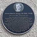 James Martin Stagg CB OBE FRSE - geograph.org.uk - 6175405.jpg 1570 × 1567; 1022 Кб
-
 King's Park School - geograph.org.uk - 5983726.jpg 640 × 427; 507 Кб
-
 Larch Wood, Dalkeith Park - geograph.org.uk - 5080283.jpg 800 × 533; 267 Кб
-
 Laundry Bridge and River South Esk - geograph.org.uk - 5937055.jpg 640 × 384; 420 Кб
-
 Leafhopper sp. on trefoil - Flickr - S. Rae.jpg 1072 × 979; 378 Кб
-
 Leaving Dalkeith in Midlothian - geograph.org.uk - 2079632.jpg 640 × 480; 75 Кб
-
 Lonchaeid fly - Flickr - S. Rae (3).jpg 689 × 608; 320 Кб
-
 London Road, Dalkeith - geograph.org.uk - 4927631.jpg 1024 × 683; 241 Кб
-
 Lugton Brae - geograph.org.uk - 5983683.jpg 640 × 427; 350 Кб
-
 Lugton Brae - geograph.org.uk - 5983689.jpg 640 × 427; 302 Кб
-
 Lugton, Dalkeith - geograph.org.uk - 5237801.jpg 1024 × 682; 176 Кб
-
 Map of Edinburghshire Sheet 007, Ordnance Survey (NLS), Published 1854.jpg 16 536 × 11 496; 37,07 Мб
-
 Mayson's, Dalkeith - geograph.org.uk - 4483796.jpg 640 × 480; 89 Кб
-
 Meeting of the Waters (36908947571).jpg 10 093 × 3023; 34,26 Мб
-
 Melangyna lasiophthalma (female) - Flickr - S. Rae (9).jpg 871 × 716; 435 Кб
-
 Melangyna sp. (female) - umbellatarum possibly - Flickr - S. Rae.jpg 982 × 860; 447 Кб
-
 Memorial to Robert Burns, Dalkeith - geograph.org.uk - 3539176.jpg 3264 × 2448; 3,54 Мб
-
 Midlothian House - geograph.org.uk - 3691168.jpg 640 × 480; 314 Кб
-
 Midlothian House, Dalkeith.jpg 1421 × 1066; 386 Кб
-
 Millstones at Bridgend, Dalkeith - geograph.org.uk - 2497267.jpg 640 × 480; 78 Кб
-
 Montagu Bridge (36908975091).jpg 3648 × 5472; 5,84 Мб
-
 Morrison's Supermarket - geograph.org.uk - 5983733.jpg 640 × 427; 380 Кб
-
-
 National Cycle Network milepost, Dalkeith - geograph.org.uk - 5845391.jpg 1600 × 1225; 518 Кб
-
 Nedlands Yacht Club - main clubhouse - panoramio.jpg 1280 × 851; 381 Кб
-
 New Cow Bridge - geograph.org.uk - 5639882.jpg 1500 × 1125; 2,01 Мб
-
 New houses, Thornybank - geograph.org.uk - 5079976.jpg 800 × 533; 178 Кб
-
 New housing estate, Woodburn - geograph.org.uk - 2232942.jpg 1024 × 768; 816 Кб
-
 Newmills Road, Dalkeith - geograph.org.uk - 4927627.jpg 683 × 1024; 307 Кб
-
 North end of Dalkeith High Street - geograph.org.uk - 3692427.jpg 640 × 480; 65 Кб
-
 North Esk singletrack - geograph.org.uk - 6080964.jpg 1024 × 683; 414 Кб
-
 Oakwood, Dalkeith Park - geograph.org.uk - 2424429.jpg 640 × 480; 363 Кб
-
 Offices at South Street, Dalkeith - geograph.org.uk - 4096650.jpg 3264 × 2448; 2,4 Мб
-
 Old building at Bridgend, Dalkeith - geograph.org.uk - 2497268.jpg 640 × 482; 63 Кб
-
 Old Edinburgh Road, Dalkeith - geograph.org.uk - 3539247.jpg 2197 × 1525; 1,24 Мб
-

-
 Ordnance Survey One-Inch Map Sheet 62 Edinburgh.jpg 7460 × 8801; 9,23 Мб
-
 Ordnance Survey Sheet NT 36 (36 36) Dalkeith, Published 1947.jpg 7575 × 9720; 14,17 Мб
-
 Parhelophilus sp - Flickr - S. Rae.jpg 888 × 702; 429 Кб
-
 Parhelophilus sp. (male) - Flickr - S. Rae (1).jpg 837 × 662; 215 Кб
-
 Parhelophilus sp. (male) - Flickr - S. Rae (2).jpg 1000 × 838; 464 Кб
-
 Parhelophilus sp. (male) - Flickr - S. Rae.jpg 892 × 728; 256 Кб
-
 Parhelophilus versicolor (female) - Flickr - S. Rae.jpg 940 × 788; 372 Кб
-
 Parhelophilus versicolor (female) 1 - Flickr - S. Rae.jpg 1374 × 1137; 500 Кб
-
 Parhelophilus versicolor (female) 2 - Flickr - S. Rae.jpg 1236 × 1041; 462 Кб
-
 Parhelophilus versicolor (female) 3 - Flickr - S. Rae.jpg 1152 × 912; 319 Кб
-
 Parhelophilus versicolor (female) 4 - Flickr - S. Rae.jpg 1080 × 962; 347 Кб
-
 Path between houses, Thornybank - geograph.org.uk - 5845376.jpg 1600 × 1066; 466 Кб
-
 Path, Old Wood - geograph.org.uk - 5080288.jpg 800 × 533; 245 Кб
-
 Peacocks, Dalkeith - geograph.org.uk - 2886976.jpg 640 × 480; 225 Кб
-
 Pebble mosaic - dragonfly - geograph.org.uk - 3539155.jpg 3422 × 2776; 4,31 Мб
-
 Pebble mosaic - swan - geograph.org.uk - 3539145.jpg 3338 × 2800; 4,2 Мб
-
 Permit reader, under construction - geograph.org.uk - 4870335.jpg 683 × 1024; 245 Кб
-
 Pheasant Grove - geograph.org.uk - 5478207.jpg 640 × 480; 73 Кб
-
 Phratora sp. - Leaf Beetle on Sallow leaf - Flickr - S. Rae.jpg 1112 × 994; 695 Кб
-
 Pipiza sp. (female) - Flickr - S. Rae (5).jpg 1473 × 1221; 967 Кб
-
 Pipiza sp. (female) - Flickr - S. Rae (6).jpg 1611 × 1317; 1,1 Мб
-
 Plaque, Lansbury Court - geograph.org.uk - 2768372.jpg 640 × 480; 341 Кб
-
 Platycheirus cf. peltatus (male) - Flickr - S. Rae (1).jpg 1054 × 852; 488 Кб
-
 Platycheirus cf. scutatus (male) - Flickr - S. Rae (4).jpg 1164 × 924; 274 Кб
-
 Platycheirus cf. scutatus (male) - Flickr - S. Rae (5).jpg 854 × 670; 163 Кб
-
 Platycheirus cf. scutatus (male) - Flickr - S. Rae (6).jpg 768 × 594; 135 Кб
-
 Platycheirus in prayer - Flickr - S. Rae.jpg 784 × 756; 232 Кб
-
 Platycheirus sp. scambus^ (male) - Flickr - S. Rae.jpg 984 × 790; 340 Кб
-
 Plummer Court - geograph.org.uk - 5936770.jpg 640 × 431; 313 Кб
-
 Pondskater - Flickr - S. Rae.jpg 2144 × 1777; 1,09 Мб
-
 Preparing for a Parade - geograph.org.uk - 5936822.jpg 640 × 351; 385 Кб
-
 Quality Window Blinds - geograph.org.uk - 4927642.jpg 1024 × 1024; 255 Кб
-
 Quarterly Journal of the Geological Society of London, vol. 9 Plate 12.png 3689 × 1292; 3,27 Мб
-
 Railings in Glebe Street - geograph.org.uk - 2497285.jpg 640 × 480; 103 Кб
-
 Riding in Dalkeith Park - geograph.org.uk - 6079769.jpg 1024 × 683; 481 Кб
-
 Riponnensia splendens (male) - Flickr - S. Rae (3).jpg 1227 × 1056; 336 Кб
-
 Riponnensia splendens (male) - Flickr - S. Rae (4).jpg 1065 × 921; 351 Кб
-
 Riponnensia splendens (male) - Flickr - S. Rae (5).jpg 1064 × 898; 298 Кб
-
 River South Esk at Dalkeith - geograph.org.uk - 1035584.jpg 640 × 480; 108 Кб
-
 Road junction, Dalkeith Park - geograph.org.uk - 6079765.jpg 1024 × 683; 324 Кб
-
 Road to Newfarm, Dalkeith - geograph.org.uk - 5339404.jpg 1024 × 682; 151 Кб
-
 Road, Dalkeith Park - geograph.org.uk - 6079681.jpg 1024 × 683; 325 Кб
-
 Road, Dalkeith Park - geograph.org.uk - 6079772.jpg 1024 × 683; 490 Кб
-
 Road, Dalkeith Park - geograph.org.uk - 6079773.jpg 1024 × 683; 443 Кб
-
 Rookery at Newfarm - geograph.org.uk - 1204341.jpg 640 × 480; 93 Кб
-
 Salters Road (A6094) - geograph.org.uk - 4484945.jpg 640 × 480; 70 Кб
-
 Salters Road (A6094) - geograph.org.uk - 4484952.jpg 640 × 480; 78 Кб
-
 Salters Road, Dalkeith - geograph.org.uk - 5486823.jpg 1024 × 682; 113 Кб
-
 Salticus scenicus (Zebra Jumper) - breakfast - Flickr - S. Rae.jpg 1580 × 1426; 399 Кб
-

-
 Sandstone wall - geograph.org.uk - 2232883.jpg 1024 × 768; 1008 Кб
-
 Sawfly devouring a hoverfly - Flickr - S. Rae.jpg 1350 × 1179; 655 Кб
-
 Shaft cap, Grannies Park - geograph.org.uk - 4927676.jpg 1024 × 683; 499 Кб
-

-
 Sign for the County Hotel, Dalkeith - geograph.org.uk - 4478154.jpg 640 × 547; 104 Кб
-
 Site of Dalkeith bus garage - geograph.org.uk - 3711403.jpg 640 × 480; 193 Кб
-
 Smeaton Substation - geograph.org.uk - 5079988.jpg 800 × 533; 158 Кб
-
 South Street - geograph.org.uk - 5936818.jpg 640 × 427; 281 Кб
-
 St Andrew Street, Dalkeith - geograph.org.uk - 2485139.jpg 640 × 480; 84 Кб
-
 St Andrew Street, Dalkeith - geograph.org.uk - 4927592.jpg 1024 × 683; 250 Кб


.jpg)


_-_Flickr_-_S._Rae.jpg)


_-_Drone_Fly_-_Flickr_-_S._Rae_(8).jpg)


.jpg)


_-_Flickr_-_S._Rae_(1).jpg)


_-_geograph.org.uk_-_4483798.jpg)


.jpg)
.jpg)


.jpg)


,_Published_1854.jpg)

_-_Flickr_-_S._Rae_(9).jpg)
_-_umbellatarum_possibly_-_Flickr_-_S._Rae.jpg)


.jpg)


_Dalkeith,_Published_1947.jpg)

_-_Flickr_-_S._Rae_(1).jpg)
_-_Flickr_-_S._Rae_(2).jpg)
_-_Flickr_-_S._Rae.jpg)
_-_Flickr_-_S._Rae.jpg)
_1_-_Flickr_-_S._Rae.jpg)
_2_-_Flickr_-_S._Rae.jpg)
_3_-_Flickr_-_S._Rae.jpg)
_4_-_Flickr_-_S._Rae.jpg)


_-_Flickr_-_S._Rae_(5).jpg)
_-_Flickr_-_S._Rae_(6).jpg)

_-_Flickr_-_S._Rae_(1).jpg)
_-_Flickr_-_S._Rae_(4).jpg)
_-_Flickr_-_S._Rae_(5).jpg)
_-_Flickr_-_S._Rae_(6).jpg)

_-_Flickr_-_S._Rae.jpg)


_-_Flickr_-_S._Rae_(3).jpg)
_-_Flickr_-_S._Rae_(4).jpg)
_-_Flickr_-_S._Rae_(5).jpg)


_-_geograph.org.uk_-_4484945.jpg)
_-_geograph.org.uk_-_4484952.jpg)

_-_breakfast_-_Flickr_-_S._Rae.jpg)


.jpg)