Category:Dalserf (civil parish)
Jump to navigation
Jump to search
Scottish parish in South Lanarkshire, Scotland, UK | |||||
| Upload media | |||||
| Instance of | |||||
|---|---|---|---|---|---|
| Part of |
| ||||
| Named after | |||||
| Location |
| ||||
| Population |
| ||||
| Area |
| ||||
 | |||||
Subcategories
This category has the following 7 subcategories, out of 7 total.
A
L
- Larkhall Viaduct (8 F)
M
- Mauldslie Bridge (6 F)
- Mauldslie Castle West Lodge (5 F)
R
- Rosebank, South Lanarkshire (5 F)
Media in category "Dalserf (civil parish)"
The following 200 files are in this category, out of 296 total.
(previous page) (next page)-

-
 A closed road - geograph.org.uk - 2999014.jpg 640 × 426; 239 KB
-
 A grand entrance at Milton-Lockhart - geograph.org.uk - 3676991.jpg 640 × 483; 95 KB
-
 A turbine at Lochhead Wind Farm - geograph.org.uk - 3629563.jpg 1,024 × 768; 94 KB
-

-
 A wind turbine near Stonehouse - geograph.org.uk - 2033584.jpg 2,048 × 1,537; 1.99 MB
-
 A71 approaching Stonehouse - geograph.org.uk - 4941399.jpg 640 × 481; 59 KB
-
 A71 from the M74Junction 8 slip road - geograph.org.uk - 4941388.jpg 640 × 340; 37 KB
-
 A72 approaching J7 of the M74 - geograph.org.uk - 3169792.jpg 640 × 449; 50 KB
-
 A72 Bridge, Junction 7, M74 - geograph.org.uk - 2774023.jpg 640 × 430; 42 KB
-
 A72 Lanark Road - geograph.org.uk - 3169782.jpg 640 × 481; 86 KB
-
 A72 south of Dalserf - geograph.org.uk - 5116864.jpg 640 × 432; 83 KB
-
 Abuse of the facilities - geograph.org.uk - 2667224.jpg 640 × 360; 247 KB
-

-
 Access Bridge over M74 - geograph.org.uk - 3951520.jpg 640 × 480; 262 KB
-
 Ambiance - geograph.org.uk - 2675076.jpg 640 × 360; 221 KB
-
 Approaching Marlage on Hill Road - geograph.org.uk - 6227525.jpg 1,024 × 575; 140 KB
-
 Approaching Netherburn from the west - geograph.org.uk - 4942956.jpg 640 × 481; 84 KB
-
 Approaching Skellyton Farm - geograph.org.uk - 1631528.jpg 640 × 480; 118 KB
-
 Avon Water at Millheugh (3) - geograph.org.uk - 4706037.jpg 1,024 × 683; 181 KB
-
 Avongrove Veterinary Clinic - geograph.org.uk - 3179760.jpg 640 × 481; 62 KB
-
 Ayr Road - geograph.org.uk - 2667136.jpg 640 × 360; 208 KB
-
 B17 bomber - geograph.org.uk - 1654405.jpg 640 × 480; 65 KB
-
 B7078 approaching Larkhall - geograph.org.uk - 4941392.jpg 640 × 475; 54 KB
-
 B7078 in Larkhall - geograph.org.uk - 4941396.jpg 640 × 467; 53 KB
-
 Beeches and bluebells, Rosebank - geograph.org.uk - 5389894.jpg 4,896 × 3,672; 6.78 MB
-
 Beeches on Clatty Brae - geograph.org.uk - 5566751.jpg 4,608 × 3,456; 6.94 MB
-
 Below Stonehouse - geograph.org.uk - 2922591.jpg 640 × 360; 189 KB
-
 Bend on the SW corner of Glen Avenue - geograph.org.uk - 3948480.jpg 640 × 480; 49 KB
-
 Bluebells at Clatty Brae, Rosebank - geograph.org.uk - 5389886.jpg 4,896 × 3,672; 7.24 MB
-
 Bogside Cottages, Ashgill - geograph.org.uk - 6273437.jpg 5,152 × 3,864; 6.38 MB
-
 Brick work, Canderside - geograph.org.uk - 3948060.jpg 640 × 480; 228 KB
-

-
 Bridge carrying the A72 over the M74 - geograph.org.uk - 2647109.jpg 800 × 574; 73 KB
-

-
 Bridge over Northbound M74 - geograph.org.uk - 3951535.jpg 640 × 480; 274 KB
-
 Bridge over the Cander Water on Candermill Road - geograph.org.uk - 6227540.jpg 1,024 × 575; 252 KB
-
 Bridge over the Clyde - geograph.org.uk - 3438775.jpg 3,935 × 2,698; 2.99 MB
-
 Broomfield - geograph.org.uk - 5359145.jpg 1,024 × 683; 354 KB
-
 Broomfield Road, near Netherburn - geograph.org.uk - 1991773.jpg 4,000 × 3,000; 2.51 MB
-
 Burnhead Road - geograph.org.uk - 2667163.jpg 640 × 360; 225 KB
-
 Burnhead Road Bridge, M74 - geograph.org.uk - 2774012.jpg 640 × 430; 51 KB
-
 Cameronian Hall, Victoria Street - geograph.org.uk - 4116284.jpg 640 × 480; 65 KB
-
 Cander Water - geograph.org.uk - 3948049.jpg 640 × 480; 323 KB
-
 Canderdyke-head Plantation - geograph.org.uk - 2922596.jpg 640 × 360; 282 KB
-

-

-
 Candermill Road Bridge, M74 - geograph.org.uk - 2774001.jpg 640 × 430; 60 KB
-
 Canderrig Colliery site - geograph.org.uk - 5359138.jpg 1,024 × 683; 434 KB
-
 Canderside Toll - geograph.org.uk - 3948500.jpg 640 × 480; 218 KB
-
 Canderside Toll - geograph.org.uk - 906667.jpg 640 × 480; 71 KB
-
 Car park at Larkhall Golf Course - geograph.org.uk - 3948426.jpg 640 × 480; 79 KB
-
 Cherrytree Crescent, Larkhall - geograph.org.uk - 3948464.jpg 640 × 480; 41 KB
-
 Church Street, Larkhall - geograph.org.uk - 1372796.jpg 640 × 479; 60 KB
-
 Church, Larkhall - geograph.org.uk - 2667206.jpg 360 × 640; 141 KB
-
 Clover and Clydeview Cottages - geograph.org.uk - 2667129.jpg 640 × 360; 231 KB
-
 Clyde's Mill Falls - geograph.org.uk - 3529106.jpg 4,608 × 3,456; 5.78 MB
-

-
 Cottages on Church Street, Larkhill - geograph.org.uk - 3629548.jpg 1,024 × 768; 149 KB
-
 Cumulonimbus over Howlethole - geograph.org.uk - 2915015.jpg 640 × 480; 227 KB
-
 Dalserf - geograph.org.uk - 3677101.jpg 640 × 480; 70 KB
-
 Dalserf Burn - geograph.org.uk - 1691729.jpg 3,264 × 1,914; 1.93 MB
-
 Dalserf Holm - geograph.org.uk - 5573766.jpg 4,608 × 2,990; 3.42 MB
-
 Dalserf Kirk - geograph.org.uk - 3677104.jpg 640 × 480; 67 KB
-
 Dalserf Kirk - geograph.org.uk - 3692799.jpg 640 × 480; 67 KB
-
 Dalserf Main Street - geograph.org.uk - 3169753.jpg 640 × 481; 80 KB
-
 Derelict Agricultural Building near Lochhead - geograph.org.uk - 4651428.jpg 1,885 × 947; 489 KB
-
 Derelict land, Larkhall - geograph.org.uk - 2918094.jpg 640 × 360; 234 KB
-
 Dobbies Car Park - geograph.org.uk - 6081235.jpg 640 × 427; 73 KB
-
 Draffan Road - geograph.org.uk - 3004435.jpg 640 × 426; 216 KB
-
 Dumping, Candermill and Marlage Road - geograph.org.uk - 2922599.jpg 640 × 360; 265 KB
-
 Dunsmore Brothers - geograph.org.uk - 2667151.jpg 640 × 360; 240 KB
-
 Edge of Cander Moss Nature Reserve - geograph.org.uk - 5503282.jpg 1,600 × 1,042; 388 KB
-
 Evening light on footpath above Rosebank - geograph.org.uk - 5389915.jpg 4,896 × 3,672; 6.82 MB
-
 Fairholm Bridge - geograph.org.uk - 2190285.jpg 1,600 × 1,200; 487 KB
-
 Farm Access Bridge over Southbound M74 - geograph.org.uk - 4032549.jpg 640 × 480; 237 KB
-
 Farm buildings at Skellyton - geograph.org.uk - 3692809.jpg 640 × 480; 59 KB
-
 Farmland by Sandyholm - geograph.org.uk - 3644497.jpg 1,024 × 768; 156 KB
-
 Field entrance and midden - geograph.org.uk - 2999736.jpg 640 × 426; 224 KB
-
 Field of sheep near Hill Cottages - geograph.org.uk - 4941411.jpg 640 × 481; 57 KB
-
 Field, Cairncockle - geograph.org.uk - 3948517.jpg 640 × 480; 203 KB
-
 Field, Netherburn - geograph.org.uk - 2840529.jpg 640 × 426; 272 KB
-
 Field, Netherburn - geograph.org.uk - 3004429.jpg 640 × 426; 221 KB
-

-
 Footbridge over the M74 - geograph.org.uk - 4652603.jpg 4,608 × 2,925; 2.89 MB
-
 Footbridge over the M74 by Strutherhill - geograph.org.uk - 2647086.jpg 1,600 × 1,116; 281 KB
-
 Footbridge south of Junction 7, M74 - geograph.org.uk - 2774019.jpg 640 × 430; 48 KB
-
 Footbridge, M74 - geograph.org.uk - 2774009.jpg 640 × 430; 50 KB
-

-
 Garrion Bridge - geograph.org.uk - 2675042.jpg 640 × 480; 252 KB
-
 Garrion Bridge - geograph.org.uk - 3677111.jpg 480 × 640; 58 KB
-
 Georgie's Brae - geograph.org.uk - 6273462.jpg 2,366 × 1,690; 1.06 MB
-
 Glass houses at Rosebank Nurseries - geograph.org.uk - 3677092.jpg 640 × 480; 88 KB
-
 Glengowan Primary School - geograph.org.uk - 1173356.jpg 640 × 480; 64 KB
-
 Glimpse of the River Clyde - geograph.org.uk - 4696068.jpg 4,608 × 3,456; 4.53 MB
-
 Goulding's Garden Centre - geograph.org.uk - 2915004.jpg 640 × 480; 245 KB
-
 Goulding's Garden Centre - geograph.org.uk - 5116865.jpg 640 × 481; 61 KB
-
 Grass field - geograph.org.uk - 2832393.jpg 640 × 426; 238 KB
-
 Grass field, Merryton - geograph.org.uk - 2832366.jpg 640 × 426; 225 KB
-
 Grassland near Lochhead Farm - geograph.org.uk - 2669744.jpg 640 × 480; 76 KB
-
 Growing grass near Canderside Toll - geograph.org.uk - 2922578.jpg 640 × 360; 191 KB
-
 Heading north out of Netherburn - geograph.org.uk - 5664506.jpg 640 × 480; 78 KB
-
 Hill - geograph.org.uk - 2922602.jpg 640 × 360; 180 KB
-
 Hill Road - geograph.org.uk - 4941409.jpg 567 × 640; 60 KB
-
 Hilton Gardens Care Home - geograph.org.uk - 3164588.jpg 640 × 481; 59 KB
-
 Himalayan balsam by the Clyde Walkway - geograph.org.uk - 5906959.jpg 1,024 × 768; 316 KB
-
 Himalayan balsam by the River Clyde - geograph.org.uk - 5906973.jpg 1,024 × 768; 351 KB
-
 Hop on Santa's 'Wonderland Wagons' - geograph.org.uk - 3057925.jpg 3,264 × 2,448; 4.77 MB
-

-
 Houses on Carlisle Road the B7078 - geograph.org.uk - 3629569.jpg 1,024 × 768; 123 KB
-
 Houses on Queendale Road, Larkhill - geograph.org.uk - 3629554.jpg 1,024 × 768; 140 KB
-
 John Street, Larkhall - geograph.org.uk - 3948435.jpg 640 × 480; 47 KB
-
 Junction 7, M74 - geograph.org.uk - 2838902.jpg 640 × 426; 226 KB
-
 Junction 8 of the M74 - geograph.org.uk - 3611478.jpg 3,663 × 2,442; 1.66 MB
-
 Junction 8 of the M74 - geograph.org.uk - 3611494.jpg 3,428 × 2,285; 1.92 MB
-
 Junction 8 on the M74 - geograph.org.uk - 2647070.jpg 800 × 522; 51 KB
-

-
 Junction of M74 slip road and A72 - geograph.org.uk - 5579026.jpg 1,024 × 768; 117 KB
-
 Junction on A71 at Shawsburn - geograph.org.uk - 5580468.jpg 1,024 × 683; 78 KB
-
 Lanark Road, heading north - geograph.org.uk - 5108273.jpg 640 × 481; 65 KB
-
 Larkhall Academy - geograph.org.uk - 1173408.jpg 640 × 480; 66 KB
-
 Larkhall Academy - geograph.org.uk - 1457127.jpg 640 × 480; 54 KB
-
 Larkhall Baptist Church - geograph.org.uk - 1198650.jpg 481 × 640; 78 KB
-
 Larkhall Cemetery Lodge House - geograph.org.uk - 1173396.jpg 640 × 480; 66 KB
-
 Larkhall from the air - geograph.org.uk - 6057743.jpg 1,024 × 768; 342 KB
-
 Larkhall Golf Club - geograph.org.uk - 2667161.jpg 640 × 360; 232 KB
-

-
 Larkhall Lodge - geograph.org.uk - 799014.jpg 480 × 640; 53 KB
-
 Larkhall MOT centre - geograph.org.uk - 3948460.jpg 640 × 480; 49 KB
-
 Larkhall railway station - geograph.org.uk - 2776624.jpg 640 × 360; 205 KB
-
 Larkhall railway station - geograph.org.uk - 3427233.jpg 640 × 480; 128 KB
-
 Larkhall railway station - geograph.org.uk - 3427236.jpg 640 × 480; 159 KB
-
 Larkhall railway station - geograph.org.uk - 3427238.jpg 640 × 480; 162 KB
-
 Larkhall railway station - geograph.org.uk - 3427240.jpg 640 × 480; 170 KB
-
 Larkhall railway station - geograph.org.uk - 3427243.jpg 640 × 480; 156 KB
-
 Larkhall railway station - geograph.org.uk - 3427246.jpg 640 × 480; 155 KB
-
 Larkhall railway station - geograph.org.uk - 3427250.jpg 480 × 640; 171 KB
-
 Larkhall railway station - geograph.org.uk - 3427254.jpg 640 × 480; 137 KB
-
 Larkhall railway station, Lanarkshire - geograph.org.uk - 3942048.jpg 1,024 × 768; 219 KB
-
 Larkhall to Hamilton Railway - geograph.org.uk - 3169797.jpg 640 × 481; 83 KB
-
 Larkhall Train Station in South Lanarkshire - geograph.org.uk - 4854316.jpg 5,760 × 3,840; 6.7 MB
-
 Leaving Netherburn on Broomfield Road - geograph.org.uk - 6227507.jpg 1,024 × 536; 109 KB
-
 Lochead Access Bridge, M74 - geograph.org.uk - 2773999.jpg 640 × 430; 60 KB
-
 Lochhead farm Wind Farm - geograph.org.uk - 1282207.jpg 640 × 480; 47 KB
-
 Lochhead Farm wind turbines from M74 - geograph.org.uk - 2420958.jpg 640 × 480; 77 KB
-
 Lochhead Farm, Lanarkshire - geograph.org.uk - 801054.jpg 640 × 481; 65 KB
-
 Lochhead Farm, Lanarkshire - geograph.org.uk - 801055.jpg 640 × 481; 64 KB
-
 Lochhead Farm, Lanarkshire - geograph.org.uk - 801057.jpg 640 × 481; 63 KB
-
 Lochhead Farm, Lanarkshire - geograph.org.uk - 801058.jpg 640 × 481; 96 KB
-
 Lochhead Wind Farm - geograph.org.uk - 5359142.jpg 1,024 × 683; 268 KB
-
 Lodge House at Mauldslie Bridge - geograph.org.uk - 5906955.jpg 1,024 × 768; 263 KB
-
 M 74 junction 8 - geograph.org.uk - 2277481.jpg 1,024 × 685; 53 KB
-
 M74 - geograph.org.uk - 2675050.jpg 640 × 360; 211 KB
-
 M74 - geograph.org.uk - 2675061.jpg 640 × 360; 220 KB
-
 M74 approaching Junction 8 - geograph.org.uk - 1846796.jpg 640 × 480; 53 KB
-
 M74 Approaching junction 8 - geograph.org.uk - 2680768.jpg 640 × 480; 134 KB
-
 M74 at Cander Moss - geograph.org.uk - 1846792.jpg 640 × 480; 43 KB
-
 M74 at Junction 8 - geograph.org.uk - 1846800.jpg 640 × 480; 44 KB
-
 M74 at Junction 8 - geograph.org.uk - 2680773.jpg 640 × 480; 157 KB
-
 M74 at junction 8 - geograph.org.uk - 4652600.jpg 2,179 × 1,972; 1,006 KB
-
 M74 at Lochhead Farm - geograph.org.uk - 2590509.jpg 640 × 480; 59 KB
-
 M74 Footbridge near Hareleeshill - geograph.org.uk - 3951527.jpg 640 × 480; 246 KB
-
 M74 heading north - geograph.org.uk - 2257228.jpg 640 × 430; 65 KB
-
 M74 Junction 8 at Larkhall - geograph.org.uk - 2420946.jpg 640 × 523; 81 KB
-
 M74 northbound near Cander Moss - geograph.org.uk - 3511897.jpg 640 × 481; 49 KB
-
 M74 northbound near Whitehill - geograph.org.uk - 3511889.jpg 640 × 481; 40 KB
-
 M74 northbound nears Junction 8 - geograph.org.uk - 3511901.jpg 640 × 480; 54 KB
-
 M74 Northbound, Strutherhill - geograph.org.uk - 2915361.jpg 640 × 480; 390 KB
-
 M74 Overbridge - geograph.org.uk - 1964325.jpg 2,272 × 1,704; 881 KB
-
 M74 passing the Lockhead Windfarm - geograph.org.uk - 2773998.jpg 640 × 430; 50 KB
-
 M74 traffic near Larkhall south of A72 bridge - geograph.org.uk - 3801276.jpg 2,592 × 1,936; 1.49 MB
-
 M74, Calder Moss - geograph.org.uk - 3951519.jpg 640 × 427; 237 KB
-
 M74, Cander Moss - geograph.org.uk - 3948506.jpg 640 × 480; 241 KB
-
 Machanhill - geograph.org.uk - 2667173.jpg 640 × 360; 193 KB
-
 Machanhill - geograph.org.uk - 2667180.jpg 640 × 360; 189 KB
-
 Machanhill Primary School - geograph.org.uk - 1281695.jpg 640 × 480; 84 KB
-
 Machanhill Primary School HORSA Huts - geograph.org.uk - 1281710.jpg 640 × 480; 70 KB
-
 Manse Brae - geograph.org.uk - 2918045.jpg 640 × 480; 265 KB
-
 Mauldslie Bridge - geograph.org.uk - 5313536.jpg 1,600 × 1,200; 591 KB
-
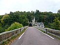 Mauldslie Bridge and Lodge - geograph.org.uk - 4696218.jpg 4,608 × 3,456; 4.82 MB
-
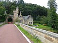
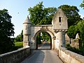
 Mauldslie West Lodge, Gateway and Gates - geograph.org.uk - 3018766.jpg 3,271 × 4,906; 6.57 MB
-
 Meadow Store, Machanhill - geograph.org.uk - 2675070.jpg 640 × 360; 200 KB
-
 Merryton railway station, Lanarkshire - geograph.org.uk - 3942023.jpg 1,024 × 768; 210 KB
-
 Millheugh Bridge - geograph.org.uk - 2776638.jpg 640 × 480; 269 KB
-
 Milton-Lockhart entrance - geograph.org.uk - 3529492.jpg 1,024 × 768; 152 KB
-
 Morgan Glen, Millheugh - geograph.org.uk - 4705996.jpg 1,024 × 683; 291 KB
-
 Mown field at Bogside, Ashgill - geograph.org.uk - 6273425.jpg 5,152 × 3,864; 7.51 MB
-
 Near Canderside Toll - geograph.org.uk - 1846807.jpg 640 × 480; 81 KB
-
 New Cycle Track to Ferniegair - geograph.org.uk - 3173444.jpg 640 × 480; 77 KB
-

-
 New Larkhall Academy - geograph.org.uk - 844943.jpg 640 × 480; 83 KB
-
 North bound slip road onto the M74 - geograph.org.uk - 5108275.jpg 640 × 456; 62 KB
-
 Northbound M74 - geograph.org.uk - 2915359.jpg 640 × 480; 354 KB
-
 Northbound M74 - geograph.org.uk - 3951524.jpg 640 × 427; 238 KB
-
 Northbound M74 - geograph.org.uk - 4652596.jpg 2,700 × 1,793; 1.09 MB
-
 Northbound M74 near Larkhall - geograph.org.uk - 6133575.jpg 800 × 533; 508 KB
-
 Northbound M74, Burnhead Road Bridge - geograph.org.uk - 3951528.jpg 640 × 427; 218 KB
-
 Old Garrion Bridge - geograph.org.uk - 2667120.jpg 640 × 480; 259 KB
-
 Old industrial building, Larkhall - geograph.org.uk - 5580454.jpg 1,024 × 768; 124 KB
-
 Old Larkhall Academy - geograph.org.uk - 1631801.jpg 640 × 480; 64 KB


_-_geograph.org.uk_-_4706037.jpg)


_over_the_Southbound_M74_-_geograph.org.uk_-_4032539.jpg)


&filefrom=Old+Milestone+by+the+B7078%2C+Carlisle+Road%2C+Dalserf+Parish+-+geograph.org.uk+-+6034718.jpg#mw-category-media)