Category:Devil's Causeway
Jump to navigation
Jump to search
English: The Devil's Causeway is a Roman road in Northumberland, in North East England. It branches off Dere Street north of Corbridge and can be traced through Northumberland for about 55 miles (89 km) north to Berwick-upon-Tweed.
Roman road that ran from Corbridge to Berwick-upon-Tweed  | |||||
| Upload media | |||||
| Instance of | |||||
|---|---|---|---|---|---|
| Location | Northumberland, North East England, England | ||||
| Length |
| ||||
 | |||||
Media in category "Devil's Causeway"
The following 9 files are in this category, out of 9 total.
-
 Bridleway on line of Devil's Causeway - geograph.org.uk - 1753303.jpg 1,024 × 768; 229 KB
-

-
 Devil's causeway - geograph.org.uk - 260677.jpg 640 × 480; 109 KB
-
 Devil's Causeway - geograph.org.uk - 389321.jpg 427 × 640; 146 KB
-
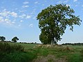
 Devil's Causeway heading for Hart Burn ford - geograph.org.uk - 1753411.jpg 1,024 × 768; 319 KB
-
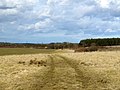
 Devil's Causeway south of Thornton Moor - geograph.org.uk - 1753354.jpg 1,024 × 768; 220 KB
-
 Roman Road resurfaced - geograph.org.uk - 456194.jpg 640 × 480; 93 KB
-
 Stile on Public Footpath - geograph.org.uk - 1702374.jpg 4,000 × 3,000; 4.46 MB
-
 Thornton Moor - geograph.org.uk - 1753343.jpg 1,024 × 768; 284 KB


