Category:Doniphan County, Kansas
Zur Navigation springen
Zur Suche springen
County im US-Bundesstaat Kansas   | |||||
| Medium hochladen | |||||
| Ist ein(e) | |||||
|---|---|---|---|---|---|
| Benannt nach | |||||
| Ort | Kansas | ||||
| Hauptstadt | |||||
| Datum der Gründung, Erstellung, Entstehung, Erbauung |
| ||||
| Einwohnerzahl |
| ||||
| Fläche |
| ||||
| Verschieden von | |||||
| offizielle Website | |||||
 | |||||
Counties of Kansas: Allen · Anderson · Atchison · Barber · Barton · Bourbon · Brown · Butler · Chase · Chautauqua · Cherokee · Cheyenne · Clark · Clay · Cloud · Coffey · Comanche · Cowley · Crawford · Decatur · Dickinson · Doniphan · Douglas · Edwards · Elk · Ellis · Ellsworth · Finney · Ford · Franklin · Geary · Gove · Graham · Grant · Gray · Greeley · Greenwood · Hamilton · Harper · Harvey · Haskell · Hodgeman · Jackson · Jefferson · Jewell · Johnson · Kearny · Kingman · Kiowa · Labette · Lane · Leavenworth · Lincoln · Linn · Logan · Lyon · Marion · Marshall · McPherson · Meade · Miami · Mitchell · Montgomery · Morris · Morton · Nemaha · Neosho · Ness · Norton · Osage · Osborne · Ottawa · Pawnee · Phillips · Pottawatomie · Pratt · Rawlins · Reno · Republic · Rice · Riley · Rooks · Rush · Russell · Saline · Scott · Sedgwick · Seward · Shawnee · Sheridan · Sherman · Smith · Stafford · Stanton · Stevens · Sumner · Thomas · Trego · Wabaunsee · Wallace · Washington · Wichita · Wilson · Woodson · Wyandotte
Unterkategorien
Es werden 11 von insgesamt 11 Unterkategorien in dieser Kategorie angezeigt:
In Klammern die Anzahl der enthaltenen Kategorien (K), Seiten (S), Dateien (D)
C
D
- Denton, Kansas (2 D)
E
- Elwood, Kansas (3 D)
H
K
- Konza Prairie Preserve (Kansas) (1 S, 27 D)
M
- Maps of Doniphan County, Kansas (22 D)
N
P
T
W
Medien in der Kategorie „Doniphan County, Kansas“
Folgende 31 Dateien sind in dieser Kategorie, von 31 insgesamt.
-

-
-

-

-

-
-
 Crop of ISS067-E-174799 Elwood, Kansas.jpg 989 × 946; 310 KB
-

-
-

-
-

-
 Iowa Point sign.jpg 640 × 480; 74 KB
-

-
-

-
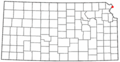 KSMap-doton-Elwood.png 300 × 156; 8 KB
-
 KSMap-doton-Leona.png 300 × 156; 8 KB
-
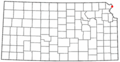 KSMap-doton-Wathena.png 300 × 156; 8 KB
-
 KSMap-doton-White Cloud.png 300 × 156; 8 KB
-
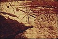
 Pony-trail.jpg 3.072 × 2.304; 2,06 MB
-

-
 St Joseph Missouri River.jpg 2.856 × 2.142; 1,61 MB
-

-

-

-
 USA Doniphan County, Kansas age pyramid.svg 520 × 600; 8 KB
-
-

-

-
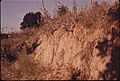
 Wolf River Kansas.jpg 2.856 × 2.142; 2,19 MB


