Category:Dorfkirche Saxdorf
Jump to navigation
Jump to search
| Object location | | View all coordinates using: OpenStreetMap |
|---|
This is the category of the Brandenburger Baudenkmal (cultural heritage monument) with the ID 09135327 (Wikidata)
|
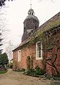
church building in Elbe-Elster district, Brandenburg state, Germany  _01.jpg) | |||||
| Upload media | |||||
| Instance of | |||||
|---|---|---|---|---|---|
| Location | Saxdorf, Uebigau-Wahrenbrück, Elbe-Elster District, Brandenburg, Germany | ||||
| Street address |
| ||||
| Heritage designation | |||||
| Inception |
| ||||
| Religion or worldview | |||||
 | |||||
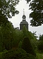
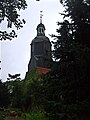
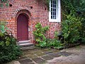
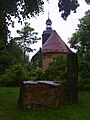
English: Pictures of the church in Saxdorf, Uebigau-Wahrenbrück municipality, Elbe-Elster district, Brandenburg state, Germany.
Deutsch: Ansichten der Kirche in Saxdorf, Stadt Uebigau-Wahrenbrück , Landkreis Elbe-Elster , Land Brandenburg , Deutschland.
Français : Photos de l'église à Saxdorf, ville de Uebigau-Wahrenbrück, , arrondissement de Elbe-Elster , état federé de Brandebourg , Allemagne.
Español: Vistas de la iglesia en Saxdorf, ciudad de Uebigau-Wahrenbrück, distrito de Elbe-Elster , estado federado de Brandeburgo , Alemania.
Address: Hauptstraße 5, Saxdorf, 04895 Uebigau-Wahrenbrück
Subcategories
This category has only the following subcategory.
I
Media in category "Dorfkirche Saxdorf"
The following 17 files are in this category, out of 17 total.
-
 Dorfkiche Saxdorf.jpg 1,944 × 2,592; 3.29 MB
-
 Dorfkirche Saxdorf Freko RK01.jpg 3,648 × 2,736; 5.12 MB
-
 Kirche Saxdorf 1 b.jpg 1,767 × 2,402; 3.11 MB
-
 Kirche Saxdorf 1 c.jpg 1,763 × 2,003; 2.49 MB
-
 Kirche Saxdorf 1.jpg 1,821 × 2,484; 1.71 MB
-
 Kirche Saxdorf 2.jpg 1,920 × 2,560; 2.61 MB
-
 Kirche Saxdorf 3.jpg 1,920 × 2,560; 2.8 MB
-
 Kirche Saxdorf 4.jpg 2,560 × 1,920; 2.08 MB
-
 Kirche Saxdorf 5.jpg 1,920 × 2,560; 2.03 MB
-
 Kirche Saxdorf Ausschnitt.jpg 942 × 1,261; 783 KB
-
 Kriegerdenkmal Saxdorf S5002472.jpg 1,432 × 1,596; 960 KB
-
 Saxdorf Kirche Ausschnitt.jpg 3,089 × 4,114; 3.71 MB
-
 Saxdorf Kirche.jpg 3,089 × 4,363; 1.03 MB
-
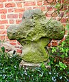 Saxdorf Steinkreuz Ausschnit 2t.jpg 1,496 × 1,769; 2.41 MB
-
 Saxdorf Steinkreuz.jpg 3,000 × 4,000; 1,006 KB
-
 Saxdorfer Kirche (Juli 2014).jpg 1,333 × 2,000; 1.05 MB
-
 Steinkreuz Saxdorf 1.jpg 1,920 × 2,560; 2.97 MB


.jpg)
